


Segnali stradaliIslanda
 Norme stradali
 Islanda
 Segnali di precedenza
 Segnali di pericolo
 Segnali di divieto
 Segnali di obbligo
 Segnali di indicazione
 Pannelli integrativi
Segnali stradali
Un segnale stradale è un simbolo visivo standardizzato posto lungo le strade per guidare e avvertire conducenti, ciclisti e pedoni e per regolarne la circolazione. Fornisce informazioni essenziali su condizioni, regole, direzioni e pericoli, favorendo sicurezza e scorrevolezza. Forme e colori diversi, come triangoli di pericolo, cerchi di divieto o obbligo e rettangoli informativi, ne consentono il rapido riconoscimento e una comprensione chiara.
Come si raggruppano i segnali in Islanda?
Il regolamento usa serie 100 pericoli, 200 precedenze, 300 divieti, 400 obblighi, 500 regole speciali e 600/700 informazioni e orientamento.
🔗 reglugerd.is • Iceland: Regulation 250/2024 articles 5-6, signs 110,362; Act section 7
🔗 althingi.is • Iceland: Road Traffic Act 77/2019, edition 1 October 2026
Un limite temporaneo di cantiere è vincolante in Islanda?
Un limite temporaneo prescrittivo autorizzato in vigore va rispettato. Il solo avviso di lavori non è un nuovo limite numerico, ma le condizioni possono imporre di rallentare.
🔗 reglugerd.is • Iceland: Regulation 250/2024 articles 5-6, signs 110,362; Act section 7
🔗 althingi.is • Iceland: Road Traffic Act 77/2019, edition 1 October 2026

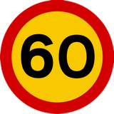
101. Limiti di velocità nazionali
Questo segnale indica i limiti di velocità nazionali. Le velocità massime generali applicabili dipendono dal tipo di strada, dalla categoria del veicolo e dalle regole locali quando non è indicato un limite diverso.
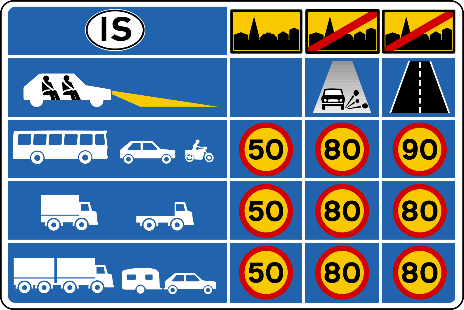
English • Traffic sign 656 • Maximum speed information. Gives the Traffic Act's general maximum speed rules for different conditions.
Íslenska • Umferðarmerki 656 • Hámarkshraðaupplýsingar. Merki þetta gefur upplýsingar um almennar reglur umferðarlaga um leyfilegan hámarkshraða við mismunandi aðstæður.
Fonti
🔗 Commons.wikimedia.org
🔗 Reglugerd.is • Reglugerð nr. 250/2024 • 21. gr.
SVG source: Gigillo83, drawn by original of Umferðastrofa • Public domain • Original revision 2013-01-01. Wikimedia original unmodified.
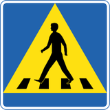
102. Attraversamento pedonale
Questo segnale indica un attraversamento pedonale. Segna un punto appositamente predisposto in cui i pedoni attraversano la strada. Precedenza e regole di attraversamento dipendono dai segnali, dai semafori e dalle disposizioni locali applicabili.
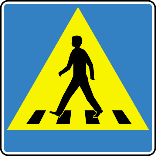
English • Traffic sign 516 • Pedestrian crossing. Indicates a crossing for pedestrians to cross the carriageway. The pedestrian symbol faces towards the crossing.
Íslenska • Umferðarmerki 516 • Gangbraut. Merki þetta gefur til kynna gangbraut sem ætluð er gangandi vegfarendum til að komast yfir akbraut. Merkið tekur breytingum þannig að táknmynd gangandi vegfaranda stefnir í átt að viðkomandi gangbraut.
Fonti
🔗 Commons.wikimedia.org
🔗 Reglugerd.is • Reglugerð nr. 250/2024 • 19. gr.
Image via Commons.wikimedia.org
Fry1989 • CC BY-SA 3.0 • Source revision 2023-01-08. Wikimedia original unmodified.
103. Strettoia: precedenza sul traffico in senso opposto
Questo segnale indica una strettoia in cui il traffico in senso opposto deve dare la precedenza.
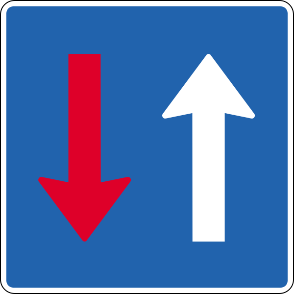
English • Traffic sign 214 • Oncoming traffic gives way. Indicates priority over oncoming traffic.
Íslenska • Umferðarmerki 214 • Umferð á móti veitir forgang. Merki þetta gefur til kynna að umferð á móti veiti forgang.
Fonti
🔗 Commons.wikimedia.org
🔗 Reglugerd.is • Reglugerð nr. 250/2024 • 11. gr.
SVG source: Gigillo83, drawn by original of Umferðastrofa • Public domain • Original revision 2012-12-31. Wikimedia original unmodified.
104. Strada senza uscita
Questo segnale indica una strada senza uscita. Non offre un collegamento con altre strade per i veicoli, ma può restare possibile accedere a proprietà o altre destinazioni lungo la strada.
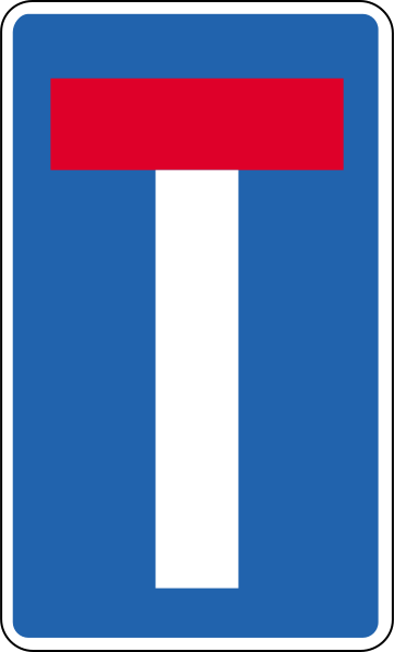
English • Traffic sign 652.7 • Dead-end road. Closed at one end. May indicate a continuing footpath, cycle path or shared path. Adapted to conditions.
Íslenska • Umferðarmerki 652.7 • Botngata. Merki þetta gefur til kynna að vegur sé lokaður í annan endann. Á merkinu má gefa til kynna að göngustígur, hjólastígur eða sameiginlegur stígur sé í framhaldi af veginum. Merkið tekur breytingum eftir aðstæðum.
Fonti
🔗 Commons.wikimedia.org
🔗 Reglugerd.is • Reglugerð nr. 250/2024 • 21. gr.
SVG source: Gigillo83, drawn by original of Umferðastrofa • Public domain • Original revision 2012-12-31. Wikimedia original unmodified.
105. Strada a senso unico
Questo segnale indica una strada a senso unico. Il traffico veicolare può procedere solo nel senso consentito, salvo eccezioni indicate dai segnali o dalle regole locali.

English • Traffic sign 526 • One-way traffic. Traffic is one-way in the arrow's direction.
Íslenska • Umferðarmerki 526 • Einstefna. Merki þetta gefur til kynna að einstefnuakstur sé um veginn í þá átt sem örin vísar.
Fonti
🔗 Commons.wikimedia.org
🔗 Reglugerd.is • Reglugerð nr. 250/2024 • 19. gr.
SVG source: Gigillo83, drawn by original of Umferðastrofa • Public domain • Original revision 2013-03-06. Wikimedia original unmodified.
106. Strada a senso unico
Questo segnale indica una strada a senso unico. I conducenti possono procedere solo nel senso consentito.

English • Traffic sign 526 • One-way traffic. Traffic is one-way in the arrow's direction.
Íslenska • Umferðarmerki 526 • Einstefna. Merki þetta gefur til kynna að einstefnuakstur sé um veginn í þá átt sem örin vísar.
Fonti
🔗 Commons.wikimedia.org
🔗 Reglugerd.is • Reglugerð nr. 250/2024 • 19. gr.
SVG source: Gigillo83, drawn by original of Umferðastrofa • Public domain • Original revision 2012-12-31. Wikimedia original unmodified.
107. Informazioni sulla prossima uscita
Questo segnale fornisce informazioni sulla prossima uscita. Può mostrarne il numero, la destinazione, la direzione o la distanza.

English • Traffic sign 715 • Exit lane direction sign. Stands at the beginning of an exit lane and identifies the destination it leads to.
Íslenska • Umferðarmerki 715 • Fráreinavísir. Merki þetta stendur við upphaf fráreinar og vísar á stað sem fráreinin leiðir til.
Fonti
🔗 Commons.wikimedia.org
🔗 Reglugerd.is • Reglugerð nr. 250/2024 • 23. gr.
SVG source: Gigillo83, drawn by original of Umferðastrofa • Public domain • Original revision 2013-03-06. Wikimedia original unmodified.
108. Destinazione raggiungibile tramite la rampa
Questo segnale fornisce informazioni sulla destinazione raggiungibile tramite la rampa. La destinazione esposta indica dove conduce la rampa.
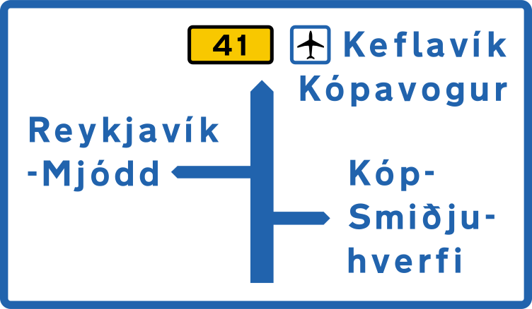
English • Traffic sign 703 • Junction route diagram. Gives a simplified view of route choices at the junction ahead before reaching it.
Íslenska • Umferðarmerki 703 • Staðarleiðatafla. Merki þetta sýnir einfaldaða mynd af leiðavali við vegamót sem eru fram undan, áður en komið er að vegamótum.
Fonti
🔗 Commons.wikimedia.org
🔗 Reglugerd.is • Reglugerð nr. 250/2024 • 23. gr.
SVG source: Gigillo83, drawn by original of Umferðastrofa • Public domain • Original revision 2013-03-06. Wikimedia original unmodified.
109. Schema delle corsie e delle loro direzioni
Questo segnale fornisce uno schema delle corsie e delle loro direzioni. Le frecce o altre indicazioni mostrano come proseguono le corsie e quali direzioni o destinazioni permettono di raggiungere.

English • Traffic sign 500 • Lane sign. Shows lanes and their permitted use, including travel directions, directions at junctions, merging and diverging lanes. White arrows on blue show permitted directions; other directions are prohibited. Temporary signs, for example for roadworks, use black arrows on orange. Lane-specific restrictions, reserved lanes and special rules appear through appropriate signs, such as mandatory or prohibition signs, and any supplementary plates within the lane diagram. Slow traffic must use a lane specifically marked for it. Designs must reflect the road layout under this article. The sign shows all lanes of the carriageway. Designs, numbers and names in use must be published on the Icelandic Road and Coastal Administration's website. The signs in this article are examples with the following meanings.
Íslenska • Umferðarmerki 500 • Akreinamerki. Merkin gefa til kynna akreinar og heimila notkun þeirra, þ. á m. í hvaða átt umferð má aka, hvert heimilt sé að aka þegar komið er að vegamótum, hvar akrein sameinast annarri og hvar akreinar skiljast að. Heimilar akstursstefnur á akreinum eru gefnar til kynna með hvítum örvum á bláum grunni. Óheimilt er að nota akrein til aksturs í aðra akstursstefnu en gefin er til kynna á merkinu. Þegar akreinamerki eru notuð tímabundið, t.d. vegna vegavinnu, eru örvarnar svartar á appelsínugulum grunni. Takmarkanir á tiltekinni umferð um sérstakar akreinar, sérreinar og aðrar sérreglur um umferð á akrein eru gefnar til kynna á akreinamerki með viðeigandi umferðarmerki, t.d. boð- eða bannmerki, og eftir atvikum undirmerki á mynd viðkomandi akreinar. Hægfara umferð er skylt að nota akrein sem sérstaklega er merkt fyrir slíka umferð. Akreinamerki skulu útfærð eftir legu vegar á hverjum stað í samræmi við ákvæði þessarar greinar. Merkið sýnir allar akreinar viðkomandi akbrautar. Útlit, númer og heiti akreinamerkja í notkun skulu birt á vefsíðu Vegagerðarinnar. Merki sem sýnd eru í þessari grein eru tekin sem dæmi og hafa eftirfarandi merkingar:.
Fonti
🔗 Commons.wikimedia.org
🔗 Reglugerd.is • Reglugerð nr. 250/2024 • 19. gr.
SVG source: Gigillo83, drawn by original of Umferðastrofa • Public domain • Original revision 2013-03-06. Wikimedia original unmodified.
110. Schema dell'incrocio, direzioni e destinazioni
Questo segnale mostra lo schema dell'incrocio, le direzioni e le destinazioni. Il diagramma mostra come sono disposte le strade e quale direzione seguire per raggiungere ciascuna destinazione o imboccare l’itinerario indicato.
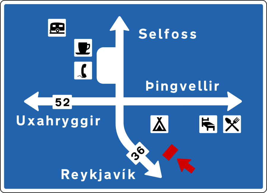
English • Traffic sign 703 • Junction route diagram. Gives a simplified view of route choices at the junction ahead before reaching it.
Íslenska • Umferðarmerki 703 • Staðarleiðatafla. Merki þetta sýnir einfaldaða mynd af leiðavali við vegamót sem eru fram undan, áður en komið er að vegamótum.
Fonti
🔗 Commons.wikimedia.org
🔗 Reglugerd.is • Reglugerð nr. 250/2024 • 23. gr.
SVG source: Gigillo83, drawn by original of Umferðastrofa • Public domain • Original revision 2013-03-06. Wikimedia original unmodified.
111. Fine di una corsia
Questo segnale indica la fine di una corsia. Lo schema mostra quale corsia termina e come proseguono quelle rimanenti.

English • Traffic sign 500 • Lane sign. Shows lanes and their permitted use, including travel directions, directions at junctions, merging and diverging lanes. White arrows on blue show permitted directions; other directions are prohibited. Temporary signs, for example for roadworks, use black arrows on orange. Lane-specific restrictions, reserved lanes and special rules appear through appropriate signs, such as mandatory or prohibition signs, and any supplementary plates within the lane diagram. Slow traffic must use a lane specifically marked for it. Designs must reflect the road layout under this article. The sign shows all lanes of the carriageway. Designs, numbers and names in use must be published on the Icelandic Road and Coastal Administration's website. The signs in this article are examples with the following meanings.
Íslenska • Umferðarmerki 500 • Akreinamerki. Merkin gefa til kynna akreinar og heimila notkun þeirra, þ. á m. í hvaða átt umferð má aka, hvert heimilt sé að aka þegar komið er að vegamótum, hvar akrein sameinast annarri og hvar akreinar skiljast að. Heimilar akstursstefnur á akreinum eru gefnar til kynna með hvítum örvum á bláum grunni. Óheimilt er að nota akrein til aksturs í aðra akstursstefnu en gefin er til kynna á merkinu. Þegar akreinamerki eru notuð tímabundið, t.d. vegna vegavinnu, eru örvarnar svartar á appelsínugulum grunni. Takmarkanir á tiltekinni umferð um sérstakar akreinar, sérreinar og aðrar sérreglur um umferð á akrein eru gefnar til kynna á akreinamerki með viðeigandi umferðarmerki, t.d. boð- eða bannmerki, og eftir atvikum undirmerki á mynd viðkomandi akreinar. Hægfara umferð er skylt að nota akrein sem sérstaklega er merkt fyrir slíka umferð. Akreinamerki skulu útfærð eftir legu vegar á hverjum stað í samræmi við ákvæði þessarar greinar. Merkið sýnir allar akreinar viðkomandi akbrautar. Útlit, númer og heiti akreinamerkja í notkun skulu birt á vefsíðu Vegagerðarinnar. Merki sem sýnd eru í þessari grein eru tekin sem dæmi og hafa eftirfarandi merkingar:.
Fonti
🔗 Commons.wikimedia.org
🔗 Reglugerd.is • Reglugerð nr. 250/2024 • 19. gr.
SVG source: Gigillo83, drawn by original of Umferðastrofa • Public domain • Original revision 2013-03-06. Wikimedia original unmodified.
112. Sosta consentita
Questo segnale indica che la sosta è consentita. I veicoli possono essere parcheggiati nell'area interessata secondo le condizioni, restrizioni o regole locali di sosta applicabili.
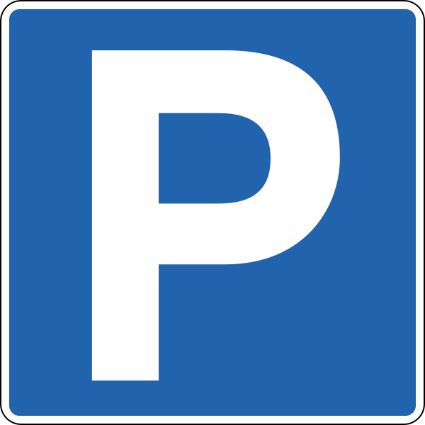
English • Traffic sign 552.1 • Parking. Permitted unless contrary to the Traffic Act's stopping or parking provisions. Applies within a defined car park or on the sign's side from the sign to the next junction unless a plate states otherwise. A plate gives further restrictions.
Íslenska • Umferðarmerki 552.1 • Bifreiðastæði. Merki þetta gefur til kynna að heimilt sé að leggja, sé það ekki í andstöðu við ákvæði umferðarlaga um að stöðva eða leggja ökutæki. Merkið gildir á afmörkuðu bifreiðastæði eða þeim megin vegar sem merkið stendur, frá merkinu og að næstu vegamótum nema annað sé tekið fram með undirmerki. Nánari lýsing á takmörkun kemur fram á undirmerki.
Fonti
🔗 Commons.wikimedia.org
🔗 Reglugerd.is • Reglugerð nr. 250/2024 • 19. gr.
SVG source: Gigillo83, drawn by original of Umferðastrofa • Public domain • Original revision 2012-12-31. Wikimedia original unmodified.
113. Controllo della velocità media
Questo segnale indica il controllo della velocità media. La velocità media del veicolo viene misurata su un tratto definito e confrontata con il limite applicabile.
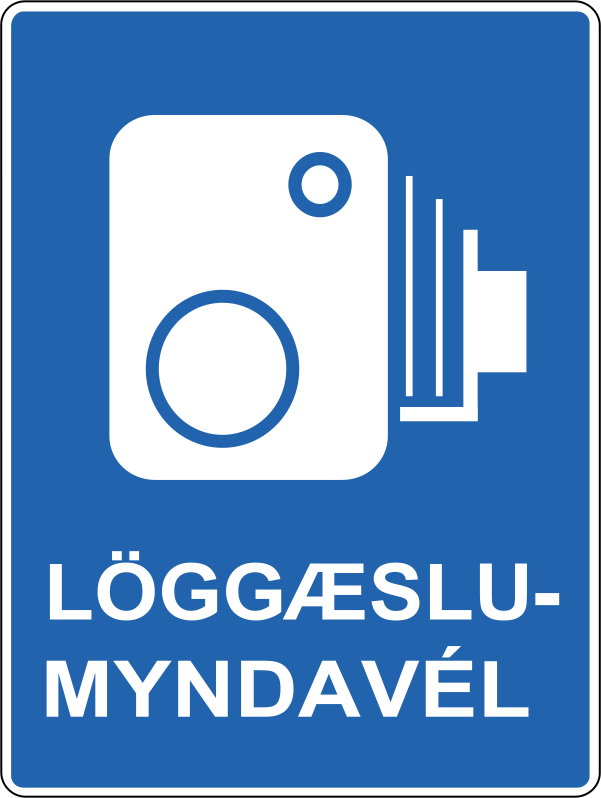
English • Traffic sign 655.61 • Enforcement camera. Indicates an automatic enforcement camera ahead that may photograph a traffic offence.
Íslenska • Umferðarmerki 655.61 • Löggæslumyndavél. Merki þetta gefur til kynna að fram undan sé sjálfvirk löggæslumyndavél sem gæti tekið ljósmynd af umferðarlagabroti.
Fonti
🔗 Commons.wikimedia.org
🔗 Reglugerd.is • Reglugerð nr. 250/2024 • 21. gr.
SVG source: Gigillo83, drawn by original of Umferðastrofa • Public domain • Original revision 2013-09-22. Wikimedia original unmodified.
114. Configurazione dell'incrocio
Questo segnale mostra la forma o configurazione di un incrocio che si incontra più avanti. Il diagramma indica come sono disposte la strada da cui si arriva e le strade che vi si collegano.

English • Supplementary plate 815.1 • Course of the priority road through a junction. A thick line shows the priority road; thin lines show non-priority roads with give-way or stop requirements.
Íslenska • Undirmerki 815.1 • Leið aðalbrautar á vegamótum. Merki þetta gefur til kynna leið aðalbrautar á vegamótum þar sem sver lína táknar leið aðalbrautar en mjó lína víkjandi veg með biðskyldu eða stöðvunarskyldu gagnvart aðalbraut.
Fonti
🔗 Commons.wikimedia.org
🔗 Reglugerd.is • Reglugerð nr. 250/2024 • 27. gr.
SVG source: Gigillo83, drawn by original of Umferðastrofa • Public domain • Original revision 2013-03-06. Wikimedia original unmodified.
Artwork verified against Vegagerdin.is • official published diagram 815.1.
115. Configurazione dell'incrocio
Questo segnale mostra la forma o configurazione di un incrocio che si incontra più avanti. Il diagramma indica come sono disposte la strada da cui si arriva e le strade che vi si collegano.

English • Supplementary plate 815.3 • Course of the priority road through a junction. A thick line shows the priority road; thin lines show non-priority roads with give-way or stop requirements.
Íslenska • Undirmerki 815.3 • Leið aðalbrautar á vegamótum. Merki þetta gefur til kynna leið aðalbrautar á vegamótum þar sem sver lína táknar leið aðalbrautar en mjó lína víkjandi veg með biðskyldu eða stöðvunarskyldu gagnvart aðalbraut.
Fonti
🔗 Commons.wikimedia.org
🔗 Reglugerd.is • Reglugerð nr. 250/2024 • 27. gr.
SVG source: Gigillo83, drawn by original of Umferðastrofa • Public domain • Original revision 2013-03-06. Wikimedia original unmodified.
Artwork verified against Vegagerdin.is • official published diagram 815.3.
116. Configurazione dell'incrocio
Questo segnale mostra la forma o configurazione di un incrocio che si incontra più avanti. Il diagramma indica come sono disposte la strada da cui si arriva e le strade che vi si collegano.

English • Supplementary plate 815.2 • Course of the priority road through a junction. A thick line shows the priority road; thin lines show non-priority roads with give-way or stop requirements.
Íslenska • Undirmerki 815.2 • Leið aðalbrautar á vegamótum. Merki þetta gefur til kynna leið aðalbrautar á vegamótum þar sem sver lína táknar leið aðalbrautar en mjó lína víkjandi veg með biðskyldu eða stöðvunarskyldu gagnvart aðalbraut.
Fonti
🔗 Commons.wikimedia.org
🔗 Reglugerd.is • Reglugerð nr. 250/2024 • 27. gr.
SVG source: Gigillo83, drawn by original of Umferðastrofa • Public domain • Original revision 2013-03-06. Wikimedia original unmodified.
Artwork verified against Vegagerdin.is • official published diagram 815.2.
117. Per persone con disabilità
Questo pannello integrativo indica che il segnale principale si applica specificamente alle persone con disabilità. Eventuali requisiti relativi al permesso o all’appartenenza alla categoria indicata dipendono dal segnale e dalle regole locali applicabili.

English • Symbol 807.82 • Road users with reduced mobility. The symbol represents such road users.
Íslenska • Tákn 807.82 • Hreyfihamlaðir vegfarendur. Táknið stendur fyrir umferð hreyfihamlaðra vegfarenda.
Fonti
🔗 Commons.wikimedia.org
🔗 Reglugerd.is • Reglugerð nr. 250/2024 • 27. gr.
SVG source: Gigillo83, drawn by original of Umferðastrofa • Public domain • Original revision 2022-07-31. Wikimedia original unmodified.
118. Per persone non vedenti
Questo pannello integrativo indica che il segnale principale riguarda specificamente le persone non vedenti o ipovedenti.

English • Supplementary plate 840.1 • Visually impaired road users. Draws attention to the possible presence of people with impaired vision.
Íslenska • Undirmerki 840.1 • Sjónskertir vegfarendur. Merki þetta vekur athygli á að vænta megi umferðar sjónskerts fólks.
Fonti
🔗 Commons.wikimedia.org
🔗 Reglugerd.is • Reglugerð nr. 250/2024 • 27. gr.
SVG source: Original: The Icelands Public Roads Administration (Vegagerdin) Vector: Ricordisamoa • Public domain • Original revision 2013-01-03. Wikimedia original unmodified.
Artwork verified against Vegagerdin.is • official published diagram 840.1.
119. Per persone sorde
Questo pannello integrativo indica che il segnale principale riguarda specificamente le persone sorde o con capacità uditiva ridotta.

English • Supplementary plate 840.2 • Hearing-impaired road users. Draws attention to the possible presence of people with impaired hearing.
Íslenska • Undirmerki 840.2 • Heyrnarskertir vegfarendur. Merki þetta vekur athygli á að vænta megi umferðar heyrnarskerts fólks.
Fonti
🔗 Commons.wikimedia.org
🔗 Reglugerd.is • Reglugerð nr. 250/2024 • 27. gr.
SVG source: Gigillo83, drawn by original of Umferðastrofa • Public domain • Original revision 2013-03-06. Wikimedia original unmodified.
120. A sinistra
Questo pannello integrativo indica che il segnale principale si applica nella direzione della freccia, a sinistra.

English • Supplementary plate 828.3 • Extent. The accompanying prohibition or special-rule sign applies in the arrow's direction. A length in whole metres may appear in the arrow. The plate may be horizontal or vertical. A horizontal plate stands parallel to the street and applies in the direction or directions shown. A vertical plate stands across the street: an upward arrow means the prohibition applies beyond the sign; a downward arrow means it applies up to the sign; arrows both ways mean it applies on both sides. This colour is always used regardless of the main sign's colour.
Íslenska • Undirmerki 828.3 • Gildissvæði. Merki þetta gefur til kynna að bannmerki eða sérreglumerki sem það stendur með gildi í þá átt sem örin tilgreinir. Heimilt er að setja upplýsingar um lengd í heilum metrum inn á örina. Undirmerkið getur hvort heldur sem er verið lárétt eða lóðrétt. Lárétt undirmerki stendur samsíða götu og gildir í þá átt eða þær áttir sem það vísar. Lóðrétt undirmerki stendur þvert á götu. Ör sem vísar upp á lóðréttu undirmerki gefur til kynna að bann gildi í framhaldi af merkinu en ör sem vísar niður að bann gildi að merkinu. Lóðrétt ör sem vísar bæði upp og niður gefur til kynna að bann gildi beggja vegna merkisins. Merkið er alltaf notað í þessum lit óháð lit aðalmerkis.
Fonti
🔗 Commons.wikimedia.org
🔗 Reglugerd.is • Reglugerð nr. 250/2024 • 27. gr.
SVG source: Gigillo83, drawn by original of Umferðastrofa • Public domain • Original revision 2013-03-06. Wikimedia original unmodified.
121. A sinistra o a destra
Questo pannello integrativo indica che il segnale principale si applica in entrambe le direzioni indicate dalle frecce, a sinistra e a destra.

English • Supplementary plate 828.5 • Extent. The accompanying prohibition or special-rule sign applies in the arrow's direction. A length in whole metres may appear in the arrow. The plate may be horizontal or vertical. A horizontal plate stands parallel to the street and applies in the direction or directions shown. A vertical plate stands across the street: an upward arrow means the prohibition applies beyond the sign; a downward arrow means it applies up to the sign; arrows both ways mean it applies on both sides. This colour is always used regardless of the main sign's colour.
Íslenska • Undirmerki 828.5 • Gildissvæði. Merki þetta gefur til kynna að bannmerki eða sérreglumerki sem það stendur með gildi í þá átt sem örin tilgreinir. Heimilt er að setja upplýsingar um lengd í heilum metrum inn á örina. Undirmerkið getur hvort heldur sem er verið lárétt eða lóðrétt. Lárétt undirmerki stendur samsíða götu og gildir í þá átt eða þær áttir sem það vísar. Lóðrétt undirmerki stendur þvert á götu. Ör sem vísar upp á lóðréttu undirmerki gefur til kynna að bann gildi í framhaldi af merkinu en ör sem vísar niður að bann gildi að merkinu. Lóðrétt ör sem vísar bæði upp og niður gefur til kynna að bann gildi beggja vegna merkisins. Merkið er alltaf notað í þessum lit óháð lit aðalmerkis.
Fonti
🔗 Commons.wikimedia.org
🔗 Reglugerd.is • Reglugerð nr. 250/2024 • 27. gr.
SVG source: Gigillo83, drawn by original of Umferðastrofa • Public domain • Original revision 2013-03-06. Wikimedia original unmodified.
122. A destra
Questo pannello integrativo indica che il segnale principale si applica nella direzione della freccia, a destra.

English • Supplementary plate 828.1 • Extent. The accompanying prohibition or special-rule sign applies in the arrow's direction. A length in whole metres may appear in the arrow. The plate may be horizontal or vertical. A horizontal plate stands parallel to the street and applies in the direction or directions shown. A vertical plate stands across the street: an upward arrow means the prohibition applies beyond the sign; a downward arrow means it applies up to the sign; arrows both ways mean it applies on both sides. This colour is always used regardless of the main sign's colour.
Íslenska • Undirmerki 828.1 • Gildissvæði. Merki þetta gefur til kynna að bannmerki eða sérreglumerki sem það stendur með gildi í þá átt sem örin tilgreinir. Heimilt er að setja upplýsingar um lengd í heilum metrum inn á örina. Undirmerkið getur hvort heldur sem er verið lárétt eða lóðrétt. Lárétt undirmerki stendur samsíða götu og gildir í þá átt eða þær áttir sem það vísar. Lóðrétt undirmerki stendur þvert á götu. Ör sem vísar upp á lóðréttu undirmerki gefur til kynna að bann gildi í framhaldi af merkinu en ör sem vísar niður að bann gildi að merkinu. Lóðrétt ör sem vísar bæði upp og niður gefur til kynna að bann gildi beggja vegna merkisins. Merkið er alltaf notað í þessum lit óháð lit aðalmerkis.
Fonti
🔗 Commons.wikimedia.org
🔗 Reglugerd.is • Reglugerð nr. 250/2024 • 27. gr.
SVG source: Gigillo83, drawn by original of Umferðastrofa • Public domain • Original revision 2013-03-06. Wikimedia original unmodified.
123. metri a sinistra
Questo pannello integrativo indica che il segnale principale si riferisce a un luogo alla distanza indicata a sinistra.

English • Supplementary plate 828.4 • Extent. The accompanying prohibition or special-rule sign applies in the arrow's direction. A length in whole metres may appear in the arrow. The plate may be horizontal or vertical. A horizontal plate stands parallel to the street and applies in the direction or directions shown. A vertical plate stands across the street: an upward arrow means the prohibition applies beyond the sign; a downward arrow means it applies up to the sign; arrows both ways mean it applies on both sides. This colour is always used regardless of the main sign's colour.
Íslenska • Undirmerki 828.4 • Gildissvæði. Merki þetta gefur til kynna að bannmerki eða sérreglumerki sem það stendur með gildi í þá átt sem örin tilgreinir. Heimilt er að setja upplýsingar um lengd í heilum metrum inn á örina. Undirmerkið getur hvort heldur sem er verið lárétt eða lóðrétt. Lárétt undirmerki stendur samsíða götu og gildir í þá átt eða þær áttir sem það vísar. Lóðrétt undirmerki stendur þvert á götu. Ör sem vísar upp á lóðréttu undirmerki gefur til kynna að bann gildi í framhaldi af merkinu en ör sem vísar niður að bann gildi að merkinu. Lóðrétt ör sem vísar bæði upp og niður gefur til kynna að bann gildi beggja vegna merkisins. Merkið er alltaf notað í þessum lit óháð lit aðalmerkis.
Fonti
🔗 Commons.wikimedia.org
🔗 Reglugerd.is • Reglugerð nr. 250/2024 • 27. gr.
SVG source: Gigillo83, drawn by original of Umferðastrofa • Public domain • Original revision 2013-03-06. Wikimedia original unmodified.
124. metri a sinistra o a destra
Questo pannello integrativo indica che il segnale principale si riferisce a luoghi alla distanza indicata a sinistra e a destra.
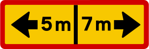
English • Supplementary plate 828.6 • Extent. The accompanying prohibition or special-rule sign applies in the arrow's direction. A length in whole metres may appear in the arrow. The plate may be horizontal or vertical. A horizontal plate stands parallel to the street and applies in the direction or directions shown. A vertical plate stands across the street: an upward arrow means the prohibition applies beyond the sign; a downward arrow means it applies up to the sign; arrows both ways mean it applies on both sides. This colour is always used regardless of the main sign's colour.
Íslenska • Undirmerki 828.6 • Gildissvæði. Merki þetta gefur til kynna að bannmerki eða sérreglumerki sem það stendur með gildi í þá átt sem örin tilgreinir. Heimilt er að setja upplýsingar um lengd í heilum metrum inn á örina. Undirmerkið getur hvort heldur sem er verið lárétt eða lóðrétt. Lárétt undirmerki stendur samsíða götu og gildir í þá átt eða þær áttir sem það vísar. Lóðrétt undirmerki stendur þvert á götu. Ör sem vísar upp á lóðréttu undirmerki gefur til kynna að bann gildi í framhaldi af merkinu en ör sem vísar niður að bann gildi að merkinu. Lóðrétt ör sem vísar bæði upp og niður gefur til kynna að bann gildi beggja vegna merkisins. Merkið er alltaf notað í þessum lit óháð lit aðalmerkis.
Fonti
🔗 Commons.wikimedia.org
🔗 Reglugerd.is • Reglugerð nr. 250/2024 • 27. gr.
SVG source: Gigillo83, drawn by original of Umferðastrofa • Public domain • Original revision 2013-03-06. Wikimedia original unmodified.
125. metri a destra
Questo pannello integrativo indica che il segnale principale si riferisce a un luogo alla distanza indicata a destra.

English • Supplementary plate 828.2 • Extent. The accompanying prohibition or special-rule sign applies in the arrow's direction. A length in whole metres may appear in the arrow. The plate may be horizontal or vertical. A horizontal plate stands parallel to the street and applies in the direction or directions shown. A vertical plate stands across the street: an upward arrow means the prohibition applies beyond the sign; a downward arrow means it applies up to the sign; arrows both ways mean it applies on both sides. This colour is always used regardless of the main sign's colour.
Íslenska • Undirmerki 828.2 • Gildissvæði. Merki þetta gefur til kynna að bannmerki eða sérreglumerki sem það stendur með gildi í þá átt sem örin tilgreinir. Heimilt er að setja upplýsingar um lengd í heilum metrum inn á örina. Undirmerkið getur hvort heldur sem er verið lárétt eða lóðrétt. Lárétt undirmerki stendur samsíða götu og gildir í þá átt eða þær áttir sem það vísar. Lóðrétt undirmerki stendur þvert á götu. Ör sem vísar upp á lóðréttu undirmerki gefur til kynna að bann gildi í framhaldi af merkinu en ör sem vísar niður að bann gildi að merkinu. Lóðrétt ör sem vísar bæði upp og niður gefur til kynna að bann gildi beggja vegna merkisins. Merkið er alltaf notað í þessum lit óháð lit aðalmerkis.
Fonti
🔗 Commons.wikimedia.org
🔗 Reglugerd.is • Reglugerð nr. 250/2024 • 27. gr.
SVG source: Gigillo83, drawn by original of Umferðastrofa • Public domain • Original revision 2013-03-06. Wikimedia original unmodified.
126. Si applica dopo la svolta a sinistra
Questo pannello integrativo indica che il segnale principale si applica dopo la svolta a sinistra.

English • Supplementary plate 810.7 • Direction to which the main sign applies. Points in the direction covered by the main sign.
Íslenska • Undirmerki 810.7 • Stefna sem aðalmerki á við. Merki þetta vísar í þá átt sem aðalmerki á við.
Fonti
🔗 Commons.wikimedia.org
🔗 Reglugerd.is • Reglugerð nr. 250/2024 • 27. gr.
SVG source: Civitas13, drawn by original of Samgöngustofu • Public domain • Original revision 2018-08-28. Wikimedia original unmodified.
127. Si applica dopo la svolta a destra
Questo pannello integrativo indica che il segnale principale si applica dopo la svolta a destra.

English • Supplementary plate 810.6 • Direction to which the main sign applies. Points in the direction covered by the main sign.
Íslenska • Undirmerki 810.6 • Stefna sem aðalmerki á við. Merki þetta vísar í þá átt sem aðalmerki á við.
Fonti
🔗 Commons.wikimedia.org
🔗 Reglugerd.is • Reglugerð nr. 250/2024 • 27. gr.
SVG source: Civitas13, drawn by original of Samgöngustofu • Public domain • Original revision 2018-08-28. Wikimedia original unmodified.
128. metri più avanti
Questo pannello integrativo indica la distanza dal segnale principale al punto in cui inizia il pericolo o la prescrizione, oppure a cui si riferisce l’informazione indicata. La distanza è espressa in metri.
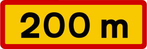
English • Supplementary plate 802.1 • Distance. Shows the distance to the point referred to by the main sign, in whole metres or kilometres to one decimal place. Uses the main sign's colour.
Íslenska • Undirmerki 802.1 • Fjarlægð. Merki þetta segir til um hversu langt er að þeim stað sem aðalmerkið á við. Fjarlægðin er gefin upp í heilum metrum eða kílómetrum með einum aukastaf. Merkið tekur lit aðalmerkis.
Fonti
🔗 Commons.wikimedia.org
🔗 Reglugerd.is • Reglugerð nr. 250/2024 • 27. gr.
SVG source: Gigillo83, drawn by original of Umferðastrofa • Public domain • Original revision 2013-03-06. Wikimedia original unmodified.
129. Stop tra metri
Questo pannello integrativo preannuncia un segnale di STOP alla distanza indicata più avanti. Il valore riportato indica la distanza dal successivo segnale di STOP.
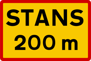
English • Supplementary plate 824 • Stop ahead. Used with 202 ‘Give way’ to warn of a junction with 204 ‘Compulsory stop’ ahead.
Íslenska • Undirmerki 824 • Stöðvunarskylda fram undan. Merki þetta er notað með merkinu 202 Biðskylda og gefur til kynna að fram undan sé stöðvunarskylda við vegamót, merkt með merkinu 204 Stöðvunarskylda.
Fonti
🔗 Commons.wikimedia.org
🔗 Reglugerd.is • Reglugerð nr. 250/2024 • 27. gr.
SVG source: Gigillo83, drawn by original of Umferðastrofa • Public domain • Original revision 2013-03-06. Wikimedia original unmodified.
130. Tra metri, per metri
Questo pannello integrativo indica la distanza fino all’inizio del tratto interessato dal segnale principale e la lunghezza di tale tratto. Entrambe le distanze sono espresse in metri.
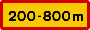
English • Supplementary plate 804.1 • Length of application. Gives the distances from the sign to the beginning and end of the main sign's application, in whole metres or kilometres to one decimal place. Uses the main sign's colour.
Íslenska • Undirmerki 804.1 • Lengd gildissvæðis. Merki þetta segir til um gildissvæði aðalmerkis. Á merkinu kemur fram fjarlægð að upphafi gildissvæðis og fjarlægð að lokum þess, mæld frá merkinu. Fjarlægðin er gefin upp í heilum metrum eða kílómetrum með einum aukastaf. Merkið tekur lit aðalmerkis.
Fonti
🔗 Commons.wikimedia.org
🔗 Reglugerd.is • Reglugerð nr. 250/2024 • 27. gr.
SVG source: Gigillo83, drawn by original of Umferðastrofa • Public domain • Original revision 2013-03-06. Wikimedia original unmodified.
131. Massa indicata
Questo pannello integrativo riporta il valore indicato della massa del veicolo. Leggilo insieme al segnale principale per determinare come il valore della massa influisce sulla norma o sulla limitazione applicabile.
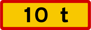
English • Supplementary plate 808 • Text. Defines the accompanying sign's scope, exemptions or explanation. A total mass in whole tonnes below a prohibition sign limits it to vehicles above that mass. Where the main sign does not apply to all vehicles, ‘EXCEPT’ with a symbol or text identifies exempt road users. ‘Deliveries permitted’ with operating times gives unloading hours and an exemption from the accompanying prohibition.
Íslenska • Undirmerki 808 • Texti. Merki þetta gefur nánari skilgreiningu á gildissviði, undanþágu frá eða skýringu á því umferðarmerki sem merkið stendur með. Undirmerki með heildarþyngd í heilum tonnum undir bannmerki, gefur til kynna að bannmerkið taki einungis til ökutækja yfir þeirri heildarþyngd sem fram kemur á undirmerkinu. Þar sem aðalmerki gildir ekki um öll ökutæki er undirmerki notað með textanum "NEMA" og myndtákni eða texta fyrir þá tegund umferðar sem undanþegin er banni eða fyrirmælum. Undirmerki með textanum "Vöruafgreiðsla heimil" ásamt gildistíma gefur til kynna vörulosunartíma og þar með undanþágu frá banni sem merkið sem það stendur með gefur til kynna.
Fonti
🔗 Commons.wikimedia.org
🔗 Reglugerd.is • Reglugerð nr. 250/2024 • 27. gr.
SVG source: Gigillo83, drawn by original of Umferðastrofa • Public domain • Original revision 2013-03-06. Wikimedia original unmodified.
132. Configurazione dell'incrocio
Questo pannello integrativo mostra la forma o configurazione del prossimo incrocio.

English • Supplementary plate 815.1 • Course of the priority road through a junction. A thick line shows the priority road; thin lines show non-priority roads with give-way or stop requirements.
Íslenska • Undirmerki 815.1 • Leið aðalbrautar á vegamótum. Merki þetta gefur til kynna leið aðalbrautar á vegamótum þar sem sver lína táknar leið aðalbrautar en mjó lína víkjandi veg með biðskyldu eða stöðvunarskyldu gagnvart aðalbraut.
Fonti
🔗 Commons.wikimedia.org
🔗 Reglugerd.is • Reglugerð nr. 250/2024 • 27. gr.
SVG source: Gigillo83, drawn by original of Umferðastrofa • Public domain • Original revision 2013-03-06. Wikimedia original unmodified.
133. Configurazione dell'incrocio
Questo pannello integrativo mostra la forma o configurazione del prossimo incrocio.

English • Supplementary plate 815.2 • Course of the priority road through a junction. A thick line shows the priority road; thin lines show non-priority roads with give-way or stop requirements.
Íslenska • Undirmerki 815.2 • Leið aðalbrautar á vegamótum. Merki þetta gefur til kynna leið aðalbrautar á vegamótum þar sem sver lína táknar leið aðalbrautar en mjó lína víkjandi veg með biðskyldu eða stöðvunarskyldu gagnvart aðalbraut.
Fonti
🔗 Commons.wikimedia.org
🔗 Reglugerd.is • Reglugerð nr. 250/2024 • 27. gr.
SVG source: Gigillo83, drawn by original of Umferðastrofa • Public domain • Original revision 2013-03-06. Wikimedia original unmodified.
134. Configurazione dell'incrocio
Questo pannello integrativo mostra la forma o configurazione del prossimo incrocio.

English • Supplementary plate 815.3 • Course of the priority road through a junction. A thick line shows the priority road; thin lines show non-priority roads with give-way or stop requirements.
Íslenska • Undirmerki 815.3 • Leið aðalbrautar á vegamótum. Merki þetta gefur til kynna leið aðalbrautar á vegamótum þar sem sver lína táknar leið aðalbrautar en mjó lína víkjandi veg með biðskyldu eða stöðvunarskyldu gagnvart aðalbraut.
Fonti
🔗 Commons.wikimedia.org
🔗 Reglugerd.is • Reglugerð nr. 250/2024 • 27. gr.
SVG source: Gigillo83, drawn by original of Umferðastrofa • Public domain • Original revision 2013-03-06. Wikimedia original unmodified.
135. Sosta perpendicolare al marciapiede
Questo pannello integrativo indica che i veicoli devono parcheggiare perpendicolarmente al bordo del marciapiede, come illustrato.

English • Supplementary plate 829.2 • Parking layout. Shows parallel, perpendicular or angled parking.
Íslenska • Undirmerki 829.2 • Bifreiðastæði, fyrirkomulag. Merki þetta gefur til kynna fyrirkomulag bifreiðastæða, samsíða, hornrétt eða á ská.
Fonti
🔗 Commons.wikimedia.org
🔗 Reglugerd.is • Reglugerð nr. 250/2024 • 27. gr.
SVG source: Gigillo83, drawn by original of Umferðastrofa • Public domain • Original revision 2013-03-06. Wikimedia original unmodified.
Artwork verified against Vegagerdin.is • official published diagram 829.2.
136. Sosta parallela al marciapiede
Questo pannello integrativo indica che i veicoli devono parcheggiare parallelamente al bordo del marciapiede, come illustrato.

English • Supplementary plate 829.1 • Parking layout. Shows parallel, perpendicular or angled parking.
Íslenska • Undirmerki 829.1 • Bifreiðastæði, fyrirkomulag. Merki þetta gefur til kynna fyrirkomulag bifreiðastæða, samsíða, hornrétt eða á ská.
Fonti
🔗 Commons.wikimedia.org
🔗 Reglugerd.is • Reglugerð nr. 250/2024 • 27. gr.
SVG source: Gigillo83, drawn by original of Umferðastrofa • Public domain • Original revision 2013-03-06. Wikimedia original unmodified.
Artwork verified against Vegagerdin.is • official published diagram 829.1.
137. Sosta obliqua verso sinistra
Questo pannello integrativo indica che i veicoli devono parcheggiare in posizione obliqua verso sinistra, come illustrato.

English • Supplementary plate 829.3 • Parking layout. Shows parallel, perpendicular or angled parking.
Íslenska • Undirmerki 829.3 • Bifreiðastæði, fyrirkomulag. Merki þetta gefur til kynna fyrirkomulag bifreiðastæða, samsíða, hornrétt eða á ská.
Fonti
🔗 Commons.wikimedia.org
🔗 Reglugerd.is • Reglugerð nr. 250/2024 • 27. gr.
SVG source: Gigillo83, drawn by original of Umferðastrofa • Public domain • Original revision 2013-03-06. Wikimedia original unmodified.
Artwork verified against Vegagerdin.is • official published diagram 829.3.
138. Possibile rimozione dei veicoli in sosta vietata
Questo pannello integrativo avverte che i veicoli in sosta vietata possono essere rimossi.
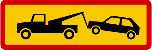
English • Supplementary plate 831.5 • Offending vehicles may be removed. Indicates that illegally parked vehicles may be removed.
Íslenska • Undirmerki 831.5 • Brotlegir verða fjarlægðir. Merki þetta gefur til kynna að ökutæki sem lagt er óleyfilega geti verið fjarlægð.
Fonti
🔗 Commons.wikimedia.org
🔗 Reglugerd.is • Reglugerð nr. 250/2024 • 27. gr.
SVG source: Gigillo83, drawn by original of Umferðastrofa • Public domain • Original revision 2013-03-06. Wikimedia original unmodified.
139. Sosta limitata a 1 ora
Questo pannello integrativo indica che la sosta è limitata a un massimo di 1 ora.

English • Supplementary plate 831.1 • Maximum parking duration. Shows the maximum permitted time. Sign 831.2 requires a disc behind the windscreen to be set to the correct time when parking.
Íslenska • Undirmerki 831.1 • Hámarkstími. Merki þetta gefur til kynna hámarkstíma sem heimilt er að leggja. Merki 831.2 gefur til kynna að stilla skuli skífu undir framrúðu á réttan tíma þegar bifreiðinni er lagt.
Fonti
🔗 Commons.wikimedia.org
🔗 Reglugerd.is • Reglugerð nr. 250/2024 • 27. gr.
SVG source: Gigillo83, drawn by original of Umferðastrofa • Public domain • Original revision 2013-03-06. Wikimedia original unmodified.
140. Durante l'orario indicato
Questo pannello integrativo indica che il segnale principale si applica durante l'orario indicato.
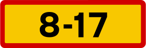
English • Supplementary plate 806 • Times of application. Shows when the main sign applies, using whole hours from 0–24. Figures without brackets apply Monday to Friday; bracketed figures apply Saturdays; red figures without brackets apply Sundays and statutory holidays. If the same hours apply daily, black or white figures with ‘Every day’ are used. For particular weekdays the abbreviations are mán, þri, mið, fim, fös, lau and sun. A specified weekday applies regardless of whether it is a working day or statutory holiday.
Íslenska • Undirmerki 806 • Gildistími. Merki þetta segir til um gildistíma aðalmerkis. Tíminn er gefinn upp í heilum tölum á bilinu 0-24. Stafir án sviga segja til um gildistíma á mánudögum til föstudaga. Stafir innan sviga segja til um gildistíma á laugardögum. Rauðir stafir án sviga segja til um gildistíma á sunnudögum og lögboðnum frídögum. Ef sömu tímamörk gilda alla daga er gildistíminn táknaður með svörtum eða hvítum stöfum og textanum "Alla daga". Ef gildistími nær aðeins til vissra vikudaga eru eftirfarandi styttingar notaðar á dagaheitum: mán, þri, mið, fim, fös, lau, sun. Gildi merkið á vissum vikudegi gildir það óháð því hvort dagurinn sé virkur dagur eða lögboðinn frídagur.
Fonti
🔗 Commons.wikimedia.org
🔗 Reglugerd.is • Reglugerð nr. 250/2024 • 27. gr.
SVG source: Gigillo83, drawn by original of Umferðastrofa • Public domain • Original revision 2013-03-06. Wikimedia original unmodified.
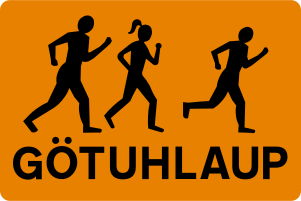
141. Podisti
Questo pannello integrativo avverte che dei podisti possono percorrere o attraversare la strada.
Fonti
Image via Commons.wikimedia.org
Gigillo83, drawn by original of Umferðastrofa • Public domain • Source revision 2013-03-06. Wikimedia original unmodified.
142. Strada a corsia unica
Questo pannello integrativo avverte che la strada più avanti ha un'unica corsia condivisa dal traffico nei due sensi di marcia.
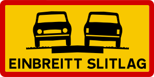
English • Supplementary plate 854.1 • Single-width paved surface. The paved surface is 5 m wide or less. Road users must therefore move onto the gravel shoulder when meeting.
Íslenska • Undirmerki 854.1 • Einbreitt slitlag. Merki þetta gefur til kynna að bundið slitlag sé 5 metrar að breidd eða mjórra. Vegfarendur þurfa því að víkja út á malaröxl þegar mæst er.
Fonti
🔗 Commons.wikimedia.org
🔗 Reglugerd.is • Reglugerð nr. 250/2024 • 27. gr.
SVG source: Gigillo83, drawn by original of Umferðastrofa • Public domain • Original revision 2013-03-06. Wikimedia original unmodified.
Artwork verified against Vegagerdin.is • official published diagram 854.1.
143. Ponte a corsia unica
Questo pannello integrativo avverte che il ponte più avanti ha un'unica corsia condivisa dal traffico nei due sensi di marcia.
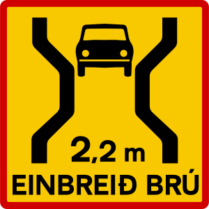
English • Supplementary plate 854.3 • Single-lane bridge with narrow carriageway. Indicates a single-lane bridge ahead with a carriageway narrower than 3.05 m.
Íslenska • Undirmerki 854.3 • Einbreið brú með þröngri akbraut. Merki þetta gefur til kynna að fram undan sé einbreið brú með akbraut mjórri en 3,05 m.
Fonti
🔗 Commons.wikimedia.org
🔗 Reglugerd.is • Reglugerð nr. 250/2024 • 27. gr.
SVG source: Gigillo83, drawn by original of Umferðastrofa • Public domain • Original revision 2013-03-06. Wikimedia original unmodified.
144. Galleria a corsia unica
Questo pannello integrativo avverte che la galleria più avanti ha un'unica corsia condivisa dal traffico nei due sensi di marcia.
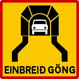
English • Supplementary plate 854.4 • Single-lane tunnel. Indicates a single-lane tunnel ahead.
Íslenska • Undirmerki 854.4 • Einbreið jarðgöng. Merki þetta gefur til kynna að fram undan séu einbreið jarðgöng.
Fonti
🔗 Commons.wikimedia.org
🔗 Reglugerd.is • Reglugerð nr. 250/2024 • 27. gr.
SVG source: Gigillo83, drawn by original of Umferðastrofa • Public domain • Original revision 2013-03-06. Wikimedia original unmodified.
145. Rischio di incidenti
Questo pannello integrativo avverte di un maggiore rischio di incidenti sul tratto di strada interessato.
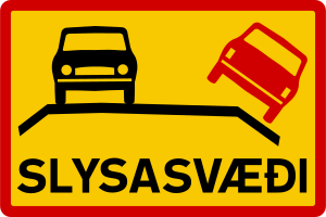
English • Supplementary plate 852 • Accident-prone area. Indicates unusually frequent accidents in the area.
Íslenska • Undirmerki 852 • Slysasvæði. Merki þetta gefur til kynna að slys séu óvenju tíð á svæðinu.
Fonti
🔗 Commons.wikimedia.org
🔗 Reglugerd.is • Reglugerð nr. 250/2024 • 27. gr.
SVG source: Gigillo83, drawn by original of Umferðastrofa • Public domain • Original revision 2013-03-06. Wikimedia original unmodified.
146. Strada con fondo in ghiaia
Questo pannello integrativo avverte che la strada più avanti ha un fondo in ghiaia.
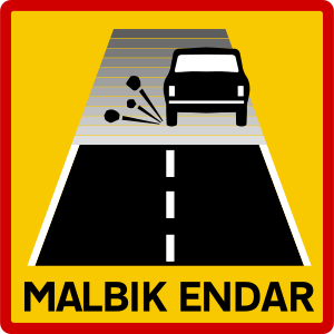
English • Supplementary plate 842.2 • Paved surface ends. The paved surface ends and a gravel road begins.
Íslenska • Undirmerki 842.2 • Malbik endar. Merki þetta gefur til kynna að bundið slitlag endi og malarvegur taki við.
Fonti
🔗 Commons.wikimedia.org
🔗 Reglugerd.is • Reglugerð nr. 250/2024 • 27. gr.
SVG source: Gigillo83, drawn by original of Umferðastrofa • Public domain • Original revision 2013-03-06. Wikimedia original unmodified.
147. Fondo stradale nuovo
Questo pannello integrativo indica che la strada più avanti ha un fondo appena posato o riparato di recente.
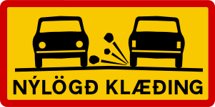
English • Supplementary plate 842.1 • New surface dressing. Indicates driving on newly laid surface dressing.
Íslenska • Undirmerki 842.1 • Nýlögð klæðing. Merki þetta gefur til kynna að ekið sé á nýlagðri klæðingu.
Fonti
🔗 Commons.wikimedia.org
🔗 Reglugerd.is • Reglugerð nr. 250/2024 • 27. gr.
SVG source: Gigillo83, drawn by original of Umferðastrofa • Public domain • Original revision 2013-03-06. Wikimedia original unmodified.
Artwork verified against Vegagerdin.is • official published diagram 842.1.
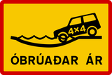
148. Veicolo 4x4 obbligatorio
Questo pannello integrativo indica che è necessario un veicolo a quattro ruote motrici sul percorso successivo.
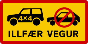
English • Supplementary plate 844.2 • Difficult road. Marks a route impassable for ordinary passenger cars but passable for four-wheel-drive vehicles with greater ground clearance, such as off-road vehicles.
Íslenska • Undirmerki 844.2 • Illfær vegur. Merki þetta gefur til kynna að ekið sé inn á leið sem er ófær almennum fólksbifreiðum en fær fjórhjóladrifnum bifreiðum sem eru hærri en almennar fólksbifreiðar, svo sem jeppum.
Fonti
🔗 Commons.wikimedia.org
🔗 Reglugerd.is • Reglugerð nr. 250/2024 • 27. gr.
SVG source: Gigillo83, drawn by original of Umferðastrofa • Public domain • Original revision 2013-03-06. Wikimedia original unmodified.
Artwork verified against Vegagerdin.is • official published diagram 844.2.
149. Strada di montagna difficile anche per veicoli 4×4
Questo pannello integrativo avverte della presenza di una strada di montagna estremamente impegnativa, che può mettere in difficoltà anche i veicoli a quattro ruote motrici.
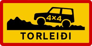
English • Supplementary plate 844.3 • Very difficult route. Passable only for specially equipped off-road vehicles, such as jeeps and mountain vehicles. May have very steep slopes, snowdrifts and rivers barely passable by vehicles.
Íslenska • Undirmerki 844.3 • Torleiði. Merki þetta gefur til kynna að ekið sé inn á leið sem einungis er fær sérútbúnum torfærubifreiðum, svo sem jeppum og fjallabílum. Á leiðinni kunna að vera mjög brattar brekkur, snjóskaflar og ár sem tæplega eru færar bifreiðum.
Fonti
🔗 Commons.wikimedia.org
🔗 Reglugerd.is • Reglugerð nr. 250/2024 • 27. gr.
SVG source: Gigillo83, drawn by original of Umferðastrofa • Public domain • Original revision 2013-03-06. Wikimedia original unmodified.
Artwork verified against Vegagerdin.is • official published diagram 844.3.
150. Strada da percorrere a bassa velocità
Questo pannello integrativo indica un tratto di strada su cui è obbligatorio o consigliato procedere a bassa velocità.
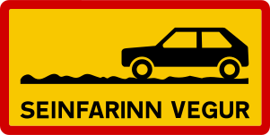
English • Supplementary plate 844.1 • Slow-going road. Passable for passenger cars but slow to travel and possibly rough and steep.
Íslenska • Undirmerki 844.1 • Seinfarinn vegur. Merki þetta gefur til kynna að ekið sé inn á leið sem fær er fólksbílum en sé seinfarin og mögulega gróf og brött.
Fonti
🔗 Commons.wikimedia.org
🔗 Reglugerd.is • Reglugerð nr. 250/2024 • 27. gr.
SVG source: Gigillo83, drawn by original of Umferðastrofa • Public domain • Original revision 2013-03-06. Wikimedia original unmodified.
Artwork verified against Vegagerdin.is • official published diagram 844.1.