


VerkehrszeichenIsland
 Verkehrsregeln
 Island
 Vorfahrtzeichen
 Warnzeichen
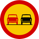 Verbotszeichen
 Gebotszeichen
 Hinweiszeichen
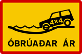 Zusatzzeichen
Verkehrszeichen
Ein Verkehrszeichen ist ein standardisiertes visuelles Zeichen entlang einer Straße, das Fahrer, Radfahrer und Fußgänger leitet, warnt oder ihr Verhalten regelt. Verkehrszeichen vermitteln wichtige Informationen über Straßenverhältnisse, Vorschriften, Richtungen und mögliche Gefahren und tragen damit zu Sicherheit und einem geordneten Verkehrsablauf bei. Sie besitzen unterschiedliche Formen und Farben, etwa dreieckige Warnzeichen, runde Verbots- oder Gebotszeichen und rechteckige Hinweiszeichen, die jeweils auf schnelle Erkennbarkeit und eindeutiges Verständnis ausgelegt sind.
Wie werden Verkehrszeichen in Island eingeteilt?
Die Verordnung verwendet Warnungen der Reihe 100, 200 Vorfahrt, 300 Verbote, 400 Gebote, 500 Sonderregeln und 600/700 Informationen und Wegweisung.
🔗 reglugerd.is • Island: Verordnung 250/2024 Artikel 5-6, Zeichen 110,362; Gesetz § 7
🔗 althingi.is • Island: Straßenverkehrsgesetz 77/2019, Fassung vom 1. Oktober 2026
Ist eine vorübergehende Geschwindigkeitsbegrenzung an Baustellen in Island verbindlich?
Eine geltende von einer befugten Stelle angeordnete vorübergehende Höchstgeschwindigkeit ist einzuhalten. Eine Baustellenwarnung allein ist keine neue zahlenmäßige Grenze; die Bedingungen können trotzdem langsameres Fahren verlangen.
🔗 reglugerd.is • Island: Verordnung 250/2024 Artikel 5-6, Zeichen 110,362; Gesetz § 7
🔗 althingi.is • Island: Straßenverkehrsgesetz 77/2019, Fassung vom 1. Oktober 2026

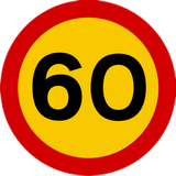
101. Nationale Geschwindigkeitsbegrenzungen
Dieses Verkehrszeichen zeigt die nationalen Geschwindigkeitsbegrenzungen an. Die geltenden allgemeinen Höchstgeschwindigkeiten richten sich nach Straßentyp, Fahrzeugkategorie und örtlichen Verkehrsregeln, sofern keine andere Geschwindigkeitsbegrenzung angezeigt ist.
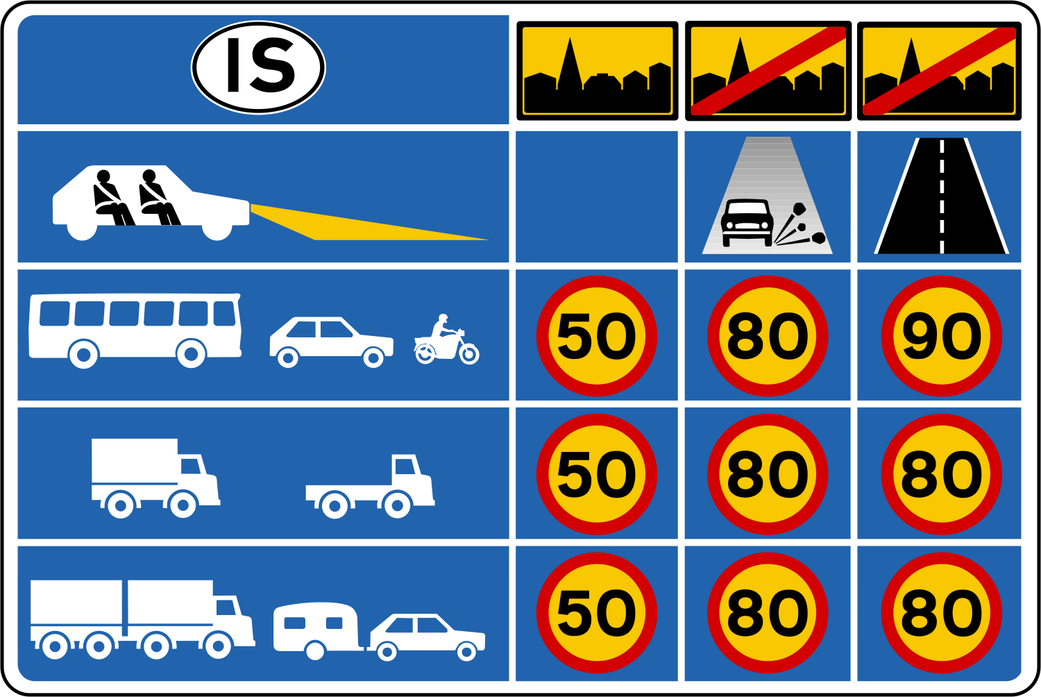
English • Traffic sign 656 • Maximum speed information. Gives the Traffic Act's general maximum speed rules for different conditions.
Íslenska • Umferðarmerki 656 • Hámarkshraðaupplýsingar. Merki þetta gefur upplýsingar um almennar reglur umferðarlaga um leyfilegan hámarkshraða við mismunandi aðstæður.
Quellen
🔗 Commons.wikimedia.org
🔗 Reglugerd.is • Reglugerð nr. 250/2024 • 21. gr.
SVG source: Gigillo83, drawn by original of Umferðastrofa • Public domain • Original revision 2013-01-01. Wikimedia original unmodified.
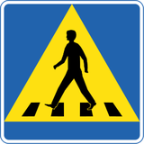
102. Fußgängerüberweg
Dieses Verkehrszeichen kennzeichnet einen Fußgängerüberweg. Es markiert eine ausgewiesene Stelle zum Überqueren der Straße durch Fußgänger. Vorfahrt und Überquerungsregeln richten sich nach den geltenden Verkehrszeichen, Signalen und örtlichen Vorschriften.
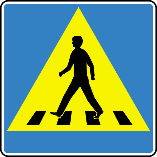
English • Traffic sign 516 • Pedestrian crossing. Indicates a crossing for pedestrians to cross the carriageway. The pedestrian symbol faces towards the crossing.
Íslenska • Umferðarmerki 516 • Gangbraut. Merki þetta gefur til kynna gangbraut sem ætluð er gangandi vegfarendum til að komast yfir akbraut. Merkið tekur breytingum þannig að táknmynd gangandi vegfaranda stefnir í átt að viðkomandi gangbraut.
Quellen
🔗 Commons.wikimedia.org
🔗 Reglugerd.is • Reglugerð nr. 250/2024 • 19. gr.
Image via Commons.wikimedia.org
Fry1989 • CC BY-SA 3.0 • Source revision 2023-01-08. Wikimedia original unmodified.
103. Fahrbahnverengung, Gegenverkehr muss warten
Dieses Verkehrszeichen kennzeichnet eine Fahrbahnverengung, an der der Gegenverkehr Vorrang gewähren muss.
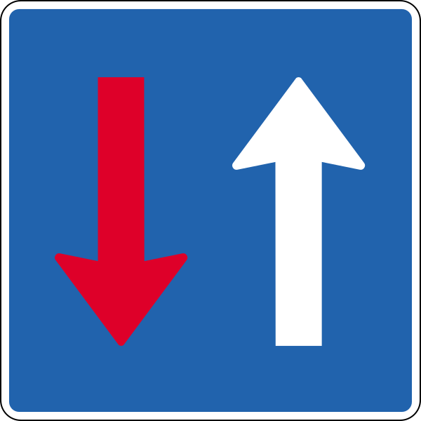
English • Traffic sign 214 • Oncoming traffic gives way. Indicates priority over oncoming traffic.
Íslenska • Umferðarmerki 214 • Umferð á móti veitir forgang. Merki þetta gefur til kynna að umferð á móti veiti forgang.
Quellen
🔗 Commons.wikimedia.org
🔗 Reglugerd.is • Reglugerð nr. 250/2024 • 11. gr.
SVG source: Gigillo83, drawn by original of Umferðastrofa • Public domain • Original revision 2012-12-31. Wikimedia original unmodified.
104. Sackgasse
Dieses Verkehrszeichen kennzeichnet eine Sackgasse. Die Straße hat keine Durchfahrt für Fahrzeuge, der Zugang zu Grundstücken oder anderen Zielen entlang der Straße kann jedoch weiterhin möglich sein.
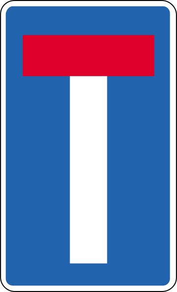
English • Traffic sign 652.7 • Dead-end road. Closed at one end. May indicate a continuing footpath, cycle path or shared path. Adapted to conditions.
Íslenska • Umferðarmerki 652.7 • Botngata. Merki þetta gefur til kynna að vegur sé lokaður í annan endann. Á merkinu má gefa til kynna að göngustígur, hjólastígur eða sameiginlegur stígur sé í framhaldi af veginum. Merkið tekur breytingum eftir aðstæðum.
Quellen
🔗 Commons.wikimedia.org
🔗 Reglugerd.is • Reglugerð nr. 250/2024 • 21. gr.
SVG source: Gigillo83, drawn by original of Umferðastrofa • Public domain • Original revision 2012-12-31. Wikimedia original unmodified.
105. Einbahnstraße
Dieses Verkehrszeichen kennzeichnet eine Einbahnstraße. Fahrzeuge dürfen nur in der erlaubten Richtung fahren, vorbehaltlich Ausnahmen, die durch Verkehrszeichen oder örtliche Regeln angezeigt werden.

English • Traffic sign 526 • One-way traffic. Traffic is one-way in the arrow's direction.
Íslenska • Umferðarmerki 526 • Einstefna. Merki þetta gefur til kynna að einstefnuakstur sé um veginn í þá átt sem örin vísar.
Quellen
🔗 Commons.wikimedia.org
🔗 Reglugerd.is • Reglugerð nr. 250/2024 • 19. gr.
SVG source: Gigillo83, drawn by original of Umferðastrofa • Public domain • Original revision 2013-03-06. Wikimedia original unmodified.
106. Einbahnstraße
Dieses Verkehrszeichen kennzeichnet eine Einbahnstraße. Fahrer dürfen nur in der erlaubten Richtung fahren.

English • Traffic sign 526 • One-way traffic. Traffic is one-way in the arrow's direction.
Íslenska • Umferðarmerki 526 • Einstefna. Merki þetta gefur til kynna að einstefnuakstur sé um veginn í þá átt sem örin vísar.
Quellen
🔗 Commons.wikimedia.org
🔗 Reglugerd.is • Reglugerð nr. 250/2024 • 19. gr.
SVG source: Gigillo83, drawn by original of Umferðastrofa • Public domain • Original revision 2012-12-31. Wikimedia original unmodified.
107. Information über die nächste Ausfahrt
Dieses Verkehrszeichen gibt Informationen über die nächste Ausfahrt. Es kann Ausfahrtnummer, Ziel, Richtung oder Entfernung zur Ausfahrt anzeigen.

English • Traffic sign 715 • Exit lane direction sign. Stands at the beginning of an exit lane and identifies the destination it leads to.
Íslenska • Umferðarmerki 715 • Fráreinavísir. Merki þetta stendur við upphaf fráreinar og vísar á stað sem fráreinin leiðir til.
Quellen
🔗 Commons.wikimedia.org
🔗 Reglugerd.is • Reglugerð nr. 250/2024 • 23. gr.
SVG source: Gigillo83, drawn by original of Umferðastrofa • Public domain • Original revision 2013-03-06. Wikimedia original unmodified.
108. Ziel der Auffahrt
Dieses Verkehrszeichen gibt Informationen über das über die Auffahrt erreichbare Ziel. Das angezeigte Ziel zeigt, wohin die Auffahrt führt.
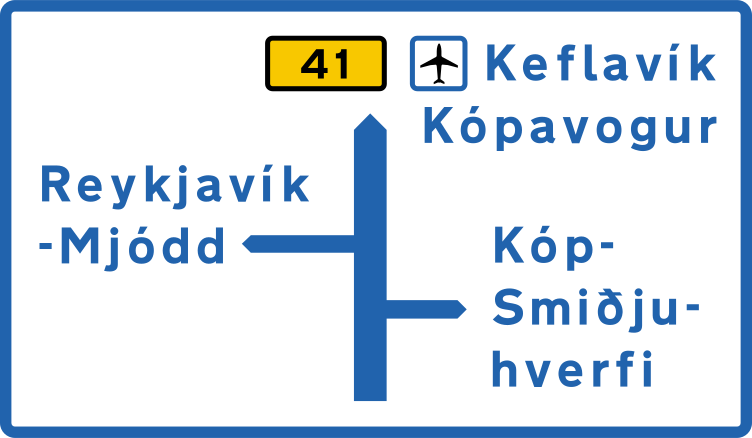
English • Traffic sign 703 • Junction route diagram. Gives a simplified view of route choices at the junction ahead before reaching it.
Íslenska • Umferðarmerki 703 • Staðarleiðatafla. Merki þetta sýnir einfaldaða mynd af leiðavali við vegamót sem eru fram undan, áður en komið er að vegamótum.
Quellen
🔗 Commons.wikimedia.org
🔗 Reglugerd.is • Reglugerð nr. 250/2024 • 23. gr.
SVG source: Gigillo83, drawn by original of Umferðastrofa • Public domain • Original revision 2013-03-06. Wikimedia original unmodified.
109. Übersicht der Fahrstreifen und Fahrtrichtungen
Dieses Verkehrszeichen gibt eine Übersicht der Fahrstreifen und ihrer Richtungen. Pfeile oder andere Angaben zeigen, wie die Fahrstreifen weiterführen und welchen Richtungen oder Zielen sie dienen.

English • Traffic sign 500 • Lane sign. Shows lanes and their permitted use, including travel directions, directions at junctions, merging and diverging lanes. White arrows on blue show permitted directions; other directions are prohibited. Temporary signs, for example for roadworks, use black arrows on orange. Lane-specific restrictions, reserved lanes and special rules appear through appropriate signs, such as mandatory or prohibition signs, and any supplementary plates within the lane diagram. Slow traffic must use a lane specifically marked for it. Designs must reflect the road layout under this article. The sign shows all lanes of the carriageway. Designs, numbers and names in use must be published on the Icelandic Road and Coastal Administration's website. The signs in this article are examples with the following meanings.
Íslenska • Umferðarmerki 500 • Akreinamerki. Merkin gefa til kynna akreinar og heimila notkun þeirra, þ. á m. í hvaða átt umferð má aka, hvert heimilt sé að aka þegar komið er að vegamótum, hvar akrein sameinast annarri og hvar akreinar skiljast að. Heimilar akstursstefnur á akreinum eru gefnar til kynna með hvítum örvum á bláum grunni. Óheimilt er að nota akrein til aksturs í aðra akstursstefnu en gefin er til kynna á merkinu. Þegar akreinamerki eru notuð tímabundið, t.d. vegna vegavinnu, eru örvarnar svartar á appelsínugulum grunni. Takmarkanir á tiltekinni umferð um sérstakar akreinar, sérreinar og aðrar sérreglur um umferð á akrein eru gefnar til kynna á akreinamerki með viðeigandi umferðarmerki, t.d. boð- eða bannmerki, og eftir atvikum undirmerki á mynd viðkomandi akreinar. Hægfara umferð er skylt að nota akrein sem sérstaklega er merkt fyrir slíka umferð. Akreinamerki skulu útfærð eftir legu vegar á hverjum stað í samræmi við ákvæði þessarar greinar. Merkið sýnir allar akreinar viðkomandi akbrautar. Útlit, númer og heiti akreinamerkja í notkun skulu birt á vefsíðu Vegagerðarinnar. Merki sem sýnd eru í þessari grein eru tekin sem dæmi og hafa eftirfarandi merkingar:.
Quellen
🔗 Commons.wikimedia.org
🔗 Reglugerd.is • Reglugerð nr. 250/2024 • 19. gr.
SVG source: Gigillo83, drawn by original of Umferðastrofa • Public domain • Original revision 2013-03-06. Wikimedia original unmodified.
110. Kreuzungsverlauf, Richtungen und Ziele
Dieses Verkehrszeichen zeigt den Kreuzungsverlauf, Richtungen und Ziele. Die Darstellung zeigt die Anordnung der Straßen und welche Richtung zu den angegebenen Zielen oder Routen führt.
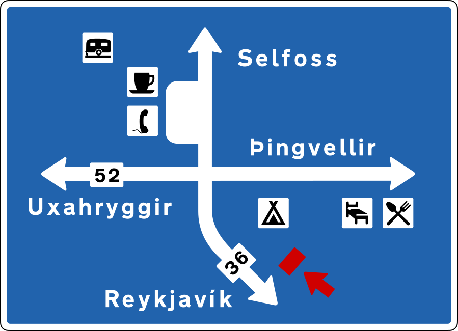
English • Traffic sign 703 • Junction route diagram. Gives a simplified view of route choices at the junction ahead before reaching it.
Íslenska • Umferðarmerki 703 • Staðarleiðatafla. Merki þetta sýnir einfaldaða mynd af leiðavali við vegamót sem eru fram undan, áður en komið er að vegamótum.
Quellen
🔗 Commons.wikimedia.org
🔗 Reglugerd.is • Reglugerð nr. 250/2024 • 23. gr.
SVG source: Gigillo83, drawn by original of Umferðastrofa • Public domain • Original revision 2013-03-06. Wikimedia original unmodified.
111. Ende eines Fahrstreifens
Dieses Verkehrszeichen kennzeichnet das Ende eines Fahrstreifens. Die dargestellte Fahrstreifenführung zeigt, welcher Fahrstreifen endet und wie die verbleibenden Fahrstreifen weiterführen.
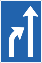
English • Traffic sign 500 • Lane sign. Shows lanes and their permitted use, including travel directions, directions at junctions, merging and diverging lanes. White arrows on blue show permitted directions; other directions are prohibited. Temporary signs, for example for roadworks, use black arrows on orange. Lane-specific restrictions, reserved lanes and special rules appear through appropriate signs, such as mandatory or prohibition signs, and any supplementary plates within the lane diagram. Slow traffic must use a lane specifically marked for it. Designs must reflect the road layout under this article. The sign shows all lanes of the carriageway. Designs, numbers and names in use must be published on the Icelandic Road and Coastal Administration's website. The signs in this article are examples with the following meanings.
Íslenska • Umferðarmerki 500 • Akreinamerki. Merkin gefa til kynna akreinar og heimila notkun þeirra, þ. á m. í hvaða átt umferð má aka, hvert heimilt sé að aka þegar komið er að vegamótum, hvar akrein sameinast annarri og hvar akreinar skiljast að. Heimilar akstursstefnur á akreinum eru gefnar til kynna með hvítum örvum á bláum grunni. Óheimilt er að nota akrein til aksturs í aðra akstursstefnu en gefin er til kynna á merkinu. Þegar akreinamerki eru notuð tímabundið, t.d. vegna vegavinnu, eru örvarnar svartar á appelsínugulum grunni. Takmarkanir á tiltekinni umferð um sérstakar akreinar, sérreinar og aðrar sérreglur um umferð á akrein eru gefnar til kynna á akreinamerki með viðeigandi umferðarmerki, t.d. boð- eða bannmerki, og eftir atvikum undirmerki á mynd viðkomandi akreinar. Hægfara umferð er skylt að nota akrein sem sérstaklega er merkt fyrir slíka umferð. Akreinamerki skulu útfærð eftir legu vegar á hverjum stað í samræmi við ákvæði þessarar greinar. Merkið sýnir allar akreinar viðkomandi akbrautar. Útlit, númer og heiti akreinamerkja í notkun skulu birt á vefsíðu Vegagerðarinnar. Merki sem sýnd eru í þessari grein eru tekin sem dæmi og hafa eftirfarandi merkingar:.
Quellen
🔗 Commons.wikimedia.org
🔗 Reglugerd.is • Reglugerð nr. 250/2024 • 19. gr.
SVG source: Gigillo83, drawn by original of Umferðastrofa • Public domain • Original revision 2013-03-06. Wikimedia original unmodified.
112. Parken erlaubt
Dieses Verkehrszeichen zeigt an, dass Parken erlaubt ist. Fahrzeuge dürfen im Geltungsbereich des Zeichens unter Beachtung der angegebenen Bedingungen, Beschränkungen und örtlichen Parkregeln geparkt werden.
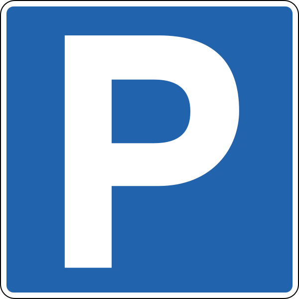
English • Traffic sign 552.1 • Parking. Permitted unless contrary to the Traffic Act's stopping or parking provisions. Applies within a defined car park or on the sign's side from the sign to the next junction unless a plate states otherwise. A plate gives further restrictions.
Íslenska • Umferðarmerki 552.1 • Bifreiðastæði. Merki þetta gefur til kynna að heimilt sé að leggja, sé það ekki í andstöðu við ákvæði umferðarlaga um að stöðva eða leggja ökutæki. Merkið gildir á afmörkuðu bifreiðastæði eða þeim megin vegar sem merkið stendur, frá merkinu og að næstu vegamótum nema annað sé tekið fram með undirmerki. Nánari lýsing á takmörkun kemur fram á undirmerki.
Quellen
🔗 Commons.wikimedia.org
🔗 Reglugerd.is • Reglugerð nr. 250/2024 • 19. gr.
SVG source: Gigillo83, drawn by original of Umferðastrofa • Public domain • Original revision 2012-12-31. Wikimedia original unmodified.
113. Streckenradar
Dieses Verkehrszeichen kennzeichnet eine Streckenüberwachung, auch Abschnittskontrolle genannt. Die Durchschnittsgeschwindigkeit eines Fahrzeugs wird über einen festgelegten Straßenabschnitt gemessen und mit der geltenden Geschwindigkeitsbegrenzung verglichen.
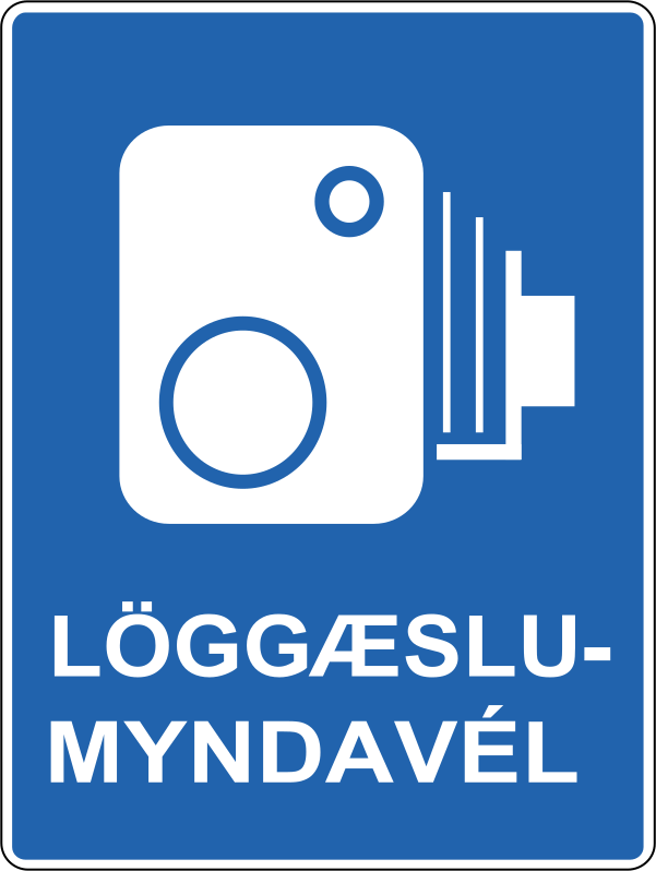
English • Traffic sign 655.61 • Enforcement camera. Indicates an automatic enforcement camera ahead that may photograph a traffic offence.
Íslenska • Umferðarmerki 655.61 • Löggæslumyndavél. Merki þetta gefur til kynna að fram undan sé sjálfvirk löggæslumyndavél sem gæti tekið ljósmynd af umferðarlagabroti.
Quellen
🔗 Commons.wikimedia.org
🔗 Reglugerd.is • Reglugerð nr. 250/2024 • 21. gr.
SVG source: Gigillo83, drawn by original of Umferðastrofa • Public domain • Original revision 2013-09-22. Wikimedia original unmodified.
114. Kreuzungsform
Dieses Verkehrszeichen zeigt die Form oder den Verlauf einer vorausliegenden Kreuzung. Die Darstellung zeigt, wie die zuführende Straße und die anschließenden Straßen angeordnet sind.
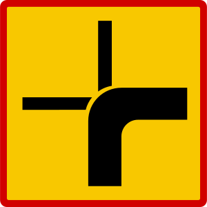
English • Supplementary plate 815.1 • Course of the priority road through a junction. A thick line shows the priority road; thin lines show non-priority roads with give-way or stop requirements.
Íslenska • Undirmerki 815.1 • Leið aðalbrautar á vegamótum. Merki þetta gefur til kynna leið aðalbrautar á vegamótum þar sem sver lína táknar leið aðalbrautar en mjó lína víkjandi veg með biðskyldu eða stöðvunarskyldu gagnvart aðalbraut.
Quellen
🔗 Commons.wikimedia.org
🔗 Reglugerd.is • Reglugerð nr. 250/2024 • 27. gr.
SVG source: Gigillo83, drawn by original of Umferðastrofa • Public domain • Original revision 2013-03-06. Wikimedia original unmodified.
Artwork verified against Vegagerdin.is • official published diagram 815.1.
115. Kreuzungsform
Dieses Verkehrszeichen zeigt die Form oder den Verlauf einer vorausliegenden Kreuzung. Die Darstellung zeigt, wie die zuführende Straße und die anschließenden Straßen angeordnet sind.

English • Supplementary plate 815.3 • Course of the priority road through a junction. A thick line shows the priority road; thin lines show non-priority roads with give-way or stop requirements.
Íslenska • Undirmerki 815.3 • Leið aðalbrautar á vegamótum. Merki þetta gefur til kynna leið aðalbrautar á vegamótum þar sem sver lína táknar leið aðalbrautar en mjó lína víkjandi veg með biðskyldu eða stöðvunarskyldu gagnvart aðalbraut.
Quellen
🔗 Commons.wikimedia.org
🔗 Reglugerd.is • Reglugerð nr. 250/2024 • 27. gr.
SVG source: Gigillo83, drawn by original of Umferðastrofa • Public domain • Original revision 2013-03-06. Wikimedia original unmodified.
Artwork verified against Vegagerdin.is • official published diagram 815.3.
116. Kreuzungsform
Dieses Verkehrszeichen zeigt die Form oder den Verlauf einer vorausliegenden Kreuzung. Die Darstellung zeigt, wie die zuführende Straße und die anschließenden Straßen angeordnet sind.

English • Supplementary plate 815.2 • Course of the priority road through a junction. A thick line shows the priority road; thin lines show non-priority roads with give-way or stop requirements.
Íslenska • Undirmerki 815.2 • Leið aðalbrautar á vegamótum. Merki þetta gefur til kynna leið aðalbrautar á vegamótum þar sem sver lína táknar leið aðalbrautar en mjó lína víkjandi veg með biðskyldu eða stöðvunarskyldu gagnvart aðalbraut.
Quellen
🔗 Commons.wikimedia.org
🔗 Reglugerd.is • Reglugerð nr. 250/2024 • 27. gr.
SVG source: Gigillo83, drawn by original of Umferðastrofa • Public domain • Original revision 2013-03-06. Wikimedia original unmodified.
Artwork verified against Vegagerdin.is • official published diagram 815.2.
117. Für Menschen mit Behinderung
Dieses Zusatzzeichen zeigt an, dass das Hauptverkehrszeichen speziell für Menschen mit Behinderung gilt. Etwaige Genehmigungs- oder Berechtigungsvoraussetzungen richten sich nach dem Hauptzeichen und den örtlichen Regeln.
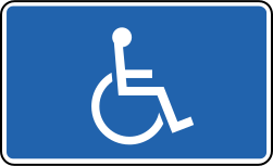
English • Symbol 807.82 • Road users with reduced mobility. The symbol represents such road users.
Íslenska • Tákn 807.82 • Hreyfihamlaðir vegfarendur. Táknið stendur fyrir umferð hreyfihamlaðra vegfarenda.
Quellen
🔗 Commons.wikimedia.org
🔗 Reglugerd.is • Reglugerð nr. 250/2024 • 27. gr.
SVG source: Gigillo83, drawn by original of Umferðastrofa • Public domain • Original revision 2022-07-31. Wikimedia original unmodified.
118. Für blinde Menschen
Dieses Zusatzzeichen zeigt an, dass das Hauptverkehrszeichen speziell blinde oder sehbehinderte Menschen betrifft.

English • Supplementary plate 840.1 • Visually impaired road users. Draws attention to the possible presence of people with impaired vision.
Íslenska • Undirmerki 840.1 • Sjónskertir vegfarendur. Merki þetta vekur athygli á að vænta megi umferðar sjónskerts fólks.
Quellen
🔗 Commons.wikimedia.org
🔗 Reglugerd.is • Reglugerð nr. 250/2024 • 27. gr.
SVG source: Original: The Icelands Public Roads Administration (Vegagerdin) Vector: Ricordisamoa • Public domain • Original revision 2013-01-03. Wikimedia original unmodified.
Artwork verified against Vegagerdin.is • official published diagram 840.1.
119. Für gehörlose Menschen
Dieses Zusatzzeichen zeigt an, dass das Hauptverkehrszeichen speziell gehörlose oder hörbehinderte Menschen betrifft.

English • Supplementary plate 840.2 • Hearing-impaired road users. Draws attention to the possible presence of people with impaired hearing.
Íslenska • Undirmerki 840.2 • Heyrnarskertir vegfarendur. Merki þetta vekur athygli á að vænta megi umferðar heyrnarskerts fólks.
Quellen
🔗 Commons.wikimedia.org
🔗 Reglugerd.is • Reglugerð nr. 250/2024 • 27. gr.
SVG source: Gigillo83, drawn by original of Umferðastrofa • Public domain • Original revision 2013-03-06. Wikimedia original unmodified.
120. Nach links
Dieses Zusatzzeichen zeigt an, dass das Hauptverkehrszeichen in Pfeilrichtung nach links gilt.

English • Supplementary plate 828.3 • Extent. The accompanying prohibition or special-rule sign applies in the arrow's direction. A length in whole metres may appear in the arrow. The plate may be horizontal or vertical. A horizontal plate stands parallel to the street and applies in the direction or directions shown. A vertical plate stands across the street: an upward arrow means the prohibition applies beyond the sign; a downward arrow means it applies up to the sign; arrows both ways mean it applies on both sides. This colour is always used regardless of the main sign's colour.
Íslenska • Undirmerki 828.3 • Gildissvæði. Merki þetta gefur til kynna að bannmerki eða sérreglumerki sem það stendur með gildi í þá átt sem örin tilgreinir. Heimilt er að setja upplýsingar um lengd í heilum metrum inn á örina. Undirmerkið getur hvort heldur sem er verið lárétt eða lóðrétt. Lárétt undirmerki stendur samsíða götu og gildir í þá átt eða þær áttir sem það vísar. Lóðrétt undirmerki stendur þvert á götu. Ör sem vísar upp á lóðréttu undirmerki gefur til kynna að bann gildi í framhaldi af merkinu en ör sem vísar niður að bann gildi að merkinu. Lóðrétt ör sem vísar bæði upp og niður gefur til kynna að bann gildi beggja vegna merkisins. Merkið er alltaf notað í þessum lit óháð lit aðalmerkis.
Quellen
🔗 Commons.wikimedia.org
🔗 Reglugerd.is • Reglugerð nr. 250/2024 • 27. gr.
SVG source: Gigillo83, drawn by original of Umferðastrofa • Public domain • Original revision 2013-03-06. Wikimedia original unmodified.
121. Nach links und rechts
Dieses Zusatzzeichen zeigt an, dass das Hauptverkehrszeichen in beiden durch die Pfeile gezeigten Richtungen, nach links und rechts, gilt.

English • Supplementary plate 828.5 • Extent. The accompanying prohibition or special-rule sign applies in the arrow's direction. A length in whole metres may appear in the arrow. The plate may be horizontal or vertical. A horizontal plate stands parallel to the street and applies in the direction or directions shown. A vertical plate stands across the street: an upward arrow means the prohibition applies beyond the sign; a downward arrow means it applies up to the sign; arrows both ways mean it applies on both sides. This colour is always used regardless of the main sign's colour.
Íslenska • Undirmerki 828.5 • Gildissvæði. Merki þetta gefur til kynna að bannmerki eða sérreglumerki sem það stendur með gildi í þá átt sem örin tilgreinir. Heimilt er að setja upplýsingar um lengd í heilum metrum inn á örina. Undirmerkið getur hvort heldur sem er verið lárétt eða lóðrétt. Lárétt undirmerki stendur samsíða götu og gildir í þá átt eða þær áttir sem það vísar. Lóðrétt undirmerki stendur þvert á götu. Ör sem vísar upp á lóðréttu undirmerki gefur til kynna að bann gildi í framhaldi af merkinu en ör sem vísar niður að bann gildi að merkinu. Lóðrétt ör sem vísar bæði upp og niður gefur til kynna að bann gildi beggja vegna merkisins. Merkið er alltaf notað í þessum lit óháð lit aðalmerkis.
Quellen
🔗 Commons.wikimedia.org
🔗 Reglugerd.is • Reglugerð nr. 250/2024 • 27. gr.
SVG source: Gigillo83, drawn by original of Umferðastrofa • Public domain • Original revision 2013-03-06. Wikimedia original unmodified.
122. Nach rechts
Dieses Zusatzzeichen zeigt an, dass das Hauptverkehrszeichen in Pfeilrichtung nach rechts gilt.

English • Supplementary plate 828.1 • Extent. The accompanying prohibition or special-rule sign applies in the arrow's direction. A length in whole metres may appear in the arrow. The plate may be horizontal or vertical. A horizontal plate stands parallel to the street and applies in the direction or directions shown. A vertical plate stands across the street: an upward arrow means the prohibition applies beyond the sign; a downward arrow means it applies up to the sign; arrows both ways mean it applies on both sides. This colour is always used regardless of the main sign's colour.
Íslenska • Undirmerki 828.1 • Gildissvæði. Merki þetta gefur til kynna að bannmerki eða sérreglumerki sem það stendur með gildi í þá átt sem örin tilgreinir. Heimilt er að setja upplýsingar um lengd í heilum metrum inn á örina. Undirmerkið getur hvort heldur sem er verið lárétt eða lóðrétt. Lárétt undirmerki stendur samsíða götu og gildir í þá átt eða þær áttir sem það vísar. Lóðrétt undirmerki stendur þvert á götu. Ör sem vísar upp á lóðréttu undirmerki gefur til kynna að bann gildi í framhaldi af merkinu en ör sem vísar niður að bann gildi að merkinu. Lóðrétt ör sem vísar bæði upp og niður gefur til kynna að bann gildi beggja vegna merkisins. Merkið er alltaf notað í þessum lit óháð lit aðalmerkis.
Quellen
🔗 Commons.wikimedia.org
🔗 Reglugerd.is • Reglugerð nr. 250/2024 • 27. gr.
SVG source: Gigillo83, drawn by original of Umferðastrofa • Public domain • Original revision 2013-03-06. Wikimedia original unmodified.
123. Meter nach links
Dieses Zusatzzeichen zeigt an, dass sich das Hauptverkehrszeichen auf eine Stelle in der angegebenen Entfernung nach links bezieht.
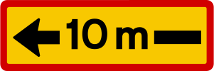
English • Supplementary plate 828.4 • Extent. The accompanying prohibition or special-rule sign applies in the arrow's direction. A length in whole metres may appear in the arrow. The plate may be horizontal or vertical. A horizontal plate stands parallel to the street and applies in the direction or directions shown. A vertical plate stands across the street: an upward arrow means the prohibition applies beyond the sign; a downward arrow means it applies up to the sign; arrows both ways mean it applies on both sides. This colour is always used regardless of the main sign's colour.
Íslenska • Undirmerki 828.4 • Gildissvæði. Merki þetta gefur til kynna að bannmerki eða sérreglumerki sem það stendur með gildi í þá átt sem örin tilgreinir. Heimilt er að setja upplýsingar um lengd í heilum metrum inn á örina. Undirmerkið getur hvort heldur sem er verið lárétt eða lóðrétt. Lárétt undirmerki stendur samsíða götu og gildir í þá átt eða þær áttir sem það vísar. Lóðrétt undirmerki stendur þvert á götu. Ör sem vísar upp á lóðréttu undirmerki gefur til kynna að bann gildi í framhaldi af merkinu en ör sem vísar niður að bann gildi að merkinu. Lóðrétt ör sem vísar bæði upp og niður gefur til kynna að bann gildi beggja vegna merkisins. Merkið er alltaf notað í þessum lit óháð lit aðalmerkis.
Quellen
🔗 Commons.wikimedia.org
🔗 Reglugerd.is • Reglugerð nr. 250/2024 • 27. gr.
SVG source: Gigillo83, drawn by original of Umferðastrofa • Public domain • Original revision 2013-03-06. Wikimedia original unmodified.
124. Meter nach links und rechts
Dieses Zusatzzeichen zeigt an, dass sich das Hauptverkehrszeichen auf Stellen in der angegebenen Entfernung nach links und rechts bezieht.
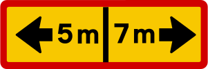
English • Supplementary plate 828.6 • Extent. The accompanying prohibition or special-rule sign applies in the arrow's direction. A length in whole metres may appear in the arrow. The plate may be horizontal or vertical. A horizontal plate stands parallel to the street and applies in the direction or directions shown. A vertical plate stands across the street: an upward arrow means the prohibition applies beyond the sign; a downward arrow means it applies up to the sign; arrows both ways mean it applies on both sides. This colour is always used regardless of the main sign's colour.
Íslenska • Undirmerki 828.6 • Gildissvæði. Merki þetta gefur til kynna að bannmerki eða sérreglumerki sem það stendur með gildi í þá átt sem örin tilgreinir. Heimilt er að setja upplýsingar um lengd í heilum metrum inn á örina. Undirmerkið getur hvort heldur sem er verið lárétt eða lóðrétt. Lárétt undirmerki stendur samsíða götu og gildir í þá átt eða þær áttir sem það vísar. Lóðrétt undirmerki stendur þvert á götu. Ör sem vísar upp á lóðréttu undirmerki gefur til kynna að bann gildi í framhaldi af merkinu en ör sem vísar niður að bann gildi að merkinu. Lóðrétt ör sem vísar bæði upp og niður gefur til kynna að bann gildi beggja vegna merkisins. Merkið er alltaf notað í þessum lit óháð lit aðalmerkis.
Quellen
🔗 Commons.wikimedia.org
🔗 Reglugerd.is • Reglugerð nr. 250/2024 • 27. gr.
SVG source: Gigillo83, drawn by original of Umferðastrofa • Public domain • Original revision 2013-03-06. Wikimedia original unmodified.
125. Meter nach rechts
Dieses Zusatzzeichen zeigt an, dass sich das Hauptverkehrszeichen auf eine Stelle in der angegebenen Entfernung nach rechts bezieht.

English • Supplementary plate 828.2 • Extent. The accompanying prohibition or special-rule sign applies in the arrow's direction. A length in whole metres may appear in the arrow. The plate may be horizontal or vertical. A horizontal plate stands parallel to the street and applies in the direction or directions shown. A vertical plate stands across the street: an upward arrow means the prohibition applies beyond the sign; a downward arrow means it applies up to the sign; arrows both ways mean it applies on both sides. This colour is always used regardless of the main sign's colour.
Íslenska • Undirmerki 828.2 • Gildissvæði. Merki þetta gefur til kynna að bannmerki eða sérreglumerki sem það stendur með gildi í þá átt sem örin tilgreinir. Heimilt er að setja upplýsingar um lengd í heilum metrum inn á örina. Undirmerkið getur hvort heldur sem er verið lárétt eða lóðrétt. Lárétt undirmerki stendur samsíða götu og gildir í þá átt eða þær áttir sem það vísar. Lóðrétt undirmerki stendur þvert á götu. Ör sem vísar upp á lóðréttu undirmerki gefur til kynna að bann gildi í framhaldi af merkinu en ör sem vísar niður að bann gildi að merkinu. Lóðrétt ör sem vísar bæði upp og niður gefur til kynna að bann gildi beggja vegna merkisins. Merkið er alltaf notað í þessum lit óháð lit aðalmerkis.
Quellen
🔗 Commons.wikimedia.org
🔗 Reglugerd.is • Reglugerð nr. 250/2024 • 27. gr.
SVG source: Gigillo83, drawn by original of Umferðastrofa • Public domain • Original revision 2013-03-06. Wikimedia original unmodified.
126. Gilt nach dem Linksabbiegen
Dieses Zusatzzeichen zeigt an, dass das Hauptverkehrszeichen nach dem Linksabbiegen gilt.

English • Supplementary plate 810.7 • Direction to which the main sign applies. Points in the direction covered by the main sign.
Íslenska • Undirmerki 810.7 • Stefna sem aðalmerki á við. Merki þetta vísar í þá átt sem aðalmerki á við.
Quellen
🔗 Commons.wikimedia.org
🔗 Reglugerd.is • Reglugerð nr. 250/2024 • 27. gr.
SVG source: Civitas13, drawn by original of Samgöngustofu • Public domain • Original revision 2018-08-28. Wikimedia original unmodified.
127. Gilt nach dem Rechtsabbiegen
Dieses Zusatzzeichen zeigt an, dass das Hauptverkehrszeichen nach dem Rechtsabbiegen gilt.

English • Supplementary plate 810.6 • Direction to which the main sign applies. Points in the direction covered by the main sign.
Íslenska • Undirmerki 810.6 • Stefna sem aðalmerki á við. Merki þetta vísar í þá átt sem aðalmerki á við.
Quellen
🔗 Commons.wikimedia.org
🔗 Reglugerd.is • Reglugerð nr. 250/2024 • 27. gr.
SVG source: Civitas13, drawn by original of Samgöngustofu • Public domain • Original revision 2018-08-28. Wikimedia original unmodified.
128. Meter voraus
Dieses Zusatzzeichen gibt die Entfernung vom Hauptverkehrszeichen bis zu der Stelle an, an der die angezeigte Gefahr, Regelung oder Information beginnt. Die Entfernung wird in Metern angegeben.
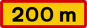
English • Supplementary plate 802.1 • Distance. Shows the distance to the point referred to by the main sign, in whole metres or kilometres to one decimal place. Uses the main sign's colour.
Íslenska • Undirmerki 802.1 • Fjarlægð. Merki þetta segir til um hversu langt er að þeim stað sem aðalmerkið á við. Fjarlægðin er gefin upp í heilum metrum eða kílómetrum með einum aukastaf. Merkið tekur lit aðalmerkis.
Quellen
🔗 Commons.wikimedia.org
🔗 Reglugerd.is • Reglugerð nr. 250/2024 • 27. gr.
SVG source: Gigillo83, drawn by original of Umferðastrofa • Public domain • Original revision 2013-03-06. Wikimedia original unmodified.
129. Stopp in Metern
Dieses Zusatzzeichen kündigt ein Stoppschild in der angegebenen Entfernung voraus an. Der angezeigte Wert gibt die Entfernung zum bevorstehenden Stoppschild an.
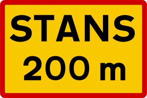
English • Supplementary plate 824 • Stop ahead. Used with 202 ‘Give way’ to warn of a junction with 204 ‘Compulsory stop’ ahead.
Íslenska • Undirmerki 824 • Stöðvunarskylda fram undan. Merki þetta er notað með merkinu 202 Biðskylda og gefur til kynna að fram undan sé stöðvunarskylda við vegamót, merkt með merkinu 204 Stöðvunarskylda.
Quellen
🔗 Commons.wikimedia.org
🔗 Reglugerd.is • Reglugerð nr. 250/2024 • 27. gr.
SVG source: Gigillo83, drawn by original of Umferðastrofa • Public domain • Original revision 2013-03-06. Wikimedia original unmodified.
130. In Metern für Meter
Dieses Zusatzzeichen gibt die Entfernung bis zum Beginn des vom Hauptverkehrszeichen betroffenen Abschnitts und die Länge dieses Abschnitts an. Beide Entfernungen werden in Metern angegeben.
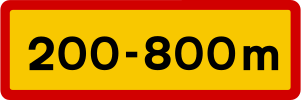
English • Supplementary plate 804.1 • Length of application. Gives the distances from the sign to the beginning and end of the main sign's application, in whole metres or kilometres to one decimal place. Uses the main sign's colour.
Íslenska • Undirmerki 804.1 • Lengd gildissvæðis. Merki þetta segir til um gildissvæði aðalmerkis. Á merkinu kemur fram fjarlægð að upphafi gildissvæðis og fjarlægð að lokum þess, mæld frá merkinu. Fjarlægðin er gefin upp í heilum metrum eða kílómetrum með einum aukastaf. Merkið tekur lit aðalmerkis.
Quellen
🔗 Commons.wikimedia.org
🔗 Reglugerd.is • Reglugerð nr. 250/2024 • 27. gr.
SVG source: Gigillo83, drawn by original of Umferðastrofa • Public domain • Original revision 2013-03-06. Wikimedia original unmodified.
131. Angegebene Masse
Dieses Zusatzzeichen zeigt eine angegebene Fahrzeugmasse. Lesen Sie es zusammen mit dem Hauptverkehrszeichen, um zu bestimmen, wie der Massenwert die geltende Regel oder Beschränkung beeinflusst.
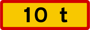
English • Supplementary plate 808 • Text. Defines the accompanying sign's scope, exemptions or explanation. A total mass in whole tonnes below a prohibition sign limits it to vehicles above that mass. Where the main sign does not apply to all vehicles, ‘EXCEPT’ with a symbol or text identifies exempt road users. ‘Deliveries permitted’ with operating times gives unloading hours and an exemption from the accompanying prohibition.
Íslenska • Undirmerki 808 • Texti. Merki þetta gefur nánari skilgreiningu á gildissviði, undanþágu frá eða skýringu á því umferðarmerki sem merkið stendur með. Undirmerki með heildarþyngd í heilum tonnum undir bannmerki, gefur til kynna að bannmerkið taki einungis til ökutækja yfir þeirri heildarþyngd sem fram kemur á undirmerkinu. Þar sem aðalmerki gildir ekki um öll ökutæki er undirmerki notað með textanum "NEMA" og myndtákni eða texta fyrir þá tegund umferðar sem undanþegin er banni eða fyrirmælum. Undirmerki með textanum "Vöruafgreiðsla heimil" ásamt gildistíma gefur til kynna vörulosunartíma og þar með undanþágu frá banni sem merkið sem það stendur með gefur til kynna.
Quellen
🔗 Commons.wikimedia.org
🔗 Reglugerd.is • Reglugerð nr. 250/2024 • 27. gr.
SVG source: Gigillo83, drawn by original of Umferðastrofa • Public domain • Original revision 2013-03-06. Wikimedia original unmodified.
132. Kreuzungsform
Dieses Zusatzzeichen zeigt die Form oder den Verlauf der vorausliegenden Kreuzung.
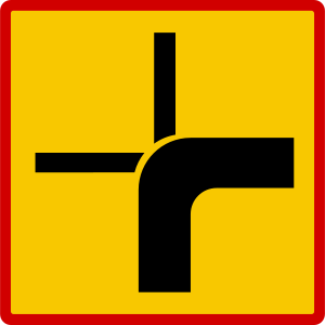
English • Supplementary plate 815.1 • Course of the priority road through a junction. A thick line shows the priority road; thin lines show non-priority roads with give-way or stop requirements.
Íslenska • Undirmerki 815.1 • Leið aðalbrautar á vegamótum. Merki þetta gefur til kynna leið aðalbrautar á vegamótum þar sem sver lína táknar leið aðalbrautar en mjó lína víkjandi veg með biðskyldu eða stöðvunarskyldu gagnvart aðalbraut.
Quellen
🔗 Commons.wikimedia.org
🔗 Reglugerd.is • Reglugerð nr. 250/2024 • 27. gr.
SVG source: Gigillo83, drawn by original of Umferðastrofa • Public domain • Original revision 2013-03-06. Wikimedia original unmodified.
133. Kreuzungsform
Dieses Zusatzzeichen zeigt die Form oder den Verlauf der vorausliegenden Kreuzung.

English • Supplementary plate 815.2 • Course of the priority road through a junction. A thick line shows the priority road; thin lines show non-priority roads with give-way or stop requirements.
Íslenska • Undirmerki 815.2 • Leið aðalbrautar á vegamótum. Merki þetta gefur til kynna leið aðalbrautar á vegamótum þar sem sver lína táknar leið aðalbrautar en mjó lína víkjandi veg með biðskyldu eða stöðvunarskyldu gagnvart aðalbraut.
Quellen
🔗 Commons.wikimedia.org
🔗 Reglugerd.is • Reglugerð nr. 250/2024 • 27. gr.
SVG source: Gigillo83, drawn by original of Umferðastrofa • Public domain • Original revision 2013-03-06. Wikimedia original unmodified.
134. Kreuzungsform
Dieses Zusatzzeichen zeigt die Form oder den Verlauf der vorausliegenden Kreuzung.

English • Supplementary plate 815.3 • Course of the priority road through a junction. A thick line shows the priority road; thin lines show non-priority roads with give-way or stop requirements.
Íslenska • Undirmerki 815.3 • Leið aðalbrautar á vegamótum. Merki þetta gefur til kynna leið aðalbrautar á vegamótum þar sem sver lína táknar leið aðalbrautar en mjó lína víkjandi veg með biðskyldu eða stöðvunarskyldu gagnvart aðalbraut.
Quellen
🔗 Commons.wikimedia.org
🔗 Reglugerd.is • Reglugerð nr. 250/2024 • 27. gr.
SVG source: Gigillo83, drawn by original of Umferðastrofa • Public domain • Original revision 2013-03-06. Wikimedia original unmodified.
135. Senkrechtes Parken
Dieses Zusatzzeichen zeigt an, dass Fahrzeuge wie dargestellt senkrecht zum Bordstein parken müssen.

English • Supplementary plate 829.2 • Parking layout. Shows parallel, perpendicular or angled parking.
Íslenska • Undirmerki 829.2 • Bifreiðastæði, fyrirkomulag. Merki þetta gefur til kynna fyrirkomulag bifreiðastæða, samsíða, hornrétt eða á ská.
Quellen
🔗 Commons.wikimedia.org
🔗 Reglugerd.is • Reglugerð nr. 250/2024 • 27. gr.
SVG source: Gigillo83, drawn by original of Umferðastrofa • Public domain • Original revision 2013-03-06. Wikimedia original unmodified.
Artwork verified against Vegagerdin.is • official published diagram 829.2.
136. Parallelparken
Dieses Zusatzzeichen zeigt an, dass Fahrzeuge wie dargestellt parallel zum Bordstein parken müssen.

English • Supplementary plate 829.1 • Parking layout. Shows parallel, perpendicular or angled parking.
Íslenska • Undirmerki 829.1 • Bifreiðastæði, fyrirkomulag. Merki þetta gefur til kynna fyrirkomulag bifreiðastæða, samsíða, hornrétt eða á ská.
Quellen
🔗 Commons.wikimedia.org
🔗 Reglugerd.is • Reglugerð nr. 250/2024 • 27. gr.
SVG source: Gigillo83, drawn by original of Umferðastrofa • Public domain • Original revision 2013-03-06. Wikimedia original unmodified.
Artwork verified against Vegagerdin.is • official published diagram 829.1.
137. Schrägparken nach links
Dieses Zusatzzeichen zeigt an, dass Fahrzeuge wie dargestellt schräg nach links parken müssen.

English • Supplementary plate 829.3 • Parking layout. Shows parallel, perpendicular or angled parking.
Íslenska • Undirmerki 829.3 • Bifreiðastæði, fyrirkomulag. Merki þetta gefur til kynna fyrirkomulag bifreiðastæða, samsíða, hornrétt eða á ská.
Quellen
🔗 Commons.wikimedia.org
🔗 Reglugerd.is • Reglugerð nr. 250/2024 • 27. gr.
SVG source: Gigillo83, drawn by original of Umferðastrofa • Public domain • Original revision 2013-03-06. Wikimedia original unmodified.
Artwork verified against Vegagerdin.is • official published diagram 829.3.
138. Falsch geparkte Fahrzeuge können abgeschleppt werden
Dieses Zusatzzeichen warnt davor, dass rechtswidrig geparkte Fahrzeuge abgeschleppt werden können.
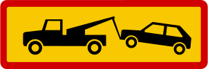
English • Supplementary plate 831.5 • Offending vehicles may be removed. Indicates that illegally parked vehicles may be removed.
Íslenska • Undirmerki 831.5 • Brotlegir verða fjarlægðir. Merki þetta gefur til kynna að ökutæki sem lagt er óleyfilega geti verið fjarlægð.
Quellen
🔗 Commons.wikimedia.org
🔗 Reglugerd.is • Reglugerð nr. 250/2024 • 27. gr.
SVG source: Gigillo83, drawn by original of Umferðastrofa • Public domain • Original revision 2013-03-06. Wikimedia original unmodified.
139. Parken auf 1 Stunde begrenzt
Dieses Zusatzzeichen zeigt an, dass die Parkdauer auf höchstens 1 Stunde begrenzt ist.

English • Supplementary plate 831.1 • Maximum parking duration. Shows the maximum permitted time. Sign 831.2 requires a disc behind the windscreen to be set to the correct time when parking.
Íslenska • Undirmerki 831.1 • Hámarkstími. Merki þetta gefur til kynna hámarkstíma sem heimilt er að leggja. Merki 831.2 gefur til kynna að stilla skuli skífu undir framrúðu á réttan tíma þegar bifreiðinni er lagt.
Quellen
🔗 Commons.wikimedia.org
🔗 Reglugerd.is • Reglugerð nr. 250/2024 • 27. gr.
SVG source: Gigillo83, drawn by original of Umferðastrofa • Public domain • Original revision 2013-03-06. Wikimedia original unmodified.
140. Während der angegebenen Zeit
Dieses Zusatzzeichen zeigt an, dass das Hauptverkehrszeichen während der angegebenen Zeit gilt.
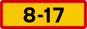
English • Supplementary plate 806 • Times of application. Shows when the main sign applies, using whole hours from 0–24. Figures without brackets apply Monday to Friday; bracketed figures apply Saturdays; red figures without brackets apply Sundays and statutory holidays. If the same hours apply daily, black or white figures with ‘Every day’ are used. For particular weekdays the abbreviations are mán, þri, mið, fim, fös, lau and sun. A specified weekday applies regardless of whether it is a working day or statutory holiday.
Íslenska • Undirmerki 806 • Gildistími. Merki þetta segir til um gildistíma aðalmerkis. Tíminn er gefinn upp í heilum tölum á bilinu 0-24. Stafir án sviga segja til um gildistíma á mánudögum til föstudaga. Stafir innan sviga segja til um gildistíma á laugardögum. Rauðir stafir án sviga segja til um gildistíma á sunnudögum og lögboðnum frídögum. Ef sömu tímamörk gilda alla daga er gildistíminn táknaður með svörtum eða hvítum stöfum og textanum "Alla daga". Ef gildistími nær aðeins til vissra vikudaga eru eftirfarandi styttingar notaðar á dagaheitum: mán, þri, mið, fim, fös, lau, sun. Gildi merkið á vissum vikudegi gildir það óháð því hvort dagurinn sé virkur dagur eða lögboðinn frídagur.
Quellen
🔗 Commons.wikimedia.org
🔗 Reglugerd.is • Reglugerð nr. 250/2024 • 27. gr.
SVG source: Gigillo83, drawn by original of Umferðastrofa • Public domain • Original revision 2013-03-06. Wikimedia original unmodified.
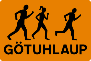
141. Läufer
Dieses Zusatzzeichen warnt davor, dass Läufer die Straße benutzen oder überqueren können.
Quellen
Image via Commons.wikimedia.org
Gigillo83, drawn by original of Umferðastrofa • Public domain • Source revision 2013-03-06. Wikimedia original unmodified.
142. Einspurige Straße
Dieses Zusatzzeichen warnt davor, dass die Straße voraus nur einen Fahrstreifen hat, den der Verkehr in beiden Richtungen gemeinsam benutzt.
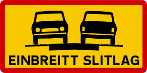
English • Supplementary plate 854.1 • Single-width paved surface. The paved surface is 5 m wide or less. Road users must therefore move onto the gravel shoulder when meeting.
Íslenska • Undirmerki 854.1 • Einbreitt slitlag. Merki þetta gefur til kynna að bundið slitlag sé 5 metrar að breidd eða mjórra. Vegfarendur þurfa því að víkja út á malaröxl þegar mæst er.
Quellen
🔗 Commons.wikimedia.org
🔗 Reglugerd.is • Reglugerð nr. 250/2024 • 27. gr.
SVG source: Gigillo83, drawn by original of Umferðastrofa • Public domain • Original revision 2013-03-06. Wikimedia original unmodified.
Artwork verified against Vegagerdin.is • official published diagram 854.1.
143. Einspurige Brücke
Dieses Zusatzzeichen warnt davor, dass die Brücke voraus nur einen Fahrstreifen hat, den der Verkehr in beiden Richtungen gemeinsam benutzt.
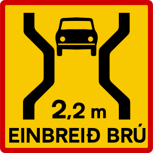
English • Supplementary plate 854.3 • Single-lane bridge with narrow carriageway. Indicates a single-lane bridge ahead with a carriageway narrower than 3.05 m.
Íslenska • Undirmerki 854.3 • Einbreið brú með þröngri akbraut. Merki þetta gefur til kynna að fram undan sé einbreið brú með akbraut mjórri en 3,05 m.
Quellen
🔗 Commons.wikimedia.org
🔗 Reglugerd.is • Reglugerð nr. 250/2024 • 27. gr.
SVG source: Gigillo83, drawn by original of Umferðastrofa • Public domain • Original revision 2013-03-06. Wikimedia original unmodified.
144. Einspuriger Tunnel
Dieses Zusatzzeichen warnt davor, dass der Tunnel voraus nur einen Fahrstreifen hat, den der Verkehr in beiden Richtungen gemeinsam benutzt.
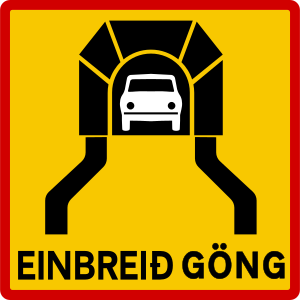
English • Supplementary plate 854.4 • Single-lane tunnel. Indicates a single-lane tunnel ahead.
Íslenska • Undirmerki 854.4 • Einbreið jarðgöng. Merki þetta gefur til kynna að fram undan séu einbreið jarðgöng.
Quellen
🔗 Commons.wikimedia.org
🔗 Reglugerd.is • Reglugerð nr. 250/2024 • 27. gr.
SVG source: Gigillo83, drawn by original of Umferðastrofa • Public domain • Original revision 2013-03-06. Wikimedia original unmodified.
145. Unfallgefahr
Dieses Zusatzzeichen warnt vor einer erhöhten Unfallgefahr auf dem betreffenden Straßenabschnitt.
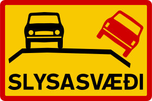
English • Supplementary plate 852 • Accident-prone area. Indicates unusually frequent accidents in the area.
Íslenska • Undirmerki 852 • Slysasvæði. Merki þetta gefur til kynna að slys séu óvenju tíð á svæðinu.
Quellen
🔗 Commons.wikimedia.org
🔗 Reglugerd.is • Reglugerð nr. 250/2024 • 27. gr.
SVG source: Gigillo83, drawn by original of Umferðastrofa • Public domain • Original revision 2013-03-06. Wikimedia original unmodified.
146. Schotterstraße
Dieses Zusatzzeichen warnt davor, dass die vorausliegende Straße eine Schotteroberfläche hat.
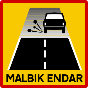
English • Supplementary plate 842.2 • Paved surface ends. The paved surface ends and a gravel road begins.
Íslenska • Undirmerki 842.2 • Malbik endar. Merki þetta gefur til kynna að bundið slitlag endi og malarvegur taki við.
Quellen
🔗 Commons.wikimedia.org
🔗 Reglugerd.is • Reglugerð nr. 250/2024 • 27. gr.
SVG source: Gigillo83, drawn by original of Umferðastrofa • Public domain • Original revision 2013-03-06. Wikimedia original unmodified.
147. Neue Fahrbahndecke
Dieses Zusatzzeichen zeigt an, dass die vorausliegende Straße einen neu verlegten oder kürzlich reparierten Belag hat.
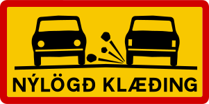
English • Supplementary plate 842.1 • New surface dressing. Indicates driving on newly laid surface dressing.
Íslenska • Undirmerki 842.1 • Nýlögð klæðing. Merki þetta gefur til kynna að ekið sé á nýlagðri klæðingu.
Quellen
🔗 Commons.wikimedia.org
🔗 Reglugerd.is • Reglugerð nr. 250/2024 • 27. gr.
SVG source: Gigillo83, drawn by original of Umferðastrofa • Public domain • Original revision 2013-03-06. Wikimedia original unmodified.
Artwork verified against Vegagerdin.is • official published diagram 842.1.
148. 4x4 erforderlich
Dieses Zusatzzeichen zeigt an, dass auf der vorausliegenden Strecke ein Fahrzeug mit Allradantrieb erforderlich ist.
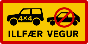
English • Supplementary plate 844.2 • Difficult road. Marks a route impassable for ordinary passenger cars but passable for four-wheel-drive vehicles with greater ground clearance, such as off-road vehicles.
Íslenska • Undirmerki 844.2 • Illfær vegur. Merki þetta gefur til kynna að ekið sé inn á leið sem er ófær almennum fólksbifreiðum en fær fjórhjóladrifnum bifreiðum sem eru hærri en almennar fólksbifreiðar, svo sem jeppum.
Quellen
🔗 Commons.wikimedia.org
🔗 Reglugerd.is • Reglugerð nr. 250/2024 • 27. gr.
SVG source: Gigillo83, drawn by original of Umferðastrofa • Public domain • Original revision 2013-03-06. Wikimedia original unmodified.
Artwork verified against Vegagerdin.is • official published diagram 844.2.
149. Bergstraße, auch für 4×4-Fahrzeuge schwierig
Dieses Zusatzzeichen warnt vor einer extrem schwierigen Bergstraße, die selbst Fahrzeuge mit Allradantrieb stark fordern kann.
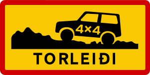
English • Supplementary plate 844.3 • Very difficult route. Passable only for specially equipped off-road vehicles, such as jeeps and mountain vehicles. May have very steep slopes, snowdrifts and rivers barely passable by vehicles.
Íslenska • Undirmerki 844.3 • Torleiði. Merki þetta gefur til kynna að ekið sé inn á leið sem einungis er fær sérútbúnum torfærubifreiðum, svo sem jeppum og fjallabílum. Á leiðinni kunna að vera mjög brattar brekkur, snjóskaflar og ár sem tæplega eru færar bifreiðum.
Quellen
🔗 Commons.wikimedia.org
🔗 Reglugerd.is • Reglugerð nr. 250/2024 • 27. gr.
SVG source: Gigillo83, drawn by original of Umferðastrofa • Public domain • Original revision 2013-03-06. Wikimedia original unmodified.
Artwork verified against Vegagerdin.is • official published diagram 844.3.
150. Langsam befahrbare Straße
Dieses Zusatzzeichen kennzeichnet einen Straßenabschnitt, auf dem langsames Fahren vorgeschrieben oder empfohlen ist.
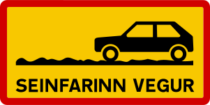
English • Supplementary plate 844.1 • Slow-going road. Passable for passenger cars but slow to travel and possibly rough and steep.
Íslenska • Undirmerki 844.1 • Seinfarinn vegur. Merki þetta gefur til kynna að ekið sé inn á leið sem fær er fólksbílum en sé seinfarin og mögulega gróf og brött.
Quellen
🔗 Commons.wikimedia.org
🔗 Reglugerd.is • Reglugerð nr. 250/2024 • 27. gr.
SVG source: Gigillo83, drawn by original of Umferðastrofa • Public domain • Original revision 2013-03-06. Wikimedia original unmodified.
Artwork verified against Vegagerdin.is • official published diagram 844.1.