


Panneaux de signalisationPhilippines
 Règles de circulation
 Philippines
 Panneaux de priorité
 Panneaux de danger
 Panneaux d’interdiction
 Panneaux d’obligation
 Panneaux d’indication
 Panneaux additionnels
Panneaux de signalisation
Un panneau de signalisation est un symbole visuel standardisé placé le long des routes afin de guider les conducteurs, les cyclistes et les piétons, de les avertir ou de réglementer leur circulation. Ces panneaux fournissent des informations essentielles sur l’état de la route, les règles, les directions et les dangers potentiels, contribuant à la sécurité et à la fluidité du trafic. Ils existent sous différentes formes et couleurs. On trouve notamment les panneaux triangulaires de danger, les panneaux circulaires d’interdiction ou d’obligation et les panneaux rectangulaires d’information, chaque type étant conçu pour être rapidement reconnu et clairement compris.
Une limitation temporaire de chantier est-elle obligatoire aux Philippines ?
Toute limitation temporaire réglementaire autorisée doit être respectée. Un avertissement de travaux seul ne crée pas une nouvelle vitesse chiffrée, mais les conditions peuvent imposer de ralentir.

51. Arrêt et stationnement interdits
Ce panneau de signalisation indique que le stationnement et l’arrêt sont interdits. Cela signifie que le stationnement ainsi que l'arrêt du véhicule sont strictement interdits dans la zone où le panneau est placé. Arrêt interdit : il n’est même pas permis de s’arrêter brièvement, même pour déposer ou prendre des passagers. Stationnement interdit : il n’est pas autorisé non plus, car il inclut l’arrêt. Les infractions peuvent entraîner une amende ou une mise en fourrière.
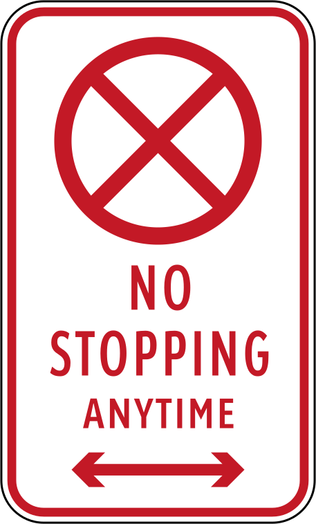
English • Traffic sign R5-8 • No stopping at any time. Stopping is prohibited at any time along the section indicated by the arrows.
Filipino • R5-8 • Bawal huminto anumang oras. Bawal huminto sa bahaging ipinapakita ng mga palaso, anumang oras.
Sources
🔗 Commons.wikimedia.org
🔗 Fliphtml5.com • LTO • Road Traffic Signs & Pavement Markings • p. 11 (pampublikong kopya)
🔗 Lto.gov.ph • LTO • opisyal na materyal
🔗 Scribd.com • DPWH • R5-8 (pampublikong kopya)
SVG source: Government of the Philippines - Department of Public Works and Highways derivative work: Fry1989 eh? derivative work: TagaSanPedroAko (Let's talk/Usap tayo) • Public domain • Original revision 2018-09-30. Wikimedia original unmodified.
Artwork verified against Tuktukph.top • official published diagram R5-8.
52. Contourner l'obstacle par la gauche ou la droite
Ce panneau de signalisation indique que la circulation doit contourner l’obstacle par la gauche ou par la droite. Utilisez l’un des côtés autorisés en suivant l’aménagement et la signalisation.

English • Traffic sign R2-4 • Pass on either side. You may pass the traffic island or obstruction on the left or right, as shown by the arrows.
Filipino • R2-4 • Maaaring dumaan sa alinmang panig. Maaaring daanan ang isla o sagabal sa kaliwa o kanan, ayon sa mga palaso.
Sources
🔗 Commons.wikimedia.org
🔗 Fliphtml5.com • LTO • Road Traffic Signs & Pavement Markings • p. 6 (pampublikong kopya)
🔗 Lto.gov.ph • LTO • opisyal na materyal
🔗 Scribd.com • DPWH • R2-4 (pampublikong kopya)
SVG source: Government of the Philippines - Department of Public Works and Highways derivative work: Photo07 • Public domain • Original revision 2014-05-25. Wikimedia original unmodified.
53. Contourner l'obstacle par la droite
Ce panneau de signalisation indique que la circulation doit contourner l’obstacle par la droite. Restez à droite de l’obstacle et suivez les éventuels marquages ou panneaux complémentaires.

English • Traffic sign R2-3 • Pass on the right. Pass the traffic island or obstruction on its right, as shown by the arrow.
Filipino • R2-3 • Dumaan sa kanan. Daanan ang isla o sagabal sa kanang panig nito, ayon sa palaso.
Sources
🔗 Commons.wikimedia.org
🔗 Fliphtml5.com • LTO • Road Traffic Signs & Pavement Markings • p. 6 (pampublikong kopya)
🔗 Lto.gov.ph • LTO • opisyal na materyal
🔗 Scribd.com • DPWH • R2-3 (pampublikong kopya)
SVG source: Government of the Philippines - Department of Public Works and Highways derivative work: Fry1989 eh? • Public domain • Original revision 2015-05-14. Wikimedia original unmodified.
54. Obligation de tourner à droite
Ce panneau de signalisation indique une obligation de tourner à droite. Cela signifie que tout le trafic doit tourner à droite à l'endroit où le panneau est placé. Aller tout droit ou tourner à gauche est interdit.

English • Traffic sign R2-2 • One-way traffic to the right. Follow the one-way flow of traffic to the right, as shown by the arrow.
Filipino • R2-2 • Isahang direksiyon pakanan. Sundin ang isahang daloy ng trapiko patungo sa kanan, ayon sa palaso.
Sources
🔗 Commons.wikimedia.org
🔗 Fliphtml5.com • LTO • Road Traffic Signs & Pavement Markings • p. 6 (pampublikong kopya)
🔗 Lto.gov.ph • LTO • opisyal na materyal
🔗 Scribd.com • DPWH • R2-2 (pampublikong kopya)
SVG source: Government of the Philippines - Department of Public Works and Highways derivative work: Fry1989 eh? • Public domain • Original revision 2015-04-23. Wikimedia original unmodified.
55. Circulation tout droit obligatoire
Ce panneau de signalisation indique que rouler tout droit est obligatoire, il est interdit de tourner à gauche ou à droite. Cela signifie que les véhicules doivent continuer tout droit — il est interdit de tourner à gauche ou à droite.

English • Traffic sign R2-1 • Ahead only. Continue straight ahead in the direction of the arrow. Turning is prohibited where this sign applies.
Filipino • R2-1 • Dumiretso lamang. Dumiretso sa direksiyong ipinapakita ng palaso. Bawal lumiko sa lugar na sakop ng karatula.
Sources
🔗 Commons.wikimedia.org
🔗 Fliphtml5.com • LTO • Road Traffic Signs & Pavement Markings • p. 6 (pampublikong kopya)
🔗 Lto.gov.ph • LTO • opisyal na materyal
🔗 Scribd.com • DPWH • R2-1 (pampublikong kopya)
SVG source: Government of the Philippines - Department of Public Works and Highways derivative work: Fry1989 eh? • Public domain • Original revision 2015-04-23. Wikimedia original unmodified.
56. Début d'une vitesse minimale
Ce panneau de signalisation indique le début d’une vitesse minimale. Cela signifie que tous les véhicules doivent circuler à une vitesse égale ou supérieure à la limite indiquée — rouler plus lentement est interdit, sauf si la circulation, la météo ou une urgence le justifient. Vise à empêcher que les véhicules lents ne gênent la circulation. Exceptions possibles en cas de danger, d’embouteillage ou de mauvaises conditions. Emplacements courants : autoroutes, tunnels, voies rapides.
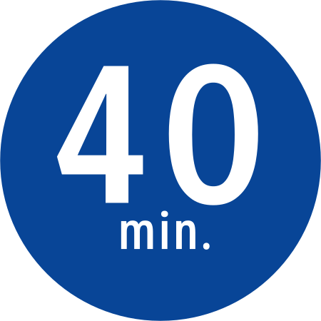
English • Traffic sign R4-3 • Minimum speed: 40 km/h. This sign indicates a minimum speed of 40 km/h on the section of expressway it covers. Continue to adapt your driving to traffic and safety conditions.
Filipino • R4-3 • Pinakamababang bilis: 40 km/h. Ipinapakita ng karatulang ito ang 40 km/h na pinakamababang bilis sa bahaging sakop nito sa expressway. Iangkop pa rin ang pagmamaneho sa trapiko at kaligtasan.
Sources
🔗 Commons.wikimedia.org
🔗 Fliphtml5.com • LTO • Road Traffic Signs & Pavement Markings • p. 9 (pampublikong kopya)
🔗 Lto.gov.ph • LTO • opisyal na materyal
🔗 Scribd.com • DPWH • R4-3 (pampublikong kopya)
SVG source: Government of the Philippines derivative work: Fry1989 eh? • Public domain • Original revision 2018-10-14. Wikimedia original unmodified.
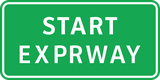
57. Début d'une voie express
Ce panneau de signalisation indique le début d'une voie express. Le début d'une voie express marque le point où la route devient officiellement une voie express, conçue pour un trafic plus rapide avec accès contrôlé.
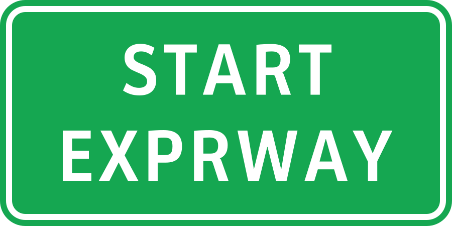
English • Traffic sign GE6-2 • Start of an expressway. The expressway begins here. Follow the limits, restrictions and other signs designated for the expressway.
Filipino • GE6-2 • Simula ng expressway. Dito nagsisimula ang expressway. Sundin ang mga limitasyon, pagbabawal at iba pang karatulang nakatalaga sa expressway.
Sources
🔗 Commons.wikimedia.org
🔗 Fliphtml5.com • LTO • Road Traffic Signs & Pavement Markings • p. 31 (pampublikong kopya)
🔗 Lto.gov.ph • LTO • opisyal na materyal
🔗 Scribd.com • DPWH • GE6-2 (pampublikong kopya)
SVG source: Original sign - Department of Public Works and Highways (Philippines) Redrawn sign - TagaSanPedroAko • Public domain • Original revision 2018-10-13. Wikimedia original unmodified.
58. Impasse
Ce panneau de signalisation indique une impasse. Une impasse (également appelée cul-de-sac ou voie sans issue) est une route qui se termine sans sortie — les véhicules peuvent y entrer mais doivent faire demi-tour pour repartir, car il n’y a pas de connexion avec une autre route.
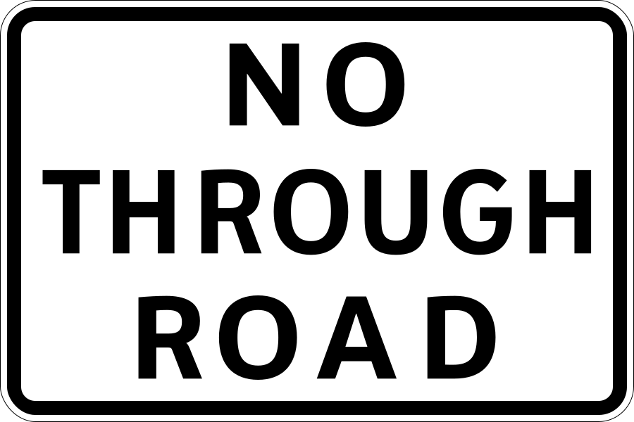
English • Traffic sign S2-8 • Dead end. This road does not lead to another road for through travel. It may be used to reach destinations along it.
Filipino • S2-8 • Kalsadang walang lagusan. Hindi umaabot ang kalsadang ito sa isa pang kalsada para sa tuloy-tuloy na biyahe. Maaari itong gamitin upang puntahan ang mga lugar na nasa loob nito.
Sources
🔗 Commons.wikimedia.org
🔗 Fliphtml5.com • LTO • Road Traffic Signs & Pavement Markings • p. 33 (pampublikong kopya)
🔗 Lto.gov.ph • LTO • opisyal na materyal
🔗 Scribd.com • DPWH • S2-8 (pampublikong kopya)
SVG source: Government of the Philippines - Department of Public Works and Highways derivative work: Fry1989 eh? • Public domain • Original revision 2020-07-13. Wikimedia original unmodified.
59. Information sur la prochaine sortie
Ce panneau donne des informations sur la prochaine sortie. Les informations sur la prochaine sortie sont fournies sur les autoroutes et routes principales pour informer les conducteurs.
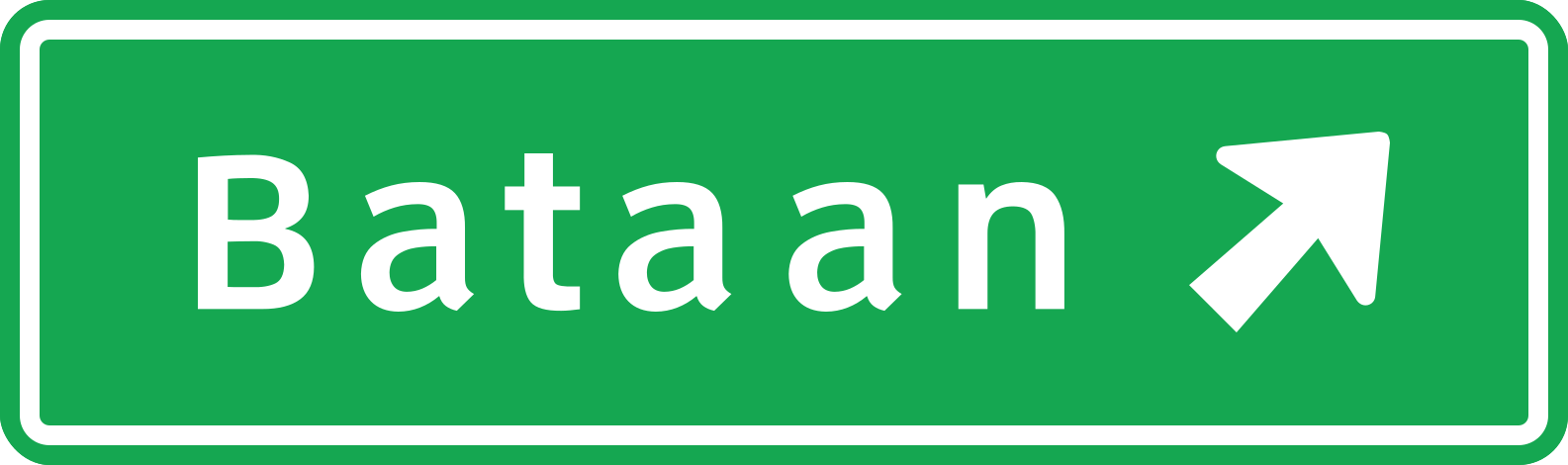
English • Traffic sign G1-2 • Direction to Bataan. The arrow shows the route towards Bataan at the approaching junction. Choose the correct lane early.
Filipino • G1-2 • Direksiyon patungong Bataan. Ipinapakita ng palaso ang direksiyon ng daan patungong Bataan sa papalapit na sangandaan. Piliin nang maaga ang tamang lane.
Sources
🔗 Commons.wikimedia.org
🔗 Fliphtml5.com • LTO • Road Traffic Signs & Pavement Markings • p. 22 (pampublikong kopya)
🔗 Lto.gov.ph • LTO • opisyal na materyal
🔗 Scribd.com • DPWH • G1-2 (pampublikong kopya)
SVG source: Department of Public Works and Highways (Philippines) Sign redrawn by TagaSanPedroAko. • Public domain • Original revision 2015-08-22. Wikimedia original unmodified.
Artwork verified against Tuktukph.top • official published diagram G1-2.
60. Information sur la destination de la bretelle
Ce panneau donne des informations sur les directions de la bretelle.
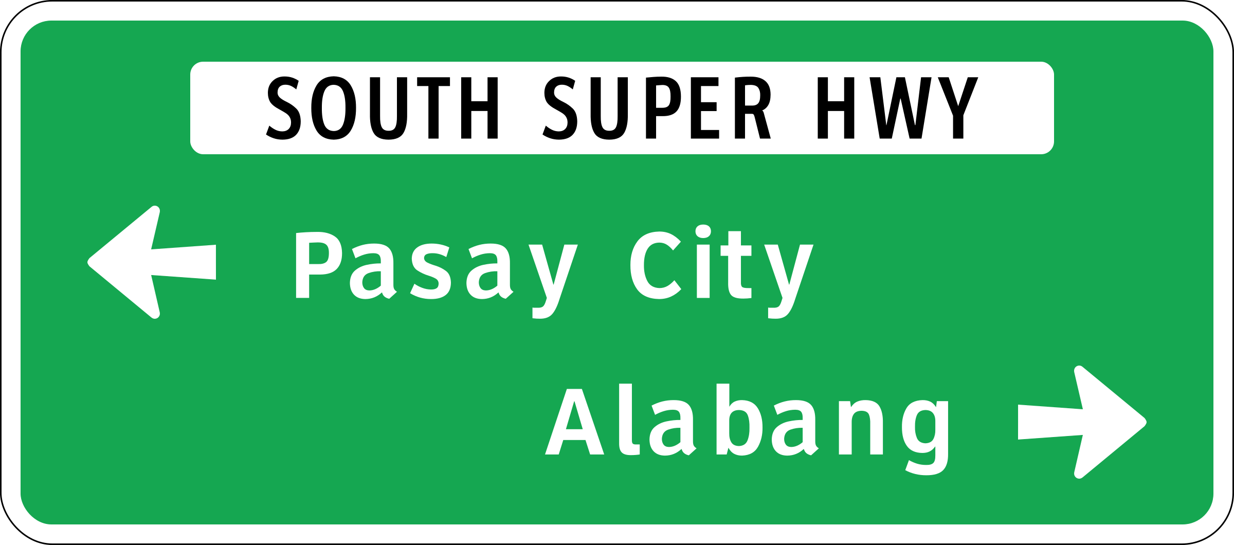
English • Traffic sign G1-3 • Directions on South Super Highway. At the approaching junction, the route to Pasay City is to the left and the route to Alabang is to the right, as shown by the arrows.
Filipino • G1-3 • Mga direksiyon sa South Super Highway. Sa papalapit na sangandaan, pakaliwa ang daan patungong Pasay City at pakanan ang daan patungong Alabang, ayon sa mga palaso.
Sources
🔗 Commons.wikimedia.org
🔗 Fliphtml5.com • LTO • Road Traffic Signs & Pavement Markings • p. 22 (pampublikong kopya)
🔗 Lto.gov.ph • LTO • opisyal na materyal
🔗 Scribd.com • DPWH • G1-3 (pampublikong kopya)
SVG source: Original sign: Department of Public Works and Highways Sign redrawn by TagaSanPedroAko, using sign specifications, other than the fonts, which rather used Clearview(via the Roadgeek 2005 road sign fonts) • Public domain • Original revision 2016-01-01. Wikimedia original unmodified.
Artwork verified against Tuktukph.top • official published diagram G1-3.
61. Information sur les directions du rond-point
Ce panneau donne des informations sur les directions du rond-point. Un panneau de direction de rond-point est un panneau routier qui aide les conducteurs à s'orienter dans le rond-point, en affichant clairement sa configuration et ses sorties.
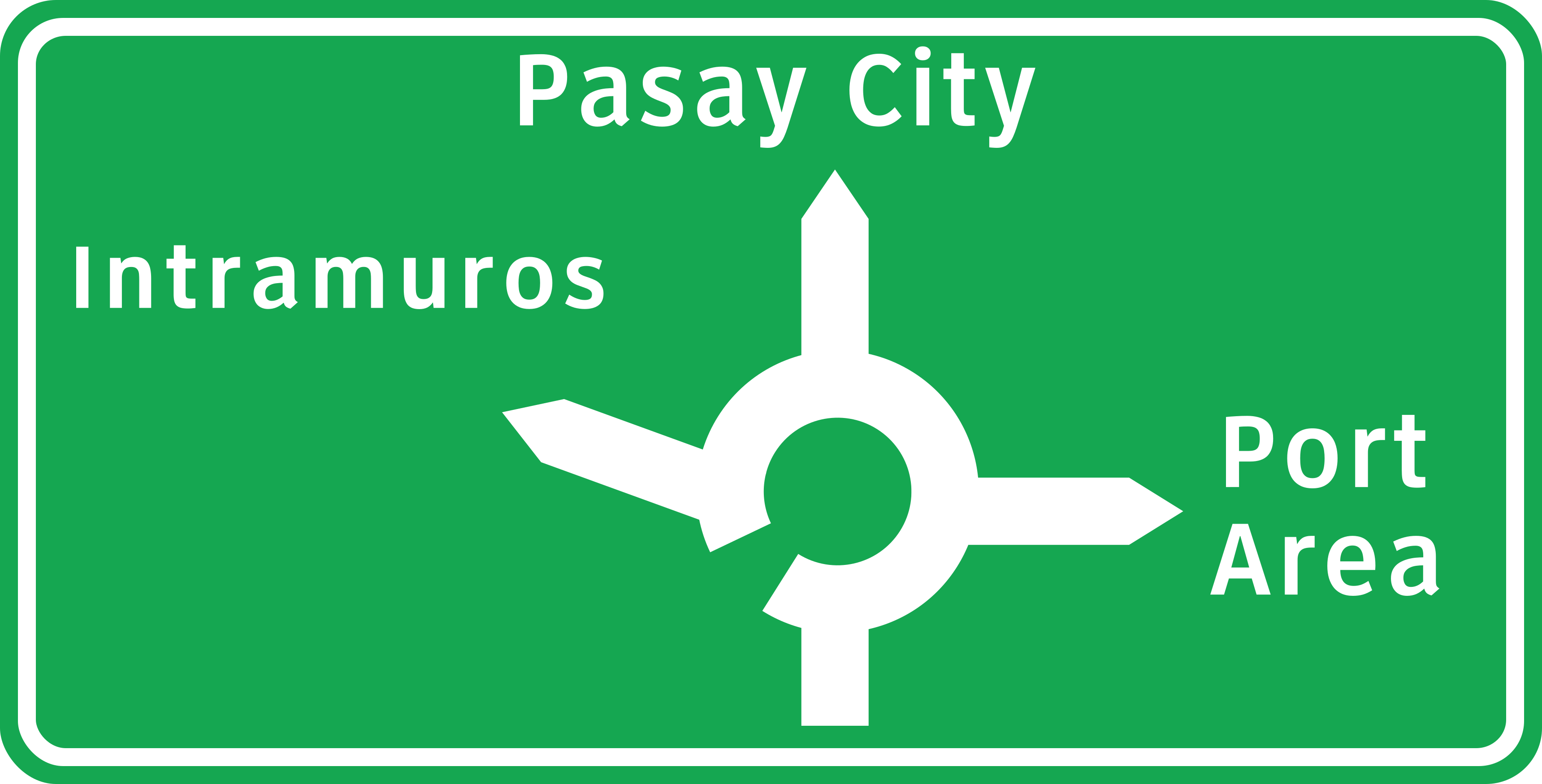
English • Traffic sign G1-5 • Directions at a roundabout. The diagram shows the roundabout exits: straight ahead towards Pasay City, left towards Intramuros and right towards Port Area.
Filipino • G1-5 • Mga direksiyon sa rotonda. Ipinapakita ng diagram ang mga sangay ng rotonda: diretso patungong Pasay City, pakaliwa patungong Intramuros at pakanan patungong Port Area.
Sources
🔗 Commons.wikimedia.org
🔗 Fliphtml5.com • LTO • Road Traffic Signs & Pavement Markings • p. 22 (pampublikong kopya)
🔗 Lto.gov.ph • LTO • opisyal na materyal
🔗 Scribd.com • DPWH • G1-5 (pampublikong kopya)
Image via Commons.wikimedia.org
Diagram:Department of Public Works and Highways (Philippines) Derivative work:TagaSanPedroAko • Public domain • Source revision 2018-10-14. Wikimedia original unmodified.
62. Information sur les directions du carrefour
Ce panneau donne des informations sur les directions du carrefour. Un panneau de direction est un panneau routier qui guide les conducteurs et autres usagers de la route vers des destinations telles que villes, villages, points d'intérêt ou services. Il fournit des indications claires de navigation.
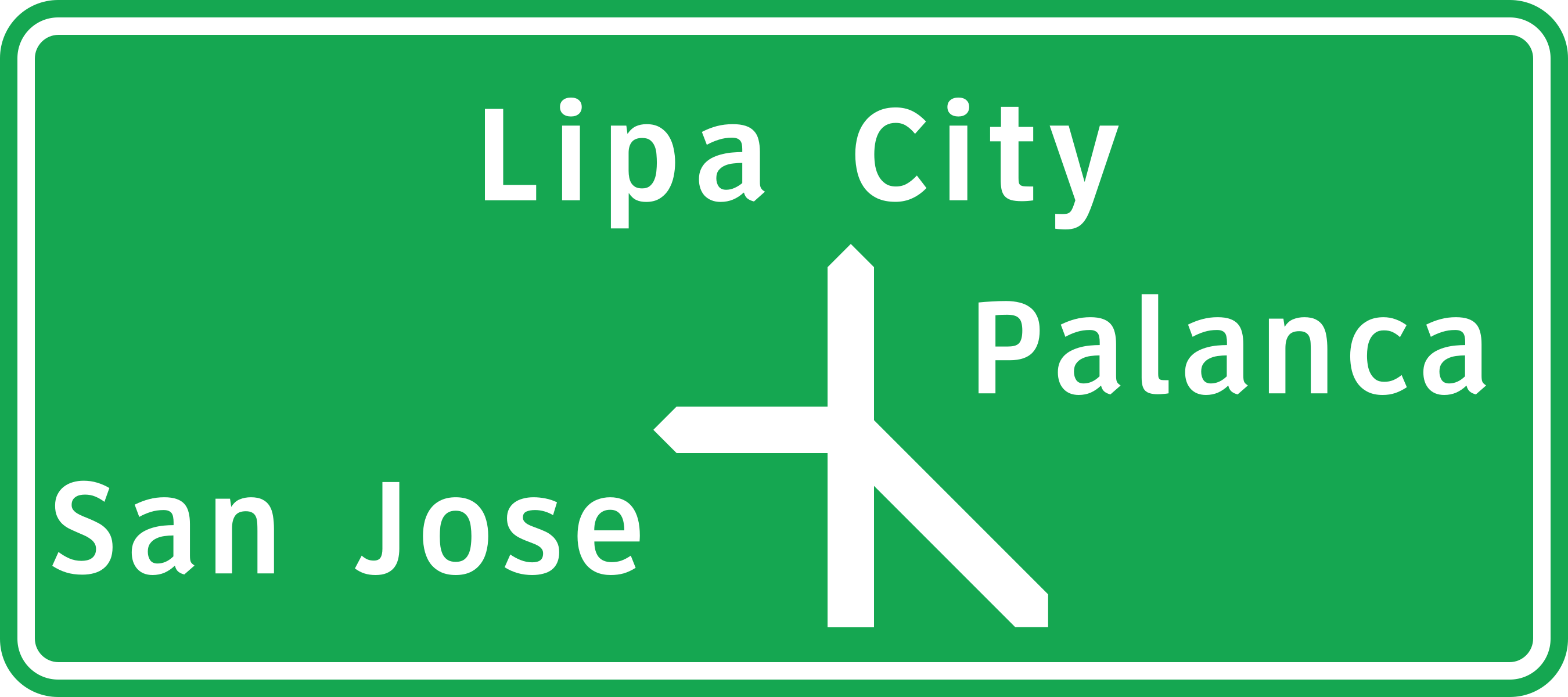
English • Traffic sign G1-4 • Directions at a junction. The diagram shows the branches ahead: straight ahead towards Lipa City, right towards Palanca and diagonally right towards San Jose.
Filipino • G1-4 • Mga direksiyon sa sangandaan. Ipinapakita ng diagram ang mga sangay sa unahan: diretso patungong Lipa City, pakanan patungong Palanca at pahilis sa kanan patungong San Jose.
Sources
🔗 Commons.wikimedia.org
🔗 Fliphtml5.com • LTO • Road Traffic Signs & Pavement Markings • p. 22 (pampublikong kopya)
🔗 Lto.gov.ph • LTO • opisyal na materyal
🔗 Scribd.com • DPWH • G1-4 (pampublikong kopya)
Image via Commons.wikimedia.org
Diagram:Department of Public Works and Highways (Philippines) Derivative work:TagaSanPedroAko • Public domain • Source revision 2018-10-14. Wikimedia original unmodified.
63. Pour personnes aveugles
Le panonceau pour personnes aveugles est un panneau de signalisation placé sous un panneau principal pour indiquer que l’avertissement ou la réglementation concerne spécifiquement les piétons aveugles ou malvoyants. Il informe les usagers de la route que la situation ou la règle touche les personnes aveugles, incitant à une vigilance accrue ou au respect de mesures d’accessibilité particulières.
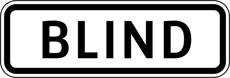
English • Supplementary plate W8-6 • Blind people. Used with a pedestrian warning sign, this plate indicates that blind people may be crossing ahead. Slow down and take care.
Filipino • W8-6 • Mga taong bulag. Kasama ng babala sa pedestrian, ipinapakita ng platong ito na maaaring may mga taong bulag na tatawid sa unahan. Magbagal at mag-ingat.
Sources
🔗 Commons.wikimedia.org
🔗 Fliphtml5.com • LTO • Road Traffic Signs & Pavement Markings • p. 21 (pampublikong kopya)
🔗 Lto.gov.ph • LTO • opisyal na materyal
🔗 Scribd.com • DPWH • W8-6 (pampublikong kopya)
SVG source: Government of the Philippines - Department of Public Works and Highways derivative work: Fry1989 eh? • Public domain • Original revision 2018-10-06. Wikimedia original unmodified.
64. Pour les enfants handicapés
Le panonceau pour enfants handicapés est un panneau placé sous un panneau principal pour indiquer que la signification du panneau concerne spécifiquement les enfants en situation de handicap. Il informe les conducteurs de la présence possible d’enfants handicapés et de la nécessité d’une attention particulière.

English • Supplementary plate W8-10 • Disabled people. Used with a crossing warning sign, this plate indicates that disabled people may be crossing ahead. Slow down and take care.
Filipino • W8-10 • Mga taong may kapansanan. Kasama ng babala sa tawiran, ipinapakita ng platong ito na maaaring may mga taong may kapansanan na tatawid sa unahan. Magbagal at mag-ingat.
Sources
🔗 Commons.wikimedia.org
🔗 Fliphtml5.com • LTO • Road Traffic Signs & Pavement Markings • p. 21 (pampublikong kopya)
🔗 Lto.gov.ph • LTO • opisyal na materyal
🔗 Scribd.com • DPWH • W8-10 (pampublikong kopya)
SVG source: Government of the Philippines - Department of Public Works and Highways derivative work: Fry1989 eh? • Public domain • Original revision 2018-10-07. Wikimedia original unmodified.
65. Pour bus
Ce panneau additionnel indique que le panneau principal s’applique spécifiquement aux autobus. Les catégories de véhicules concernées dépendent des définitions locales applicables.

English • Supplementary plate W8-11B • For buses. The turning prohibition on the main sign applies to buses. Read this plate together with that sign.
Filipino • W8-11B • Para sa mga bus. Ang pagbabawal sa pagliko sa pangunahing karatula ay para sa mga bus. Basahin ang plato kasama ng karatulang iyon.
Sources
🔗 Commons.wikimedia.org (HueMan1 • CC BY-SA 4.0)
🔗 Fliphtml5.com • LTO • Road Traffic Signs & Pavement Markings • p. 21 (pampublikong kopya)
🔗 Lto.gov.ph • LTO • opisyal na materyal
🔗 Scribd.com • DPWH • W8-11B (pampublikong kopya)
SVG source: HueMan1 • CC BY-SA 4.0 • Original revision 2018-10-07. Wikimedia original unmodified.
66. mètres plus loin
Ce panneau additionnel indique la distance entre le panneau principal et le point où commence le danger ou l’application de la règle ou de l’information indiquée. La distance est exprimée en mètres.

English • Supplementary plate W8-3 • Distance in metres. This plate shows how many metres remain before the danger indicated by the main warning sign. No number is shown in this example illustration. The illustration is an example of a plate; read the actual number on the sign installed on the road.
Filipino • W8-3 • Distansiya sa metro. Ipinapakita ng platong ito kung ilang metro pa bago ang panganib na tinutukoy ng pangunahing babala. Walang bilang na nakalagay sa halimbawang larawang ito. Halimbawa ng isang plato ang larawang ito; basahin ang aktuwal na bilang sa karatulang naka-install sa kalsada.
Sources
🔗 Commons.wikimedia.org
🔗 Fliphtml5.com • LTO • Road Traffic Signs & Pavement Markings • p. 21 (pampublikong kopya)
🔗 Lto.gov.ph • LTO • opisyal na materyal
🔗 Scribd.com • DPWH • W8-3 (pampublikong kopya)
SVG source: Department of Public Works and Highways (Philippines) Sign redrawn by TagaSanPedroAko. • Public domain • Original revision 2015-08-07. Wikimedia original unmodified.
Artwork verified against Tuktukph.top • official published diagram W8-3.
67. kilomètres plus loin
Ce panneau additionnel indique la distance entre le panneau principal et le point où commence le danger ou l’application de la règle ou de l’information indiquée. La distance est exprimée en kilomètres.

English • Supplementary plate W8-4 • Distance in kilometres. This plate shows how many kilometres remain before the danger indicated by the main warning sign. No number is shown in this example illustration. The illustration is an example of a plate; read the actual number on the sign installed on the road.
Filipino • W8-4 • Distansiya sa kilometro. Ipinapakita ng platong ito kung ilang kilometro pa bago ang panganib na tinutukoy ng pangunahing babala. Walang bilang na nakalagay sa halimbawang larawang ito. Halimbawa ng isang plato ang larawang ito; basahin ang aktuwal na bilang sa karatulang naka-install sa kalsada.
Sources
🔗 Commons.wikimedia.org (HueMan1 • CC BY-SA 4.0)
🔗 Fliphtml5.com • LTO • Road Traffic Signs & Pavement Markings • p. 21 (pampublikong kopya)
🔗 Lto.gov.ph • LTO • opisyal na materyal
🔗 Scribd.com • DPWH • W8-4 (pampublikong kopya)
SVG source: HueMan1 • CC BY-SA 4.0 • Original revision 2018-10-14. Wikimedia original unmodified.
Artwork verified against Tuktukph.top • official published diagram W8-4.
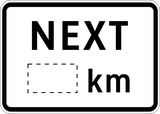
68. Sur kilomètres
Ce panneau additionnel indique la longueur de la section à laquelle s’applique le panneau principal. La longueur est exprimée en kilomètres.
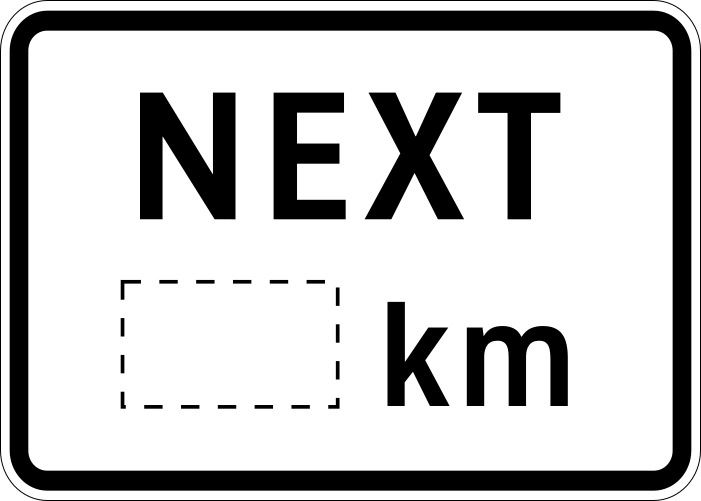
English • Supplementary plate LTO • Supplementary Signs • For the next kilometres. The condition or danger indicated by the accompanying warning extends over the distance stated on the plate. No number is shown in this example. The illustration is an example of a plate; read the actual number on the sign installed on the road.
Filipino • LTO • Supplementary Signs • Sa susunod na mga kilometro. Ang kalagayan o panganib na tinutukoy ng kasamang babala ay umaabot sa susunod na distansiyang nakasaad sa plato. Walang bilang na nakalagay sa halimbawang ito. Halimbawa ng isang plato ang larawang ito; basahin ang aktuwal na bilang sa karatulang naka-install sa kalsada.
Sources
🔗 Commons.wikimedia.org
🔗 Fliphtml5.com • LTO • Road Traffic Signs & Pavement Markings • p. 21 (pampublikong kopya)
🔗 Lto.gov.ph • LTO • opisyal na materyal
SVG source: Government of the Philippines • Public domain • Original revision 2018-10-14. Wikimedia original unmodified.
69. Hauteur
Ce panneau additionnel indique une hauteur de véhicule. Lisez-le avec le panneau principal pour déterminer comment cette valeur modifie la règle ou la restriction applicable.
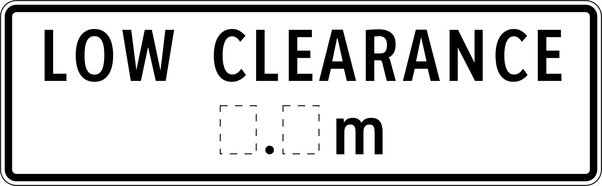
English • Supplementary plate W9-1B • Low overhead clearance. There is limited clearance under a bridge or other structure. Compare the height of your vehicle and load with the stated clearance. No number is shown in this example. The illustration is an example of a plate; read the actual number on the sign installed on the road.
Filipino • W9-1B • Mababang espasyo sa taas. May mababang espasyo sa ilalim ng tulay o iba pang istruktura. Ihambing ang taas ng iyong sasakyan at karga sa nakasaad na clearance. Walang bilang na nakalagay sa halimbawang ito. Halimbawa ng isang plato ang larawang ito; basahin ang aktuwal na bilang sa karatulang naka-install sa kalsada.
Sources
🔗 Commons.wikimedia.org
🔗 Fliphtml5.com • LTO • Road Traffic Signs & Pavement Markings • p. 21 (pampublikong kopya)
🔗 Lto.gov.ph • LTO • opisyal na materyal
🔗 Scribd.com • DPWH • W9-1B (pampublikong kopya)
SVG source: Government of the Philippines - Department of Public Works and Highways derivative work: TagaSanPedroAko (Let's talk/Usap tayo) derivative work: Fry1989 eh? • Public domain • Original revision 2018-10-14. Wikimedia original unmodified.
Artwork verified against Tuktukph.top • official published diagram W9-1B.
70. Vitesse recommandée
Le panonceau vitesse conseillée sert à apporter un complément à un panneau principal indiquant une vitesse recommandée (à titre indicatif) — il ne s’agit pas d’une limite légale, mais d’une vitesse sûre ou optimale dans des conditions normales. Souvent utilisé dans les virages, descentes, rampes, tunnels ou zones de travaux.
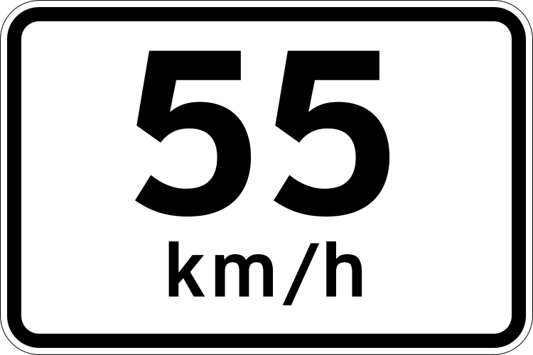
English • Supplementary plate W8-1 • Advisory speed: 55 km/h. A speed of 55 km/h is recommended for the danger indicated by the accompanying warning when weather, traffic and road conditions are good. Slow down further if necessary.
Filipino • W8-1 • Inirerekomendang bilis: 55 km/h. Inirerekomenda ang 55 km/h sa panganib na tinutukoy ng kasamang babala kapag maganda ang panahon, trapiko at kondisyon ng kalsada. Magbagal pa kung kinakailangan.
Sources
🔗 Commons.wikimedia.org
🔗 Fliphtml5.com • LTO • Road Traffic Signs & Pavement Markings • p. 21 (pampublikong kopya)
🔗 Lto.gov.ph • LTO • opisyal na materyal
🔗 Scribd.com • DPWH • W8-1 (pampublikong kopya)
SVG source: Department of Public Works and Highways (Philippines) Sign redrawn by TagaSanPedroAko. • Public domain • Original revision 2018-10-06. Wikimedia original unmodified.
71. Mouillé
Le panonceau chaussée mouillée avertit les conducteurs que la chaussée à venir peut être mouillée et glissante, augmentant le risque de perte d’adhérence. Aide à prévenir les accidents dus à l’aquaplanage ou aux dérapages.

English • Supplementary plate W8-5 • When wet. Used with a slippery-road warning sign, this plate indicates a danger when the road surface is wet.
Filipino • W8-5 • Kapag basa. Kasama ng babala sa madulas na kalsada, ipinapakita ng platong ito na may panganib kapag basa ang ibabaw ng kalsada.
Sources
🔗 Commons.wikimedia.org
🔗 Fliphtml5.com • LTO • Road Traffic Signs & Pavement Markings • p. 21 (pampublikong kopya)
🔗 Lto.gov.ph • LTO • opisyal na materyal
🔗 Scribd.com • DPWH • W8-5 (pampublikong kopya)
SVG source: Government of the Philippines - Department of Public Works and Highways derivative work: Fry1989 eh? • Public domain • Original revision 2018-10-06. Wikimedia original unmodified.
Artwork verified against Tuktukph.top • official published diagram W8-5.
72. Maison de retraite
Le panonceau maison de retraite indique la présence d’un établissement résidentiel pour personnes âgées à proximité. Il incite à réduire la vitesse et à augmenter la vigilance. Usage courant : près des maisons de retraite ou EHPAD.
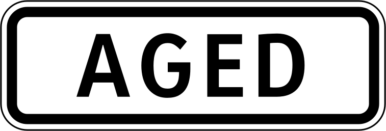
English • Supplementary plate W8-7 • Older people. Used with a pedestrian warning sign, this plate indicates that older people may be crossing ahead. Slow down and take care.
Filipino • W8-7 • Mga nakatatanda. Kasama ng babala sa pedestrian, ipinapakita ng platong ito na maaaring may mga nakatatandang tatawid sa unahan. Magbagal at mag-ingat.
Sources
🔗 Commons.wikimedia.org
🔗 Fliphtml5.com • LTO • Road Traffic Signs & Pavement Markings • p. 21 (pampublikong kopya)
🔗 Lto.gov.ph • LTO • opisyal na materyal
🔗 Scribd.com • DPWH • W8-7 (pampublikong kopya)
SVG source: Government of the Philippines - Department of Public Works and Highways derivative work: Fry1989 eh? • Public domain • Original revision 2018-10-06. Wikimedia original unmodified.
73. École maternelle
Le panonceau jardin d’enfants signale aux conducteurs la présence d’un jardin d’enfants ou d’une école maternelle à proximité, alertant sur la nécessité d'une prudence accrue. Il avertit que de jeunes enfants peuvent traverser ou jouer près de la route. Emplacement courant : près des entrées de jardins d’enfants ou de maternelles.

English • Supplementary plate W8-8 • Playground. Used with a pedestrian or children warning sign, this plate indicates a playground ahead. Slow down and watch for children.
Filipino • W8-8 • Palaruan. Kasama ng babala sa pedestrian o mga bata, ipinapakita ng platong ito na may palaruan sa unahan. Magbagal at bantayan ang mga bata.
Sources
🔗 Commons.wikimedia.org
🔗 Fliphtml5.com • LTO • Road Traffic Signs & Pavement Markings • p. 21 (pampublikong kopya)
🔗 Lto.gov.ph • LTO • opisyal na materyal
🔗 Scribd.com • DPWH • W8-8 (pampublikong kopya)
SVG source: Government of the Philippines - Department of Public Works and Highways derivative work: Fry1989 eh? • Public domain • Original revision 2018-10-06. Wikimedia original unmodified.
Artwork verified against Tuktukph.top • official published diagram W8-8.
74. École
Le panonceau école avertit les conducteurs qu’ils approchent d’une zone scolaire où des enfants peuvent être présents, nécessitant une vigilance accrue. Il signale la présence d’enfants traversant ou jouant près de la route. Usage courant : près des écoles primaires ou secondaires.
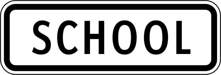
English • Supplementary plate W8-9 • School. Used with a pedestrian or children warning sign, this plate indicates a school ahead. Slow down and watch for people crossing.
Filipino • W8-9 • Paaralan. Kasama ng babala sa pedestrian o mga bata, ipinapakita ng platong ito na may paaralan sa unahan. Magbagal at bantayan ang mga tumatawid.
Sources
🔗 Commons.wikimedia.org
🔗 Fliphtml5.com • LTO • Road Traffic Signs & Pavement Markings • p. 21 (pampublikong kopya)
🔗 Lto.gov.ph • LTO • opisyal na materyal
🔗 Scribd.com • DPWH • W8-9 (pampublikong kopya)
SVG source: Government of the Philippines - Department of Public Works and Highways derivative work: Fry1989 eh? • Public domain • Original revision 2018-10-07. Wikimedia original unmodified.
