

Panneaux de signalisationPologne
 Règles de circulation
 Pologne
 Panneaux de priorité
 Panneaux de danger
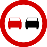 Panneaux d’interdiction
 Panneaux d’obligation
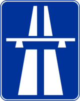 Panneaux d’indication
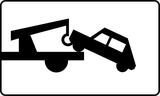 Panneaux additionnels
Panneaux de signalisation
Un panneau de signalisation est un symbole visuel standardisé placé le long des routes afin de guider, avertir ou réglementer les conducteurs, cyclistes et piétons. Ces panneaux fournissent des informations essentielles sur l’état de la route, les règles, les directions et les dangers potentiels, contribuant à la sécurité et à la fluidité du trafic. Ils existent sous différentes formes et couleurs, comme les panneaux triangulaires de danger, les panneaux circulaires d’interdiction ou d’obligation et les panneaux rectangulaires d’information, chacune étant conçue pour être rapidement reconnue et clairement comprise.

151. Cyclistes autorisés
Un panonceau cyclistes autorisés indique que les cyclistes (conducteurs de vélos) sont autorisés à accéder ou à utiliser la route, la voie ou la zone, même si celle-ci est autrement restreinte. L'accès est permis pour les cyclistes, soit à titre d'exception à une interdiction, soit comme groupe d'usagers indiqué. Peut inclure le texte : « Cyclistes autorisés », « Sauf vélos », « Vélos autorisés ».
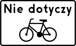
English • Except bicycles. Below B-1, a plate bearing “Nie dotyczy” (does not apply) and a vehicle symbol or wording identifying a vehicle means that the prohibition does not apply to that vehicle. The plate's meaning depends on the sign above it.
Polski • tabliczka z napisem „Nie dotyczy” i symbolem roweru. Umieszczona pod znakiem B-1 tabliczka z napisem „Nie dotyczy” wraz z symbolem pojazdu lub wyrażeniem określającym pojazd wskazuje, że zakaz nie dotyczy pojazdu określonego tabliczką. Znaczenie tabliczki zależy od znaku, pod którym została umieszczona.
Sources
🔗 Commons.wikimedia.org
🔗 Eli.gov.pl • § 16 ust. 2
SVG source: Masur • Public domain • Original revision 2009-06-28. Wikimedia original unmodified.
152. Véhicules d'urgence autorisés
Le panonceau véhicules de secours autorisés indique que seuls les véhicules de service d'urgence sont autorisés à accéder, entrer ou utiliser une route, voie ou zone, même si cela est normalement interdit par le panneau principal. Les véhicules d’urgence (tels que polices, pompiers, ambulances) sont exceptés de la restriction ci-dessus. Toute autre circulation doit respecter la limitation. Peut afficher le texte : « Véhicules de secours autorisés », « Sauf services de secours », « Réservé police, pompiers, ambulance ».
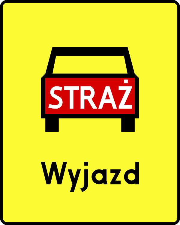
English • Supplementary plate T-16 • Exit used by the emergency vehicles shown. Below A-30, plates indicate: T-8, traffic directed onto tram tracks; T-10, a road crossing a railway siding or similar track, where a railway employee stops road traffic while a train passes or shunts; T-11, a ferry crossing; T-12, a longitudinal step in the road surface; T-13, a section with wheel-rut deformation; T-14, frequent accidents of the type shown; T-15, frequent accidents caused by a slippery road surface due to rain; T-16, an exit used by the emergency vehicles shown; T-17, a national border; and T-18, an unexpected change in traffic direction following the course shown.
Polski • T-16 • tabliczka wskazująca miejsce wyjazdu pojazdów uprzywilejowanych wskazanych na tabliczce. Umieszczona pod znakiem A-30 tabliczka wskazuje: T-8 - miejsce, w którym ruch pojazdów został skierowany na tory tramwajowe; T-10 - przecięcie drogi z bocznicą kolej ową lub torem o podobnym charakterze; w miejscu tak oznakowanym ruch na drodze jest wstrzymywany przez pracownika kolei podczas przejeżdżania (przetaczania) pociągu; T-11 - przeprawę promową; T-12 - podłużny uskok nawierzchni; T-13 - odcinek drogi, na którym występują deformacje nawierzchni w postaci kolein; T-14 - miejsce częstych wypadków o charakterze wskazanym na tabliczce; T-15 - miejsce częstych wypadków spowodowanych śliską nawierzchnią jezdni ze względu na opady deszczu; T-16 - miejsce wyjazdu pojazdów uprzywilejowanych wskazanych na tabliczce; T-17 - granicę państwa; T-18 - nieoczekiwaną zmianę kierunku ruchu o przebiegu wskazanym na tabliczce.
Sources
🔗 Commons.wikimedia.org
🔗 Eli.gov.pl • § 11 ust. 2
SVG source: --Szczepan talk • Public domain • Original revision 2012-04-06. Wikimedia original unmodified.
153. Ambulances autorisées
Le panonceau ambulances autorisées indique que les ambulances sont autorisées à accéder, entrer ou utiliser une route, voie ou zone, même si d’autres véhicules sont restreints par le panneau principal. Les ambulances sont exceptées de la restriction affichée sur le panneau principal. Cela permet aux véhicules médicaux d’urgence de rejoindre rapidement patients ou hôpitaux. Peut afficher le texte : « Ambulances autorisées », « Sauf ambulances », « Réservé aux véhicules médicaux d’urgence ».
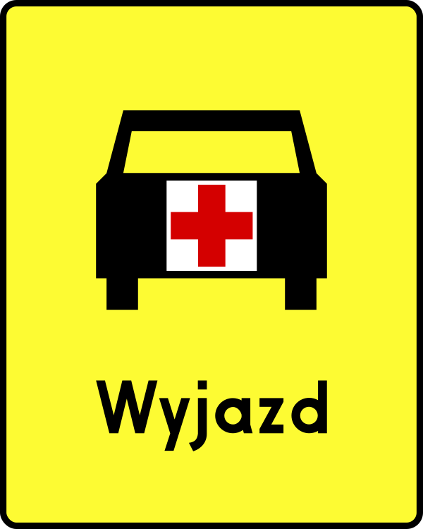
English • Supplementary plate T-16 • Exit used by the emergency vehicles shown. Below A-30, plates indicate: T-8, traffic directed onto tram tracks; T-10, a road crossing a railway siding or similar track, where a railway employee stops road traffic while a train passes or shunts; T-11, a ferry crossing; T-12, a longitudinal step in the road surface; T-13, a section with wheel-rut deformation; T-14, frequent accidents of the type shown; T-15, frequent accidents caused by a slippery road surface due to rain; T-16, an exit used by the emergency vehicles shown; T-17, a national border; and T-18, an unexpected change in traffic direction following the course shown.
Polski • T-16 • tabliczka wskazująca miejsce wyjazdu pojazdów uprzywilejowanych wskazanych na tabliczce. Umieszczona pod znakiem A-30 tabliczka wskazuje: T-8 - miejsce, w którym ruch pojazdów został skierowany na tory tramwajowe; T-10 - przecięcie drogi z bocznicą kolej ową lub torem o podobnym charakterze; w miejscu tak oznakowanym ruch na drodze jest wstrzymywany przez pracownika kolei podczas przejeżdżania (przetaczania) pociągu; T-11 - przeprawę promową; T-12 - podłużny uskok nawierzchni; T-13 - odcinek drogi, na którym występują deformacje nawierzchni w postaci kolein; T-14 - miejsce częstych wypadków o charakterze wskazanym na tabliczce; T-15 - miejsce częstych wypadków spowodowanych śliską nawierzchnią jezdni ze względu na opady deszczu; T-16 - miejsce wyjazdu pojazdów uprzywilejowanych wskazanych na tabliczce; T-17 - granicę państwa; T-18 - nieoczekiwaną zmianę kierunku ruchu o przebiegu wskazanym na tabliczce.
Sources
🔗 Commons.wikimedia.org
🔗 Eli.gov.pl • § 11 ust. 2
SVG source: Pz • Public domain • Original revision 2012-04-06. Wikimedia original unmodified.
154. Usagers du ferry autorisés
Le panonceau usagers du ferry autorisés indique que seuls les véhicules et passagers utilisant un service de ferry sont autorisés à accéder ou emprunter une route, une voie ou une zone, même si le panneau principal mentionne une restriction. Les usagers du ferry (véhicules ou personnes embarquant ou débarquant) sont exceptés de la restriction. Permet l'accès aux terminaux ou routes menant directement aux embarcadères, tout en restreignant la circulation générale. Peut afficher le texte : « Usagers du ferry autorisés », « Sauf usagers ferry », « Réservé usagers ferry ».
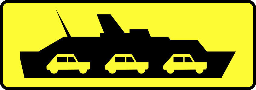
English • Supplementary plate T-11 • Ferry crossing. Below A-30, plates indicate: T-8, traffic directed onto tram tracks; T-10, a road crossing a railway siding or similar track, where a railway employee stops road traffic while a train passes or shunts; T-11, a ferry crossing; T-12, a longitudinal step in the road surface; T-13, a section with wheel-rut deformation; T-14, frequent accidents of the type shown; T-15, frequent accidents caused by a slippery road surface due to rain; T-16, an exit used by the emergency vehicles shown; T-17, a national border; and T-18, an unexpected change in traffic direction following the course shown.
Polski • T-11 • tabliczka wskazująca przeprawę promową. Umieszczona pod znakiem A-30 tabliczka wskazuje: T-8 - miejsce, w którym ruch pojazdów został skierowany na tory tramwajowe; T-10 - przecięcie drogi z bocznicą kolej ową lub torem o podobnym charakterze; w miejscu tak oznakowanym ruch na drodze jest wstrzymywany przez pracownika kolei podczas przejeżdżania (przetaczania) pociągu; T-11 - przeprawę promową; T-12 - podłużny uskok nawierzchni; T-13 - odcinek drogi, na którym występują deformacje nawierzchni w postaci kolein; T-14 - miejsce częstych wypadków o charakterze wskazanym na tabliczce; T-15 - miejsce częstych wypadków spowodowanych śliską nawierzchnią jezdni ze względu na opady deszczu; T-16 - miejsce wyjazdu pojazdów uprzywilejowanych wskazanych na tabliczce; T-17 - granicę państwa; T-18 - nieoczekiwaną zmianę kierunku ruchu o przebiegu wskazanym na tabliczce.
Sources
🔗 Commons.wikimedia.org
🔗 Eli.gov.pl • § 11 ust. 2
SVG source: --Szczepan talk • Public domain • Original revision 2009-06-06. Wikimedia original unmodified.
155. À gauche ou à droite
Un panonceau à gauche ou à droite est placé sous un panneau principal pour indiquer que l’instruction, la restriction ou la direction concerne à la fois la gauche et la droite, ou que les aménagements concernés (ex. parking, voies, chemins) se trouvent à gauche et à droite.

English • Supplementary plate T-26 • Restriction applies along the side of a square. Sign B-35, B-36, B-37 or B-38 with plate T-26, installed on a square parallel to the edge of the carriageway, means that its prohibition applies to the side of the square where it stands.
Polski • T-26 • tabliczka wskazująca, że zakaz postoju lub zatrzymywania dotyczy strony placu. Znak B-35, B-36, B-37 lub B-38 wraz z tabliczką T-26, umieszczony na placu równolegle do krawędzi jezdni, oznacza, że zakaz wyrażony tym znakiem dotyczy strony placu, przy której został ustawiony.
Sources
🔗 Commons.wikimedia.org
🔗 Eli.gov.pl • § 28 ust. 8
SVG source: Masur • Public domain • Original revision 2009-06-28. Wikimedia original unmodified.
156. Panneau valable
Un panonceau panneau valable est placé sous un panneau principal pour signaler que la réglementation, la restriction ou la zone indiquée par le panneau principal est en vigueur à partir de cet endroit.

English • Supplementary plate T-25b • Continuation of a parking or stopping prohibition. Below B-35, B-36, B-37 or B-38, plates indicate: T-25a, beginning of the prohibition; T-25b, continuation of the prohibition; and T-25c, cancellation of the prohibition.
Polski • T-25b • tabliczka wskazująca kontynuację zakazu postoju lub zatrzymywania. Umieszczone pod znakiem B-35, B-36, B-37 lub B-38 tabliczki wskazują: T-25a - początek zakazu wyrażonego znakiem; T-25b - kontynuację zakazu wyrażonego znakiem; T-25c - odwołanie zakazu wyrażonego znakiem.
Sources
🔗 Commons.wikimedia.org
🔗 Eli.gov.pl • § 28 ust. 7
SVG source: Masur • Public domain • Original revision 2009-06-28. Wikimedia original unmodified.
157. Fin du panneau
Un panonceau panneau se termine est placé sous un panneau principal pour indiquer que la réglementation, la restriction ou la zone indiquée par le panneau principal prend fin à cet endroit.

English • Supplementary plate T-25c • Cancellation of a parking or stopping prohibition. Below B-35, B-36, B-37 or B-38, plates indicate: T-25a, beginning of the prohibition; T-25b, continuation of the prohibition; and T-25c, cancellation of the prohibition.
Polski • T-25c • tabliczka wskazująca odwołanie zakazu postoju lub zatrzymywania. Umieszczone pod znakiem B-35, B-36, B-37 lub B-38 tabliczki wskazują: T-25a - początek zakazu wyrażonego znakiem; T-25b - kontynuację zakazu wyrażonego znakiem; T-25c - odwołanie zakazu wyrażonego znakiem.
Sources
🔗 Commons.wikimedia.org
🔗 Eli.gov.pl • § 28 ust. 7
SVG source: Masur • Public domain • Original revision 2009-06-28. Wikimedia original unmodified.
158. Déviation temporaire à gauche
Ce panneau additionnel indique une déviation temporaire vers la gauche. La circulation suit l’itinéraire temporaire dans la direction indiquée.

English • Supplementary plate T-18 • Unexpected change in traffic direction following the course shown on the plate. Below A-30, plates indicate: T-8, traffic directed onto tram tracks; T-10, a road crossing a railway siding or similar track, where a railway employee stops road traffic while a train passes or shunts; T-11, a ferry crossing; T-12, a longitudinal step in the road surface; T-13, a section with wheel-rut deformation; T-14, frequent accidents of the type shown; T-15, frequent accidents caused by a slippery road surface due to rain; T-16, an exit used by the emergency vehicles shown; T-17, a national border; and T-18, an unexpected change in traffic direction following the course shown.
Polski • T-18 • tabliczka wskazująca nieoczekiwaną zmianę kierunku ruchu o przebiegu wskazanym na tabliczce. Umieszczona pod znakiem A-30 tabliczka wskazuje: T-8 - miejsce, w którym ruch pojazdów został skierowany na tory tramwajowe; T-10 - przecięcie drogi z bocznicą kolej ową lub torem o podobnym charakterze; w miejscu tak oznakowanym ruch na drodze jest wstrzymywany przez pracownika kolei podczas przejeżdżania (przetaczania) pociągu; T-11 - przeprawę promową; T-12 - podłużny uskok nawierzchni; T-13 - odcinek drogi, na którym występują deformacje nawierzchni w postaci kolein; T-14 - miejsce częstych wypadków o charakterze wskazanym na tabliczce; T-15 - miejsce częstych wypadków spowodowanych śliską nawierzchnią jezdni ze względu na opady deszczu; T-16 - miejsce wyjazdu pojazdów uprzywilejowanych wskazanych na tabliczce; T-17 - granicę państwa; T-18 - nieoczekiwaną zmianę kierunku ruchu o przebiegu wskazanym na tabliczce.
Sources
🔗 Commons.wikimedia.org
🔗 Eli.gov.pl • § 11 ust. 2
SVG source: Miko101 • Public domain • Original revision 2023-10-03. Wikimedia original unmodified.
159. Déviation temporaire à droite
Un panonceau déviation temporaire à gauche est placé sous un panneau principal pour indiquer qu’en raison de travaux ou d’autres circonstances temporaires, la circulation doit dévier ou contourner vers la gauche à l’avance.

English • Supplementary plate T-18 • Unexpected change in traffic direction following the course shown on the plate. Below A-30, plates indicate: T-8, traffic directed onto tram tracks; T-10, a road crossing a railway siding or similar track, where a railway employee stops road traffic while a train passes or shunts; T-11, a ferry crossing; T-12, a longitudinal step in the road surface; T-13, a section with wheel-rut deformation; T-14, frequent accidents of the type shown; T-15, frequent accidents caused by a slippery road surface due to rain; T-16, an exit used by the emergency vehicles shown; T-17, a national border; and T-18, an unexpected change in traffic direction following the course shown.
Polski • T-18 • tabliczka wskazująca nieoczekiwaną zmianę kierunku ruchu o przebiegu wskazanym na tabliczce. Umieszczona pod znakiem A-30 tabliczka wskazuje: T-8 - miejsce, w którym ruch pojazdów został skierowany na tory tramwajowe; T-10 - przecięcie drogi z bocznicą kolej ową lub torem o podobnym charakterze; w miejscu tak oznakowanym ruch na drodze jest wstrzymywany przez pracownika kolei podczas przejeżdżania (przetaczania) pociągu; T-11 - przeprawę promową; T-12 - podłużny uskok nawierzchni; T-13 - odcinek drogi, na którym występują deformacje nawierzchni w postaci kolein; T-14 - miejsce częstych wypadków o charakterze wskazanym na tabliczce; T-15 - miejsce częstych wypadków spowodowanych śliską nawierzchnią jezdni ze względu na opady deszczu; T-16 - miejsce wyjazdu pojazdów uprzywilejowanych wskazanych na tabliczce; T-17 - granicę państwa; T-18 - nieoczekiwaną zmianę kierunku ruchu o przebiegu wskazanym na tabliczce.
Sources
🔗 Commons.wikimedia.org
🔗 Eli.gov.pl • § 11 ust. 2
SVG source: Miko101 • Public domain • Original revision 2023-10-03. Wikimedia original unmodified.
160. Déviation temporaire à gauche et retour
Un panonceau déviation temporaire à gauche puis retour est placé sous un panneau principal pour indiquer qu’en raison de travaux ou d’autres conditions temporaires, la circulation doit dévier à gauche puis revenir sur le trajet initial.

English • Supplementary plate T-18 • Unexpected change in traffic direction following the course shown on the plate. Below A-30, plates indicate: T-8, traffic directed onto tram tracks; T-10, a road crossing a railway siding or similar track, where a railway employee stops road traffic while a train passes or shunts; T-11, a ferry crossing; T-12, a longitudinal step in the road surface; T-13, a section with wheel-rut deformation; T-14, frequent accidents of the type shown; T-15, frequent accidents caused by a slippery road surface due to rain; T-16, an exit used by the emergency vehicles shown; T-17, a national border; and T-18, an unexpected change in traffic direction following the course shown.
Polski • T-18 • tabliczka wskazująca nieoczekiwaną zmianę kierunku ruchu o przebiegu wskazanym na tabliczce. Umieszczona pod znakiem A-30 tabliczka wskazuje: T-8 - miejsce, w którym ruch pojazdów został skierowany na tory tramwajowe; T-10 - przecięcie drogi z bocznicą kolej ową lub torem o podobnym charakterze; w miejscu tak oznakowanym ruch na drodze jest wstrzymywany przez pracownika kolei podczas przejeżdżania (przetaczania) pociągu; T-11 - przeprawę promową; T-12 - podłużny uskok nawierzchni; T-13 - odcinek drogi, na którym występują deformacje nawierzchni w postaci kolein; T-14 - miejsce częstych wypadków o charakterze wskazanym na tabliczce; T-15 - miejsce częstych wypadków spowodowanych śliską nawierzchnią jezdni ze względu na opady deszczu; T-16 - miejsce wyjazdu pojazdów uprzywilejowanych wskazanych na tabliczce; T-17 - granicę państwa; T-18 - nieoczekiwaną zmianę kierunku ruchu o przebiegu wskazanym na tabliczce.
Sources
🔗 Commons.wikimedia.org
🔗 Eli.gov.pl • § 11 ust. 2
SVG source: Miko101 • Public domain • Original revision 2023-10-03. Wikimedia original unmodified.
161. Déviation temporaire à droite et retour
Un panonceau déviation temporaire à droite puis retour est placé sous un panneau principal pour indiquer qu’en raison de travaux ou d’autres circonstances temporaires, la circulation doit dévier à droite puis reprendre l’itinéraire initial.

English • Supplementary plate T-18 • Unexpected change in traffic direction following the course shown on the plate. Below A-30, plates indicate: T-8, traffic directed onto tram tracks; T-10, a road crossing a railway siding or similar track, where a railway employee stops road traffic while a train passes or shunts; T-11, a ferry crossing; T-12, a longitudinal step in the road surface; T-13, a section with wheel-rut deformation; T-14, frequent accidents of the type shown; T-15, frequent accidents caused by a slippery road surface due to rain; T-16, an exit used by the emergency vehicles shown; T-17, a national border; and T-18, an unexpected change in traffic direction following the course shown.
Polski • T-18 • tabliczka wskazująca nieoczekiwaną zmianę kierunku ruchu o przebiegu wskazanym na tabliczce. Umieszczona pod znakiem A-30 tabliczka wskazuje: T-8 - miejsce, w którym ruch pojazdów został skierowany na tory tramwajowe; T-10 - przecięcie drogi z bocznicą kolej ową lub torem o podobnym charakterze; w miejscu tak oznakowanym ruch na drodze jest wstrzymywany przez pracownika kolei podczas przejeżdżania (przetaczania) pociągu; T-11 - przeprawę promową; T-12 - podłużny uskok nawierzchni; T-13 - odcinek drogi, na którym występują deformacje nawierzchni w postaci kolein; T-14 - miejsce częstych wypadków o charakterze wskazanym na tabliczce; T-15 - miejsce częstych wypadków spowodowanych śliską nawierzchnią jezdni ze względu na opady deszczu; T-16 - miejsce wyjazdu pojazdów uprzywilejowanych wskazanych na tabliczce; T-17 - granicę państwa; T-18 - nieoczekiwaną zmianę kierunku ruchu o przebiegu wskazanym na tabliczce.
Sources
🔗 Commons.wikimedia.org
🔗 Eli.gov.pl • § 11 ust. 2
SVG source: Miko101 • Public domain • Original revision 2023-10-03. Wikimedia original unmodified.
162. Déviation temporaire sur les voies de tram
Un panonceau déviation temporaire sur les voies de tramway est placé sous un panneau principal pour indiquer qu’en raison de travaux ou d’autres circonstances temporaires, l’itinéraire de déviation suit ou traverse des voies de tramway.
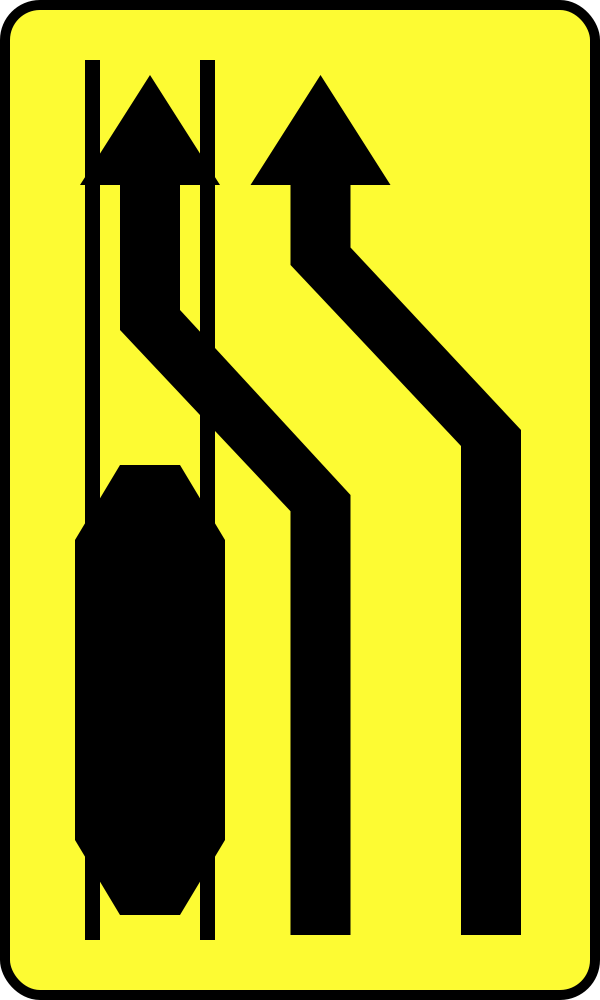
English • Supplementary plate T-8 • Traffic directed onto tram tracks. Below A-30, plates indicate: T-8, traffic directed onto tram tracks; T-10, a road crossing a railway siding or similar track, where a railway employee stops road traffic while a train passes or shunts; T-11, a ferry crossing; T-12, a longitudinal step in the road surface; T-13, a section with wheel-rut deformation; T-14, frequent accidents of the type shown; T-15, frequent accidents caused by a slippery road surface due to rain; T-16, an exit used by the emergency vehicles shown; T-17, a national border; and T-18, an unexpected change in traffic direction following the course shown.
Polski • T-8 • tabliczka wskazująca miejsce, w którym ruch pojazdów został skierowany na tory tramwajowe. Umieszczona pod znakiem A-30 tabliczka wskazuje: T-8 - miejsce, w którym ruch pojazdów został skierowany na tory tramwajowe; T-10 - przecięcie drogi z bocznicą kolej ową lub torem o podobnym charakterze; w miejscu tak oznakowanym ruch na drodze jest wstrzymywany przez pracownika kolei podczas przejeżdżania (przetaczania) pociągu; T-11 - przeprawę promową; T-12 - podłużny uskok nawierzchni; T-13 - odcinek drogi, na którym występują deformacje nawierzchni w postaci kolein; T-14 - miejsce częstych wypadków o charakterze wskazanym na tabliczce; T-15 - miejsce częstych wypadków spowodowanych śliską nawierzchnią jezdni ze względu na opady deszczu; T-16 - miejsce wyjazdu pojazdów uprzywilejowanych wskazanych na tabliczce; T-17 - granicę państwa; T-18 - nieoczekiwaną zmianę kierunku ruchu o przebiegu wskazanym na tabliczce.
Sources
🔗 Commons.wikimedia.org
🔗 Eli.gov.pl • § 11 ust. 2
SVG source: --Szczepan talk • Public domain • Original revision 2009-06-06. Wikimedia original unmodified.
163. mètre plus loin
Ce panneau additionnel indique la distance entre le panneau principal et le point où commence le danger, la règle ou l’information indiquée. La distance est exprimée en mètres.

English • Supplementary plate T-21 • Distance to the place where a prohibition begins or applies. Below a prohibitory sign, T-20 indicates the length of the carriageway section covered by the prohibition, and T-21 indicates the distance from the sign to the place where the prohibition begins or applies.
Polski • T-21 • tabliczka wskazująca odległość znaku od miejsca, od którego lub w którym zakaz obowiązuje. Umieszczona pod znakiem zakazu tabliczka wskazuje: T-20 - długość odcinka jezdni, na którym zakaz obowiązuj e; T-21 - odległość znaku od miejsca, od którego lub w którym zakaz obowiązuje.
Sources
🔗 Commons.wikimedia.org
🔗 Eli.gov.pl • § 15 ust. 5
SVG source: Miko101 • Public domain • Original revision 2009-06-21. Wikimedia original unmodified.
164. Sur mètre
Ce panneau additionnel indique la longueur de la section à laquelle s’applique le panneau principal. La longueur est exprimée en mètres.
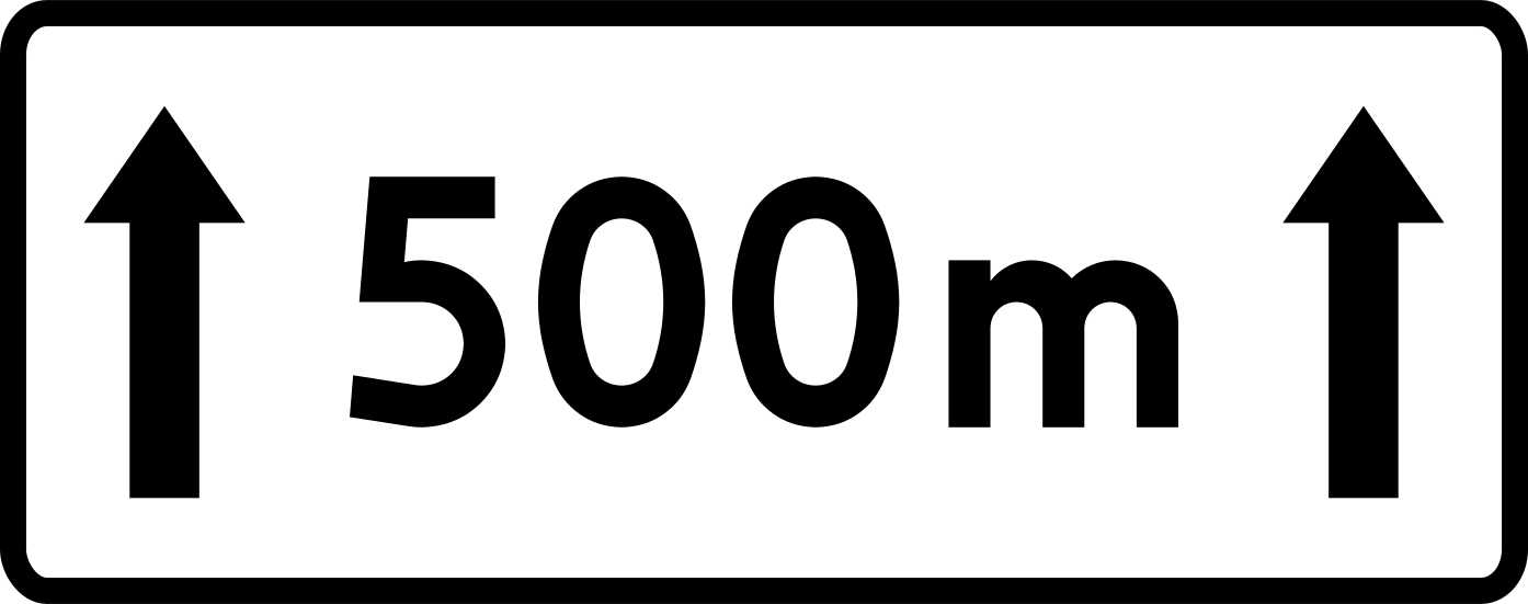
English • Supplementary plate T-20 • Length of the carriageway section covered by a prohibition. Below a prohibitory sign, T-20 indicates the length of the carriageway section covered by the prohibition, and T-21 indicates the distance from the sign to the place where the prohibition begins or applies.
Polski • T-20 • tabliczka wskazująca długość odcinka jezdni, na którym zakaz obowiązuje. Umieszczona pod znakiem zakazu tabliczka wskazuje: T-20 - długość odcinka jezdni, na którym zakaz obowiązuj e; T-21 - odległość znaku od miejsca, od którego lub w którym zakaz obowiązuje.
Sources
🔗 Commons.wikimedia.org
🔗 Eli.gov.pl • § 15 ust. 5
SVG source: Masur • Public domain • Original revision 2009-06-27. Wikimedia original unmodified.
165. Configuration du carrefour
Le panonceau forme du carrefour est placé sous un panneau principal pour indiquer la forme ou l’agencement spécifique d’un carrefour à venir. Montre la configuration de l’intersection (par exemple, intersection en T, carrefour décalé, croisement classique).

English • Supplementary plate T-6a • Course of the priority road through a junction, shown on the priority road. Below D-1, plate T-6a or T-6b shows respectively the actual course of the priority road through the junction or the layout of the minor roads.
Polski • T-6a • tabliczka wskazująca rzeczywisty przebieg drogi z pierwszeństwem przez skrzyżowanie (umieszczana na drodze z pierwszeństwem). Umieszczona pod znakiem D-1 tabliczka T-6a albo T-6b wskazuje odpowiednio rzeczywisty przebieg drogi z pierwszeństwem przez skrzyżowanie lub układ dróg podporządkowanych.
Sources
🔗 Commons.wikimedia.org
🔗 Eli.gov.pl • § 43 ust. 2
SVG source: --Szczepan talk • Public domain • Original revision 2009-06-06. Wikimedia original unmodified.
166. Configuration du carrefour
Le panonceau forme du carrefour est placé sous un panneau principal pour indiquer la forme ou l’agencement spécifique d’un carrefour à venir. Montre la configuration de l’intersection (par exemple, intersection en T, carrefour décalé, croisement classique).

English • Supplementary plate T-6c • Course of the priority road through a junction, shown on a minor road. Below A-7, plate T-6c or T-6d shows the actual course of the priority road through the junction.
Polski • T-6c • tabliczka wskazująca rzeczywisty przebieg drogi z pierwszeństwem przez skrzyżowanie (umieszczana na drodze podporządkowanej). Umieszczona pod znakiem A-7 tabliczka T-6c lub T-6d wskazuje rzeczywisty przebieg drogi z pierwszeństwem przez skrzyżowanie.
Sources
🔗 Commons.wikimedia.org
🔗 Eli.gov.pl • § 5 ust. 7
SVG source: --Szczepan talk • Public domain • Original revision 2009-06-06. Wikimedia original unmodified.
167. Configuration du carrefour
Le panonceau forme du carrefour est placé sous un panneau principal pour indiquer la forme ou l’agencement spécifique d’un carrefour à venir. Montre la configuration de l’intersection (par exemple, intersection en T, carrefour décalé, croisement classique).

English • Supplementary plate T-6b • Layout of minor roads, shown on the priority road. Below A-6a, A-6b or A-6c, plate T-6b shows the road layout at the junction.
Polski • T-6b • tabliczka wskazująca układ dróg podporządkowanych (umieszczana na drodze z pierwszeństwem). Umieszczona pod znakami A-6a, A-6b lub A-6c tabliczka T-6b wskazuje układ dróg na skrzyżowaniu.
Sources
🔗 Commons.wikimedia.org
🔗 Eli.gov.pl • § 5 ust. 3
SVG source: --Szczepan talk • Public domain • Original revision 2009-06-06. Wikimedia original unmodified.
168. Configuration du carrefour
Le panonceau forme du carrefour est placé sous un panneau principal pour indiquer la forme ou l’agencement spécifique d’un carrefour à venir. Montre la configuration de l’intersection (par exemple, intersection en T, carrefour décalé, croisement classique).

English • Supplementary plate T-6d • Priority road crossing at right angles and layout of minor roads, shown on a minor road. Below A-7, plate T-6c or T-6d shows the actual course of the priority road through the junction.
Polski • T-6d • tabliczka wskazująca prostopadły przebieg drogi z pierwszeństwem przez skrzyżowanie oraz układ dróg podpo- rządkowanych (umieszczana na drodze podporządkowanej). Umieszczona pod znakiem A-7 tabliczka T-6c lub T-6d wskazuje rzeczywisty przebieg drogi z pierwszeństwem przez skrzyżowanie.
Sources
🔗 Commons.wikimedia.org
🔗 Eli.gov.pl • § 5 ust. 7
SVG source: --Szczepan talk • Public domain • Original revision 2009-06-06. Wikimedia original unmodified.
169. Configuration du carrefour
Le panonceau forme du carrefour est placé sous un panneau principal pour indiquer la forme ou l’agencement spécifique d’un carrefour à venir. Montre la configuration de l’intersection (par exemple, intersection en T, carrefour décalé, croisement classique).

English • Supplementary plate T-7 • Layout of the tracks and road at a crossing. Below A-9 or A-10, plate T-7 shows the layout of the tracks and road at the crossing.
Polski • T-7 • tabliczka wskazująca układ torów i drogi na przejeździe. Umieszczona pod znakiem A-9 lub A-10 tabliczka T-7 wskazuje układ torów i drogi na przejeździe.
Sources
🔗 Commons.wikimedia.org
🔗 Eli.gov.pl • § 6 ust. 3
SVG source: --Szczepan talk • Public domain • Original revision 2009-06-06. Wikimedia original unmodified.
170. Stationnement en créneau sur le trottoir
Un panonceau stationnement en créneau sur le trottoir est placé sous un panneau principal pour indiquer que le stationnement en créneau sur le trottoir est autorisé dans la zone concernée.

English • Supplementary plate T-30 • Parking arrangement relative to the carriageway edge. Below D-18, plate T-30 shows how to position the vehicle relative to the carriageway edge, shown in grey, and indicates that the place is intended for motor vehicles with a maximum authorised mass not exceeding 2.5 t.
Polski • T-30 • tabliczka wskazująca sposób ustawienia pojazdu względem krawędzi jezdni. Umieszczona pod znakiem D-18 tabliczka T-30 wskazuje sposób ustawienia pojazdu względem krawędzi jezdni oznaczonej na tabliczce barwą szarą oraz że miejsce jest przeznaczone dla pojazdów samochodowych o dopuszczalnej masie całkowitej nieprzekraczającej 2,5 t.
Sources
🔗 Commons.wikimedia.org
🔗 Eli.gov.pl • § 52 ust. 2
SVG source: Masur • Public domain • Original revision 2009-06-28. Wikimedia original unmodified.
171. Stationnement en créneau partiellement sur le trottoir
Un panonceau stationnement en créneau partiel sur le trottoir est placé sous un panneau principal pour signaler que les véhicules sont autorisés à se garer en créneau, une partie sur le trottoir et une partie sur la chaussée.
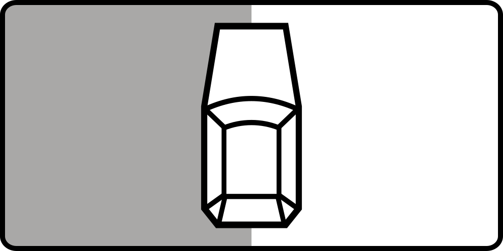
English • Supplementary plate T-30 • Parking arrangement relative to the carriageway edge. Below D-18, plate T-30 shows how to position the vehicle relative to the carriageway edge, shown in grey, and indicates that the place is intended for motor vehicles with a maximum authorised mass not exceeding 2.5 t.
Polski • T-30 • tabliczka wskazująca sposób ustawienia pojazdu względem krawędzi jezdni. Umieszczona pod znakiem D-18 tabliczka T-30 wskazuje sposób ustawienia pojazdu względem krawędzi jezdni oznaczonej na tabliczce barwą szarą oraz że miejsce jest przeznaczone dla pojazdów samochodowych o dopuszczalnej masie całkowitej nieprzekraczającej 2,5 t.
Sources
🔗 Commons.wikimedia.org
🔗 Eli.gov.pl • § 52 ust. 2
SVG source: Pz • Public domain • Original revision 2011-02-21. Wikimedia original unmodified.
172. Stationnement en créneau sur la chaussée
Un panonceau stationnement en créneau sur la chaussée est placé sous un panneau principal pour signaler que les véhicules doivent se garer en créneau, parallèlement au trottoir ou à la bordure, entièrement sur la chaussée.

English • Supplementary plate T-30 • Parking arrangement relative to the carriageway edge. Below D-18, plate T-30 shows how to position the vehicle relative to the carriageway edge, shown in grey, and indicates that the place is intended for motor vehicles with a maximum authorised mass not exceeding 2.5 t.
Polski • T-30 • tabliczka wskazująca sposób ustawienia pojazdu względem krawędzi jezdni. Umieszczona pod znakiem D-18 tabliczka T-30 wskazuje sposób ustawienia pojazdu względem krawędzi jezdni oznaczonej na tabliczce barwą szarą oraz że miejsce jest przeznaczone dla pojazdów samochodowych o dopuszczalnej masie całkowitej nieprzekraczającej 2,5 t.
Sources
🔗 Commons.wikimedia.org
🔗 Eli.gov.pl • § 52 ust. 2
SVG source: Pz • Public domain • Original revision 2011-02-21. Wikimedia original unmodified.
173. Stationnement perpendiculaire sur le trottoir
Un panonceau supplémentaire stationnement perpendiculaire sur le trottoir est placé sous un panneau de signalisation principal pour indiquer que les véhicules sont autorisés à se garer perpendiculairement à la bordure, entièrement sur le trottoir.

English • Supplementary plate T-30 • Parking arrangement relative to the carriageway edge. Below D-18, plate T-30 shows how to position the vehicle relative to the carriageway edge, shown in grey, and indicates that the place is intended for motor vehicles with a maximum authorised mass not exceeding 2.5 t.
Polski • T-30 • tabliczka wskazująca sposób ustawienia pojazdu względem krawędzi jezdni. Umieszczona pod znakiem D-18 tabliczka T-30 wskazuje sposób ustawienia pojazdu względem krawędzi jezdni oznaczonej na tabliczce barwą szarą oraz że miejsce jest przeznaczone dla pojazdów samochodowych o dopuszczalnej masie całkowitej nieprzekraczającej 2,5 t.
Sources
🔗 Commons.wikimedia.org
🔗 Eli.gov.pl • § 52 ust. 2
SVG source: Pz • Public domain • Original revision 2011-02-21. Wikimedia original unmodified.
174. Stationnement perpendiculaire partiel sur le trottoir
Un panonceau supplémentaire stationnement perpendiculaire partiellement sur le trottoir est placé sous un panneau de signalisation principal pour indiquer que les véhicules sont autorisés à se garer perpendiculairement à la bordure en partie sur le trottoir et en partie sur la chaussée.

English • Supplementary plate T-30 • Parking arrangement relative to the carriageway edge. Below D-18, plate T-30 shows how to position the vehicle relative to the carriageway edge, shown in grey, and indicates that the place is intended for motor vehicles with a maximum authorised mass not exceeding 2.5 t.
Polski • T-30 • tabliczka wskazująca sposób ustawienia pojazdu względem krawędzi jezdni. Umieszczona pod znakiem D-18 tabliczka T-30 wskazuje sposób ustawienia pojazdu względem krawędzi jezdni oznaczonej na tabliczce barwą szarą oraz że miejsce jest przeznaczone dla pojazdów samochodowych o dopuszczalnej masie całkowitej nieprzekraczającej 2,5 t.
Sources
🔗 Commons.wikimedia.org
🔗 Eli.gov.pl • § 52 ust. 2
SVG source: Pz • Public domain • Original revision 2011-02-21. Wikimedia original unmodified.
175. Stationnement perpendiculaire sur la chaussée
Un panonceau supplémentaire stationnement perpendiculaire sur la chaussée est placé sous un panneau de signalisation principal pour indiquer que les véhicules doivent se garer perpendiculairement à la bordure ou à l’accotement, entièrement sur la chaussée.

English • Supplementary plate T-30 • Parking arrangement relative to the carriageway edge. Below D-18, plate T-30 shows how to position the vehicle relative to the carriageway edge, shown in grey, and indicates that the place is intended for motor vehicles with a maximum authorised mass not exceeding 2.5 t.
Polski • T-30 • tabliczka wskazująca sposób ustawienia pojazdu względem krawędzi jezdni. Umieszczona pod znakiem D-18 tabliczka T-30 wskazuje sposób ustawienia pojazdu względem krawędzi jezdni oznaczonej na tabliczce barwą szarą oraz że miejsce jest przeznaczone dla pojazdów samochodowych o dopuszczalnej masie całkowitej nieprzekraczającej 2,5 t.
Sources
🔗 Commons.wikimedia.org
🔗 Eli.gov.pl • § 52 ust. 2
SVG source: Pz • Public domain • Original revision 2011-02-21. Wikimedia original unmodified.
176. Stationnement en épi sur le trottoir
Un panonceau complémentaire stationnement en épi sur le trottoir est placé sous un panneau principal de signalisation pour indiquer que les véhicules sont autorisés à se garer en épi sur le trottoir.
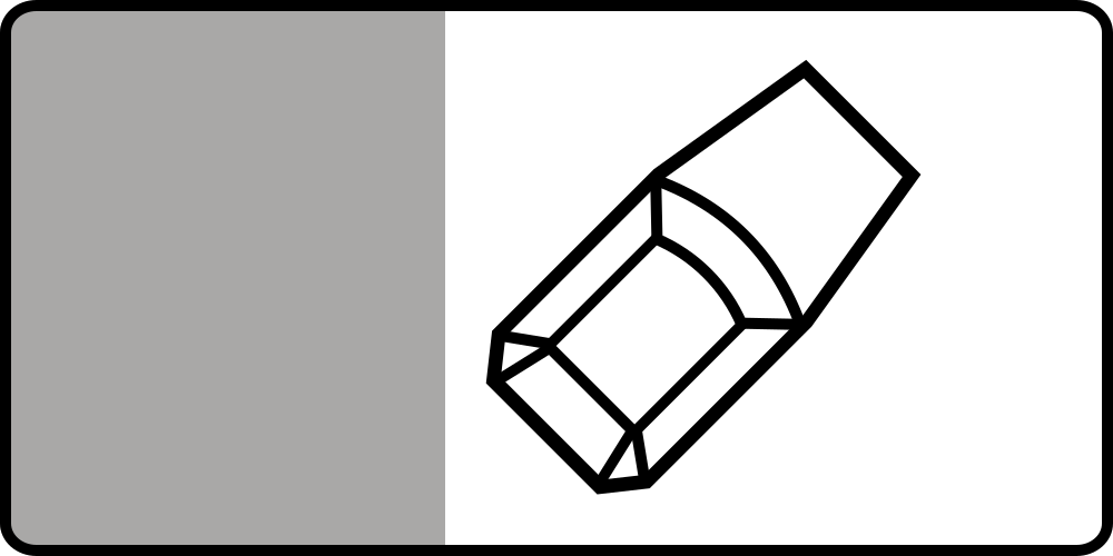
English • Supplementary plate T-30 • Parking arrangement relative to the carriageway edge. Below D-18, plate T-30 shows how to position the vehicle relative to the carriageway edge, shown in grey, and indicates that the place is intended for motor vehicles with a maximum authorised mass not exceeding 2.5 t.
Polski • T-30 • tabliczka wskazująca sposób ustawienia pojazdu względem krawędzi jezdni. Umieszczona pod znakiem D-18 tabliczka T-30 wskazuje sposób ustawienia pojazdu względem krawędzi jezdni oznaczonej na tabliczce barwą szarą oraz że miejsce jest przeznaczone dla pojazdów samochodowych o dopuszczalnej masie całkowitej nieprzekraczającej 2,5 t.
Sources
🔗 Commons.wikimedia.org
🔗 Eli.gov.pl • § 52 ust. 2
SVG source: Pz • Public domain • Original revision 2011-02-21. Wikimedia original unmodified.
177. Stationnement en épi partiel sur le trottoir
Un panonceau complémentaire stationnement en épi partiel sur le trottoir est placé sous un panneau principal de signalisation pour indiquer que les véhicules sont autorisés à se garer en épi, avec une partie du véhicule sur le trottoir et une partie sur la chaussée.

English • Supplementary plate T-30 • Parking arrangement relative to the carriageway edge. Below D-18, plate T-30 shows how to position the vehicle relative to the carriageway edge, shown in grey, and indicates that the place is intended for motor vehicles with a maximum authorised mass not exceeding 2.5 t.
Polski • T-30 • tabliczka wskazująca sposób ustawienia pojazdu względem krawędzi jezdni. Umieszczona pod znakiem D-18 tabliczka T-30 wskazuje sposób ustawienia pojazdu względem krawędzi jezdni oznaczonej na tabliczce barwą szarą oraz że miejsce jest przeznaczone dla pojazdów samochodowych o dopuszczalnej masie całkowitej nieprzekraczającej 2,5 t.
Sources
🔗 Commons.wikimedia.org
🔗 Eli.gov.pl • § 52 ust. 2
SVG source: Pz • Public domain • Original revision 2011-02-21. Wikimedia original unmodified.
178. Stationnement en épi sur la chaussée
Ce panneau additionnel indique que les véhicules doivent stationner en biais sur la chaussée, comme illustré.

English • Supplementary plate T-30 • Parking arrangement relative to the carriageway edge. Below D-18, plate T-30 shows how to position the vehicle relative to the carriageway edge, shown in grey, and indicates that the place is intended for motor vehicles with a maximum authorised mass not exceeding 2.5 t.
Polski • T-30 • tabliczka wskazująca sposób ustawienia pojazdu względem krawędzi jezdni. Umieszczona pod znakiem D-18 tabliczka T-30 wskazuje sposób ustawienia pojazdu względem krawędzi jezdni oznaczonej na tabliczce barwą szarą oraz że miejsce jest przeznaczone dla pojazdów samochodowych o dopuszczalnej masie całkowitej nieprzekraczającej 2,5 t.
Sources
🔗 Commons.wikimedia.org
🔗 Eli.gov.pl • § 52 ust. 2
SVG source: Pz • Public domain • Original revision 2011-02-21. Wikimedia original unmodified.
179. Remorquage en cas de stationnement illégal
Un panonceau enlèvement en cas de stationnement illégal est placé sous un panneau principal pour avertir que les véhicules stationnés illégalement seront enlevés.
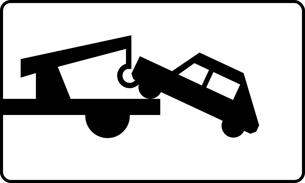
English • Supplementary plate T-24 • Vehicles will be removed at the owner's expense. Below B-35 or B-36, plate T-24 indicates that a vehicle left where the sign's prohibition applies will be removed from the road at its owner's expense.
Polski • T-24 • tabliczka wskazująca, że pozostawiony pojazd zostanie usunięty na koszt właściciela. Umieszczona pod znakiem B-35 lub B-36 tabliczka T-24 wskazuje, że pojazd pozostawiony w miejscu, w którym obowiązuje zakaz wyrażony tym znakiem, zostanie usunięty z drogi na koszt właściciela.
Sources
🔗 Commons.wikimedia.org
🔗 Eli.gov.pl • § 28 ust. 5
SVG source: Masur • Public domain • Original revision 2009-06-29. Wikimedia original unmodified.
180. Frontière
Le panonceau frontière de pays indique que le panneau principal s'applique à la limite ou à la proximité d'une frontière entre deux pays. Informe les conducteurs de l’approche, l’entrée ou la sortie d’une frontière nationale.
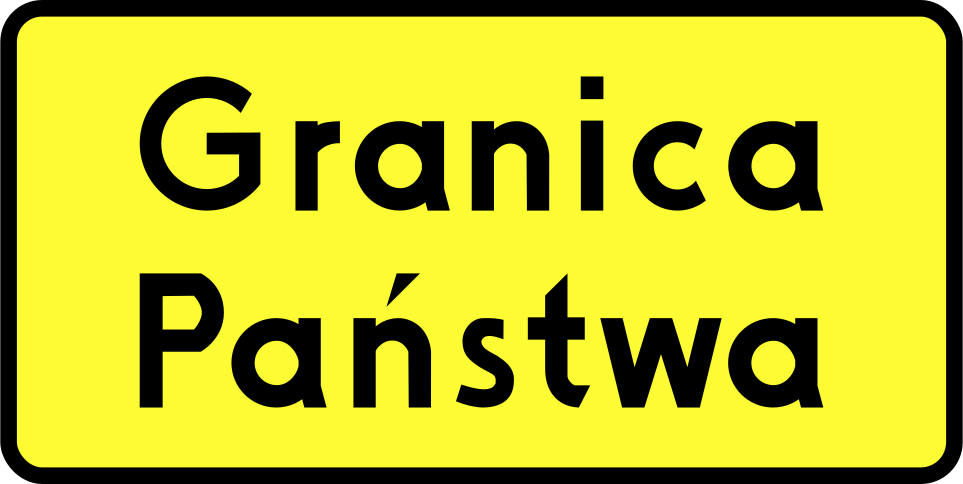
English • Supplementary plate T-17 • National border. Below A-30, plates indicate: T-8, traffic directed onto tram tracks; T-10, a road crossing a railway siding or similar track, where a railway employee stops road traffic while a train passes or shunts; T-11, a ferry crossing; T-12, a longitudinal step in the road surface; T-13, a section with wheel-rut deformation; T-14, frequent accidents of the type shown; T-15, frequent accidents caused by a slippery road surface due to rain; T-16, an exit used by the emergency vehicles shown; T-17, a national border; and T-18, an unexpected change in traffic direction following the course shown.
Polski • T-17 • tabliczka wskazująca granicę państwa. Umieszczona pod znakiem A-30 tabliczka wskazuje: T-8 - miejsce, w którym ruch pojazdów został skierowany na tory tramwajowe; T-10 - przecięcie drogi z bocznicą kolej ową lub torem o podobnym charakterze; w miejscu tak oznakowanym ruch na drodze jest wstrzymywany przez pracownika kolei podczas przejeżdżania (przetaczania) pociągu; T-11 - przeprawę promową; T-12 - podłużny uskok nawierzchni; T-13 - odcinek drogi, na którym występują deformacje nawierzchni w postaci kolein; T-14 - miejsce częstych wypadków o charakterze wskazanym na tabliczce; T-15 - miejsce częstych wypadków spowodowanych śliską nawierzchnią jezdni ze względu na opady deszczu; T-16 - miejsce wyjazdu pojazdów uprzywilejowanych wskazanych na tabliczce; T-17 - granicę państwa; T-18 - nieoczekiwaną zmianę kierunku ruchu o przebiegu wskazanym na tabliczce.
Sources
🔗 Commons.wikimedia.org
🔗 Eli.gov.pl • § 11 ust. 2
SVG source: --Szczepan talk • Public domain • Original revision 2009-06-06. Wikimedia original unmodified.
181. Distance minimale de sécurité
Un panneau supplémentaire pour la distance minimale de sécurité est généralement placé sous un panneau de réglementation ou d'avertissement pour indiquer que les véhicules doivent respecter une distance minimale avec celui qui les précède. Il se trouve souvent dans les tunnels, sur les autoroutes ou dans les zones à visibilité réduite.
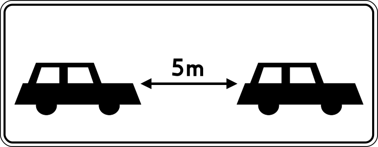
English • Supplementary plate T-32 • Minimum gap to the vehicle ahead when stopped. Below D-37, plate T-32 indicates the minimum gap to the vehicle ahead after stopping.
Polski • T-32 • tabliczka wskazująca minimalny odstęp od poprzedzającego pojazdu po zatrzymaniu. Umieszczona pod znakiem D-37 tabliczka T-32 wskazuje minimalny odstęp od poprzedzającego pojazdu po zatrzymaniu.
Sources
🔗 Commons.wikimedia.org
🔗 Eli.gov.pl • § 56 ust. 4
SVG source: --Szczepan talk • Public domain • Original revision 2020-09-21. Wikimedia original unmodified.
182. Téléphone d'urgence et extincteur d'incendie
Le panonceau téléphone d'urgence et extincteur signale la présence ou la direction d’un téléphone d’urgence et d’un extincteur à proximité — généralement utilisé là où l’accès rapide aux secours est crucial. Souvent utilisé sur autoroutes, dans les tunnels ou les aires de service.
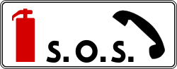
English • Supplementary plate T-33 • Emergency telephone and fire extinguisher in the lay-by. Below D-50, plate T-33, or the wording “SOS” on the sign, indicates that the lay-by contains an emergency telephone and fire extinguisher.
Polski • T-33 • tabliczka wskazująca umieszczenie w zatoce telefonu alarmowego i gaśnicy. Umieszczona pod znakiem D-50 tabliczka T-33 lub umieszczony na znaku napis „SOS” informuje, że w zatoce znajduje się telefon alarmowy i gaśnica.
Sources
🔗 Commons.wikimedia.org
🔗 Eli.gov.pl • § 60 ust. 2
SVG source: Masur • Public domain • Original revision 2020-09-19. Wikimedia original unmodified.
183. Pourcentage de pente
Le panonceau pourcentage de pente indique la raideur d’un versant de route, exprimée en pourcentage (%) et est généralement utilisé en combinaison avec un panneau d’avertissement principal pour une montée ou descente abrupte. Exemple : 10% = 10 mètres de montée/descente tous les 100 mètres parcourus.

English • Supplementary plate T-9 • Actual downhill or uphill gradient. Sign A-22, Dangerous descent, warns of a steep longitudinal downhill gradient. Plate T-9 below it shows the actual gradient.
Polski • T-9 • tabliczka wskazująca rzeczywistą wielkość spadku lub wzniesienia drogi. Znak A-22 „niebezpieczny zjazd” ostrzega o znacznym spadku podłużnym drogi; umieszczona pod znakiem tabliczka T-9 wskazuje rzeczywistą wielkość spadku.
Sources
🔗 Commons.wikimedia.org
🔗 Eli.gov.pl • § 10 ust. 4
SVG source: --Szczepan talk • Public domain • Original revision 2009-06-06. Wikimedia original unmodified.
184. Passage d’enfants
Le panonceau enfants traversant avertit les conducteurs d’être particulièrement prudents car des enfants traversent régulièrement la route à cet endroit ou à proximité. Utilisé fréquemment près des écoles, aires de jeux, parcs ou zones résidentielles.
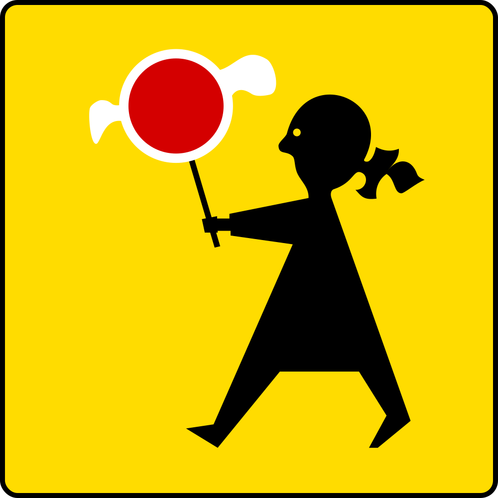
English • Supplementary plate T-27 • Pedestrian crossing particularly frequented by children. Below D-6 or D-6b, plate T-27 indicates that the pedestrian crossing is particularly frequented by children.
Polski • T-27 • tabliczka wskazująca, że przejście dla pieszych jest szczególnie uczęszczane przez dzieci. Umieszczona pod znakiem D-6 lub D-6b tabliczka T-27 wskazuje, że przejście dla pieszych jest szczególnie uczęszczane przez dzieci.
Sources
🔗 Commons.wikimedia.org
🔗 Eli.gov.pl • § 47 ust. 5
SVG source: Masur • Public domain • Original revision 2012-04-06. Wikimedia original unmodified.
185. Nombre de virages
Ce panneau additionnel indique le nombre de virages dans la section de route à venir.

English • Supplementary plate T-4 • Number of bends. Below A-3 or A-4, T-4 states the number of bends when there are more than two, while T-5 indicates the beginning of a winding road.
Polski • T-4 • tabliczka wskazująca liczbę zakrętów. Umieszczona pod znakiem A-3 lub A-4 tabliczka T-4 wskazuje liczbę zakrętów większą niż dwa, natomiast tabliczka T-5 wskazuje początek drogi krętej.
Sources
🔗 Commons.wikimedia.org
🔗 Eli.gov.pl • § 4 ust. 3
SVG source: --Szczepan talk • Public domain • Original revision 2017-08-11. Wikimedia original unmodified.
186. Route sinueuse
Le panonceau route sinueuse avertit les conducteurs d’une section de route comportant de nombreux virages ou courbes à venir, nécessitant vigilance et réduction de vitesse. Aide à se préparer à une conduite technique ou exigeante. Exemple : routes de montagne ou de campagne.
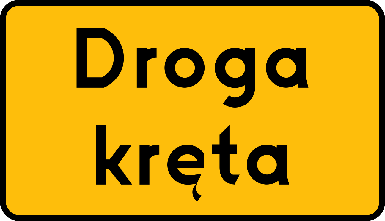
English • Supplementary plate T-5 • Beginning of a winding road. Below A-3 or A-4, T-4 states the number of bends when there are more than two, while T-5 indicates the beginning of a winding road.
Polski • T-5 • tabliczka wskazująca początek drogi krętej. Umieszczona pod znakiem A-3 lub A-4 tabliczka T-4 wskazuje liczbę zakrętów większą niż dwa, natomiast tabliczka T-5 wskazuje początek drogi krętej.
Sources
🔗 Commons.wikimedia.org
🔗 Eli.gov.pl • § 4 ust. 3
SVG source: --Szczepan talk • Public domain • Original revision 2023-10-03. Wikimedia original unmodified.
187. Route à péage
L’additif route à péage indique qu’il faut s’acquitter d’un droit de passage (péage) pour emprunter la route à venir. Paiement à une barrière de péage ou par télépéage. Position fréquente : autoroutes, ponts, tunnels ou bacs à péage.
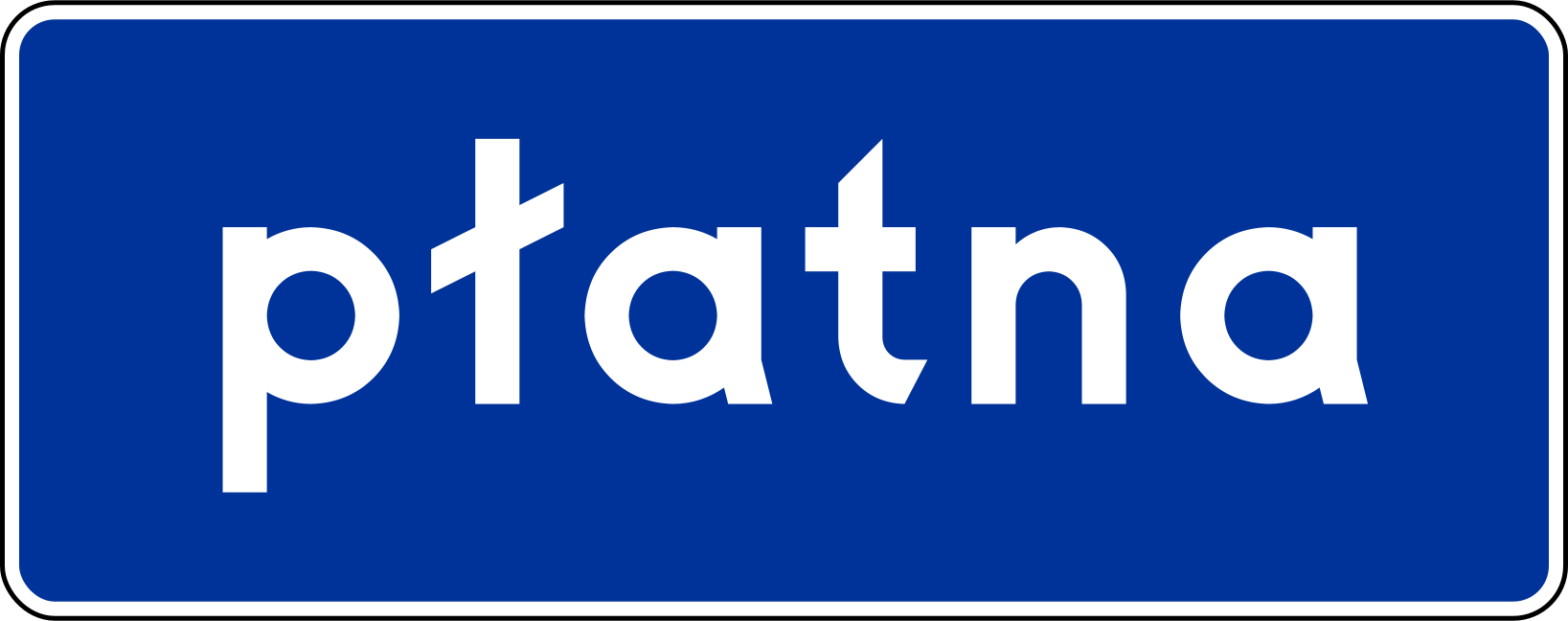
English • Supplementary plate T-28 • Toll road. Below D-7 or D-9, plate T-28 indicates that use of the expressway or motorway is charged.
Polski • T-28 • tabliczka wskazująca, że za przejazd drogą pobierana jest opłata. Umieszczona pod znakiem D-7 lub D-9 tabliczka T-28 wskazuje, że za przejazd drogą ekspresową lub autostradą jest pobierana opłata.
Sources
🔗 Commons.wikimedia.org
🔗 Eli.gov.pl • § 48 ust. 3
SVG source: Miko101 • Public domain • Original revision 2014-05-03. Wikimedia original unmodified.
188. Fin de la route à péage
L’additif fin de route à péage indique que la section de route soumise à un paiement de péage est terminée. Aucun paiement supplémentaire n’est requis au-delà de ce point.
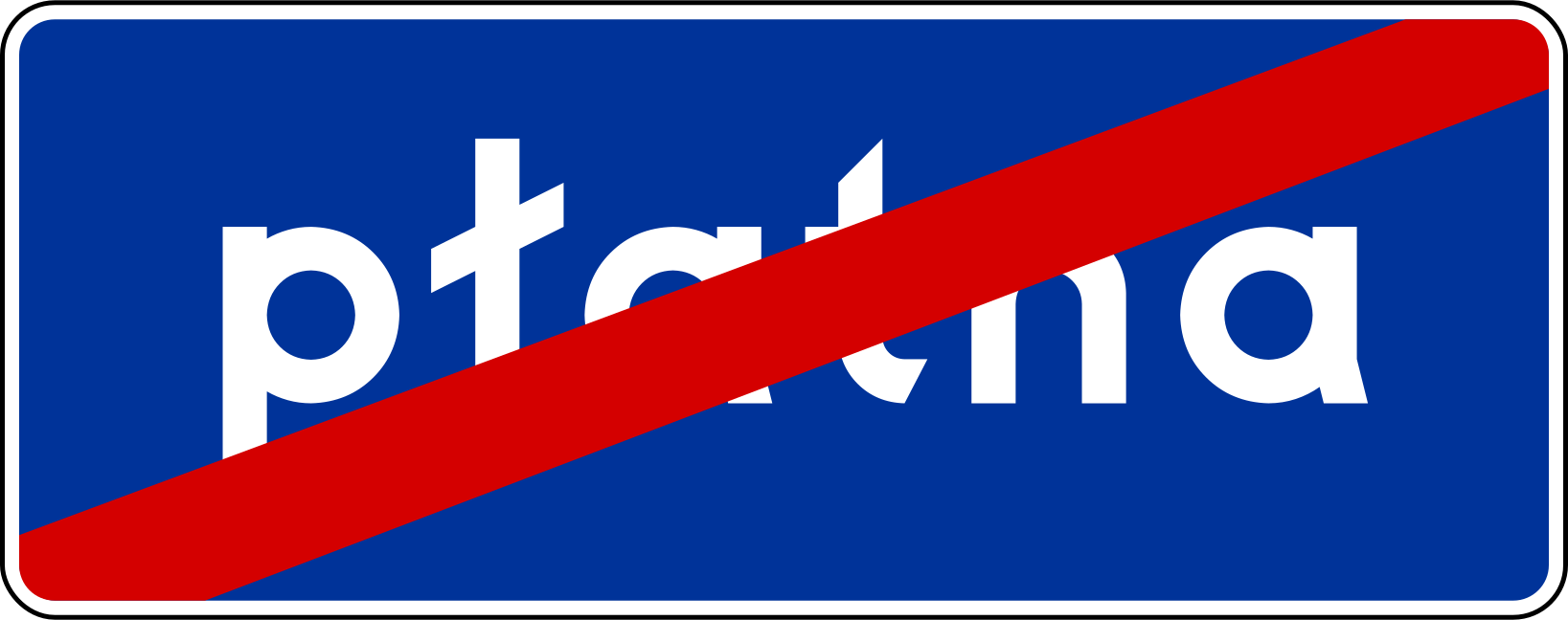
English • Supplementary plate T-28a • End of the tolled motorway section. At the beginning of a free motorway section continuing a tolled motorway, D-9 with plate T-28a (figure 5.2.9.3) indicates the end of the section for which a toll is charged.
Polski • T-28a • tabliczka wskazująca koniec odcinka autostrady, za przejazd którym pobierana jest opłata. Na początku odcinka autostrady bezpłatnej będącej kontynuacją autostrady płatnej umieszcza się znak D-9 z tabliczką T-28a (rys. 5.2.9.3) wskazującą koniec odcinka autostrady, za przejazd którym pobierana jest opłata.
Sources
🔗 Commons.wikimedia.org
🔗 Eli.gov.pl • Załącznik nr 1 • 5.2.9; rys. 9.7.40
SVG source: Pz • Public domain • Original revision 2014-05-22. Wikimedia original unmodified.
189. Schéma d'accident
Le panonceau forme d’accident fait généralement référence à un pictogramme représentant la forme ou le type d’accident dont les conducteurs doivent se méfier. Il représente visuellement un danger d’accident spécifique (par exemple, collision de voitures, véhicule renversé). Souvent placé sous ou à côté d’un panneau général d’avertissement (comme un triangle d’exclamation).
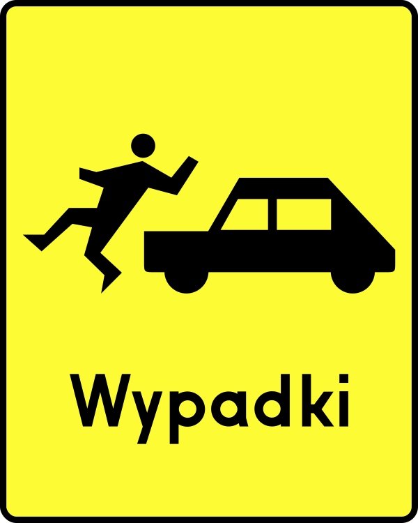
English • Supplementary plate T-14 • Frequent accidents of the type shown on the plate. Below A-30, plates indicate: T-8, traffic directed onto tram tracks; T-10, a road crossing a railway siding or similar track, where a railway employee stops road traffic while a train passes or shunts; T-11, a ferry crossing; T-12, a longitudinal step in the road surface; T-13, a section with wheel-rut deformation; T-14, frequent accidents of the type shown; T-15, frequent accidents caused by a slippery road surface due to rain; T-16, an exit used by the emergency vehicles shown; T-17, a national border; and T-18, an unexpected change in traffic direction following the course shown.
Polski • T-14 • tabliczka wskazująca miejsce częstych wypadków o charakterze wskazanym na tabliczce. Umieszczona pod znakiem A-30 tabliczka wskazuje: T-8 - miejsce, w którym ruch pojazdów został skierowany na tory tramwajowe; T-10 - przecięcie drogi z bocznicą kolej ową lub torem o podobnym charakterze; w miejscu tak oznakowanym ruch na drodze jest wstrzymywany przez pracownika kolei podczas przejeżdżania (przetaczania) pociągu; T-11 - przeprawę promową; T-12 - podłużny uskok nawierzchni; T-13 - odcinek drogi, na którym występują deformacje nawierzchni w postaci kolein; T-14 - miejsce częstych wypadków o charakterze wskazanym na tabliczce; T-15 - miejsce częstych wypadków spowodowanych śliską nawierzchnią jezdni ze względu na opady deszczu; T-16 - miejsce wyjazdu pojazdów uprzywilejowanych wskazanych na tabliczce; T-17 - granicę państwa; T-18 - nieoczekiwaną zmianę kierunku ruchu o przebiegu wskazanym na tabliczce.
Sources
🔗 Commons.wikimedia.org
🔗 Eli.gov.pl • § 11 ust. 2
SVG source: --Szczepan talk • Public domain • Original revision 2009-06-06. Wikimedia original unmodified.
190. Schéma d'accident
Le panonceau forme d’accident fait généralement référence à un pictogramme représentant la forme ou le type d’accident dont les conducteurs doivent se méfier. Il représente visuellement un danger d’accident spécifique (par exemple, collision de voitures, véhicule renversé). Souvent placé sous ou à côté d’un panneau général d’avertissement (comme un triangle d’exclamation).
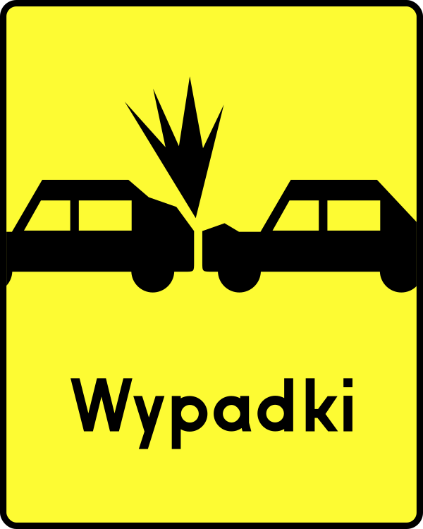
English • Supplementary plate T-14 • Frequent accidents of the type shown on the plate. Below A-30, plates indicate: T-8, traffic directed onto tram tracks; T-10, a road crossing a railway siding or similar track, where a railway employee stops road traffic while a train passes or shunts; T-11, a ferry crossing; T-12, a longitudinal step in the road surface; T-13, a section with wheel-rut deformation; T-14, frequent accidents of the type shown; T-15, frequent accidents caused by a slippery road surface due to rain; T-16, an exit used by the emergency vehicles shown; T-17, a national border; and T-18, an unexpected change in traffic direction following the course shown.
Polski • T-14 • tabliczka wskazująca miejsce częstych wypadków o charakterze wskazanym na tabliczce. Umieszczona pod znakiem A-30 tabliczka wskazuje: T-8 - miejsce, w którym ruch pojazdów został skierowany na tory tramwajowe; T-10 - przecięcie drogi z bocznicą kolej ową lub torem o podobnym charakterze; w miejscu tak oznakowanym ruch na drodze jest wstrzymywany przez pracownika kolei podczas przejeżdżania (przetaczania) pociągu; T-11 - przeprawę promową; T-12 - podłużny uskok nawierzchni; T-13 - odcinek drogi, na którym występują deformacje nawierzchni w postaci kolein; T-14 - miejsce częstych wypadków o charakterze wskazanym na tabliczce; T-15 - miejsce częstych wypadków spowodowanych śliską nawierzchnią jezdni ze względu na opady deszczu; T-16 - miejsce wyjazdu pojazdów uprzywilejowanych wskazanych na tabliczce; T-17 - granicę państwa; T-18 - nieoczekiwaną zmianę kierunku ruchu o przebiegu wskazanym na tabliczce.
Sources
🔗 Commons.wikimedia.org
🔗 Eli.gov.pl • § 11 ust. 2
SVG source: Pz • Public domain • Original revision 2011-02-20. Wikimedia original unmodified.
191. Schéma d'accident
Le panonceau forme d’accident fait généralement référence à un pictogramme représentant la forme ou le type d’accident dont les conducteurs doivent se méfier. Il représente visuellement un danger d’accident spécifique (par exemple, collision de voitures, véhicule renversé). Souvent placé sous ou à côté d’un panneau général d’avertissement (comme un triangle d’exclamation).
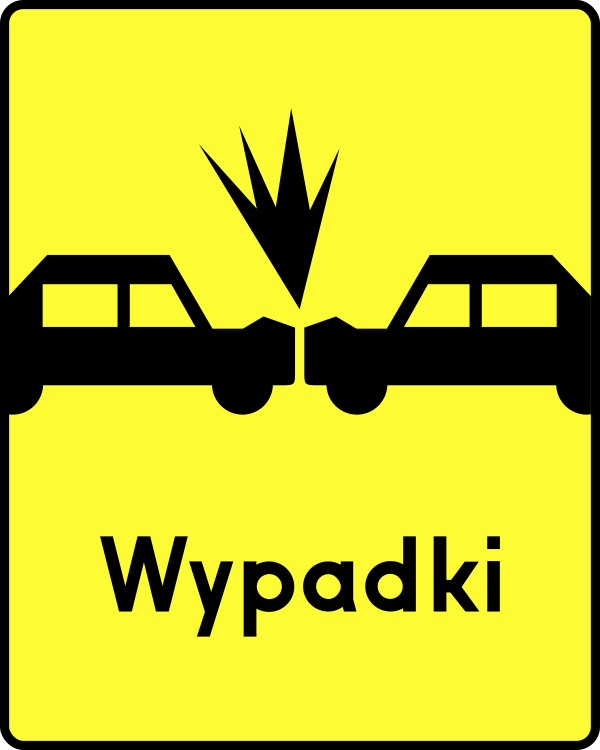
English • Supplementary plate T-14 • Frequent accidents of the type shown on the plate. Below A-30, plates indicate: T-8, traffic directed onto tram tracks; T-10, a road crossing a railway siding or similar track, where a railway employee stops road traffic while a train passes or shunts; T-11, a ferry crossing; T-12, a longitudinal step in the road surface; T-13, a section with wheel-rut deformation; T-14, frequent accidents of the type shown; T-15, frequent accidents caused by a slippery road surface due to rain; T-16, an exit used by the emergency vehicles shown; T-17, a national border; and T-18, an unexpected change in traffic direction following the course shown.
Polski • T-14 • tabliczka wskazująca miejsce częstych wypadków o charakterze wskazanym na tabliczce. Umieszczona pod znakiem A-30 tabliczka wskazuje: T-8 - miejsce, w którym ruch pojazdów został skierowany na tory tramwajowe; T-10 - przecięcie drogi z bocznicą kolej ową lub torem o podobnym charakterze; w miejscu tak oznakowanym ruch na drodze jest wstrzymywany przez pracownika kolei podczas przejeżdżania (przetaczania) pociągu; T-11 - przeprawę promową; T-12 - podłużny uskok nawierzchni; T-13 - odcinek drogi, na którym występują deformacje nawierzchni w postaci kolein; T-14 - miejsce częstych wypadków o charakterze wskazanym na tabliczce; T-15 - miejsce częstych wypadków spowodowanych śliską nawierzchnią jezdni ze względu na opady deszczu; T-16 - miejsce wyjazdu pojazdów uprzywilejowanych wskazanych na tabliczce; T-17 - granicę państwa; T-18 - nieoczekiwaną zmianę kierunku ruchu o przebiegu wskazanym na tabliczce.
Sources
🔗 Commons.wikimedia.org
🔗 Eli.gov.pl • § 11 ust. 2
SVG source: Pz • Public domain • Original revision 2011-02-20. Wikimedia original unmodified.
192. Schéma d'accident
Le panonceau forme d’accident fait généralement référence à un pictogramme représentant la forme ou le type d’accident dont les conducteurs doivent se méfier. Il représente visuellement un danger d’accident spécifique (par exemple, collision de voitures, véhicule renversé). Souvent placé sous ou à côté d’un panneau général d’avertissement (comme un triangle d’exclamation).
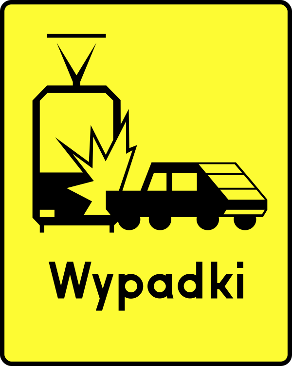
English • Supplementary plate T-14 • Frequent accidents of the type shown on the plate. Below A-30, plates indicate: T-8, traffic directed onto tram tracks; T-10, a road crossing a railway siding or similar track, where a railway employee stops road traffic while a train passes or shunts; T-11, a ferry crossing; T-12, a longitudinal step in the road surface; T-13, a section with wheel-rut deformation; T-14, frequent accidents of the type shown; T-15, frequent accidents caused by a slippery road surface due to rain; T-16, an exit used by the emergency vehicles shown; T-17, a national border; and T-18, an unexpected change in traffic direction following the course shown.
Polski • T-14 • tabliczka wskazująca miejsce częstych wypadków o charakterze wskazanym na tabliczce. Umieszczona pod znakiem A-30 tabliczka wskazuje: T-8 - miejsce, w którym ruch pojazdów został skierowany na tory tramwajowe; T-10 - przecięcie drogi z bocznicą kolej ową lub torem o podobnym charakterze; w miejscu tak oznakowanym ruch na drodze jest wstrzymywany przez pracownika kolei podczas przejeżdżania (przetaczania) pociągu; T-11 - przeprawę promową; T-12 - podłużny uskok nawierzchni; T-13 - odcinek drogi, na którym występują deformacje nawierzchni w postaci kolein; T-14 - miejsce częstych wypadków o charakterze wskazanym na tabliczce; T-15 - miejsce częstych wypadków spowodowanych śliską nawierzchnią jezdni ze względu na opady deszczu; T-16 - miejsce wyjazdu pojazdów uprzywilejowanych wskazanych na tabliczce; T-17 - granicę państwa; T-18 - nieoczekiwaną zmianę kierunku ruchu o przebiegu wskazanym na tabliczce.
Sources
🔗 Commons.wikimedia.org
🔗 Eli.gov.pl • § 11 ust. 2
SVG source: Pz • Public domain • Original revision 2012-03-07. Wikimedia original unmodified.
193. Schéma d'accident
Le panonceau forme d’accident fait généralement référence à un pictogramme représentant la forme ou le type d’accident dont les conducteurs doivent se méfier. Il représente visuellement un danger d’accident spécifique (par exemple, collision de voitures, véhicule renversé). Souvent placé sous ou à côté d’un panneau général d’avertissement (comme un triangle d’exclamation).
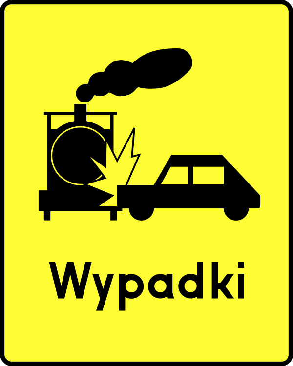
English • Supplementary plate T-14 • Frequent accidents of the type shown on the plate. Below A-30, plates indicate: T-8, traffic directed onto tram tracks; T-10, a road crossing a railway siding or similar track, where a railway employee stops road traffic while a train passes or shunts; T-11, a ferry crossing; T-12, a longitudinal step in the road surface; T-13, a section with wheel-rut deformation; T-14, frequent accidents of the type shown; T-15, frequent accidents caused by a slippery road surface due to rain; T-16, an exit used by the emergency vehicles shown; T-17, a national border; and T-18, an unexpected change in traffic direction following the course shown.
Polski • T-14 • tabliczka wskazująca miejsce częstych wypadków o charakterze wskazanym na tabliczce. Umieszczona pod znakiem A-30 tabliczka wskazuje: T-8 - miejsce, w którym ruch pojazdów został skierowany na tory tramwajowe; T-10 - przecięcie drogi z bocznicą kolej ową lub torem o podobnym charakterze; w miejscu tak oznakowanym ruch na drodze jest wstrzymywany przez pracownika kolei podczas przejeżdżania (przetaczania) pociągu; T-11 - przeprawę promową; T-12 - podłużny uskok nawierzchni; T-13 - odcinek drogi, na którym występują deformacje nawierzchni w postaci kolein; T-14 - miejsce częstych wypadków o charakterze wskazanym na tabliczce; T-15 - miejsce częstych wypadków spowodowanych śliską nawierzchnią jezdni ze względu na opady deszczu; T-16 - miejsce wyjazdu pojazdów uprzywilejowanych wskazanych na tabliczce; T-17 - granicę państwa; T-18 - nieoczekiwaną zmianę kierunku ruchu o przebiegu wskazanym na tabliczce.
Sources
🔗 Commons.wikimedia.org
🔗 Eli.gov.pl • § 11 ust. 2
SVG source: Pz • CC0 • Original revision 2014-07-19. Wikimedia original unmodified.
194. Ornières
Le panonceau ornières avertit les conducteurs de la présence de rainures ou d’ornières dans la chaussée causées par le passage répété de véhicules. Signale une chaussée irrégulière avec des ornières pouvant provoquer de l’inconfort ou une perte de contrôle, notamment à vitesse élevée.
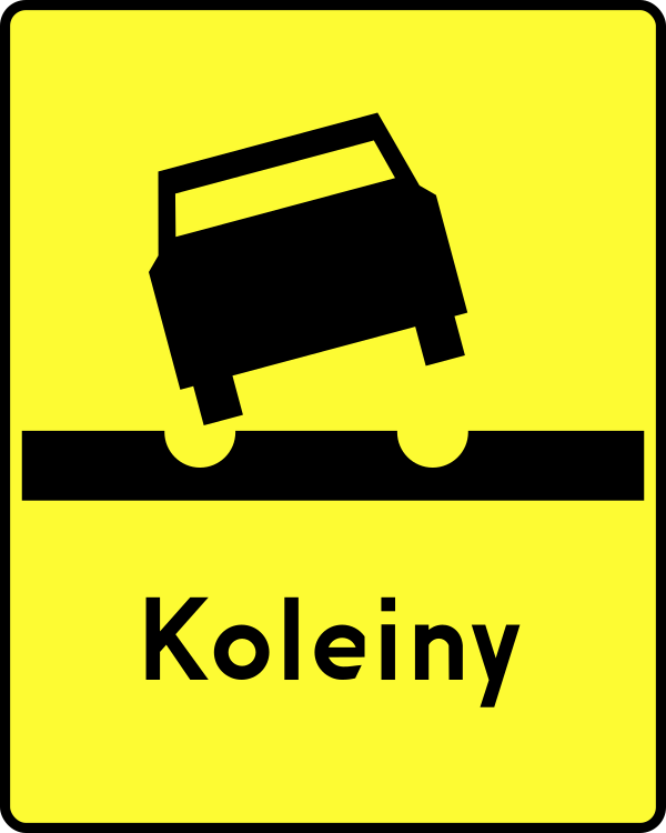
English • Supplementary plate T-13 • Road section with wheel-rut deformation. Below A-30, plates indicate: T-8, traffic directed onto tram tracks; T-10, a road crossing a railway siding or similar track, where a railway employee stops road traffic while a train passes or shunts; T-11, a ferry crossing; T-12, a longitudinal step in the road surface; T-13, a section with wheel-rut deformation; T-14, frequent accidents of the type shown; T-15, frequent accidents caused by a slippery road surface due to rain; T-16, an exit used by the emergency vehicles shown; T-17, a national border; and T-18, an unexpected change in traffic direction following the course shown.
Polski • T-13 • tabliczka wskazująca odcinek drogi, na którym występują deformacje nawierzchni w postaci kolein. Umieszczona pod znakiem A-30 tabliczka wskazuje: T-8 - miejsce, w którym ruch pojazdów został skierowany na tory tramwajowe; T-10 - przecięcie drogi z bocznicą kolej ową lub torem o podobnym charakterze; w miejscu tak oznakowanym ruch na drodze jest wstrzymywany przez pracownika kolei podczas przejeżdżania (przetaczania) pociągu; T-11 - przeprawę promową; T-12 - podłużny uskok nawierzchni; T-13 - odcinek drogi, na którym występują deformacje nawierzchni w postaci kolein; T-14 - miejsce częstych wypadków o charakterze wskazanym na tabliczce; T-15 - miejsce częstych wypadków spowodowanych śliską nawierzchnią jezdni ze względu na opady deszczu; T-16 - miejsce wyjazdu pojazdów uprzywilejowanych wskazanych na tabliczce; T-17 - granicę państwa; T-18 - nieoczekiwaną zmianę kierunku ruchu o przebiegu wskazanym na tabliczce.
Sources
🔗 Commons.wikimedia.org
🔗 Eli.gov.pl • § 11 ust. 2
SVG source: --Szczepan talk • Public domain • Original revision 2009-06-06. Wikimedia original unmodified.
195. Défaut de la chaussée
Le panonceau chaussée défectueuse avertit les conducteurs d’un défaut ou d’une irrégularité de la chaussée pouvant compromettre la sécurité. Il signale nids-de-poule, fissures, bosses, ou revêtement abîmé. Il incite à ralentir et à conduire prudemment.
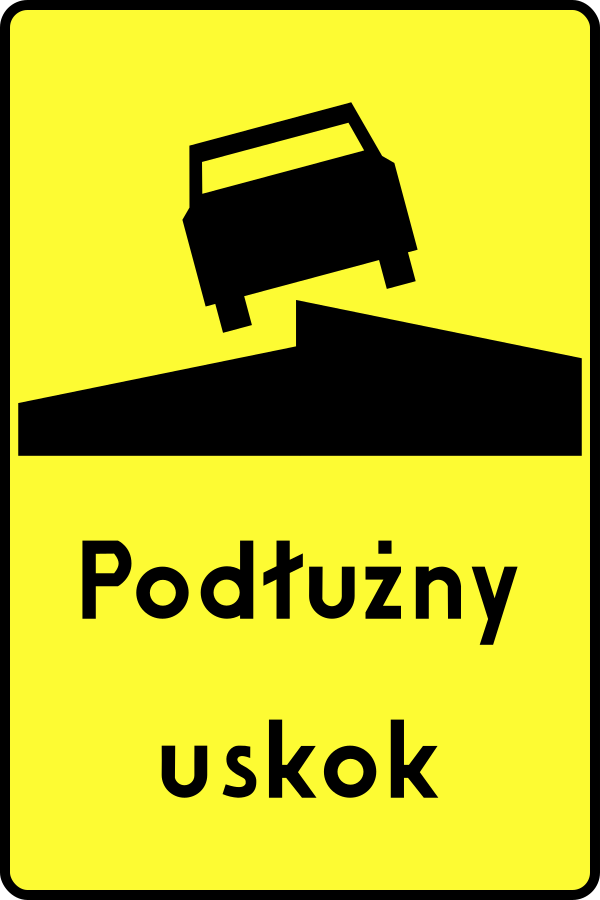
English • Supplementary plate T-12 • Longitudinal step in the road surface. Below A-30, plates indicate: T-8, traffic directed onto tram tracks; T-10, a road crossing a railway siding or similar track, where a railway employee stops road traffic while a train passes or shunts; T-11, a ferry crossing; T-12, a longitudinal step in the road surface; T-13, a section with wheel-rut deformation; T-14, frequent accidents of the type shown; T-15, frequent accidents caused by a slippery road surface due to rain; T-16, an exit used by the emergency vehicles shown; T-17, a national border; and T-18, an unexpected change in traffic direction following the course shown.
Polski • T-12 • tabliczka wskazująca podłużny uskok nawierzchni. Umieszczona pod znakiem A-30 tabliczka wskazuje: T-8 - miejsce, w którym ruch pojazdów został skierowany na tory tramwajowe; T-10 - przecięcie drogi z bocznicą kolej ową lub torem o podobnym charakterze; w miejscu tak oznakowanym ruch na drodze jest wstrzymywany przez pracownika kolei podczas przejeżdżania (przetaczania) pociągu; T-11 - przeprawę promową; T-12 - podłużny uskok nawierzchni; T-13 - odcinek drogi, na którym występują deformacje nawierzchni w postaci kolein; T-14 - miejsce częstych wypadków o charakterze wskazanym na tabliczce; T-15 - miejsce częstych wypadków spowodowanych śliską nawierzchnią jezdni ze względu na opady deszczu; T-16 - miejsce wyjazdu pojazdów uprzywilejowanych wskazanych na tabliczce; T-17 - granicę państwa; T-18 - nieoczekiwaną zmianę kierunku ruchu o przebiegu wskazanym na tabliczce.
Sources
🔗 Commons.wikimedia.org
🔗 Eli.gov.pl • § 11 ust. 2
SVG source: --Szczepan talk • Public domain • Original revision 2009-06-06. Wikimedia original unmodified.
196. Peinture de lignes
Le panonceau marquage au sol avertit les conducteurs que des travaux de marquage ou de rafraîchissement des lignes au sol ont lieu un peu plus loin. Il avertit de travaux routiers concernant le marquage au sol.

English • Supplementary plate T-19 • Road-marking painting. Sign A-14, Roadworks, warns of work on the road. Plate T-19 below it indicates that road markings are being painted.
Polski • T-19 • tabliczka wskazująca na malowanie znaków poziomych. Znak A-14 „roboty na drodze” ostrzega o prowadzonych na drodze robotach; umieszczona pod znakiem tabliczka T-19 wskazuje na malowanie znaków poziomych.
Sources
🔗 Commons.wikimedia.org
🔗 Eli.gov.pl • § 7 ust. 5
SVG source: Miko101 • Public domain • Original revision 2021-03-26. Wikimedia original unmodified.
197. Fin
Le panonceau fin indique le point de terminaison d’une règle, restriction ou zone spécifique. Placement courant : après les zones de limitation de vitesse ou de restriction.

English • Supplementary plate T-3 • End of a section where a danger occurs or recurs. Below a warning sign, T-2 indicates the length of the section where the danger occurs or recurs if it exceeds 500 m, while T-3 marks the end of such a section.
Polski • T-3 • tabliczka wskazująca koniec odcinka, na którym powtarza się lub występuje niebezpieczeństwo. Umieszczona pod znakiem ostrzegawczym tabliczka T-2 wskazuje długość odcinka drogi, na którym powtarza się lub występuje niebezpieczeństwo, jeżeli długość odcinka przekracza 500 m; umieszczona pod znakiem ostrzegawczym tabliczka T-3 oznacza koniec takiego odcinka.
Sources
🔗 Commons.wikimedia.org
🔗 Eli.gov.pl • § 3 ust. 5
SVG source: --Szczepan talk • Public domain • Original revision 2017-08-11. Wikimedia original unmodified.
198. Route glissante
L’additif chaussée glissante avertit les conducteurs que la chaussée à venir peut être glissante, ce qui augmente le risque de perte de contrôle. Signale une diminution de l’adhérence causée par : pluie, verglas, neige, déversement d’huile, gravillons, boue, surfaces usées ou polies. Encourage la réduction de la vitesse, une conduite souple et un freinage prudent.
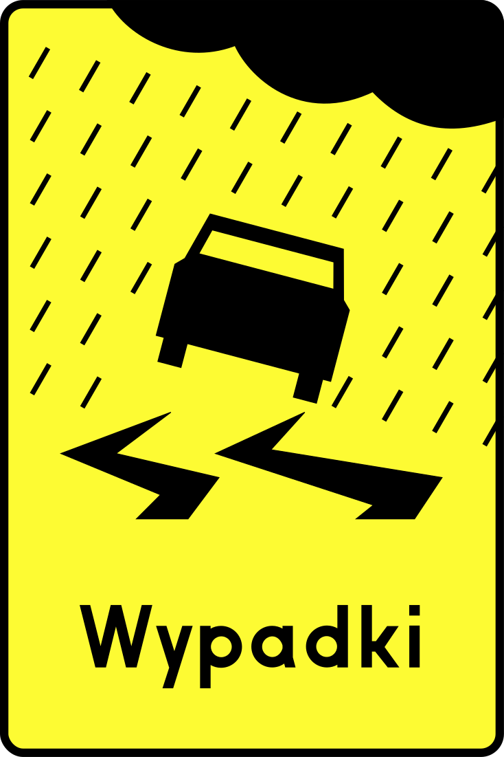
English • Supplementary plate T-15 • Frequent accidents caused by a slippery road surface due to rain. Below A-30, plates indicate: T-8, traffic directed onto tram tracks; T-10, a road crossing a railway siding or similar track, where a railway employee stops road traffic while a train passes or shunts; T-11, a ferry crossing; T-12, a longitudinal step in the road surface; T-13, a section with wheel-rut deformation; T-14, frequent accidents of the type shown; T-15, frequent accidents caused by a slippery road surface due to rain; T-16, an exit used by the emergency vehicles shown; T-17, a national border; and T-18, an unexpected change in traffic direction following the course shown.
Polski • T-15 • tabliczka wskazująca miejsce częstych wypadków spowodowanych śliską nawierzchnią jezdni ze względu na opady deszczu. Umieszczona pod znakiem A-30 tabliczka wskazuje: T-8 - miejsce, w którym ruch pojazdów został skierowany na tory tramwajowe; T-10 - przecięcie drogi z bocznicą kolej ową lub torem o podobnym charakterze; w miejscu tak oznakowanym ruch na drodze jest wstrzymywany przez pracownika kolei podczas przejeżdżania (przetaczania) pociągu; T-11 - przeprawę promową; T-12 - podłużny uskok nawierzchni; T-13 - odcinek drogi, na którym występują deformacje nawierzchni w postaci kolein; T-14 - miejsce częstych wypadków o charakterze wskazanym na tabliczce; T-15 - miejsce częstych wypadków spowodowanych śliską nawierzchnią jezdni ze względu na opady deszczu; T-16 - miejsce wyjazdu pojazdów uprzywilejowanych wskazanych na tabliczce; T-17 - granicę państwa; T-18 - nieoczekiwaną zmianę kierunku ruchu o przebiegu wskazanym na tabliczce.
Sources
🔗 Commons.wikimedia.org
🔗 Eli.gov.pl • § 11 ust. 2
SVG source: Masur • Public domain • Original revision 2009-06-28. Wikimedia original unmodified.
199. Tunnel catégorie A
Ce panneau additionnel indique la catégorie ADR A du tunnel. Aucune restriction de tunnel ne s’applique au transport de marchandises dangereuses dans cette catégorie.

Sources
SVG source: Miko101 • Public domain • Original revision 2021-12-28. Wikimedia original unmodified.
200. Tunnel catégorie B
Ce panneau additionnel indique que le panneau principal s’applique aux véhicules transportant des marchandises dangereuses dont l’accès aux tunnels routiers de catégorie B est interdit par l’ADR.
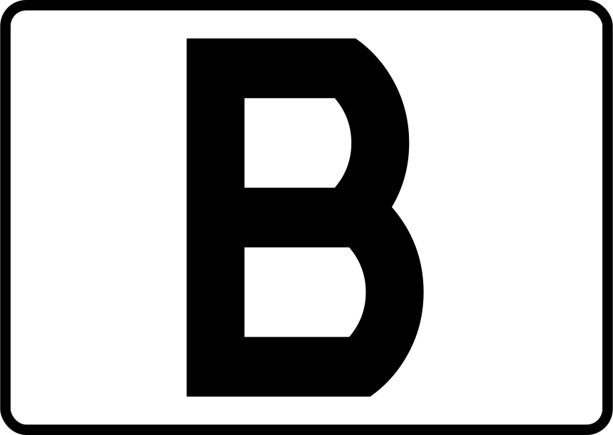
English • Supplementary plate T-31 • Tunnel category. Sign B-13a, No vehicles carrying dangerous goods, prohibits vehicles carrying dangerous goods defined in road dangerous-goods transport regulations in quantities requiring orange warning plates. Plate T-31 below it, bearing a tunnel-category letter B, C, D or E, or a plate with appropriate wording, indicates that the prohibition applies only to particular classes or groups of dangerous goods or a particular method of carrying them.
Polski • T-31 • tabliczka wskazująca kategorię tunelu. Znak B-13a „zakaz wjazdu pojazdów z towarami niebezpiecznymi” oznacza zakaz ruchu pojazdów przewożących, określone w przepisach o przewozie drogowym towarów niebezpiecznych, towary niebezpieczne w ilościach, dla których jest wymagane oznakowanie pojazdu tablicami ostrzegawczymi barwy pomarańczowej. Umieszczona pod znakiem tabliczka T-31 z literą B, C, D lub E oznaczającą kategorię tunelu lub tabliczka z odpowiednim napisem wskazuje, że zakaz dotyczy tylko określonych klas lub grup towarów niebezpiecznych lub określonego sposobu przewozu tych towarów.
Sources
🔗 Commons.wikimedia.org
🔗 Eli.gov.pl • § 19 ust. 2
SVG source: --Szczepan talk • Public domain • Original revision 2019-12-31. Wikimedia original unmodified.