

道路標識世界
 交通ルール
交通ルール
 世界
世界
126. カーシェアリング
カーシェアリングは、各人が個別に車を所有する代わりに、複数人が時間を分けて同じ車両を利用する交通制度です。組織、会員サービス、アプリを通じて予約し、固定駐車場所または指定運用区域内で借りる方式があります。
自家用車所有の必要性を減らし、共有車専用駐車区画が設けられる場合があります。規則、許可、駐車制度は国や都市によって異なります。
What is carsharing?
Carsharing is a system in which several people use one or more shared cars at different times rather than each user owning the vehicle.
How does carsharing work?
Users normally reserve a shared vehicle for a particular journey or period through a carsharing organisation or platform and return or leave it according to the rules of that service.
Can parking spaces be reserved for carsharing vehicles?
Yes. Some countries and municipalities provide parking spaces specifically reserved for authorised shared vehicles. The signs, permits and conditions vary by location.

127. チェアリフト
チェアリフトは、開放型または一部囲われた座席を連続走行するケーブルから吊り下げる空中輸送設備です。スキー場や山岳リゾートで乗客を上方や別区域へ運ぶために使われます。
道路・観光標識でチェアリフト駅、スキーリフト、山岳交通施設へ案内されることがあります。記号や用語は国によって異なります。
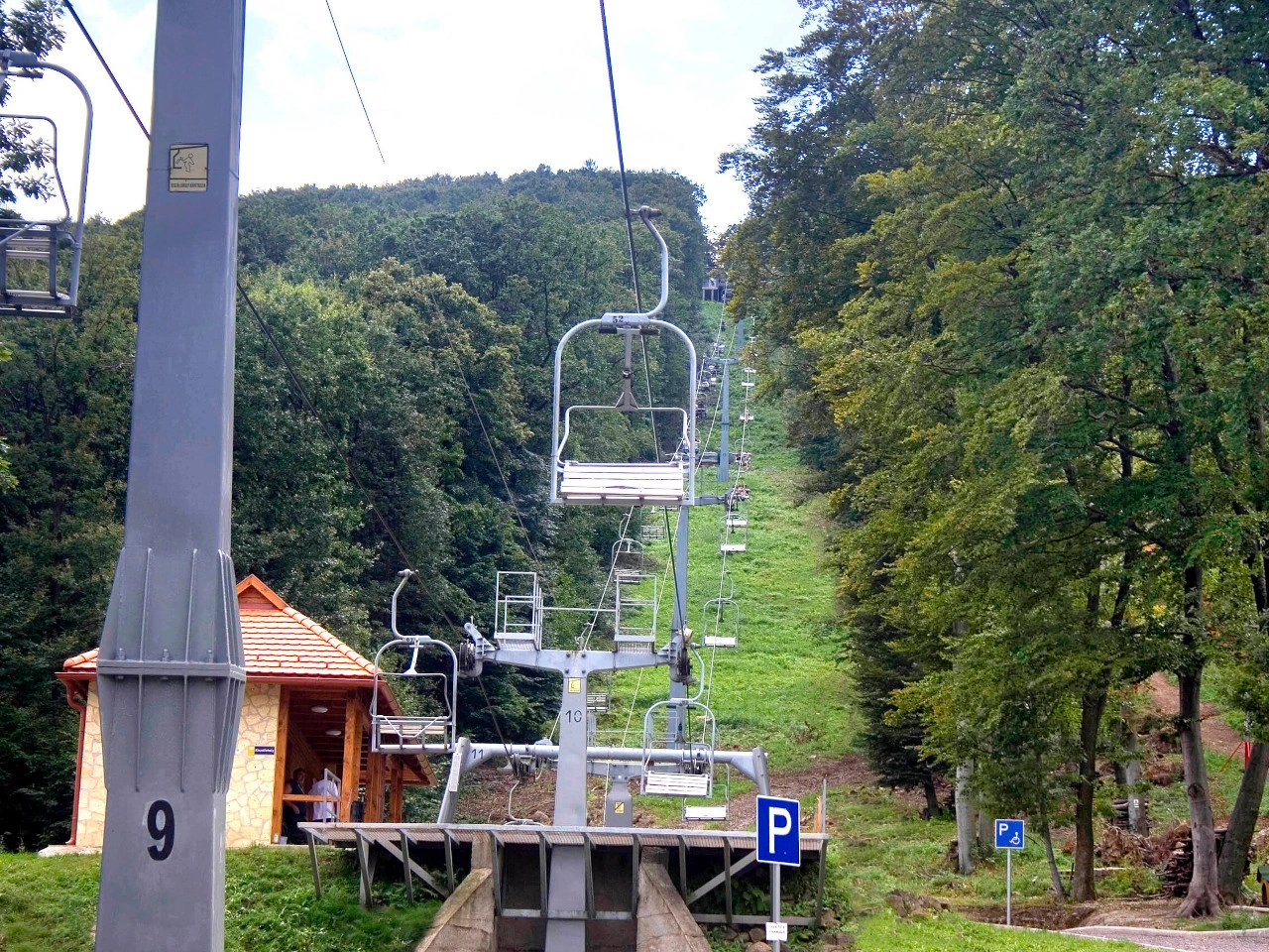
What is a chairlift?
A chairlift is an aerial transport system that carries passengers in seats suspended from a moving cable.
Where are chairlifts commonly used?
Chairlifts are commonly found at ski resorts, mountain recreation areas and other locations where passengers need to travel up steep slopes.
Can chairlifts be indicated by road signs?
Yes. Tourist or direction signs may guide travellers toward chairlifts or ski-lift facilities, although the signs and symbols used vary between countries.
128. 市街地境界
市街地境界は、道路交通上、市街地・都市区域が始まるまたは終わる境界です。地名標識や市街地標識で示され、都市速度制限、駐車規則など特別規則の開始・終了地点となることがあります。
交通上の市街地境界は自治体の行政境界と必ずしも一致しません。法的意味はその国の道路標識と交通規則によります。
What is a city limit?
A city limit marks the boundary of a city, town, village, locality or municipality. On roads, it is often indicated by a place-name or boundary sign.
Does a city-limit sign always mark a built-up area?
No. A city-limit or locality sign may simply identify a place or administrative boundary. A legally defined built-up area can use a different sign or definition.
Does passing a city-limit sign always change the speed limit?
No. In some countries a locality or boundary sign has consequences for traffic rules, while in others it mainly identifies the place. Drivers must follow the traffic signs and rules that apply in that country.
Is a city limit the same as a municipal boundary?
Not always. Some signs indicate an administrative municipal boundary, while others identify a city, town, village or locality without exactly following the municipality's legal boundary.
What is the difference between a city limit and a built-up area?
A city limit identifies the boundary of a named place or administrative area. A built-up area is a traffic-law concept that may affect rules such as default speed limits. The two boundaries can coincide, but they do not have to.
129. 自転車横断場所
自転車横断場所は、自転車が道路・車道を横断する指定地点です。自転車道同士を接続したり、道路の反対側へ移る専用横断点を設けたりします。
通常、路面表示、交通標識、信号で示されます。優先規則は国によって異なるため、自転車利用者と運転者は現地の標識、信号、交通規則に従います。
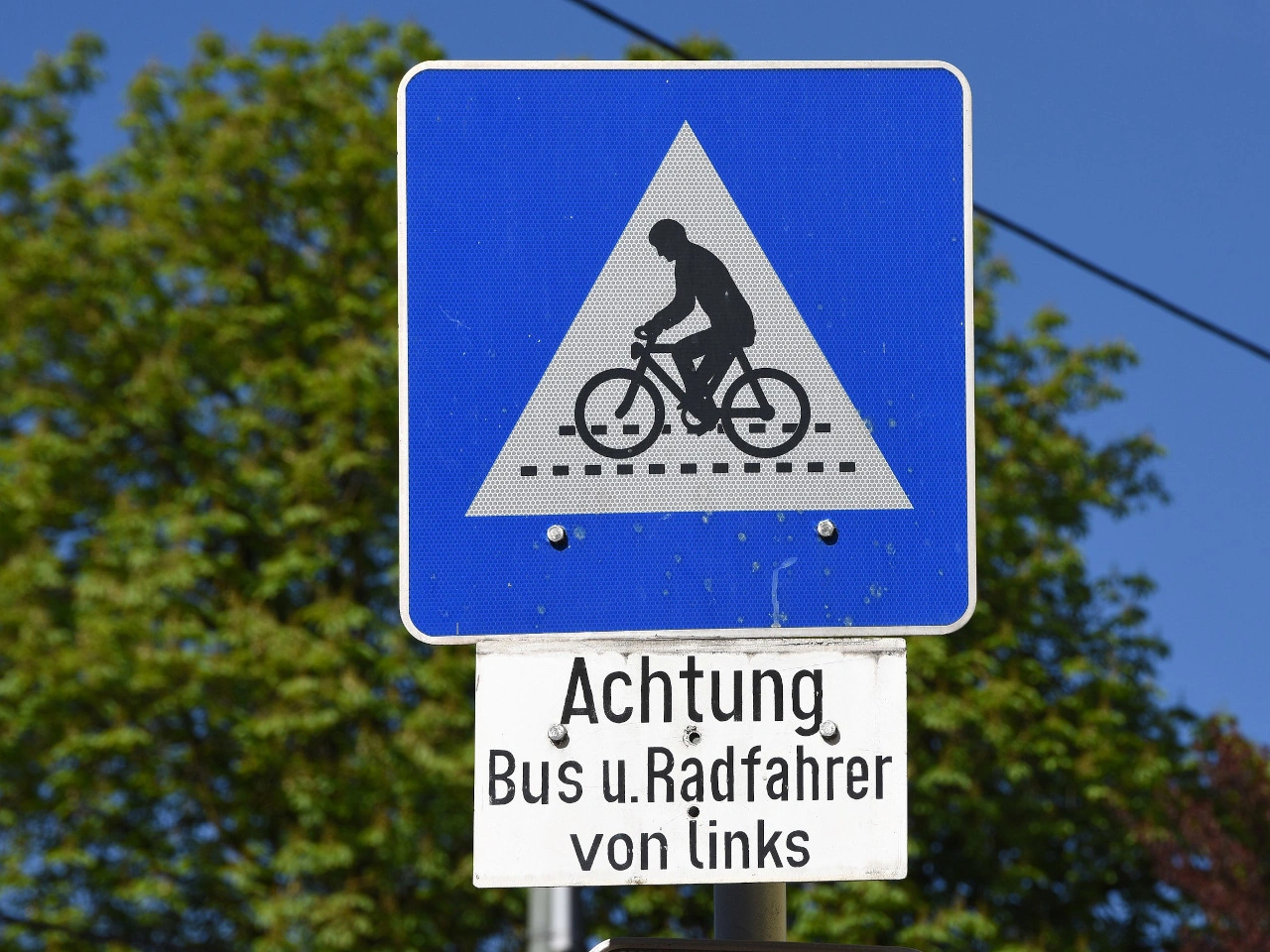
What is a cyclist crossing?
A cyclist crossing is a designated location where cyclists can cross a road or carriageway.
Do cyclists always have priority at a cyclist crossing?
No. Priority rules vary between countries and crossings. Cyclists must follow the applicable traffic signs, signals and priority rules.
How are cyclist crossings indicated?
They may be indicated by special road markings, traffic signs or traffic lights. Their appearance varies between countries.
130. トラム軌道横断
トラム軌道横断は、道路、自転車道、歩行者通路が1本以上のトラム軌道と交差する場所です。交差点、道路に埋め込まれた軌道、独立したトラム線が道路を横断する場所などがあります。
接近時はトラムをよく確認し、標識、信号、優先規則に従う必要があります。トラムはレール上を走り障害物を避けて操舵できないため、進路を横切る際は特に注意します。
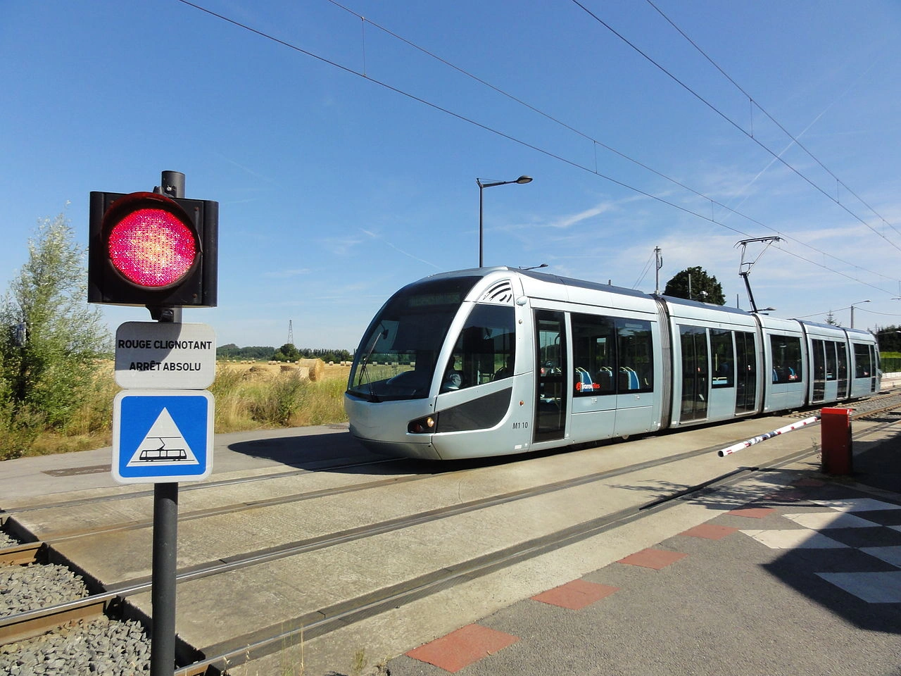
What is a tram crossing?
A tram crossing is a place where a road, cycle path or pedestrian route crosses one or more tram tracks.
How can a tram crossing be indicated?
A tram crossing may be indicated by warning signs, traffic lights, road markings or other traffic-control devices. The exact system varies between countries.
What should you do when approaching a tram crossing?
Approach carefully, look and listen for trams and follow the applicable priority rules and traffic signals. Never enter the crossing if you cannot clear the tracks safely.
131. 門型支柱
門型支柱は、道路をまたいで交通標識、車線制御信号、可変情報板、カメラなどを支える構造物です。高速道路や複数車線道路で、個別車線の真上に表示を設置するため使われます。
門型支柱上の標識・信号は車道全体ではなく特定車線にだけ適用される場合があります。各表示の位置を確認し、自分の車線に対する指示へ従います。
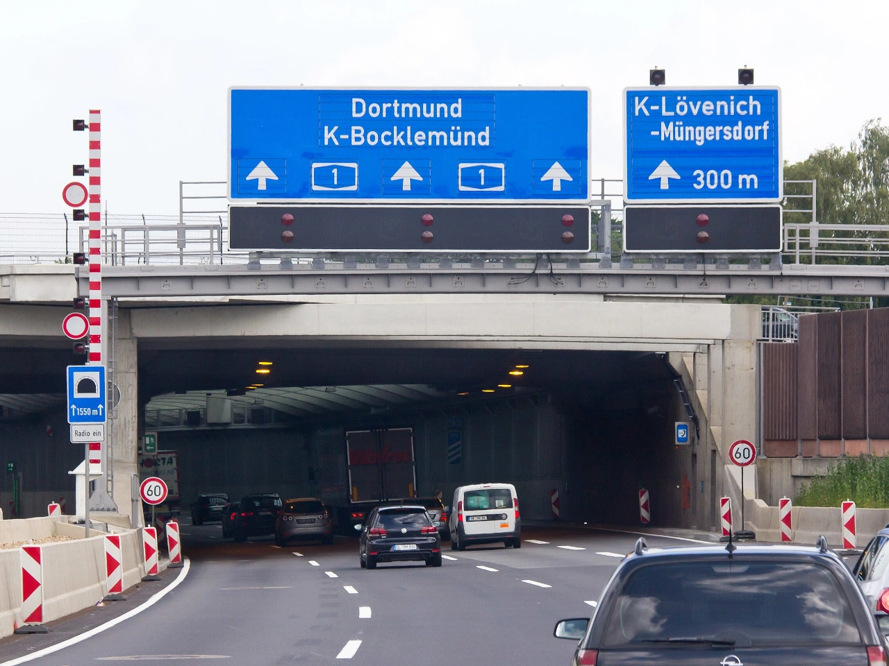
What is a road gantry?
A gantry is an overhead structure spanning a road that supports traffic signs, signals or other traffic-management equipment.
Why are gantries used?
Gantries allow signs and signals to be placed directly above traffic lanes, making lane-specific directions, restrictions and traffic information easier to see.
Can different signs on the same gantry apply to different lanes?
Yes. Where signs or lane-control signals are positioned above individual lanes, each indication may apply only to the lane directly below it.
132. 距離案内板
距離案内板は、町、都市、交差点、サービス施設など1つ以上の目的地までの残距離を示す標識です。運転者が残りの走行距離を把握するための方面案内制度の一部です。
通常、目的地名、路線番号、方向情報と距離を併記します。単位、色、配置、表示対象は国によって異なります。
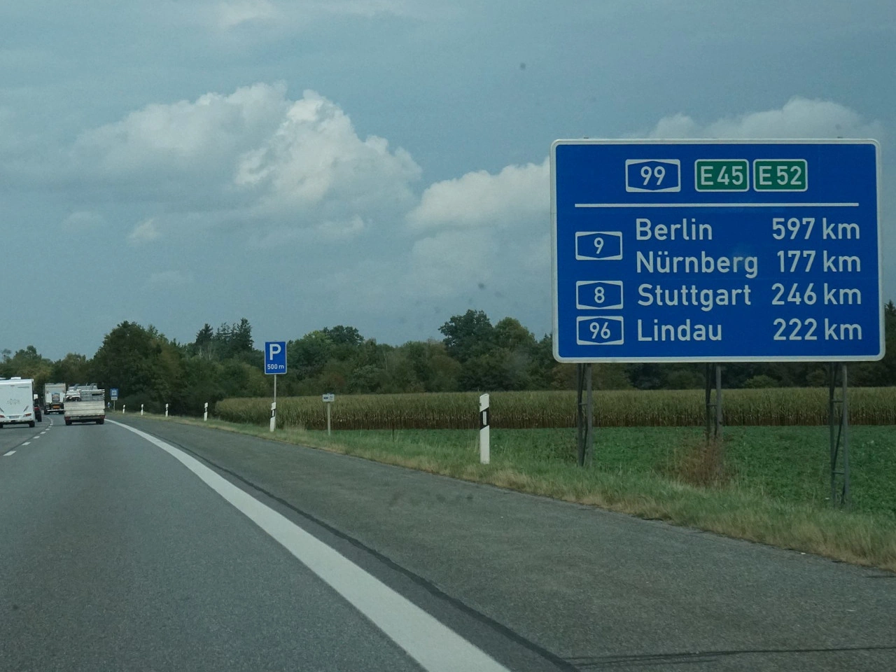
What is a distance board?
A distance board is a sign that tells road users how far they are from one or more destinations or facilities.
What information can a distance board show?
It may show destination names, distances, route numbers and directional information, depending on the country's road-sign system.
Where are distance boards commonly used?
They are commonly used on motorways, major roads and other important routes to help drivers judge the remaining distance to destinations along their journey.
133. トラック環境税
トラック環境税は、特定の大型貨物車へ課される道路料金で、走行距離、車両重量、排出量などにより金額が決まる場合があります。大型車に道路インフラ費用を負担させ、低排出車の利用を促す目的があります。
電子料金制度や車載器によって走行道路・距離を記録して徴収する場合があります。対象車両、料金、免除、環境分類は国によって異なります。
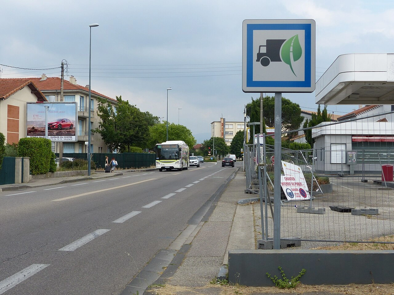
What is a truck ecotax?
A truck ecotax is a road charge for certain heavy goods vehicles that may take account of factors such as distance travelled, vehicle weight and emissions.
How is a truck ecotax calculated?
Depending on the country, the charge may depend on distance, vehicle weight, emission class, road type or location.
How is a truck ecotax collected?
Many systems use an electronic onboard unit or tolling device that records the vehicle's use of roads subject to the charge.
134. 非常駐車帯
非常駐車帯は、通常車線に留まらず緊急時に停車できる道路脇やトンネル内の指定区域です。連続した緊急車線がない道路や、車道上の停止が重大な危険となる場所で特に重要です。
主に故障・緊急時のためで、通常の駐車や休憩用ではありません。非常電話、消火器などの安全設備を備える場所もあります。
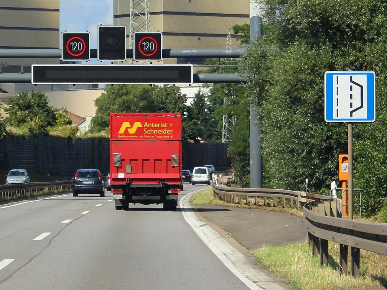
What is a breakdown bay?
A breakdown bay is a designated area where a vehicle can leave the normal traffic lanes and stop because of a breakdown or other emergency.
Where are breakdown bays commonly found?
They are commonly provided on motorways, major roads and in tunnels, particularly where there is no continuous emergency lane.
Can you use a breakdown bay as a normal parking place?
Normally, no. Breakdown bays are intended for emergencies and disabled vehicles rather than routine parking or rest stops.
135. ハイキング
ハイキングルートは、主にレクリエーションの徒歩・ハイキング用に指定された経路です。歩道、林道、地方道路などを通り、自然、文化、観光地を結ぶ場合があります。
通常、方向矢印、色マーカー、路線番号、記号、番号付き分岐点などで示されます。これらは一般の交通規制標識ではなく、レクリエーション用案内体系の一部です。
What is a hiking route?
A hiking route is a designated route intended for recreational walking or hiking, often through natural, rural or tourist areas.
How are hiking routes marked?
They may be marked using colours, arrows, symbols, route numbers or numbered junctions. The marking system varies between countries and individual trail networks.
Are hiking-route signs traffic signs?
Not necessarily. Hiking-route markers are often recreational or tourist wayfinding signs and do not normally impose traffic rules unless an official traffic sign is also present.
136. 病院
病院は、診察、治療、手術、救急医療などの専門医療を提供する施設です。地域住民、広域地域、特定医療分野を対象とする場合があります。
道路標識では医療・病院記号で案内されることがあります。病院入口付近では救急車、歩行者、出入り車両に特に注意します。
What is a hospital?
A hospital is a healthcare facility where patients can receive medical treatment, emergency care, surgery and other specialised health services.
Can hospitals be indicated by road signs?
Yes. Many countries use hospital or medical symbols on information and direction signs to guide drivers toward healthcare facilities.
What should drivers watch for near a hospital?
Drivers should watch carefully for ambulances, pedestrians, cyclists and vehicles entering or leaving hospital grounds and follow any local traffic restrictions or signs.
137. ホステル
ホステルは、比較的安価な宿泊を提供し、相部屋や共用設備を持つことが多い宿泊施設です。若い旅行者、バックパッカー、団体などによく利用されます。
観光・宿泊方面標識で案内される場合があります。ホステル、ユースホステルを示す記号や用語は国によって異なります。
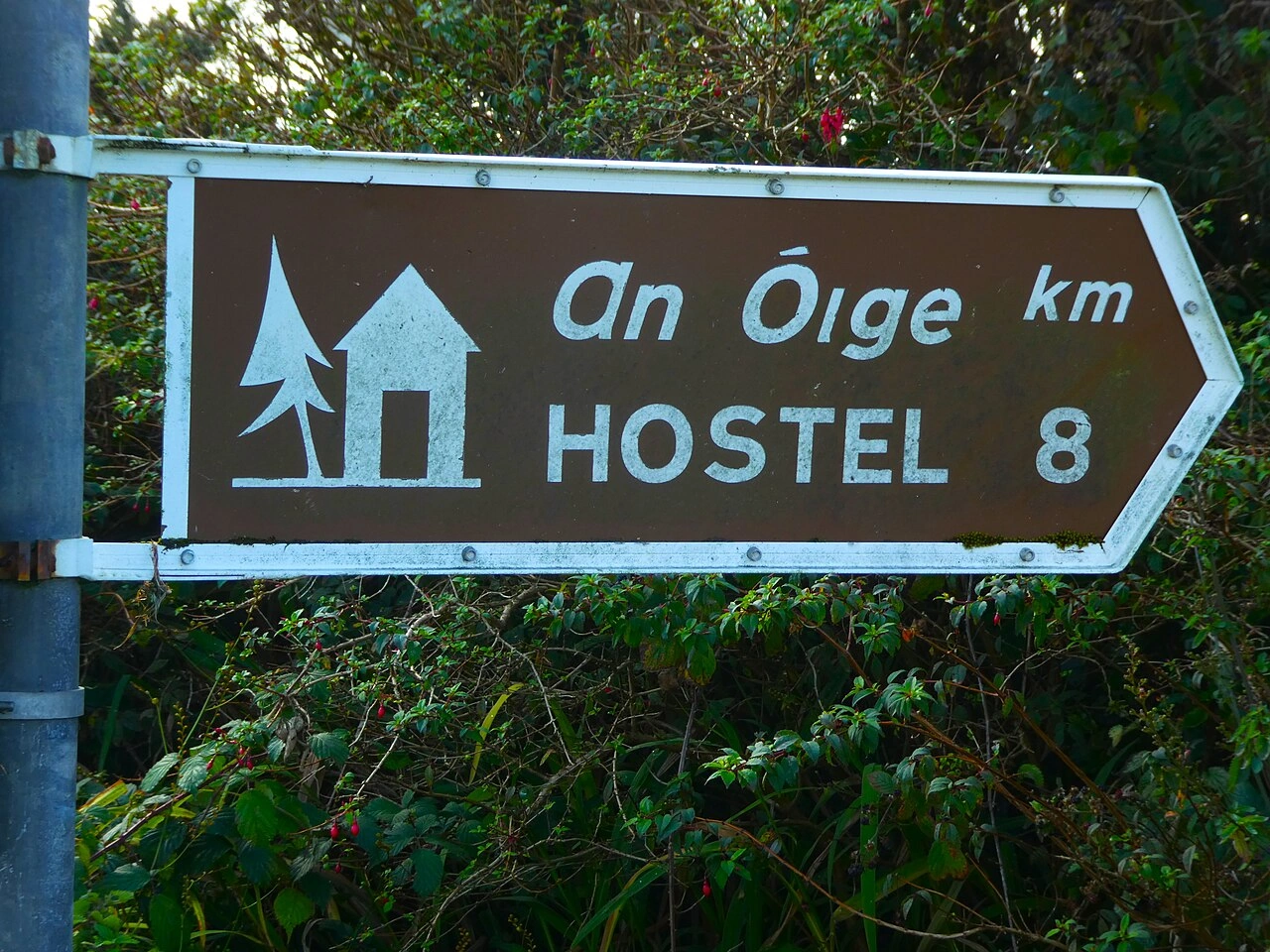
What is a hostel?
A hostel is an accommodation establishment that usually provides affordable overnight stays, often with shared rooms or communal facilities.
How is a hostel different from a hotel?
A hostel generally offers simpler and more communal accommodation, while hotels more commonly provide private rooms and a broader range of services.
Can hostels be indicated by road signs?
Yes. Some countries use tourist or accommodation signs to direct travellers toward hostels or youth hostels.
138. ホテル
ホテルは旅行者や宿泊客へ客室などを提供する宿泊施設です。レストラン、朝食、駐車場、受付、会議設備、レクリエーション施設などを備える場合があります。
旅行者が宿泊先を見つけやすいよう、宿泊、サービス、方面案内標識で表示されることがあります。記号や標識体系は国によって異なります。
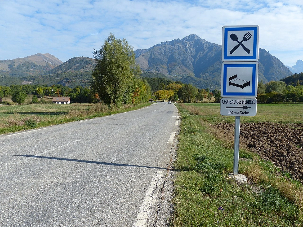
What is a hotel?
A hotel is an establishment that provides paid overnight accommodation for travellers and other guests.
What services can a hotel provide?
Depending on the establishment, a hotel may provide rooms, meals, parking, reception services and other facilities for travellers.
Can hotels be indicated by road signs?
Yes. Many countries use service or direction signs to guide travellers toward hotels and other accommodation facilities.
139. グリーンウェイ
グリーンウェイは、徒歩や自転車など主に非動力交通のための経路です。廃線跡、運河沿い、河川沿い、森林ルートなど、混雑した自動車交通から離れた回廊に整備されることが多くあります。
レクリエーションと日常移動のため安全で快適な経路を提供することを目的とします。地域規則により、乗馬、モビリティ利用者、一部許可車両も利用できる場合があります。
What is a greenway?
A greenway is a route intended primarily for non-motorised users such as pedestrians and cyclists.
Where are greenways commonly created?
Greenways may follow former railway lines, canal towpaths, river corridors, forest paths or other routes separated from busy motor traffic.
Can motor vehicles use a greenway?
Usually not as ordinary through traffic. However, local rules may allow certain vehicles, such as maintenance, emergency, agricultural or access vehicles.
140. 立体駐車場
立体駐車場は、自動車を駐車するための建物または屋根付き構造物です。複数階を持ち、地上、地下、ショッピングセンターやオフィス、交通拠点など別建物の一部に設置されます。
通常、駐車・屋内駐車標識で案内されます。施設内の標識、車線表示、高さ制限、料金条件などに従います。
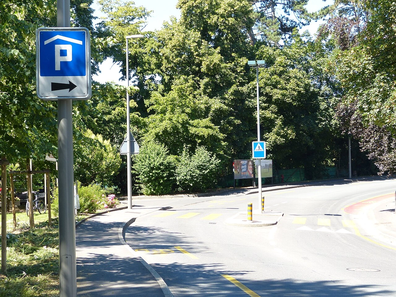
What is a parking garage?
A parking garage is a building or covered structure where motor vehicles can be parked, often on several levels.
Can a parking garage be underground?
Yes. Parking garages may be above ground, underground or incorporated into another building.
What should you check before entering a parking garage?
Check the entrance signs, vehicle-height restrictions, opening conditions, parking rules and payment requirements before entering.
141. 歩道上駐車
歩道上駐車は、主に歩行者用の歩道へ車両の全部または一部を乗り上げて駐車することです。歩行空間を狭め、車いす利用者、ベビーカー利用者、視覚障害者へ特に支障を与えることがあります。
多くの国で、標識や路面表示で明示的に許可されない限り禁止または制限されています。許可される場合でも指定範囲内に駐車し、歩行者の十分な通行幅を残します。
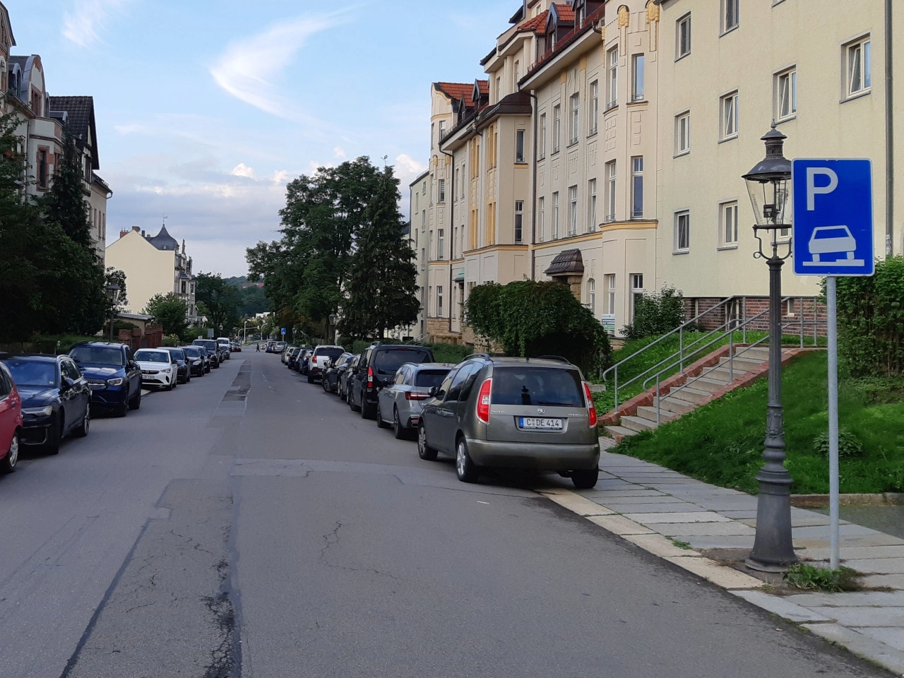
What is pavement parking?
Pavement parking means parking a vehicle fully or partly on a sidewalk or footway intended primarily for pedestrians.
Is pavement parking normally allowed?
It depends on the country. Many countries prohibit pavement parking unless traffic signs, markings or local regulations specifically permit it.
Why can pavement parking be dangerous?
It can obstruct pedestrians and reduce accessibility, potentially forcing people with wheelchairs, pushchairs or other mobility needs into the roadway.
142. 駐車ゾーン
駐車ゾーンは、単一駐車枠ではなく道路群や区域全体へ特定の駐車規則が適用される区域です。駐車可否、時間、対象車両、料金、許可証などを規制できます。
開始と終了は通常ゾーン標識で示されます。条件は各道路で繰り返し表示されない場合があるため、入口の情報を確認する必要があります。
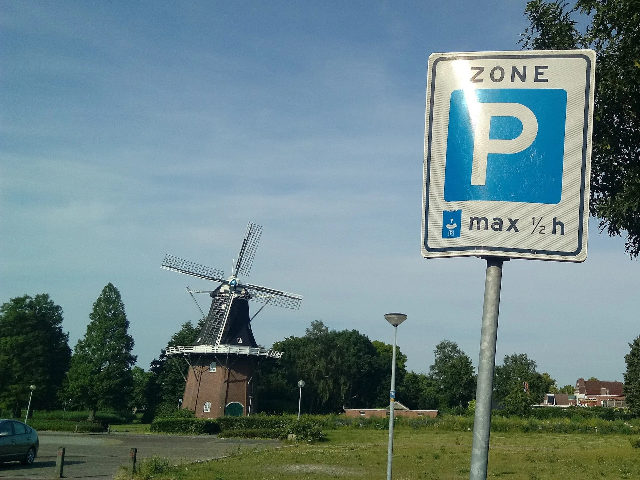
What is a parking zone?
A parking zone is a defined area in which a particular parking rule applies throughout the zone rather than only beside an individual sign.
What rules can apply in a parking zone?
A parking zone may regulate parking duration, payment, permits, vehicle categories or whether parking is permitted.
How do you know when a parking zone ends?
The zone normally remains in effect until an end-of-zone sign or another applicable traffic regulation indicates that the zone has ended.
143. 待避所
待避所は、狭い道路で対向車同士が安全にすれ違えるよう道路脇または道路内を広げた区間です。一車線道路など、通常幅では2台がすれ違えない道路で使われます。
適切な速度で接近し、対向車と協力し、不要に待避所を塞がないことが重要です。優先規則や標識は国によって異なります。
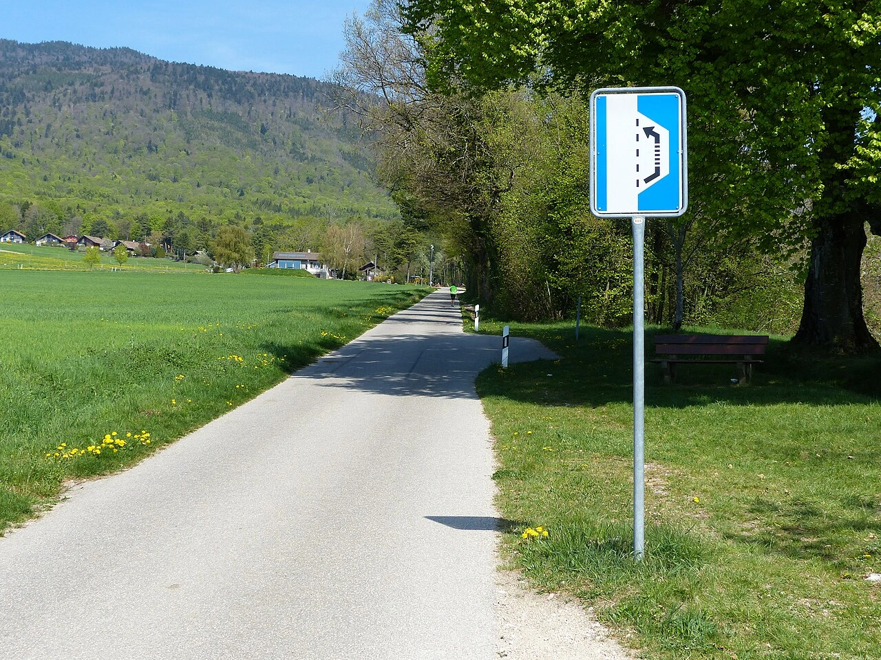
What is a passing place?
A passing place is a widened area on a narrow road where vehicles can move aside to allow opposing traffic to pass.
Where are passing places commonly found?
They are commonly found on single-track roads, narrow rural roads and mountain roads where the normal road width is insufficient for two vehicles to pass comfortably.
Who has priority at a passing place?
The applicable rule depends on the country and road layout. Drivers should slow down, cooperate with approaching traffic and use the passing place safely rather than assuming automatic priority.
144. 歩道橋
歩道橋は、歩行者が道路、鉄道などの交通路へ入らず上を横断できる橋・高架通路です。歩行者と車両の動線を立体的に分離し、平面横断が難しい・危険な場所で使われます。
階段、スロープ、エレベーターで出入りでき、歩行者・方面標識で案内されることがあります。設計やバリアフリー要件は国によって異なります。
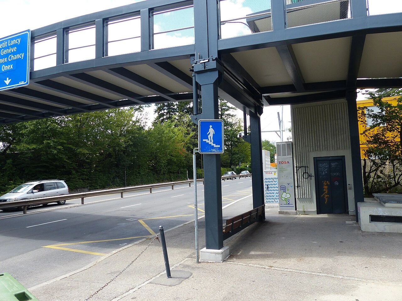
What is a pedestrian overpass?
A pedestrian overpass is an elevated walkway or bridge that allows pedestrians to cross above a road, railway or other transport route.
Why are pedestrian overpasses used?
They help separate pedestrians from moving traffic, particularly where traffic speeds or volumes make an at-grade crossing less suitable.
How can pedestrians access an overpass?
Depending on the design, access may be provided by stairs, ramps, lifts or a combination of these.
145. ピクニックエリア
ピクニックエリアは、旅行者や訪問者が食事や休憩をするための屋外指定区域です。テーブルやベンチのほか、駐車場、ごみ箱、トイレ、屋根などを備える場合があります。
休憩所、公園、展望所、観光地などに設けられ、サービス、レクリエーション、観光標識で示されます。記号は国によって異なります。
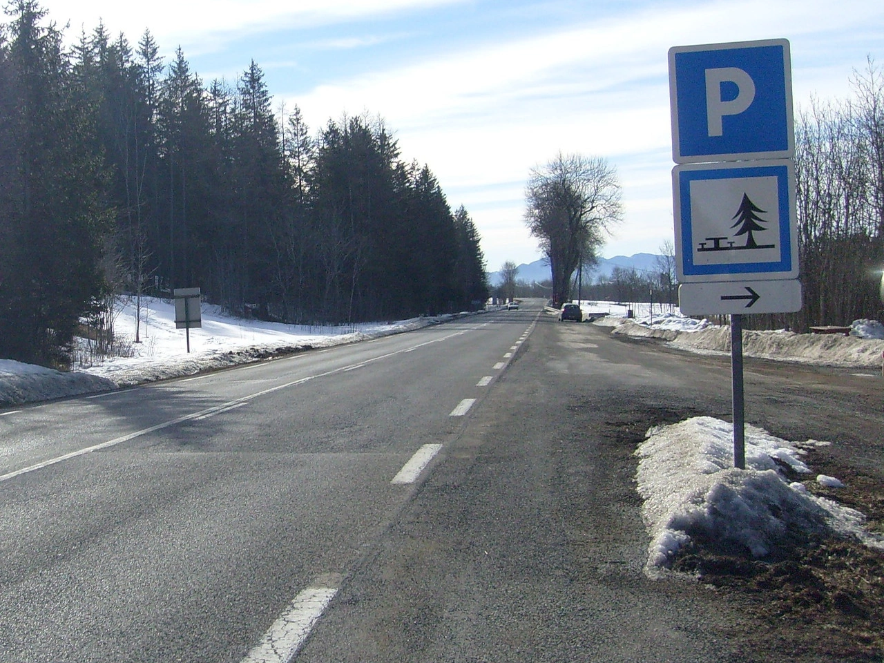
What is a picnic site?
A picnic site is a designated outdoor place where travellers and visitors can stop, rest and eat.
What facilities can a picnic site provide?
A picnic site may provide tables, benches, parking, litter bins, toilets, shelters or other recreational facilities, depending on the location.
Can picnic sites be indicated by road signs?
Yes. Service, recreational or tourist signs may direct travellers toward picnic sites, although the symbols and sign systems vary between countries.
146. 遊び場
遊び場は、子どもの遊びのための屋外・屋内区域で、ブランコ、滑り台、遊具、広場などがあります。公園、住宅地、学校、レクリエーション施設などに設置されます。
運転者は遊び場付近で子どもが突然道路へ出る可能性をよく確認し、周囲の状況に合わせて速度を調整します。
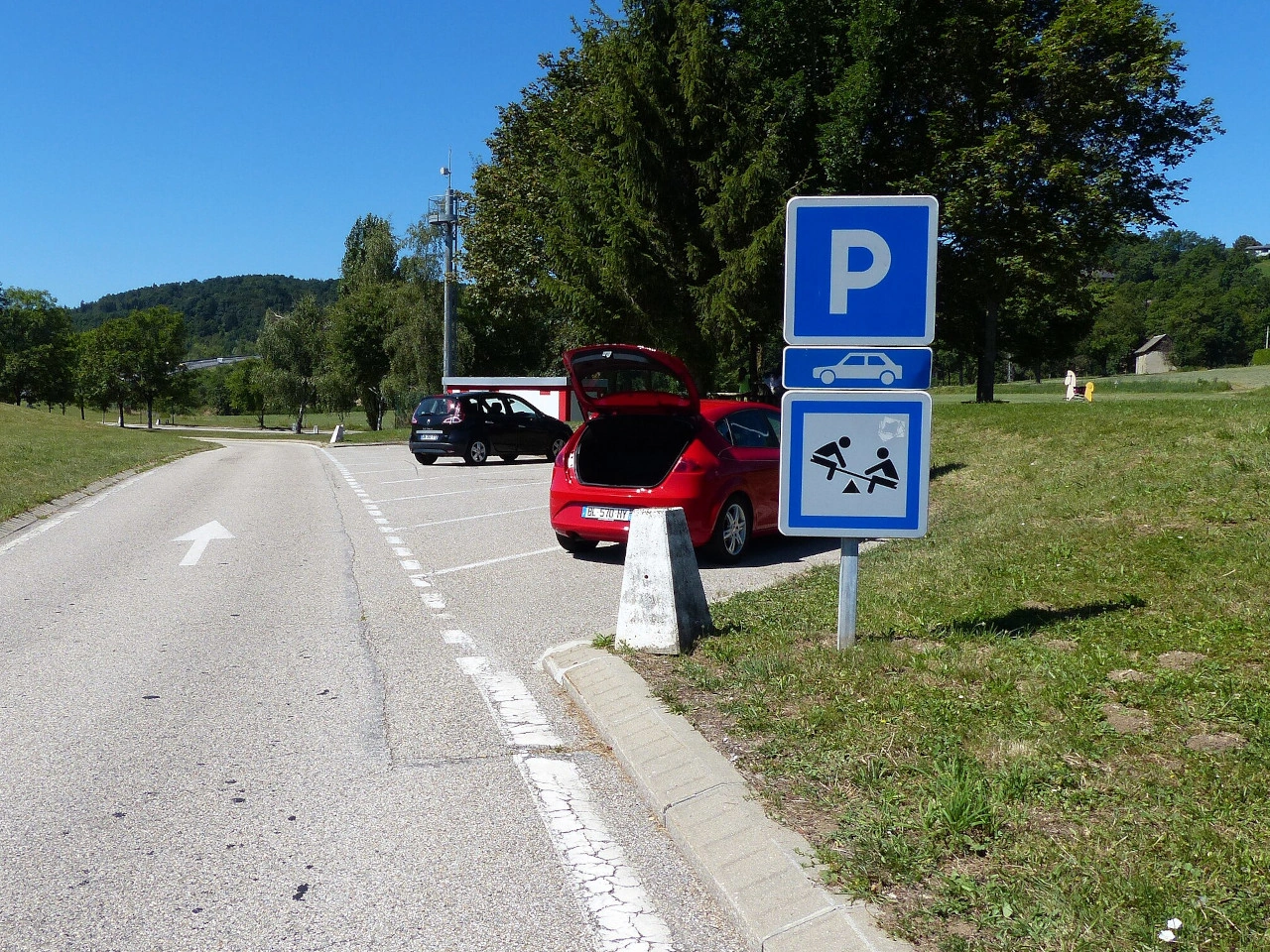
What is a playground?
A playground is an area designed for children's play, often containing play equipment or other recreational facilities.
Can road signs warn drivers about a nearby playground?
Yes. Some countries use warning or tourist signs where children are frequently present or to indicate recreational facilities such as playgrounds.
How should drivers behave near a playground?
Drivers should reduce speed when necessary, watch carefully for children and be prepared to stop if a child enters or approaches the roadway.
147. レストラン
レストランは、調理した食事や飲み物を提供する施設です。町、商業地区、観光地、給油所、高速道路サービスエリアなどにあります。
旅行者向けにサービス、観光、方面案内標識で示されることがあります。記号や標識デザインは国によって異なります。
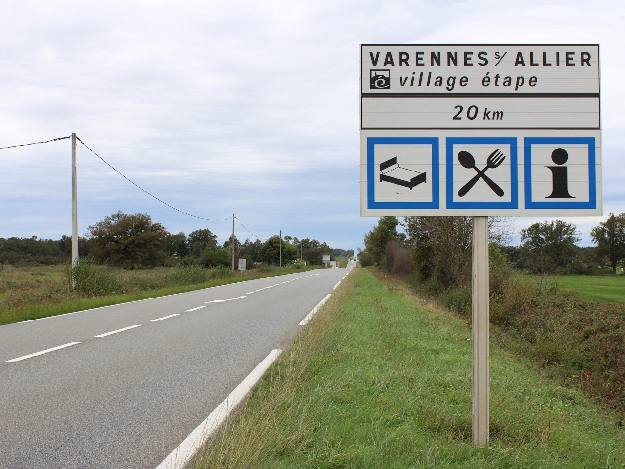
What is a restaurant?
A restaurant is an establishment where customers can order and consume prepared meals and drinks.
Can restaurants be indicated by road signs?
Yes. Many countries use service or direction signs to guide travellers toward restaurants or food facilities.
Where can roadside restaurants be found?
They may be located at motorway service areas, filling stations, rest areas, towns and tourist destinations.
148. ロードチャーチ
ロードチャーチは、主要道路や高速道路近くにあり、旅行者が祈り、静かに過ごし、休憩するため利用しやすい教会・礼拝堂です。道路脇に専用建設されたものや、インターチェンジ近くの既存教会があります。
特にヨーロッパの一部で見られ、観光、サービス、地域方面標識で示される場合があります。名称、設備、標識は国によって異なります。
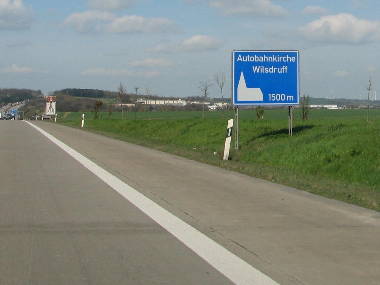
What is a road church?
A road church is a church or chapel situated near a major road or motorway that is easily accessible to travellers.
What is the purpose of a road church?
Road churches provide travellers with a place for prayer, quiet reflection or a short break from their journey.
Are road churches found in every country?
No. Road churches are particularly associated with certain European countries, and their availability, designation and signage vary considerably.
149. 通行止め
通行止めは、道路または道路区間が一時的または恒久的に一部・すべての交通へ利用できない状態です。工事、事故、洪水、イベント、構造損傷など安全上の理由で実施されます。
運転者は閉鎖標識とバリアに従い、指定された迂回路を利用します。標識で示される場合、許可車両、緊急車両、居住者、地域交通には例外があります。
What does road closed mean?
Road closed means that access to a road or section of road is prohibited or unavailable to the traffic covered by the closure.
Why can a road be closed?
Roads may be closed because of roadworks, accidents, flooding, dangerous conditions, public events or other temporary or permanent restrictions.
Can you drive past a road-closed sign?
Normally, no. You must obey the closure unless an exception specifically applies to you, such as authorised access or local traffic where indicated.
150. 通行可能
通行可能は、道路・区間が交通へ開放され、以前の閉鎖が終了または現在適用されていないことを意味します。工事、事故、洪水、イベントなど一時的制限の解除後に再開されます。
開通していても引き続き有効な標識、路面表示、規制に従います。すべての車種が利用できるという意味ではありません。

What does road open mean?
Road open means that traffic is permitted to use a road or section of road that is not currently closed.
How do you know when a closed road has reopened?
Closure signs, barriers or temporary restrictions are normally removed, covered or replaced with signs showing the new traffic arrangement. Drivers should follow the current signs rather than relying on previous conditions.
Does road open mean every vehicle may use the road?
No. Other restrictions may still apply to particular vehicles, directions, speeds or road users even though the road itself is open to traffic.