


Information signsBosnia and Herzegovina
 Traffic rules
 Bosnia and Herzegovina
 Priority signs
 Warning signs
 Prohibitory signs
 Mandatory signs
 Information signs
An information sign identifies a route, destination, facility or regulated road or area. Some carry legal consequences, so apply the actual sign meaning and local traffic code.





Which signs provide information in Bosnia and Herzegovina?
Information signs provide guidance about the road and other useful information. Read the specific road or facility designation.
🔗 mup.ks.gov.ba • Official gazette 35/2026 — full enacted amendment, Sarajevo Police copy
🔗 sluzbenilist.ba • Official Gazette — 35/2026 amendment, operative text and commencement
🔗 jpdcfbh.ba • JP Ceste FBiH — official rulebook index and source provenance
How can you recognise a built-up area in Bosnia and Herzegovina?
Observe the official signs marking the beginning and end of the settlement. Reduce speed before entering and follow any additional restriction on the road.
🔗 mup.ks.gov.ba • Official gazette 35/2026 — full enacted amendment, Sarajevo Police copy
🔗 sluzbenilist.ba • Official Gazette — 35/2026 amendment, operative text and commencement
🔗 jpdcfbh.ba • JP Ceste FBiH — official rulebook index and source provenance

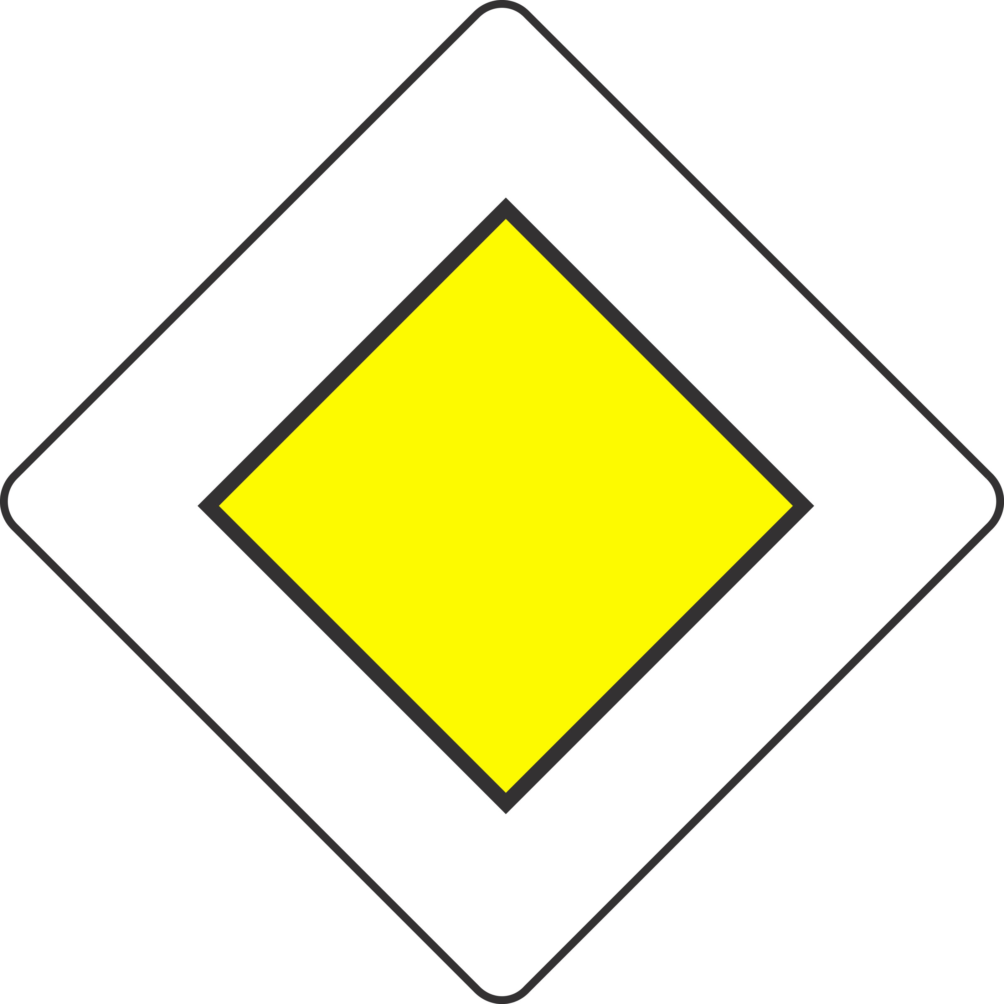
1. Start of a priority road
This traffic sign indicates the start of a priority road. Drivers on the priority road normally have priority over traffic entering from side roads until the priority road ends, unless traffic lights, other signs or applicable traffic rules indicate otherwise.
English • Traffic sign III-4 • Priority road. Vehicles have priority over traffic on intersecting or joining roads.
Bosanski • III-4 • Cesta s prvenstvom prolaza. Vozila na ovoj cesti imaju prvenstvo prolaza prema vozilima na cestama koje se s njom ukrštaju ili spajaju.
Sources
🔗 Commons.wikimedia.org
🔗 Ms.ks.gov.ba • Pravilnik o saobraćajnim znakovima • član 36, tačka 3
SVG source: Gigillo83 • Public domain • Original revision 2024-12-08. Wikimedia original unmodified.
2. End of the priority road
This traffic sign indicates the end of the priority road. The road no longer has continuing priority at subsequent intersections. Follow the applicable traffic lights, priority signs and default priority rules.
English • Traffic sign III-5 • End of priority road. Marks the end of the priority road or section.
Bosanski • III-5 • Završetak ceste s prvenstvom prolaza. Mjesto na kojem završava cesta ili dio ceste s prvenstvom prolaza.
Sources
🔗 Commons.wikimedia.org (Gigillo83 • CC BY-SA 4.0)
🔗 Ms.ks.gov.ba • Pravilnik o saobraćajnim znakovima • član 36, tačka 4
Replacement SVG: Commons.wikimedia.org • Wikimedia Commons original • Government of Slovenia • Public domain • Original revision 2022-07-28. Wikimedia original unmodified.
Artwork verified against Ms.ks.gov.ba • official published diagram III-5.
Image via Commons.wikimedia.org
Government of Slovenia • Public domain • Source revision 2022-07-28. Wikimedia original unmodified.
3. Start of a built-up area
This traffic sign indicates the start of a built-up area. From this point, the traffic rules that apply to built-up areas take effect according to the applicable local regulations.
English • Traffic sign III-84 • Settlement name. Entry into Mostar and the boundary from which built-up-area traffic rules apply.
Bosanski • III-84 • Naziv naseljenog mjesta. Ulazak u naselje Mostar i granica od koje se primjenjuju saobraćajni propisi u naselju.
Sources
🔗 Commons.wikimedia.org (Gigillo83 • CC BY-SA 4.0)
🔗 Ms.ks.gov.ba • Pravilnik o saobraćajnim znakovima • član 36, tačka 66
🔗 Sluzbenenovine.ba • Izmjene Zakona • Službeni glasnik BiH 35/26 • član 1
SVG source: Gigillo83 • CC BY-SA 4.0 • Original revision 2022-08-10. Wikimedia original unmodified.
4. End of the built-up area
This traffic sign indicates the end of the built-up area. The traffic rules specifically associated with the built-up area cease to apply from this point according to the applicable local regulations.
English • Traffic sign III-85 • End of settlement. Leaving Mostar; the built-up-area traffic rules cease to apply from this boundary.
Bosanski • III-85 • Završetak naseljenog mjesta. Izlazak iz naselja Mostar i granica od koje prestaju važiti saobraćajni propisi koji se primjenjuju u naselju.
Sources
🔗 Commons.wikimedia.org (Gigillo83 • CC BY-SA 4.0)
🔗 Ms.ks.gov.ba • Pravilnik o saobraćajnim znakovima • član 36, tačka 67
🔗 Sluzbenenovine.ba • Izmjene Zakona • Službeni glasnik BiH 35/26 • član 1
Image via Commons.wikimedia.org
Gigillo83 • CC BY-SA 4.0 • Source revision 2022-02-11. Wikimedia original unmodified.
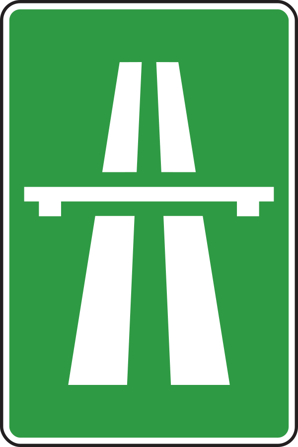
5. Start of a motorway
This traffic sign indicates the start of a motorway. From this point, special motorway rules apply, including restrictions on which road users may enter and on stopping, reversing and other manoeuvres. Follow the applicable speed limits, lane rules and local motorway regulations.
English • Traffic sign III-73 • Motorway. Marks where the motorway begins.
Bosanski • III-73 • Autocesta. Mjesto od kojeg počinje autocesta.
Sources
🔗 Commons.wikimedia.org (Gigillo83 • CC BY-SA 4.0)
🔗 Ms.ks.gov.ba • Pravilnik o saobraćajnim znakovima • član 36, tačka 57
Replacement SVG: Commons.wikimedia.org • Wikimedia Commons original • Unknown authorUnknown author • Public domain • Original revision 2025-05-18. Wikimedia original unmodified.
Image via Commons.wikimedia.org
Unknown author • Public domain • Source revision 2025-05-18. Wikimedia original unmodified.
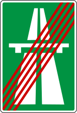
6. End of the motorway
This traffic sign indicates the end of the motorway. The special motorway rules end at this point. Follow the speed limits, access rules and other traffic signs that apply to the road ahead.
English • Traffic sign III-74 • End of motorway. Marks where the motorway ends.
Bosanski • III-74 • Završetak autoceste. Mjesto na kojem završava autocesta.
Sources
🔗 Commons.wikimedia.org (Gigillo83 • CC BY-SA 4.0)
🔗 Ms.ks.gov.ba • Pravilnik o saobraćajnim znakovima • član 36, tačka 58
Image via Commons.wikimedia.org
Gigillo83 • CC BY-SA 4.0 • Source revision 2022-01-31. Wikimedia original unmodified.
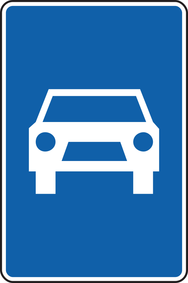
7. Start of an expressway
This traffic sign indicates the start of an expressway. From this point, the traffic rules and access conditions that apply to expressways take effect according to the applicable local regulations.
English • Traffic sign III-75 • Expressway or road reserved for motor vehicles. Marks where the expressway or reserved road begins.
Bosanski • III-75 • Brza cesta ili cesta rezervirana za saobraćaj motornih vozila. Mjesto od kojeg počinje brza cesta ili cesta rezervirana za saobraćaj motornih vozila.
Sources
🔗 Commons.wikimedia.org (มองโกเลีย๔๔ • CC BY-SA 4.0)
🔗 Ms.ks.gov.ba • Pravilnik o saobraćajnim znakovima • član 36, tačka 59
Replacement SVG: Commons.wikimedia.org • Wikimedia Commons original • Gigillo83 • CC BY-SA 4.0 • Original revision 2025-05-18. Wikimedia original unmodified.
Image via Commons.wikimedia.org
Gigillo83 • CC BY-SA 4.0 • Source revision 2025-05-18. Wikimedia original unmodified.
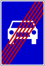
8. End of the expressway
This traffic sign indicates the end of the expressway. The special traffic rules associated with the expressway end at this point. Follow the rules and traffic signs that apply to the road ahead.
English • Traffic sign III-76 • End of expressway or road reserved for motor vehicles. Marks where that road ends.
Bosanski • III-76 • Završetak brze ceste ili ceste rezervirane za saobraćaj motornih vozila. Mjesto na kojem završava brza cesta ili cesta rezervirana za saobraćaj motornih vozila.
Sources
🔗 Commons.wikimedia.org (Gigillo83 • CC BY-SA 4.0)
🔗 Ms.ks.gov.ba • Pravilnik o saobraćajnim znakovima • član 36, tačka 60
Image via Commons.wikimedia.org
Gigillo83 • CC BY-SA 4.0 • Source revision 2022-01-31. Wikimedia original unmodified.
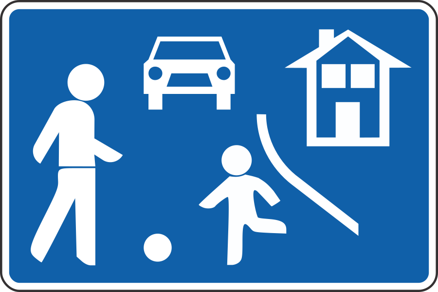
9. Start of a residential area
This traffic sign indicates the start of a residential area. Special traffic rules apply within the area according to the applicable signs and local regulations. These rules may affect speed, parking and how different road users use the road.
English • Traffic sign III-30 • Residential area with traffic calming. Entry to a settlement area where driving faster than walking speed is prohibited and children's play is permitted.
Bosanski • III-30 • Područje smirenog saobraćaja. Ulazak u područje naselja u kojem se ne smije voziti brže od brzine hoda pješaka i u kojem je dječija igra dopuštena.
Sources
🔗 Commons.wikimedia.org (Gigillo83 • CC BY-SA 4.0)
🔗 Ms.ks.gov.ba • Pravilnik o saobraćajnim znakovima • član 36, tačka 21
Replacement SVG: Commons.wikimedia.org • Wikimedia Commons original • Gigillo83 • CC BY-SA 4.0 • Original revision 2025-05-01. Wikimedia original unmodified.
Image via Commons.wikimedia.org
Gigillo83 • CC BY-SA 4.0 • Source revision 2025-05-01. Wikimedia original unmodified.
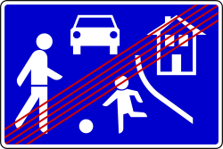
10. End of the residential area
This traffic sign indicates the end of the residential area. The special traffic rules associated with the residential area end at this point. Follow the traffic signs and rules that apply beyond the area.
English • Traffic sign III-31 • End of residential area with traffic calming. Exit from the traffic-calmed area.
Bosanski • III-31 • Završetak područja smirenog saobraćaja. Izlazak iz područja smirenog saobraćaja.
Sources
🔗 Commons.wikimedia.org (Gigillo83 • CC BY-SA 4.0)
🔗 Ms.ks.gov.ba • Pravilnik o saobraćajnim znakovima • član 36, tačka 22
Image via Commons.wikimedia.org
Gigillo83 • CC BY-SA 4.0 • Source revision 2022-02-04. Wikimedia original unmodified.
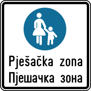
11. Start of a zone for pedestrians
This traffic sign indicates the start of a pedestrian zone. Pedestrians are the principal road users within the zone, while access by vehicles and other road users is subject to the applicable traffic signs and local rules.
English • Traffic sign III-28 • Pedestrian zone. Entry to an area exclusively for pedestrians; motor-powered vehicles are prohibited.
Bosanski • III-28 • Pješačka zona. Ulazak u područje namijenjeno isključivo kretanju pješaka; kretanje vozila na motorni pogon je zabranjeno.
Sources
🔗 Commons.wikimedia.org (Gigillo83 • CC BY-SA 4.0)
🔗 Ms.ks.gov.ba • Pravilnik o saobraćajnim znakovima • član 36, tačka 19
Image via Commons.wikimedia.org
Gigillo83 • CC BY-SA 4.0 • Source revision 2022-01-18. Wikimedia original unmodified.
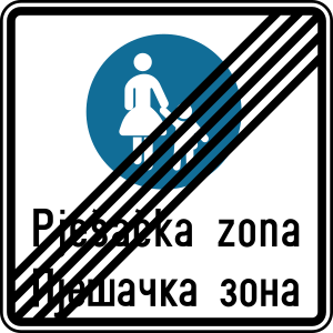
12. End of the zone for pedestrians
This traffic sign indicates the end of the pedestrian zone. The special traffic rules associated with the pedestrian zone end at this point. Follow the traffic signs and rules that apply beyond the zone.
English • Traffic sign III-29 • End of pedestrian zone. Marks where the zone's motor-vehicle prohibition ends.
Bosanski • III-29 • Završetak pješačke zone. Mjesto na kojem prestaje zabrana kretanja vozilima na motorni pogon određena pješačkom zonom.
Sources
🔗 Commons.wikimedia.org (Gigillo83 • CC BY-SA 4.0)
🔗 Ms.ks.gov.ba • Pravilnik o saobraćajnim znakovima • član 36, tačka 20
SVG source: Gigillo83 • CC BY-SA 4.0 • Original revision 2022-01-18. Wikimedia original unmodified.
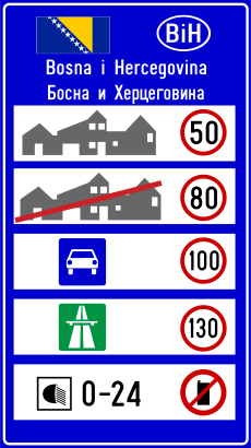
13. National speed limits
This traffic sign indicates the national speed limits. The applicable default maximum speeds depend on the road type, vehicle category and local traffic rules when no different speed limit is indicated.
Sources
🔗 Commons.wikimedia.org (Gigillo83 • CC BY-SA 4.0)
Image via Commons.wikimedia.org
Gigillo83 • CC BY-SA 4.0 • Source revision 2022-02-05. Wikimedia original unmodified.
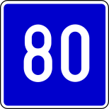
14. Advisory speed limit
This traffic sign indicates an advisory speed. The displayed value recommends an appropriate speed for the road or conditions ahead. Its legal effect depends on the applicable local rules.
English • Traffic sign III-34 • Recommended speed. A speed of 80 km/h is recommended on this section.
Bosanski • III-34 • Brzina koja se preporučuje. Na ovom dijelu ceste preporučuje se brzina od 80 km/h.
Sources
🔗 Commons.wikimedia.org (Gigillo83 • CC BY-SA 4.0)
🔗 Ms.ks.gov.ba • Pravilnik o saobraćajnim znakovima • član 36, tačka 25
Image via Commons.wikimedia.org
Gigillo83 • CC BY-SA 4.0 • Source revision 2014-09-10. Wikimedia original unmodified.
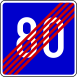
15. End of the advisory speed limit
This traffic sign indicates the end of the advisory speed. The preceding speed recommendation ends at this point. Continue according to the applicable speed limits and road conditions.
English • Traffic sign III-35 • End of recommended speed. The previous 80 km/h recommendation ends here.
Bosanski • III-35 • Prestanak preporučene brzine. Mjesto na kojem prestaje prethodna preporuka brzine od 80 km/h.
Sources
🔗 Commons.wikimedia.org (Gigillo83 • CC BY-SA 4.0)
🔗 Ms.ks.gov.ba • Pravilnik o saobraćajnim znakovima • član 36, tačka 26
Image via Commons.wikimedia.org
Gigillo83 • CC BY-SA 4.0 • Source revision 2022-02-05. Wikimedia original unmodified.
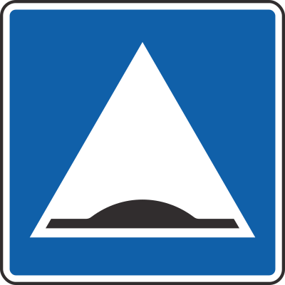
16. Speed bump
This traffic sign indicates a speed bump. A speed bump is a raised section of the roadway designed to reduce vehicle speeds.
English • Traffic sign III-12 • Traffic-calming hump. Marks the location of a traffic-calming hump.
Bosanski • III-12 • Preventivna izbočina na cesti. Mjesto na kojem se nalazi preventivna izbočina za smirivanje saobraćaja.
Sources
🔗 Commons.wikimedia.org (Gigillo83 • CC BY-SA 4.0)
🔗 Ms.ks.gov.ba • Pravilnik o saobraćajnim znakovima • član 36, tačka 10
SVG source: Gigillo83 • CC BY-SA 4.0 • Original revision 2025-05-17. Wikimedia original unmodified.
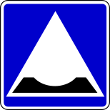
17. Dip in the road
This traffic sign indicates a dip in the road. A dip is a short section where the road surface drops and rises again.
English • Traffic sign III-13 • Traffic-calming dip. Marks the location of a traffic-calming depression.
Bosanski • III-13 • Preventivno ulegnuće na cesti. Mjesto na kojem se nalazi preventivno ulegnuće za smirivanje saobraćaja.
Sources
🔗 Commons.wikimedia.org (Gigillo83 • CC BY-SA 4.0)
🔗 Ms.ks.gov.ba • Pravilnik o saobraćajnim znakovima • član 36, tačka 10
Image via Commons.wikimedia.org
Gigillo83 • CC BY-SA 4.0 • Source revision 2022-02-05. Wikimedia original unmodified.
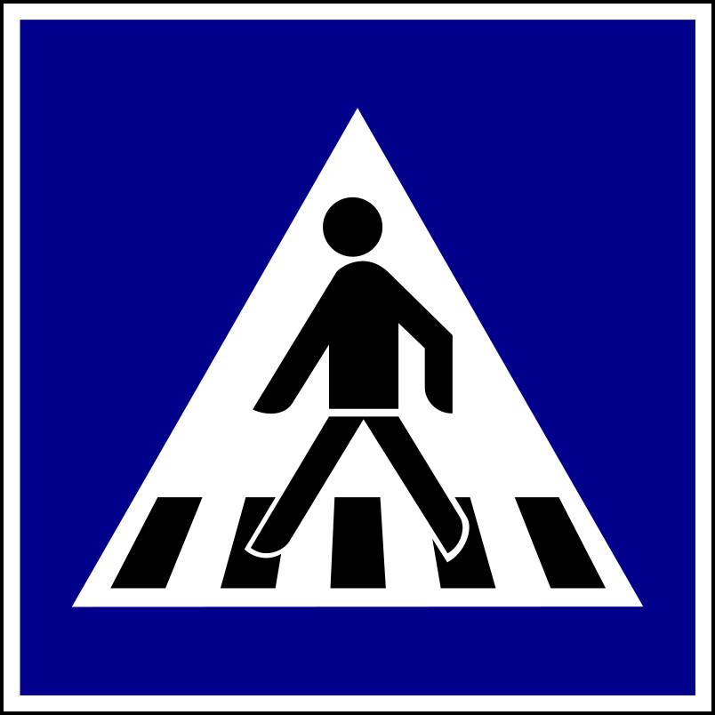
18. Crossing for pedestrians
This traffic sign indicates a crossing for pedestrians. It marks a designated place where pedestrians cross the road. Priority and crossing rules depend on the applicable traffic signs, signals and local regulations.
English • Traffic sign III-6 • Marked pedestrian crossing. Marks the crossing's location.
Bosanski • III-6 • Obilježeni pješački prijelaz. Mjesto obilježenog pješačkog prijelaza.
Sources
🔗 Commons.wikimedia.org (JankoBot56 • CC BY-SA 4.0)
🔗 Ms.ks.gov.ba • Pravilnik o saobraćajnim znakovima • član 36, tačka 5
Replacement SVG: Commons.wikimedia.org • Wikimedia Commons original • Gigillo83 • Public domain • Original revision 2022-10-02. Wikimedia original unmodified.
Artwork verified against Ms.ks.gov.ba • official published diagram III-6.
Image via Commons.wikimedia.org
Gigillo83 • Public domain • Source revision 2022-10-02. Wikimedia original unmodified.
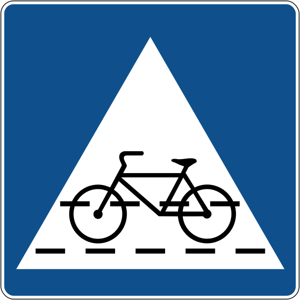
19. Crossing for cyclists
This traffic sign indicates a crossing for cyclists. It marks a designated place where cyclists cross the road. Priority depends on the applicable traffic signs, signals and local rules.
English • Traffic sign III-7 • Marked cycle crossing. Marks where a cycle path crosses the road.
Bosanski • III-7 • Obilježeni prijelaz biciklističke staze. Mjesto obilježenog prijelaza biciklističke staze preko ceste.
Sources
🔗 Commons.wikimedia.org
🔗 Ms.ks.gov.ba • Pravilnik o saobraćajnim znakovima • član 36, tačka 5
SVG source: Government of the Republic of Croatia • Public domain • Original revision 2022-09-01. Wikimedia original unmodified.
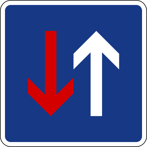
20. Road narrowing, oncoming drivers have to give way
This traffic sign indicates a road narrowing where oncoming drivers have to give way.
English • Traffic sign III-1 • Priority over oncoming vehicles. Vehicles travelling in this direction have priority at the narrow passage.
Bosanski • III-1 • Prvenstvo prolaza u odnosu na vozila iz suprotnog smjera. Na uskom prolazu vozila iz ovog smjera imaju prvenstvo prolaza u odnosu na vozila koja dolaze iz suprotnog smjera.
Sources
🔗 Commons.wikimedia.org
🔗 Ms.ks.gov.ba • Pravilnik o saobraćajnim znakovima • član 36, tačka 1
Replacement SVG: Commons.wikimedia.org • Wikimedia Commons original • Government of Slovenia • Public domain • Original revision 2014-05-14. Wikimedia original unmodified.
Image via Commons.wikimedia.org
Government of Slovenia • Public domain • Source revision 2014-05-14. Wikimedia original unmodified.
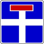
21. Dead end street
This traffic sign indicates a dead end street. The road has no through route for vehicles, although access to properties or other destinations along the road may still be possible.
English • Traffic sign III-10 • Dead-end road. The symbol's position shows its relationship to the road where the sign stands.
Bosanski • III-10 • Slijepa cesta. Cesta bez izlaza; položaj simbola pokazuje njen odnos prema cesti na kojoj je znak postavljen.
Sources
🔗 Commons.wikimedia.org (Gigillo83 • CC BY-SA 4.0)
🔗 Ms.ks.gov.ba • Pravilnik o saobraćajnim znakovima • član 36, tačka 8
Image via Commons.wikimedia.org
Gigillo83 • CC BY-SA 4.0 • Source revision 2022-02-05. Wikimedia original unmodified.
22. Road with one-way traffic
This traffic sign indicates a road with one-way traffic. Vehicular traffic may travel only in the permitted direction, subject to any exceptions indicated by traffic signs or local rules.
English • Traffic sign III-2 • One-way road. Traffic travels only in the arrow's direction, straight ahead.
Bosanski • III-2 • Cesta s jednosmjernim saobraćajem. Saobraćaj na cesti odvija se samo u smjeru strelice, ravno.
Sources
🔗 Commons.wikimedia.org
🔗 Ms.ks.gov.ba • Pravilnik o saobraćajnim znakovima • član 36, tačka 2
SVG source: Government of Slovenia • Public domain • Original revision 2014-05-14. Wikimedia original unmodified.
23. Road with one-way traffic
This traffic sign indicates a road with one-way traffic. Drivers may travel only in the permitted direction.
English • Traffic sign III-3 • One-way road. Traffic travels only in the arrow's direction, to the left.
Bosanski • III-3 • Cesta s jednosmjernim saobraćajem. Saobraćaj na cesti odvija se samo u smjeru strelice, ulijevo.
Sources
🔗 Commons.wikimedia.org
🔗 Ms.ks.gov.ba • Pravilnik o saobraćajnim znakovima • član 36, tačka 2
SVG source: Government of Slovenia • Public domain • Original revision 2014-05-14. Wikimedia original unmodified.
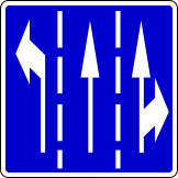
24. Overview of the lanes and their direction
This traffic sign gives an overview of the lanes and their direction. The arrows or other indications show how the lanes continue and which directions or destinations they serve.
English • Traffic sign III-91 • Lane selection. Shows lane directions on the approach to the junction; move into the appropriate lane.
Bosanski • III-91 • Prestrojavanje vozila. Prikazuje smjerove kretanja po saobraćajnim trakama na prilazu raskrsnici; vozila se trebaju prestrojiti u odgovarajuću traku.
Sources
🔗 Commons.wikimedia.org (Gigillo83 • CC BY-SA 4.0)
🔗 Ms.ks.gov.ba • Pravilnik o saobraćajnim znakovima • član 36, tačka 71
Image via Commons.wikimedia.org
Gigillo83 • CC BY-SA 4.0 • Source revision 2022-02-13. Wikimedia original unmodified.
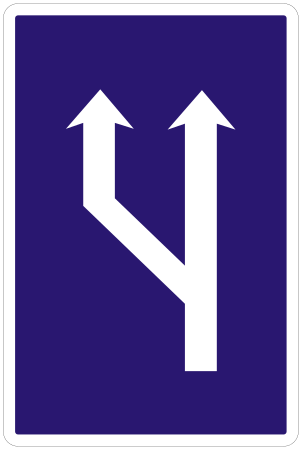
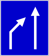
25. Start of a new lane
This traffic sign indicates the start of a new traffic lane. The displayed road layout shows where the additional lane begins and how the traffic lanes continue.
English • Traffic sign III-96 • Lane begins. Marks an additional lane for travel in the same direction.
Bosanski • III-96 • Otvaranje saobraćajne trake. Početak dodatne saobraćajne trake za kretanje vozila u istom smjeru.
Sources
🔗 Commons.wikimedia.org (Gigillo83 • CC BY-SA 4.0)
🔗 Ms.ks.gov.ba • Pravilnik o saobraćajnim znakovima • član 36, tačka 74
Replacement SVG: Commons.wikimedia.org • Wikimedia Commons original • Ministry of Interior of the Slovak Republic • Public domain • Original revision 2010-08-26. Wikimedia original unmodified.
Image via Commons.wikimedia.org
Ministry of Interior of the Slovak Republic • Public domain • Source revision 2010-08-26. Wikimedia original unmodified.
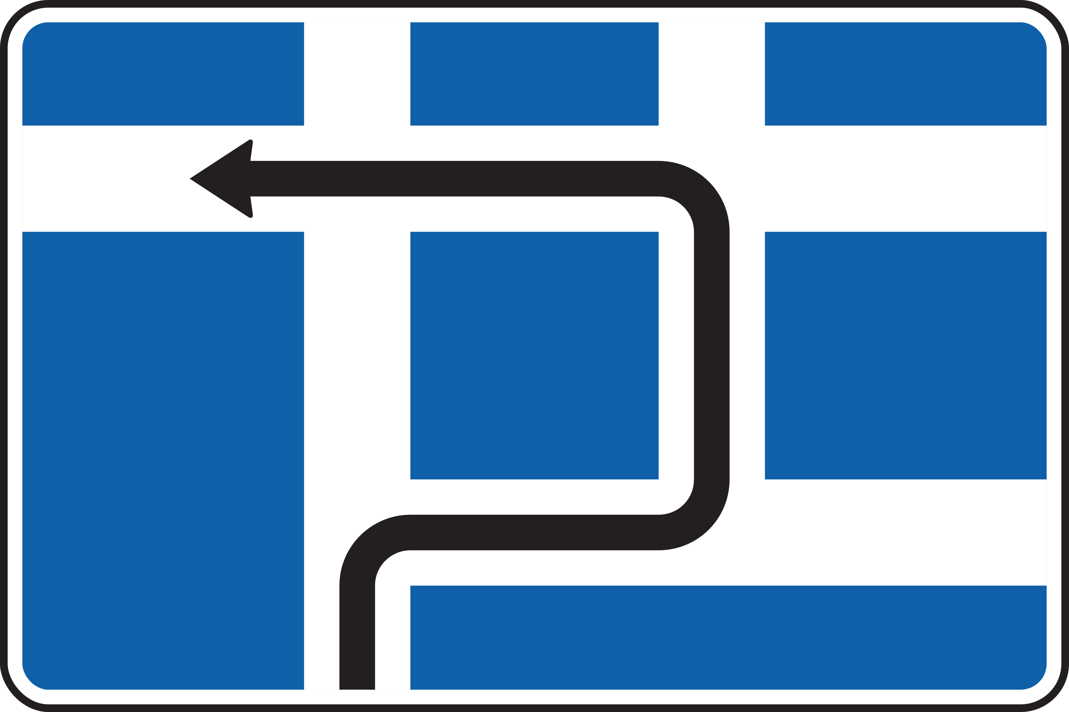
26. Route to be followed in order to turn left
This traffic sign indicates the route to use for a left turn. Follow the indicated route instead of turning left directly at this point.
English • Traffic sign III-11 • Route to a junction where left turns are prohibited. Shows the route vehicles must follow to the junction where turning left is prohibited.
Bosanski • III-11 • Smjer kretanja do raskrsnice na kojoj je zabranjeno skretanje ulijevo. Prikazuje put kojim se vozilo mora kretati do raskrsnice na kojoj je zabranjeno skretanje ulijevo.
Sources
🔗 Commons.wikimedia.org (Gigillo83 • CC BY-SA 4.0)
🔗 Ms.ks.gov.ba • Pravilnik o saobraćajnim znakovima • član 36, tačka 9
Replacement SVG: Commons.wikimedia.org • Wikimedia Commons original • Gigillo83 • CC BY-SA 4.0 • Original revision 2025-05-03. Wikimedia original unmodified.
Image via Commons.wikimedia.org
Gigillo83 • CC BY-SA 4.0 • Source revision 2025-05-03. Wikimedia original unmodified.
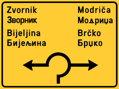
27. Information about the directions of the roundabout
This traffic sign gives information about directions at a roundabout. The diagram shows the available exits and the destinations reached from them.
English • Traffic sign IV-4 • Roundabout junction diagram. Shows the positions and directions of roads at the roundabout ahead and the destinations they lead to.
Bosanski • IV-4 • Raskrsnica — kružni tok. Prikazuje položaj i smjerove cesta na predstojećoj raskrsnici s kružnim tokom te odredišta do kojih one vode.
Sources
🔗 Commons.wikimedia.org (Gigillo83 • CC BY-SA 4.0)
🔗 Ms.ks.gov.ba • Pravilnik o saobraćajnim znakovima • član 44, tačka 3
Image via Commons.wikimedia.org
Gigillo83 • CC BY-SA 4.0 • Source revision 2022-07-28. Wikimedia original unmodified.
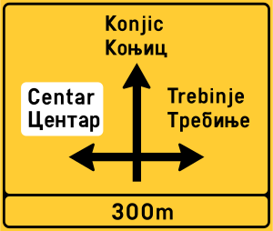
28. Junction layout, directions and destinations
This traffic sign shows the junction layout, directions and destinations. The diagram shows how the roads are arranged and which direction leads to each indicated destination or route.
English • Traffic sign IV-3 • Junction diagram. Shows the positions and directions of roads and their destinations at the junction ahead. In the image the junction is 300 m away.
Bosanski • IV-3 • Raskrsnica. Prikazuje položaj i smjerove cesta na predstojećoj raskrsnici te odredišta do kojih one vode. Raskrsnica na prikazu udaljena je 300 m.
Sources
🔗 Commons.wikimedia.org (Gigillo83 • CC BY-SA 4.0)
🔗 Ms.ks.gov.ba • Pravilnik o saobraćajnim znakovima • član 44, tačka 3
Image via Commons.wikimedia.org
Gigillo83 • CC BY-SA 4.0 • Source revision 2026-04-03. Wikimedia original unmodified.
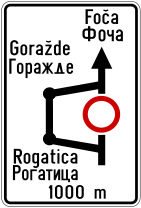
29. Detour for vehicles that are not allowed to pass
This traffic sign indicates a detour for vehicles that cannot continue on the normal route. Vehicles affected by the relevant restriction should follow the indicated alternative route.
English • Traffic sign III-111 • Advance diversion sign. Shows the diversion route because of a settlement, prohibition or carriageway damage. The image diverts via Rogatica towards Foča and Goražde; the closed section is 1000 m ahead.
Bosanski • III-111 • Predznak za obilazak. Prikazuje pravac i smjer obilaska zbog naselja, zabrane ili oštećenja kolovoza. Na prikazu obilazak vodi preko Rogatice prema Foči i Goraždu, a zatvoreni dio je udaljen 1000 m.
Sources
🔗 Commons.wikimedia.org (Gigillo83 • CC BY-SA 4.0)
🔗 Ms.ks.gov.ba • Pravilnik o saobraćajnim znakovima • član 36, tačka 86
SVG source: Gigillo83 • CC BY-SA 4.0 • Original revision 2022-01-27. Wikimedia original unmodified.
30. End of a lane
This traffic sign indicates the end of a lane. The displayed lane arrangement shows which lane ends and how the remaining traffic lanes continue.
English • Traffic sign III-97 • Lane ends. A lane for travel in the same direction ends; change lanes according to the arrows.
Bosanski • III-97 • Zatvaranje saobraćajne trake. Završetak jedne saobraćajne trake za kretanje u istom smjeru; potrebno je prestrojiti se prema prikazanim strelicama.
Sources
🔗 Commons.wikimedia.org (Gigillo83 • CC BY-SA 4.0)
🔗 Ms.ks.gov.ba • Pravilnik o saobraćajnim znakovima • član 36, tačka 75
Image via Commons.wikimedia.org
Gigillo83 • CC BY-SA 4.0 • Source revision 2022-02-13. Wikimedia original unmodified.
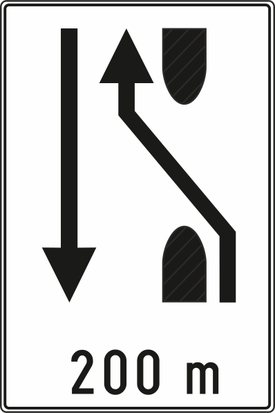
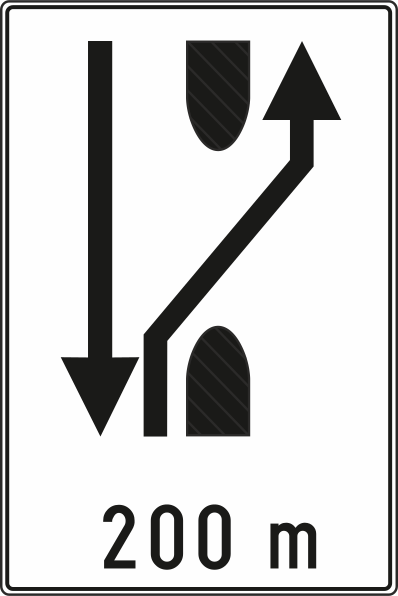
31. Temporary median strip diversion
This traffic sign indicates that traffic is temporarily directed through an opening in the central reservation. Follow the displayed direction and temporary lane markings through the diversion.
English • Traffic sign III-119 • Crossover on a divided road. In 200 m, traffic is temporarily diverted to the opposing carriageway, which becomes two-way.
Bosanski • III-119 • Preusmjeravanje saobraćaja na cesti s odvojenim kolovozima. Za 200 m saobraćaj se privremeno preusmjerava na kolovoz namijenjen suprotnom smjeru, na kojem se uspostavlja dvosmjerni saobraćaj.
Sources
🔗 Commons.wikimedia.org
🔗 Ms.ks.gov.ba • Pravilnik o saobraćajnim znakovima • član 36, tačka 92
SVG source: Government of the Republic of Croatia • Public domain • Original revision 2023-12-20. Wikimedia original unmodified.
32. End of temporary median strip diversion
This traffic sign indicates that traffic is directed back through an opening in the central reservation. Follow the displayed direction and temporary lane markings as the diversion ends.
English • Traffic sign III-121 • Return to a separate carriageway. In 200 m, the temporary use of the opposing carriageway ends and vehicles return to their own carriageway.
Bosanski • III-121 • Povratak na odvojeni kolovoz. Za 200 m završava privremeno preusmjeravanje na suprotni kolovoz; vozila se vraćaju na kolovoz za svoj smjer.
Sources
🔗 Commons.wikimedia.org
🔗 Ms.ks.gov.ba • Pravilnik o saobraćajnim znakovima • član 36, tačka 92
SVG source: Government of the Republic of Croatia • Public domain • Original revision 2023-12-20. Wikimedia original unmodified.
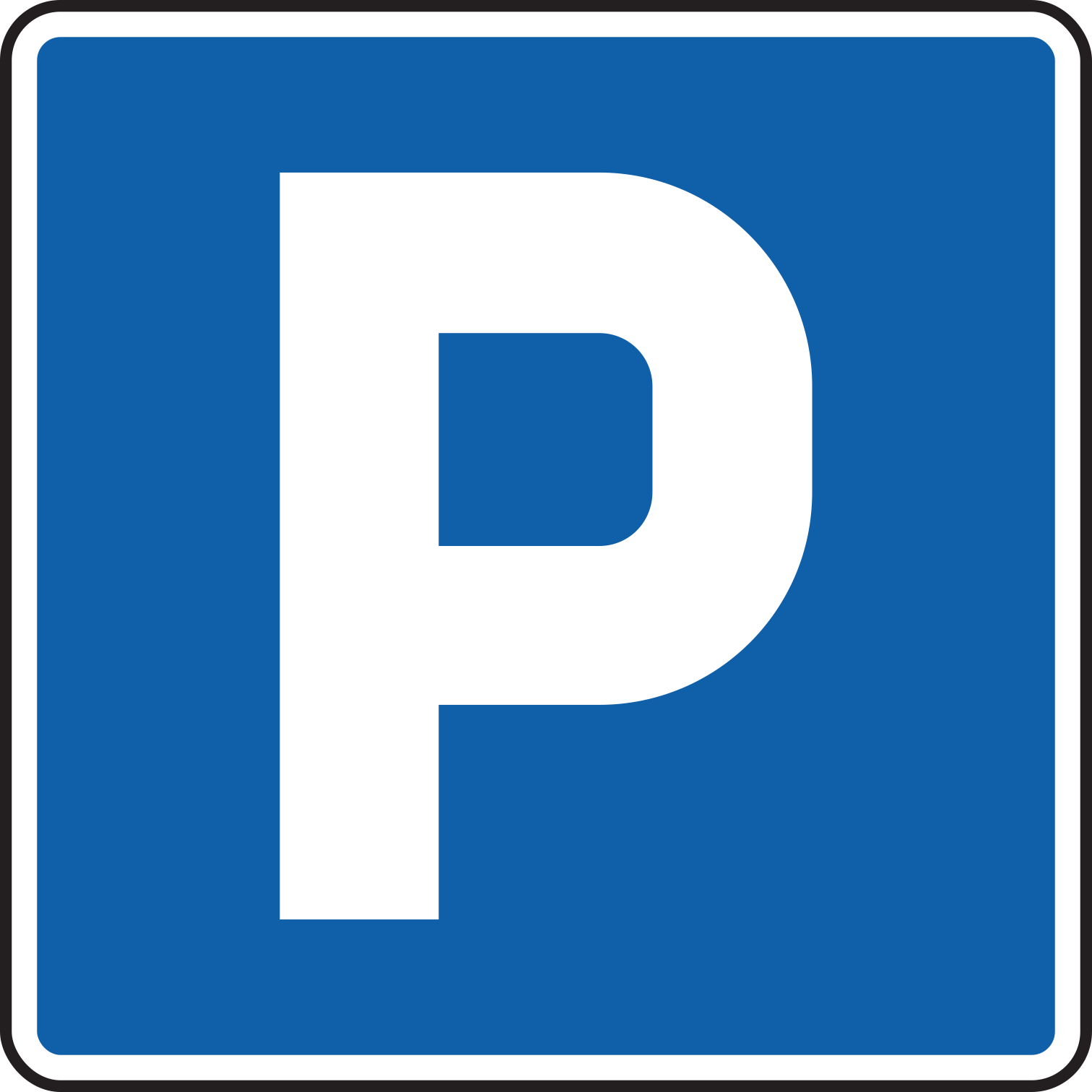
33. Parking allowed
This traffic sign indicates that parking is allowed. Vehicles may be parked in the area covered by the sign subject to any indicated conditions, restrictions or local parking rules.
English • Traffic sign III-40 • Car park. An area designated or specially provided for vehicle parking.
Bosanski • III-40 • Parkiralište. Prostor određen ili posebno uređen za parkiranje vozila.
Sources
🔗 Commons.wikimedia.org (JankoBot56 • CC BY-SA 4.0)
🔗 Ms.ks.gov.ba • Pravilnik o saobraćajnim znakovima • član 36, tačka 31
Replacement SVG: Commons.wikimedia.org • Wikimedia Commons original • Министарство грађевинарства, саобраћаја и инфраструктуре • Public domain • Original revision 2025-05-04. Wikimedia original unmodified.
Artwork verified against Ms.ks.gov.ba • official published diagram III-40.
Image via Commons.wikimedia.org
Министарство грађевинарства, саобраћаја и инфраструктуре • Public domain • Source revision 2025-05-04. Wikimedia original unmodified.
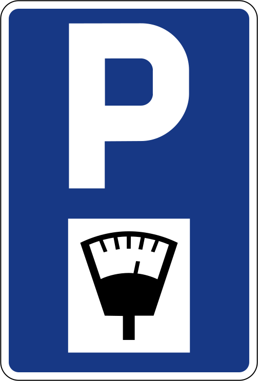
34. Parking only allowed if you pay
This traffic sign indicates that parking requires payment. Pay the applicable parking charge according to the indicated conditions and local payment rules.
English • Traffic sign III-42 • Time-limited parking. Parking duration is limited. The symbol alone does not indicate whether charges apply.
Bosanski • III-42 • Vremensko ograničenje parkiranja. Parkiranje je vremenski ograničeno. Simbol sam po sebi ne određuje naplaćuje li se parkiranje.
Sources
🔗 Commons.wikimedia.org (Gigillo83 • CC BY-SA 4.0)
🔗 Ms.ks.gov.ba • Pravilnik o saobraćajnim znakovima • član 36, tačka 31
Replacement SVG: Commons.wikimedia.org • Wikimedia Commons original • Government of Slovenia • Public domain • Original revision 2014-05-21. Wikimedia original unmodified.
Artwork verified against Ms.ks.gov.ba • official published diagram III-42.
Image via Commons.wikimedia.org
Government of Slovenia • Public domain • Source revision 2014-05-21. Wikimedia original unmodified.
