


Location markerMalaysia
 Traffic rules
 Malaysia
26. Location marker
A location marker is a roadside reference showing a measured position along a road. It normally identifies a kilometre, mile or smaller interval measured from an established starting point on that route.
Kilometre and hectometre markers help road users, emergency services, road authorities and maintenance crews identify an exact section of road. They do not impose a speed limit, priority rule or access restriction.
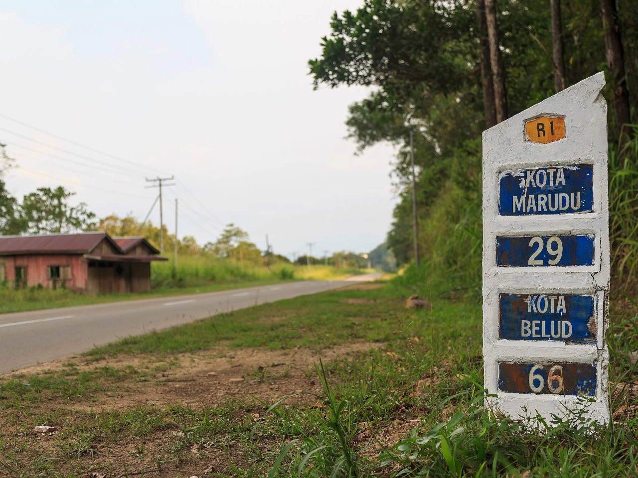
Wikimedia.org • CEphoto, Uwe Aranas • CC BY-SA
What does a roadside location marker tell you in Malaysia?
Where used, a roadside reference marker gives a measured position along a particular road, usually as a kilometre or other chainage reference. Designs and units are determined by the local road authority; the number is not automatically a distance to the next destination.
🔗 mot.gov.my • MOT — commencement on 16 October 2026; deferred compound ceiling distinguished
🔗 epsmg.jkr.gov.my • JKR — ATJ 2B/85 (Pindaan 2019), original manual endpoint; download unavailable
How can a location marker help in an emergency in Malaysia?
If you can see a marker safely, give the emergency operator the route number or road name, travel direction and marker reading. Additional landmarks, exits and GPS position can help. Do not leave a safe place or enter traffic to read a post.
🔗 mot.gov.my • MOT — commencement on 16 October 2026; deferred compound ceiling distinguished
🔗 epsmg.jkr.gov.my • JKR — ATJ 2B/85 (Pindaan 2019), original manual endpoint; download unavailable
Does a location marker set a speed limit or permit stopping in Malaysia?
No. A location marker is for orientation and road management; it does not itself set a speed limit, change priority or permit parking. Follow the actual traffic signs and stop only where the law and safety allow.
🔗 mot.gov.my • MOT — commencement on 16 October 2026; deferred compound ceiling distinguished
🔗 epsmg.jkr.gov.my • JKR — ATJ 2B/85 (Pindaan 2019), original manual endpoint; download unavailable


