


Information signsPeru
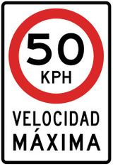 Traffic rules
 Peru
 Priority signs
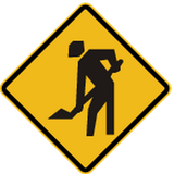 Warning signs
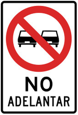 Prohibitory signs
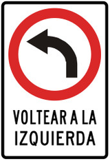 Mandatory signs
 Information signs
An information sign identifies a route, destination, facility or regulated road or area. Some carry legal consequences, so apply the actual sign meaning and local traffic code.



Which signs provide information in Peru?
Information signs guide road users to routes, destinations and services.

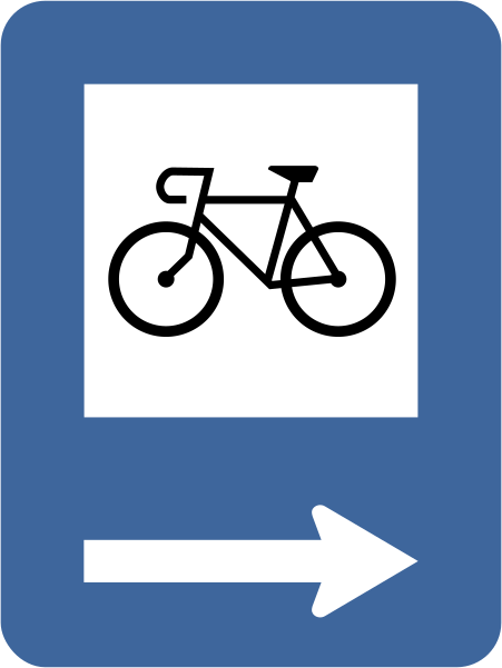
1. Lane for cyclists
This traffic sign indicates a lane for cyclists. The lane is designated for bicycle traffic, subject to the applicable road markings, traffic signs and local rules.
English • Traffic sign I-22 · historical • Direction to cycleway. Points towards a cycleway, to the right in this drawing. Historical design identified in the manual approved by R.M. No. 210-2000-MTC/15.02. This drawing is explained without presenting it as the current 2024 design. Current code I-22 refers to an information service; that meaning is not assigned to this drawing.
Español • I-22 · histórico • Dirección hacia ciclovía. Indica la dirección hacia una ciclovía, a la derecha en este dibujo. Diseño histórico identificado en el manual aprobado por R.M. N.º 210-2000-MTC/15.02. Se explica este dibujo, sin presentarlo como el diseño vigente de 2024. El código I-22 del manual vigente corresponde a servicio de información; no se atribuye ese significado a este dibujo.
Sources
🔗 Commons.wikimedia.org
🔗 Sutran.gob.pe • MTC: manual histórico, página PDF 186
🔗 Sutran.gob.pe • Manual histórico: dibujo de referencia, página PDF 193
Image via Commons.wikimedia.org
Ministerio de Transportes y Comunicaciones del República del Perú • Public domain • Source revision 2023-01-03. Wikimedia original unmodified.
2. Lane for buses
This traffic sign indicates a lane for buses. The lane is intended for buses and any other road users permitted by the applicable signs or local rules.
English • Traffic sign I-20 · historical • Bus stop. Marks a public passenger transport stop. Historical design identified in the manual approved by R.M. No. 210-2000-MTC/15.02. This drawing is explained without presenting it as the current 2024 design. The current bus-stop design is I-6.
Español • I-20 · histórico • Paradero de ómnibus. Indica un paradero del servicio colectivo de transporte público de pasajeros. Diseño histórico identificado en el manual aprobado por R.M. N.º 210-2000-MTC/15.02. Se explica este dibujo, sin presentarlo como el diseño vigente de 2024. El diseño vigente de paradero es I-6.
Sources
🔗 Commons.wikimedia.org
🔗 Sutran.gob.pe • MTC: manual histórico, página PDF 186
🔗 Sutran.gob.pe • Manual histórico: dibujo de referencia, página PDF 193
Image via Commons.wikimedia.org
Ministerio de Transportes y Comunicaciones del República del Perú • Public domain • Source revision 2014-04-09. Wikimedia original unmodified.
3. Route to be followed in order to turn left
This traffic sign indicates the route to use for a left turn. Follow the indicated route instead of turning left directly at this point.
English • Traffic sign I-37 · historical • Advance route sign for a left turn. Shows an indirect route where a direct left turn at the next junction is prohibited. Follow the arrow. Historical design identified in the manual approved by R.M. No. 210-2000-MTC/15.02. This drawing is explained without presenting it as the current 2024 design. Current code I-37 refers to cycle infrastructure separated from the pedestrian area.
Español • I-37 · histórico • Preseñalización de itinerario para girar a la izquierda. Muestra un itinerario indirecto para girar a la izquierda cuando el giro directo está prohibido en la próxima intersección. Sigue el recorrido indicado por la flecha. Diseño histórico identificado en el manual aprobado por R.M. N.º 210-2000-MTC/15.02. Se explica este dibujo, sin presentarlo como el diseño vigente de 2024. El código I-37 del manual vigente corresponde a infraestructura ciclista segregada del área peatonal.
Sources
🔗 Commons.wikimedia.org
🔗 Sutran.gob.pe • MTC: manual histórico, página PDF 188
🔗 Sutran.gob.pe • Manual histórico: dibujo de referencia, página PDF 195
Image via Commons.wikimedia.org
Consejo Nacional de Seguridad Vial • Public domain • Source revision 2016-02-14. Wikimedia original unmodified.
4. Parking allowed
This traffic sign indicates that parking is allowed. Vehicles may be parked in the area covered by the sign subject to any indicated conditions, restrictions or local parking rules.
English • Traffic sign I-19 · historical • Parking area. Points towards parking, to the right in this drawing. Historical design identified in the manual approved by R.M. No. 210-2000-MTC/15.02. This drawing is explained without presenting it as the current 2024 design. The current parking design is I-5.
Español • I-19 · histórico • Área para estacionamiento. Indica la dirección hacia un área donde puedes estacionar, a la derecha en este dibujo. Diseño histórico identificado en el manual aprobado por R.M. N.º 210-2000-MTC/15.02. Se explica este dibujo, sin presentarlo como el diseño vigente de 2024. El diseño vigente de estacionamiento es I-5.
Sources
🔗 Commons.wikimedia.org
🔗 Sutran.gob.pe • MTC: manual histórico, página PDF 186
🔗 Sutran.gob.pe • Manual histórico: dibujo de referencia, página PDF 193
Image via Commons.wikimedia.org
Ministerio de Transportes y Comunicaciones del República del Perú • Public domain • Source revision 2022-06-17. Wikimedia original unmodified.
