


Traffic signsDenmark
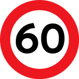 Traffic rules
 Denmark
 Priority signs
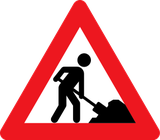 Warning signs
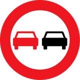 Prohibitory signs
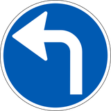 Mandatory signs
 Information signs
 Additional signs
Traffic signs
A traffic sign is a standardised visual symbol placed along roads to guide, warn, or regulate drivers, cyclists, and pedestrians. These signs provide essential information about road conditions, rules, directions, and potential hazards, helping to ensure safety and smooth traffic flow. They come in various shapes and colours—such as triangular warning signs, circular prohibitory or mandatory signs, and rectangular information signs—each designed for quick recognition and clear understanding.
How are traffic signs grouped in Denmark?
The catalogue separates A warnings, B priority, C prohibitions, D mandatory instructions and E information, with additional guidance categories.
🔗 retsinformation.dk • Danish signing order BEK 425/2023 — operative sign and marking descriptions
Is a temporary speed limit at roadworks binding in Denmark?
Where an authorised temporary regulatory speed limit is in force, you must obey it. A roadworks warning alone should not be mistaken for a new numerical limit, but conditions may require driving more slowly.
🔗 retsinformation.dk • Danish signing order BEK 425/2023 — operative sign and marking descriptions

101. End of the built-up area
This traffic sign indicates the end of the built-up area. The traffic rules specifically associated with the built-up area cease to apply from this point according to the applicable local regulations.
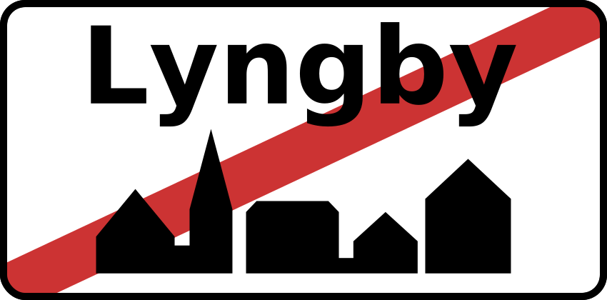
English • Traffic sign E 56 • End of built-up area. The geographical place name may appear in Danish and in English or a neighbouring country's official language.
Dansk • Tavle E 56 • Ophør af tættere bebygget område. Der kan angives det geografiske navn på området på dansk samt på engelsk eller et nabolands officielle sprog.
Sources
🔗 Commons.wikimedia.org
🔗 Retsinformation.dk • Bekendtgørelse nr. 425/2023, § 27
SVG source: AleXXw • Public domain • Original revision 2011-11-07. Wikimedia original unmodified.
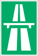
102. Start of a motorway
This traffic sign indicates the start of a motorway. From this point, special motorway rules apply, including restrictions on which road users may enter and on stopping, reversing and other manoeuvres. Follow the applicable speed limits, lane rules and local motorway regulations.
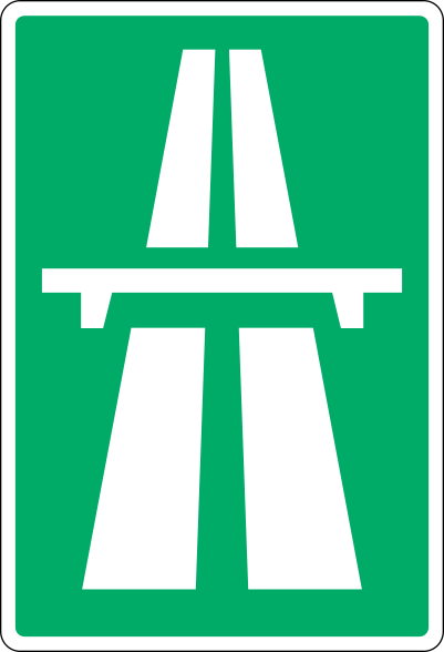
English • Traffic sign E 42 • Motorway. Marks a section where the special motorway and motorway entry/exit-road rules apply under sections 44–47 of the Road Traffic Act.
Dansk • Tavle E 42 • Motorvej. Tavlen angiver vejstrækning, hvor de særlige regler om kørsel på motorvej og til- og frakørselsveje til motorvej gælder, jf. færdselslovens §§ 44-47.
Sources
🔗 Commons.wikimedia.org
🔗 Retsinformation.dk • Bekendtgørelse nr. 425/2023, § 27
SVG source: Gigillo83, drawn by original of Vejdirektoratet • Public domain • Original revision 2013-08-06. Wikimedia original unmodified.
103. End of the motorway
This traffic sign indicates the end of the motorway. The special motorway rules end at this point. Follow the speed limits, access rules and other traffic signs that apply to the road ahead.
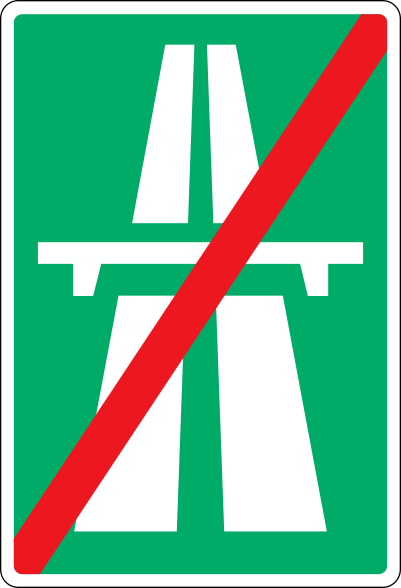
English • Traffic sign E 44 • End of motorway. Normally not used where exit roads join the ordinary road network.
Dansk • Tavle E 44 • Motorvej ophører. Tavlen anvendes normalt ikke ved frakørslers tilslutning til det almindelige vejnet.
Sources
🔗 Commons.wikimedia.org
🔗 Retsinformation.dk • Bekendtgørelse nr. 425/2023, § 27
SVG source: Gigillo83, drawn by original of Vejdirektoratet • Public domain • Original revision 2013-08-06. Wikimedia original unmodified.
104. Start of an expressway
This traffic sign indicates the start of an expressway. From this point, the traffic rules and access conditions that apply to expressways take effect according to the applicable local regulations.
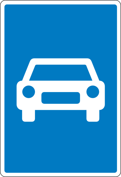
English • Traffic sign E 43 • Expressway. Marks a section where the special expressway and expressway entry/exit-road rules apply under section 48 of the Road Traffic Act.
Dansk • Tavle E 43 • Motortrafikvej. Tavlen angiver vejstrækning, hvor de særlige regler om kørsel på motortrafikvej og til- og frakørselsveje til motortrafikvej gælder, jf. færdselslovens § 48.
Sources
🔗 Commons.wikimedia.org
🔗 Retsinformation.dk • Bekendtgørelse nr. 425/2023, § 27
SVG source: Gigillo83, drawn by original of Vejdirektoratet • Public domain • Original revision 2013-06-11. Wikimedia original unmodified.
105. End of the expressway
This traffic sign indicates the end of the expressway. The special traffic rules associated with the expressway end at this point. Follow the rules and traffic signs that apply to the road ahead.
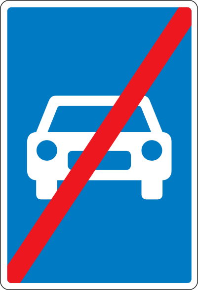
English • Traffic sign E 45 • End of expressway. Normally not used on roads crossing an expressway or where exit roads join the ordinary road network.
Dansk • Tavle E 45 • Motortrafikvej ophører. Tavlen anvendes normalt ikke på veje, der krydser motortrafikvej eller ved frakørslers tilslutning til det almindelige vejnet.
Sources
🔗 Commons.wikimedia.org
🔗 Retsinformation.dk • Bekendtgørelse nr. 425/2023, § 27
SVG source: Gigillo83, drawn by original of Vejdirektoratet • Public domain • Original revision 2013-06-11. Wikimedia original unmodified.
106. Start of a residential area
This traffic sign indicates the start of a residential area. Special traffic rules apply within the area according to the applicable signs and local regulations. These rules may affect speed, parking and how different road users use the road.
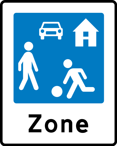
English • Traffic sign E 51 • Residential area for staying and playing. Special rules apply: 1) People may stay and play across the road's full width. 2) Driving is permitted only at very low speed, normally below 15 km/h. 3) Drivers must show particular care and consideration towards pedestrians and give way where their paths cross. 4) If people staying or playing on the road could come dangerously close to the passing vehicle, the driver must ensure they are aware of it and have made room before proceeding; they must not unnecessarily obstruct drivers. 5) Parking is permitted only in specially marked places, except for bicycles, mopeds and two-wheeled motorcycles. 6) Drivers must give way when leaving the area. May be used with plates U 1, U 2 or U 6 for advance warning.
Dansk • Tavle E 51 • Opholds- og legeområde. Tavlen angiver et område, hvor følgende særlige færdselsregler gælder: 1) Det er tilladt at opholde sig og lege på vejen i hele dens bredde. 2) Kørsel i området må kun ske med meget lav hastighed (normalt under 15 km/h). 3) De kørende skal udvise særlig agtpågivenhed og hensynsfuldhed over for gående. Hvor kørendes færdselsretning skærer gåendes, skal de kørende holde tilbage for de gående. 4) Når der på vejen opholder sig eller leger personer, der kan komme i farlig nærhed af køretøjet under dettes passage, må kørslen ikke fortsættes, forinden føreren har sikret sig, at disse personer er opmærksomme på køretøjet og har givet plads for passage. Sådanne personer må dog ikke unødigt hindre de kørende i at komme frem. 5) Parkering i opholds- og legeområder må ikke ske uden for særligt afmærkede pladser. Dette gælder dog ikke cykler, knallerter og tohjulede motorcykler. 6) Kørende har ubetinget vigepligt ved udkørsel fra et opholds- og legeområde. Tavlen kan anvendes med undertavlerne U 1, U 2 eller U 6 til forvarsling.
Sources
🔗 Commons.wikimedia.org
🔗 Retsinformation.dk • Bekendtgørelse nr. 425/2023, § 27
SVG source: Gigillo83, drawn by original of Vejdirektoratet • Public domain • Original revision 2022-11-27. Wikimedia original unmodified.
107. End of the residential area
This traffic sign indicates the end of the residential area. The special traffic rules associated with the residential area end at this point. Follow the traffic signs and rules that apply beyond the area.
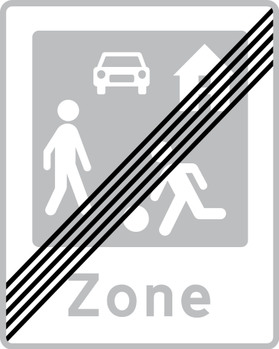
English • Traffic sign E 52 • End of residential area for staying and playing.
Dansk • Tavle E 52 • Ophør af opholds- og legeområde.
Sources
🔗 Commons.wikimedia.org
🔗 Retsinformation.dk • Bekendtgørelse nr. 425/2023, § 27
SVG source: Gigillo83, drawn by original of Vejdirektoratet • Public domain • Original revision 2022-11-27. Wikimedia original unmodified.
108. Start of a zone for pedestrians
This traffic sign indicates the start of a pedestrian zone. Pedestrians are the principal road users within the zone, while access by vehicles and other road users is subject to the applicable traffic signs and local rules.
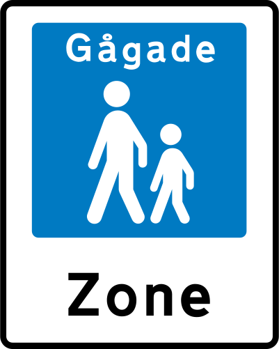
English • Traffic sign E 49 • Pedestrian street. Special rules apply: 1) Reserved for pedestrians. 2) Driving may be permitted, subject to points 4–8. 3) Permission is shown on a supplementary plate under section 18(3), points 2–5, or by ‘Driving permitted’ or plates permitting specified road users; times may be limited under section 9, U 3. 4) Driving is permitted only at very low speed, normally below 15 km/h. 5) Drivers must show particular care and consideration towards pedestrians under section 27(3) of the Road Traffic Act. 6) If pedestrians could come dangerously close to the passing vehicle, the driver must ensure they are aware of it and have made room before proceeding; they must not unnecessarily obstruct drivers. 7) Parking is permitted only in specially marked places, except for bicycles, mopeds and two-wheeled motorcycles. 8) Drivers must give way when leaving under section 26(3) of the Road Traffic Act. May be used with plates U 1, U 2 or U 6 for advance warning.
Dansk • Tavle E 49 • Gågade. Tavlen angiver et område, hvor følgende særlige færdselsregler gælder: 1) Området er reserveret til gående. 2) Tilladelse til kørsel i området kan gives. I så fald skal kørsel ske under iagttagelse af bestemmelserne i punkterne 4-8. 3) Eventuel tilladelse til kørsel angives på undertavle som anført i § 18, stk. 3, punkterne 2-5. Desuden kan anvendes undertavlen »Kørsel tilladt« eller andre undertavler, der tillader kørsel med bestemte færdselsarter. Tilladelse på undertavle kan afgrænses tidsmæssigt, jf. § 9, tavle U 3. 4) Kørsel i området må kun ske med meget lav hastighed (normalt under 15 km/h). 5) De kørende skal udvise særlig agtpågivenhed og hensynsfuldhed over for gående, jf. færdselslovens § 27, stk. 3. 6) Når der på vejen færdes personer, der kan komme i farlig nærhed af køretøjet under dettes passage, må kørslen ikke fortsættes, forinden føreren har sikret sig, at disse personer er opmærksomme på køretøjet og har givet plads for passage. Sådanne personer må dog ikke unødigt hindre de kørende i at komme frem. 7) Parkering i en gågade må ikke ske uden for særligt afmærkede pladser. Dette gælder dog ikke cykler, knallerter og tohjulede motorcykler. 8) Kørende har ubetinget vigepligt ved udkørsel fra en gågade, jf. færdselslovens § 26, stk. 3. Tavlen kan anvendes med undertavlerne U 1, U 2 eller U 6 til forvarsling.
Sources
🔗 Commons.wikimedia.org
🔗 Retsinformation.dk • Bekendtgørelse nr. 425/2023, § 27
SVG source: Gigillo83, drawn by original of Vejdirektoratet • Public domain • Original revision 2013-06-11. Wikimedia original unmodified.
109. End of the zone for pedestrians
This traffic sign indicates the end of the pedestrian zone. The special traffic rules associated with the pedestrian zone end at this point. Follow the traffic signs and rules that apply beyond the zone.
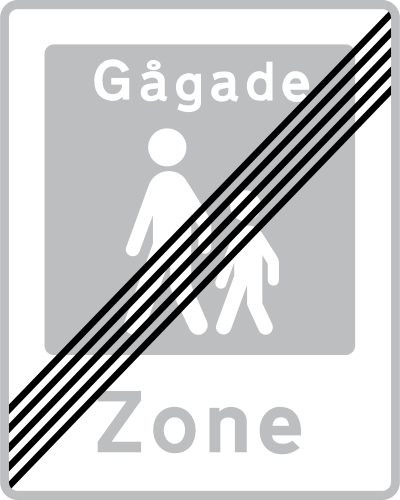
English • Traffic sign E 50 • End of pedestrian street.
Dansk • Tavle E 50 • Ophør af gågade.
Sources
🔗 Commons.wikimedia.org
🔗 Retsinformation.dk • Bekendtgørelse nr. 425/2023, § 27
SVG source: Gigillo83, drawn by original of Vejdirektoratet • Public domain • Original revision 2013-06-11. Wikimedia original unmodified.
110. National speed limits
This traffic sign indicates the national speed limits. The applicable default maximum speeds depend on the road type, vehicle category and local traffic rules when no different speed limit is indicated.
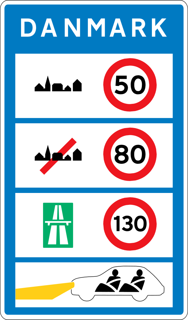
English • Traffic sign E 80 • General speed limits. Shows the general speed limits applying in the country.
Dansk • Tavle E 80 • Generelle hastighedsbegrænsninger. Tavlen angiver de generelle hastighedsbegrænsninger, som gælder i landet.
Sources
🔗 Commons.wikimedia.org
🔗 Retsinformation.dk • Bekendtgørelse nr. 425/2023, § 27
SVG source: Gigillo83, drawn by original of Vejdirektoratet • Public domain • Original revision 2013-08-06. Wikimedia original unmodified.
111. Advisory speed limit
This traffic sign indicates an advisory speed. The displayed value recommends an appropriate speed for the road or conditions ahead. Its legal effect depends on the applicable local rules.
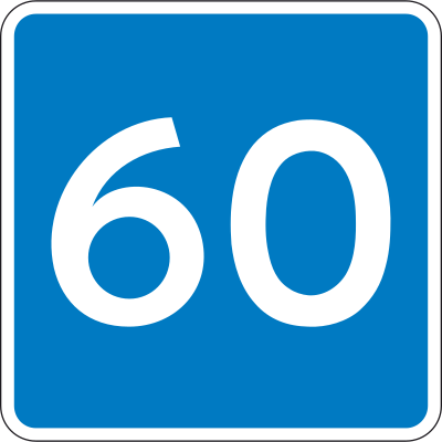
English • Traffic sign E 39 • Recommended speed. Indicates that the road is unsuitable for speeds above the value shown. Applies until ended by E 40 or a distance on a supplementary plate.
Dansk • Tavle E 39 • Anbefalet hastighed. Tavlen angiver, at vejen ikke er egnet til kørsel med højere hastighed end den angivne. Anbefalingen gælder indtil den ophæves med tavle E 40 eller ved afstandsangivelse på undertavle.
Sources
🔗 Commons.wikimedia.org
🔗 Retsinformation.dk • Bekendtgørelse nr. 425/2023, § 27
SVG source: Gigillo83, drawn by original of Vejdirektoratet • Public domain • Original revision 2013-06-11. Wikimedia original unmodified.
112. End of the advisory speed limit
This traffic sign indicates the end of the advisory speed. The preceding speed recommendation ends at this point. Continue according to the applicable speed limits and road conditions.
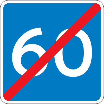
English • Traffic sign E 40 • End of recommended speed.
Dansk • Tavle E 40 • Anbefalet hastighed ophører.
Sources
🔗 Commons.wikimedia.org
🔗 Retsinformation.dk • Bekendtgørelse nr. 425/2023, § 27
SVG source: Gigillo83, drawn by original of Vejdirektoratet • Public domain • Original revision 2013-06-11. Wikimedia original unmodified.
113. Crossing for pedestrians
This traffic sign indicates a crossing for pedestrians. It marks a designated place where pedestrians cross the road. Priority and crossing rules depend on the applicable traffic signs, signals and local regulations.
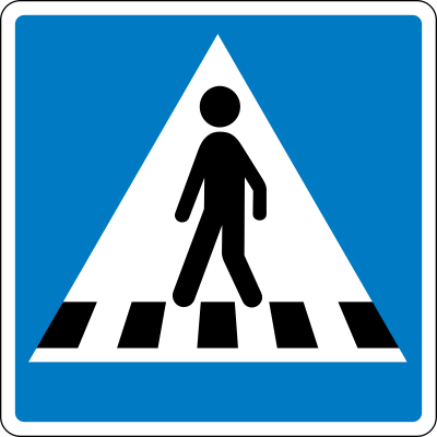
English • Traffic sign E 17 • Pedestrian crossing.
Dansk • Tavle E 17 • Fodgængerfelt.
Sources
🔗 Commons.wikimedia.org
🔗 Retsinformation.dk • Bekendtgørelse nr. 425/2023, § 27
SVG source: Gigillo83, drawn by original of Vejdirektoratet • Public domain • Original revision 2013-06-11. Wikimedia original unmodified.
114. Road narrowing, oncoming drivers have to give way
This traffic sign indicates a road narrowing where oncoming drivers have to give way.
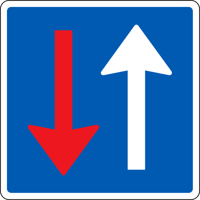
English • Traffic sign B 19 • Oncoming traffic must give way.
Dansk • Tavle B 19 • Modkørende færdsel skal holde tilbage.
Sources
🔗 Commons.wikimedia.org
🔗 Retsinformation.dk • Bekendtgørelse nr. 425/2023, § 16
SVG source: Gigillo83, drawn by original of Vejdirektoratet • Public domain • Original revision 2013-06-05. Wikimedia original unmodified.
115. Dead end street
This traffic sign indicates a dead end street. The road has no through route for vehicles, although access to properties or other destinations along the road may still be possible.
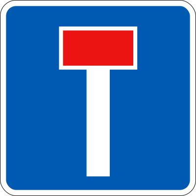
English • Traffic sign E 18 • Dead-end road. A thin white line may show that the road continues as a path.
Dansk • Tavle E 18 • Blind vej. Med tynd hvid streg kan angives, at vejen fortsætter i en sti.
Sources
🔗 Commons.wikimedia.org
🔗 Retsinformation.dk • Bekendtgørelse nr. 425/2023, § 27
SVG source: Vejdirektoratet • Public domain • Original revision 2022-09-29. Wikimedia original unmodified.
116. Dead end street with a passage for cyclists
This traffic sign indicates a dead end street with a passage for cyclists. The road has no through route for motor vehicles, but cyclists can continue beyond the dead end.
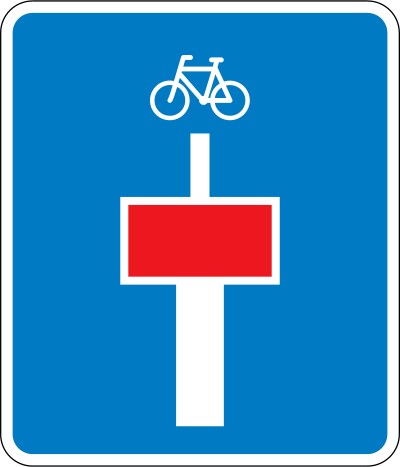
English • Traffic sign E 18 • Dead-end road. A thin white line may show that the road continues as a path.
Dansk • Tavle E 18 • Blind vej. Med tynd hvid streg kan angives, at vejen fortsætter i en sti.
Sources
🔗 Commons.wikimedia.org
🔗 Retsinformation.dk • Bekendtgørelse nr. 425/2023, § 27
SVG source: Gigillo83, drawn by original of Vejdirektoratet • Public domain • Original revision 2013-06-11. Wikimedia original unmodified.
117. General information about the directions
This traffic sign gives general information about road directions. The arrows, destinations and route information show which direction to follow.
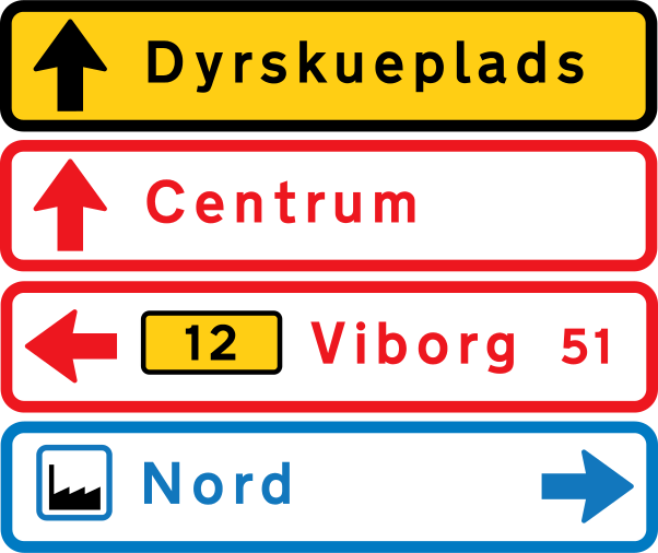
English • Traffic sign F 14 • Temporary arrow direction sign. Traffic sign F 11 • White/red arrow direction sign for geographical destinations, ports, airports and similar destinations reached without using a motorway. Traffic sign F 13 • White/blue arrow direction sign for services, including transport terminals, commercial attractions, sights, service facilities, accommodation, businesses and similar destinations.
Dansk • Tavle F 14 • Midlertidig pilvejviser. Tavle F 11 • Hvid/rød pilvejviser. Pilvejviser til geografiske mål samt til havne, lufthavne og lignende, hvor der ikke køres ad motorvej. Tavle F 13 • Hvid/blå pilvejviser. Pilvejviser til servicevejvisning, herunder terminalmål eller kommercielle attraktioner, seværdighed, serviceanlæg, overnatningsmål, virksomheder og lignende.
Sources
🔗 Commons.wikimedia.org
🔗 Retsinformation.dk • Bekendtgørelse nr. 425/2023, § 34
SVG source: Gigillo83, drawn by original of Vejdirektoratet • Public domain • Original revision 2013-07-23. Wikimedia original unmodified.
118. Information about the directions of the roundabout
This traffic sign gives information about directions at a roundabout. The diagram shows the available exits and the destinations reached from them.
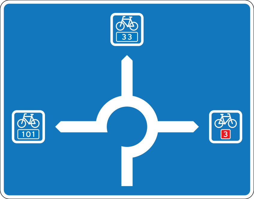
English • Traffic sign F 21,4 • Path diagram sign.
Dansk • Tavle F 21,4 • Stidiagramtavle.
Sources
🔗 Commons.wikimedia.org
🔗 Retsinformation.dk • Bekendtgørelse nr. 425/2023, § 34
SVG source: Gigillo83, drawn by original of Vejdirektoratet • Public domain • Original revision 2013-07-23. Wikimedia original unmodified.
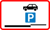
119. Parking allowed
This traffic sign indicates that parking is allowed. Vehicles may be parked in the area covered by the sign subject to any indicated conditions, restrictions or local parking rules.
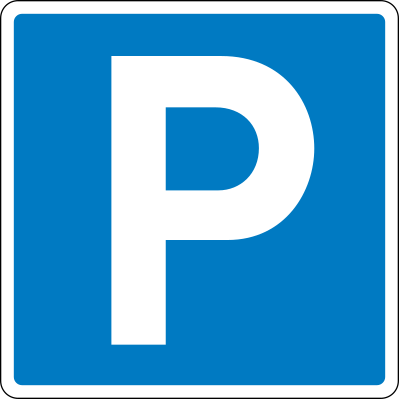
English • Traffic sign E 33 • Parking. Marks an area intended for parking. On a zone sign, E 33 indicates only restrictions on parking in the area. A roof symbol indicates indoor parking. Direction, distance, restrictions or exemptions may appear on the sign or a supplementary plate. For marked bays, see section 60, T 33. Where an unmarked parking area lies on the carriageway, plates UE 33,1–33,4 indicate its extent. The parking provisions in section 19 for C 61–62, UC 33 and UC 61–62 also apply. With plate E 23 for disabled users, stopping and parking are reserved for vehicles displaying a permit issued under section 88 a of the Road Traffic Act. A general restriction on particular vehicles may be lifted locally by a plate showing their symbols with ‘Permitted’. A black plate may refer to privately administered parking rules.
Dansk • Tavle E 33 • Parkering. Tavlen angiver areal, som er beregnet til parkering. På zonetavle anvendes E 33-tavlen alene til at angive begrænsninger i adgangen til at parkere i området. Et vinkelformet tagsymbol over symbolet tilkendegiver, at det drejer sig om indendørs parkering. Retning og/eller afstand til parkeringsplads og begrænsninger eller lempelser i adgangen til at parkere kan angives enten på selve tavlen eller på undertavle. Vedrørende parkering i bås, se § 60, T 33 Parkeringsbås. Ligger parkeringsarealet på kørebanen uden at være afmærket på denne, angives parkeringsarealets udstrækning på kørebanen med undertavlerne UE 33,1-33,4. Endvidere gælder bestemmelsen om parkering på samme måde, som anført i § 19 vedrørende C 61-62, UC 33 og UC 61-62. Hvor E 33 suppleres med undertavle E 23 Vejledning for invalide, angiver dette, at parkeringsarealet kun må benyttes til standsning og parkering af køretøjer, som er forsynet med en i medfør af færdselslovens § 88 a udstedt tilladelse. I områder, hvor der findes en generel parkeringsbegrænsning for visse køretøjer, kan denne parkeringsbegrænsning lokalt ophæves ved at supplere E 33 med en undertavle, der viser symbolet for de aktuelle køretøjer med »Tilladt« under symbolerne. Med sort undertavle kan henvises til regler for privatadministrerede parkeringsordninger.
Sources
🔗 Commons.wikimedia.org
🔗 Retsinformation.dk • Bekendtgørelse nr. 425/2023, § 27
SVG source: Gigillo83, drawn by original of Vejdirektoratet • Public domain • Original revision 2013-06-11. Wikimedia original unmodified.
120. End of the parking zone
This traffic sign indicates the end of the parking zone. The parking rules associated with that zone end at this point. Other parking restrictions or conditions may still apply.
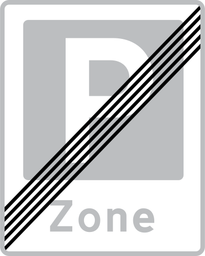
English • Traffic sign E 69 • End of zone.
Dansk • Tavle E 69 • Ophør af zone.
Sources
🔗 Commons.wikimedia.org
🔗 Retsinformation.dk • Bekendtgørelse nr. 425/2023, § 27
SVG source: Gigillo83, drawn by original of Vejdirektoratet • Public domain • Original revision 2013-06-11. Wikimedia original unmodified.
121. Section control
This traffic sign indicates section control, also called average-speed enforcement. A vehicle’s average speed is measured over a defined section of road and compared with the applicable speed limit.

English • Traffic sign E 90 • Automatic traffic enforcement. Indicates that automatic traffic enforcement may be in operation.
Dansk • Tavle E 90 • Automatisk trafikkontrol. Tavlen angiver, at der kan være automatisk trafikkontrol (ATK).
Sources
🔗 Commons.wikimedia.org
🔗 Retsinformation.dk • Bekendtgørelse nr. 425/2023, § 27
SVG source: Gigillo83, drawn by original of Vejdirektoratet • Public domain • Original revision 2013-06-11. Wikimedia original unmodified.
122. For trucks
This supplementary sign indicates that the main traffic sign applies specifically to trucks. The truck categories covered depend on the applicable local definitions.
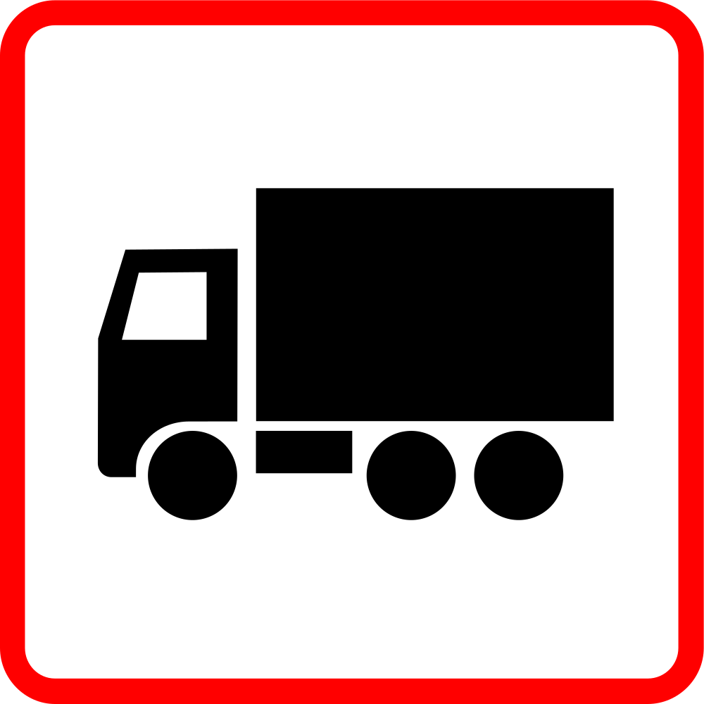
English • Supplementary plate U 4 • The main sign applies only to specified road-user categories. Symbol US 2 • Lorry with any attached trailer.
Dansk • Undertavle U 4. Hovedtavlens angivelse gælder kun for bestemte færdselsarter. Symbol US 2. Lastbil samt eventuelt tilkoblet påhængskøretøj.
Sources
🔗 Commons.wikimedia.org
🔗 Retsinformation.dk • Bekendtgørelse nr. 425/2023, § 9
🔗 Retsinformation.dk • Bekendtgørelse nr. 425/2023, § 9
SVG source: Bewitchedroutine • Public domain • Original revision 2024-03-26. Wikimedia original unmodified.
123. Cyclists allowed
This supplementary sign indicates that cyclists are allowed where the main traffic sign would otherwise restrict their access or use.
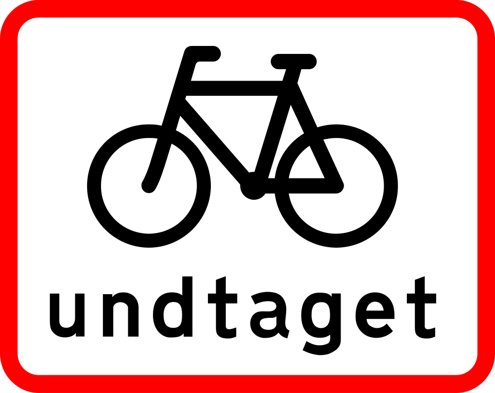
English • Supplementary plate U 5 • The main sign or traffic signal does not apply to the indicated category. Symbol US 8 • Bicycle and small moped.
Dansk • Undertavle U 5. Hovedtavlens angivelse eller signalets visning gælder ikke for den angivne færdselsart. Symbol US 8. Cykel og lille knallert.
Sources
🔗 Commons.wikimedia.org
🔗 Retsinformation.dk • Bekendtgørelse nr. 425/2023, § 9
🔗 Retsinformation.dk • Bekendtgørelse nr. 425/2023, § 9
SVG source: Bewitchedroutine • Public domain • Original revision 2024-03-26. Wikimedia original unmodified.
124. Cyclists allowed to turn
This supplementary sign indicates that cyclists are allowed to make the indicated turn even where the main traffic sign restricts that movement for other traffic.
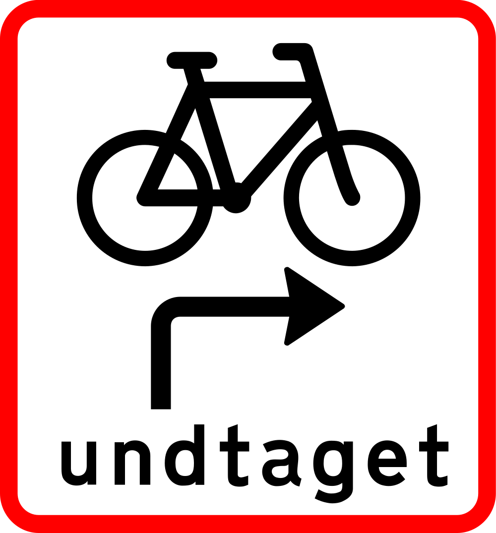
English • Supplementary plate U 7 • Signals X 11 main signal, X 12 arrow signal and X 16 cycle signal without a separate right-arrow signal do not apply to the indicated category. Symbol US 8 • Bicycle and small moped.
Dansk • Undertavle U 7. Lyssignalernes visning på X 11 Hovedsignal, X 12 Pilsignal og X 16 Cyklistsignal uden separat pilsignal mod højre gælder ikke for den angivne færdselsart. Symbol US 8. Cykel og lille knallert.
Sources
🔗 Commons.wikimedia.org
🔗 Retsinformation.dk • Bekendtgørelse nr. 425/2023, § 9
SVG source: Bewitchedroutine • Public domain • Original revision 2024-03-26. Wikimedia original unmodified.
125. Delivery vehicles allowed
This supplementary sign indicates that delivery vehicles are allowed where the main traffic sign would otherwise restrict their access, use or parking. The vehicles and activities covered depend on the applicable local rules.
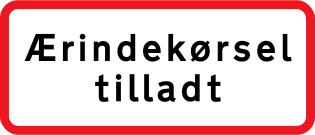
English • Undertavle • Access for errands permitted. Covers journeys on one's own or another's behalf for deliveries, collections, work, shopping, visits and similar purposes, including associated parking. Travel to and from one's own home or business also counts as access for errands.
Dansk • Undertavle • Ærindekørsel tilladt. Ved ærindekørsel forstås kørsel på egne eller andres vegne i forbindelse med aflevering, afhentning, arbejde, indkøb, gæstebud og lignende samt parkering i denne forbindelse. Kørsel til og fra egen bolig og egen erhvervsvirksomhed anses også for ærindekørsel.
Sources
🔗 Commons.wikimedia.org
🔗 Retsinformation.dk • Bekendtgørelse nr. 425/2023, § 18, stk. 3, nr. 2
Image via Commons.wikimedia.org
Vejdirektoratet • Public domain • Source revision 2022-09-28. Wikimedia original unmodified.
126. Cyclists from both directions
This supplementary sign indicates that cyclists may approach from both directions on the road or cycle path concerned by the main sign.
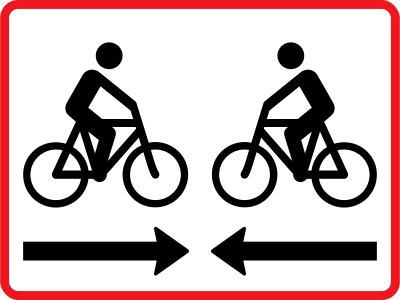
English • Supplementary plate UB 11,2 • Two-way cycle path. Indicates a cycle path on the intersecting road where travel is permitted in both directions. May be used below B 11 and B 13.
Dansk • Undertavle UB 11,2 • Dobbeltrettet cykelsti. Undertavlen angiver, at der på den krydsende vej er anlagt cykelsti, hvor færdsel i begge retninger er tilladt. Tavlen kan bruges under tavlerne B 11 og B 13.
Sources
🔗 Commons.wikimedia.org
🔗 Retsinformation.dk • Bekendtgørelse nr. 425/2023, § 16
SVG source: Vejdirektoratet • Public domain • Original revision 2022-09-20. Wikimedia original unmodified.
127. Trams from both directions
This supplementary sign indicates that trams may approach from both directions on the track or road concerned by the main sign.
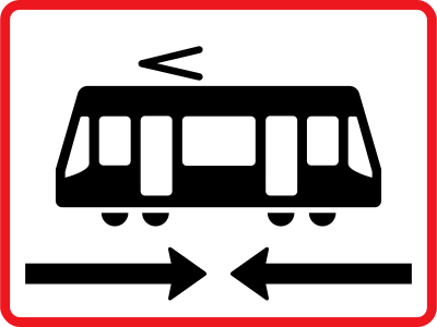
English • Supplementary plate UB 11,3 • Light rail. Indicates light rail tracks on the intersecting road where light rail vehicles may travel in both directions. May be used below B 11.
Dansk • Undertavle UB 11,3 • Letbane. Undertavlen angiver, at der på den krydsende vej er anlagt letbane, hvor færdsel med letbanekøretøjer i begge retninger er tilladt. Tavlen kan bruges under tavlen B 11.
Sources
🔗 Commons.wikimedia.org
🔗 Retsinformation.dk • Bekendtgørelse nr. 425/2023, § 16
SVG source: Vejdirektoratet • Public domain • Original revision 2022-09-20. Wikimedia original unmodified.
128. Trains from both directions
This supplementary sign indicates that trains may approach from both directions on the railway tracks concerned by the main sign.
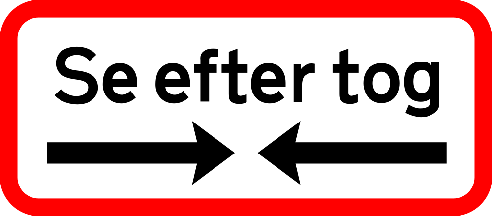
English • Supplementary plate UA 72 • Look for trains. Used at level crossings protected only by signs, possibly with a visibility area. Placed below both A 72 and A 74. Must not be used where the crossing has B 13 ‘Stop’.
Dansk • Undertavle UA 72 • Se efter tog. Undertavlen bruges ved jernbaneoverkørsler, der alene er sikret ved afmærkning eventuelt med oversigtsareal. Tavlen opsættes både som undertavle til A 72 og til A 74. Tavlen må ikke bruges, hvis jernbaneoverkørslen er afmærket med B 13 Stop.
Sources
🔗 Commons.wikimedia.org
🔗 Retsinformation.dk • Bekendtgørelse nr. 425/2023, § 13
SVG source: Bewitchedroutine • Public domain • Original revision 2024-03-13. Wikimedia original unmodified.
129. Traffic in both directions
This supplementary sign indicates that traffic travels in both directions on the road or lane concerned by the main sign.

English • Supplementary plate UD 21,1 • Two-way cycle traffic. Indicates that the cycle path carries traffic in both directions.
Dansk • Undertavle UD 21,1 • Dobbeltrettet cykeltrafik. Undertavlen angiver, at cykelstien har trafik i begge retninger.
Sources
🔗 Commons.wikimedia.org
🔗 Retsinformation.dk • Bekendtgørelse nr. 425/2023, § 23
SVG source: Bewitchedroutine • Public domain • Original revision 2024-03-18. Wikimedia original unmodified.
130. End of traffic in both directions
This supplementary sign indicates the end of the section with traffic in both directions. The preceding two-way traffic arrangement ends at this point.

English • Supplementary plate UD 21,2 • End of two-way cycle traffic. Indicates that the cycle path no longer carries traffic in both directions.
Dansk • Undertavle UD 21,2 • Dobbeltrettet cykeltrafik ophører. Undertavlen angiver, at cykelstien ikke længere har trafik i begge retninger.
Sources
🔗 Commons.wikimedia.org
🔗 Retsinformation.dk • Bekendtgørelse nr. 425/2023, § 23
SVG source: Bewitchedroutine • Public domain • Original revision 2024-03-18. Wikimedia original unmodified.
131. Start of regulation
This supplementary sign indicates the start of the regulation shown by the main traffic sign. The regulation begins at this point.
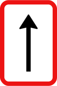
English • Supplementary plate UC 60,2 • UC 60,2 indicates that the restriction begins at the sign.
Dansk • Undertavle UC 60,2. UC 60,2 angiver, at restriktionen begynder ved tavlen.
Sources
🔗 Commons.wikimedia.org
🔗 Retsinformation.dk • Bekendtgørelse nr. 425/2023, § 19
SVG source: Vejdirektoratet • Public domain • Original revision 2022-09-28. Wikimedia original unmodified.
132. Continuation of regulation
This supplementary sign indicates the continuation or reminder of the regulation shown by the main traffic sign.
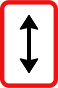
English • Supplementary plate UC 60,1 • UC 60,1 indicates that the restriction applies both before and after the sign.
Dansk • Undertavle UC 60,1. UC 60,1 angiver, at restriktionen gælder både før og efter tavlen.
Sources
🔗 Commons.wikimedia.org
🔗 Retsinformation.dk • Bekendtgørelse nr. 425/2023, § 19
SVG source: Vejdirektoratet • Public domain • Original revision 2022-09-28. Wikimedia original unmodified.
133. End of regulation
This supplementary sign indicates the end of the regulation shown by the main traffic sign. The regulation ends at this point.
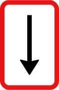
English • Supplementary plate UC 60,3 • UC 60,3 indicates that the restriction ends at the sign.
Dansk • Undertavle UC 60,3. UC 60,3 angiver, at restriktionen ophører ved tavlen.
Sources
🔗 Commons.wikimedia.org
🔗 Retsinformation.dk • Bekendtgørelse nr. 425/2023, § 19
SVG source: Vejdirektoratet • Public domain • Original revision 2022-09-28. Wikimedia original unmodified.
134. Applies after a right turn
This supplementary sign indicates that the main traffic sign applies after turning right.

English • Supplementary plate U 6 • The main sign applies to an adjoining road.
Dansk • Undertavle U 6. Hovedtavlens angivelse gælder en tilstødende vej.
Sources
🔗 Commons.wikimedia.org
🔗 Retsinformation.dk • Bekendtgørelse nr. 425/2023, § 9
SVG source: Bewitchedroutine • Public domain • Original revision 2024-03-26. Wikimedia original unmodified.
135. metres ahead
This supplementary sign indicates the distance from the main traffic sign to the point where the indicated danger, regulation or information begins. The distance is shown in metres.
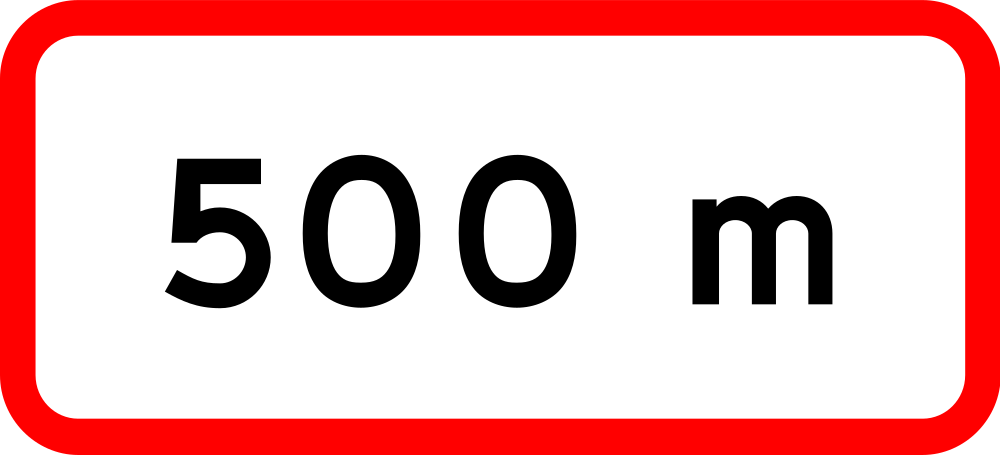
English • Supplementary plate U 1 • Distance to the point on the road from which the main sign applies.
Dansk • Undertavle U 1. Afstanden til det sted på vejen, hvorfra hovedtavlens angivelse gælder.
Sources
🔗 Commons.wikimedia.org
🔗 Retsinformation.dk • Bekendtgørelse nr. 425/2023, § 9
SVG source: Bewitchedroutine • Public domain • Original revision 2024-03-26. Wikimedia original unmodified.
136. Stop metres ahead
This supplementary sign announces a STOP sign at the indicated distance ahead. The displayed value shows the distance to the upcoming STOP sign.
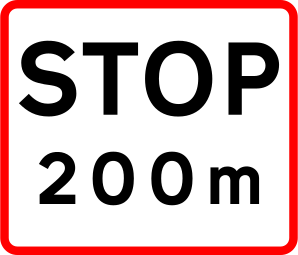
English • Supplementary plate UB 11,1 • Advance warning of Stop. With B 11, warns of a stop requirement at a junction and shows the distance to it. With A 72 ‘Level crossing without barriers’, warns of a stop requirement at the crossing and shows the distance to the track.
Dansk • Undertavle UB 11,1 • Forvarsling for stop. Undertavlen bruges i forbindelse med B 11 til forvarsling for stop ved kryds. Afstanden til krydset angives på undertavlen. Undertavlen bruges ved A 72 Jernbaneoverkørsel uden bomme til forvarsling for stop ved jernbaneoverkørsel. Afstanden til sporet angives på undertavlen.
Sources
🔗 Commons.wikimedia.org
🔗 Retsinformation.dk • Bekendtgørelse nr. 425/2023, § 16
SVG source: Bewitchedroutine • Public domain • Original revision 2024-03-18. Wikimedia original unmodified.
137. metres ahead for metres
This supplementary sign indicates the distance to the beginning of the section concerned by the main traffic sign and the length of that section. Both distances are shown in metres.
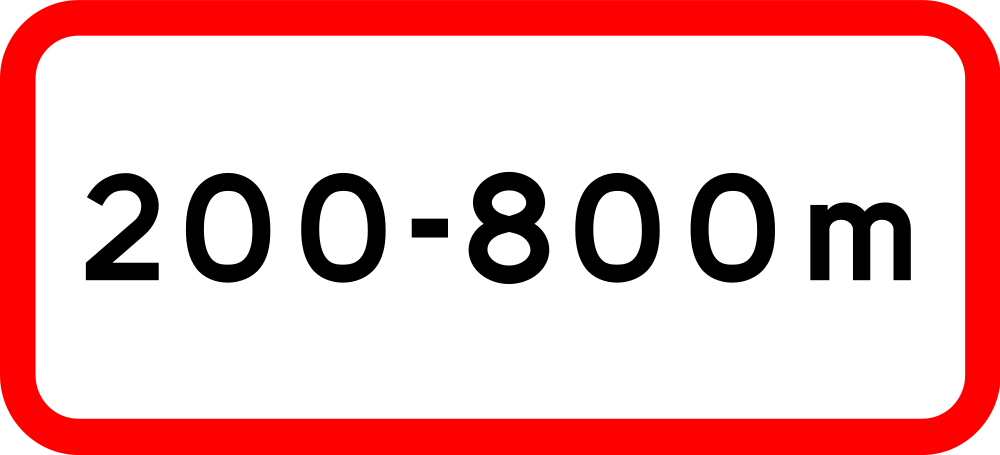
English • Supplementary plate U 2 • The main sign applies over a road section. The figures give the distances from the plate to the section's beginning and end.
Dansk • Undertavle U 2. Hovedtavlens angivelse gælder for en vejstrækning. Tallene angiver afstanden fra tavlen til vejstrækningens begyndelse og slutning.
Sources
🔗 Commons.wikimedia.org
🔗 Retsinformation.dk • Bekendtgørelse nr. 425/2023, § 9
SVG source: Bewitchedroutine • Public domain • Original revision 2024-03-26. Wikimedia original unmodified.
138. Overhead electric cable clearance
This supplementary sign indicates the clearance beneath overhead electric cables. The indicated height is relevant to vehicles or loads approaching the cables.
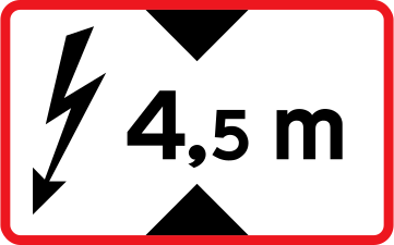
English • Supplementary plate UA 73 • Electrified railway warning. Used where live wires cross the level crossing. The indicated height is the safe clearance beneath them. May be suspended independently above the carriageway immediately before the crossing.
Dansk • Undertavle UA 73 • Varsling af elektrificeret bane. Undertavlen bruges ved jernbaneoverkørsler, hvor der er strømførende ledninger i overkørslen. Afstanden på tavlen er den sikre frihøjde under strømførende ledninger. Undertavlen kan ophænges selvstændigt over kørebanen umiddelbart før en jernbaneoverkørsel.
Sources
🔗 Commons.wikimedia.org
🔗 Retsinformation.dk • Bekendtgørelse nr. 425/2023, § 13
SVG source: Vejdirektoratet • Public domain • Original revision 2022-09-22. Wikimedia original unmodified.
139. Indicated width
This supplementary sign shows an indicated vehicle width. Read it together with the main traffic sign to determine how the width value affects the applicable rule or restriction.
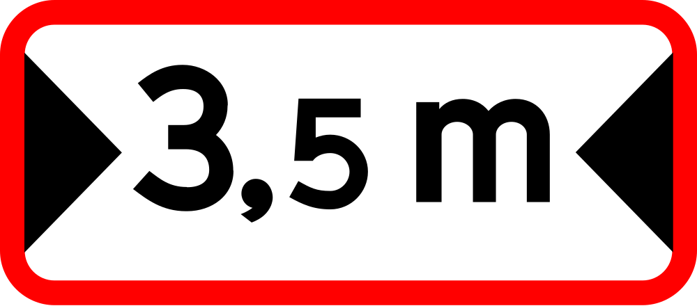
English • Supplementary plate UA 43 • Available width. Shows the clear width on the narrowed section.
Dansk • Undertavle UA 43 • Fri bredde. Undertavlen angiver den fri bredde på den indsnævrede strækning.
Sources
🔗 Commons.wikimedia.org
🔗 Retsinformation.dk • Bekendtgørelse nr. 425/2023, § 13
SVG source: Bewitchedroutine • Public domain • Original revision 2024-03-13. Wikimedia original unmodified.
140. Parking on shoulder allowed
This supplementary sign indicates that parking on the shoulder is allowed.
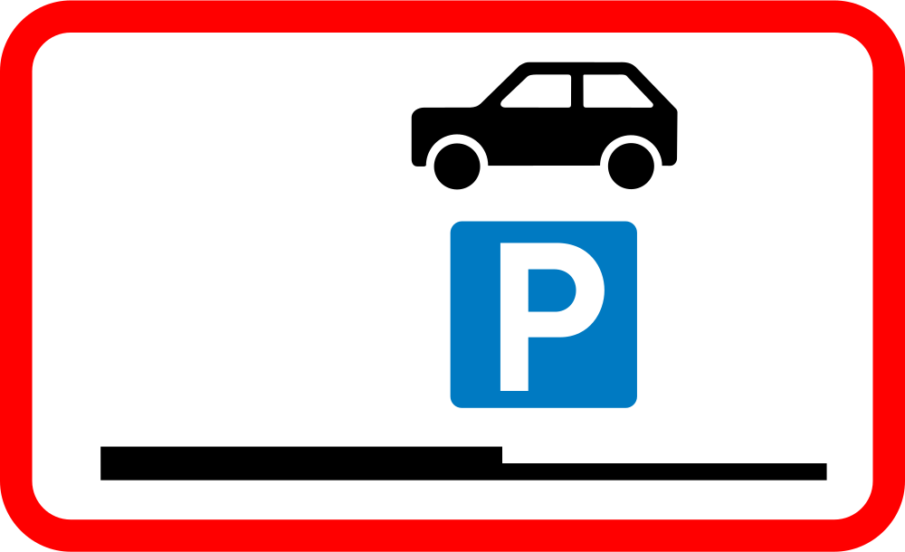
English • Supplementary plate UC 60,7 • Stopping and parking on the verge permitted. May be used as a main sign.
Dansk • Undertavle UC 60,7 • Standsning og parkering på rabat tilladt. Tavlen kan bruges som hovedtavle.
Sources
🔗 Commons.wikimedia.org
🔗 Retsinformation.dk • Bekendtgørelse nr. 425/2023, § 19
SVG source: Bewitchedroutine • Public domain • Original revision 2024-03-21. Wikimedia original unmodified.
141. Parking on pavement allowed
This supplementary sign indicates that parking on the pavement is allowed.
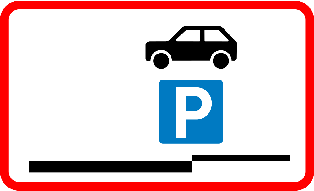
English • Supplementary plate UC 60,8 • Stopping and parking partly on the pavement permitted. May be used as a main sign.
Dansk • Undertavle UC 60,8 • Standsning og parkering med en del af køretøj på fortov tilladt. Tavlen kan bruges som hovedtavle.
Sources
🔗 Commons.wikimedia.org
🔗 Retsinformation.dk • Bekendtgørelse nr. 425/2023, § 19
SVG source: Bewitchedroutine • Public domain • Original revision 2024-03-21. Wikimedia original unmodified.
142. Parking on shoulder prohibited
This supplementary sign indicates that parking on the shoulder is prohibited.

English • Supplementary plate UC 60,6 • No parking on the verge. May be used as a main sign.
Dansk • Undertavle UC 60,6 • Parkering på rabat forbudt. Tavlen kan bruges som hovedtavle.
Sources
🔗 Commons.wikimedia.org
🔗 Retsinformation.dk • Bekendtgørelse nr. 425/2023, § 19
SVG source: Bewitchedroutine • Public domain • Original revision 2024-03-20. Wikimedia original unmodified.
143. Parking and stopping on shoulder prohibited
This supplementary sign indicates that parking and stopping on the shoulder are prohibited.

English • Supplementary plate UC 60,5 • No stopping on the verge. May be used as a main sign.
Dansk • Undertavle UC 60,5 • Standsning på rabat forbudt. Tavlen kan bruges som hovedtavle.
Sources
🔗 Commons.wikimedia.org
🔗 Retsinformation.dk • Bekendtgørelse nr. 425/2023, § 19
SVG source: Bewitchedroutine • Public domain • Original revision 2024-03-20. Wikimedia original unmodified.
144. Parking prohibited
This supplementary sign indicates that parking is prohibited where the restriction applies.
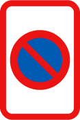
English • Supplementary plate UC 62 • UC 62 indicates no parking.
Dansk • Undertavle UC 62. UC 62 angiver parkeringsforbud.
Sources
🔗 Commons.wikimedia.org
🔗 Retsinformation.dk • Bekendtgørelse nr. 425/2023, § 19
SVG source: Vejdirektoratet • Public domain • Original revision 2022-09-27. Wikimedia original unmodified.
145. Parking and stopping prohibited
This supplementary sign indicates that parking and stopping are prohibited where the restriction applies.
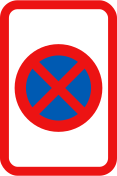
English • Supplementary plate UC 61 • UC 61 indicates no stopping.
Dansk • Undertavle UC 61. UC 61 angiver standsningsforbud.
Sources
🔗 Commons.wikimedia.org
🔗 Retsinformation.dk • Bekendtgørelse nr. 425/2023, § 19
SVG source: Vejdirektoratet • Public domain • Original revision 2022-09-27. Wikimedia original unmodified.
146. Parking limited to 1 hour
This supplementary sign indicates that parking is limited to a maximum of 1 hour.
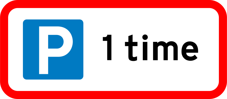
English • Supplementary plate UC 33 • UC 33 indicates limited parking permission.
Dansk • Undertavle UC 33. UC 33 angiver begrænset parkeringstilladelse.
Sources
🔗 Commons.wikimedia.org
🔗 Retsinformation.dk • Bekendtgørelse nr. 425/2023, § 19
SVG source: Bewitchedroutine • Public domain • Original revision 2024-03-19. Wikimedia original unmodified.
147. On Wednesdays
This supplementary sign indicates that the main traffic sign applies on Wednesdays.
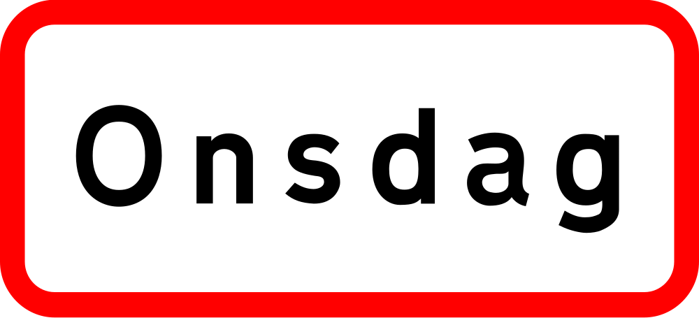
English • Supplementary plate U 3 • The main sign applies only for a stated number of hours or minutes, on specified weekdays or during specified hours. Black or white times apply on weekdays except Saturdays; bracketed times apply on Saturdays; red times apply on Sundays and public holidays.
Dansk • Undertavle U 3. Hovedtavlens angivelse gælder kun i et vist antal timer eller minutter, på visse ugedage eller inden for visse klokkeslæt. Klokkeslæt anført med sort eller hvidt gælder for hverdage undtagen lørdage, klokkeslæt anført i parentes gælder for lørdage, og klokkeslæt anført med rødt gælder for søn- og helligdage.
Sources
🔗 Commons.wikimedia.org
🔗 Retsinformation.dk • Bekendtgørelse nr. 425/2023, § 9
SVG source: Bewitchedroutine • Public domain • Original revision 2024-03-26. Wikimedia original unmodified.
148. At shown times on workdays, Saturdays, Sundays and holidays
This supplementary sign indicates that the main traffic sign applies during the indicated times on workdays, Saturdays, Sundays and public holidays.
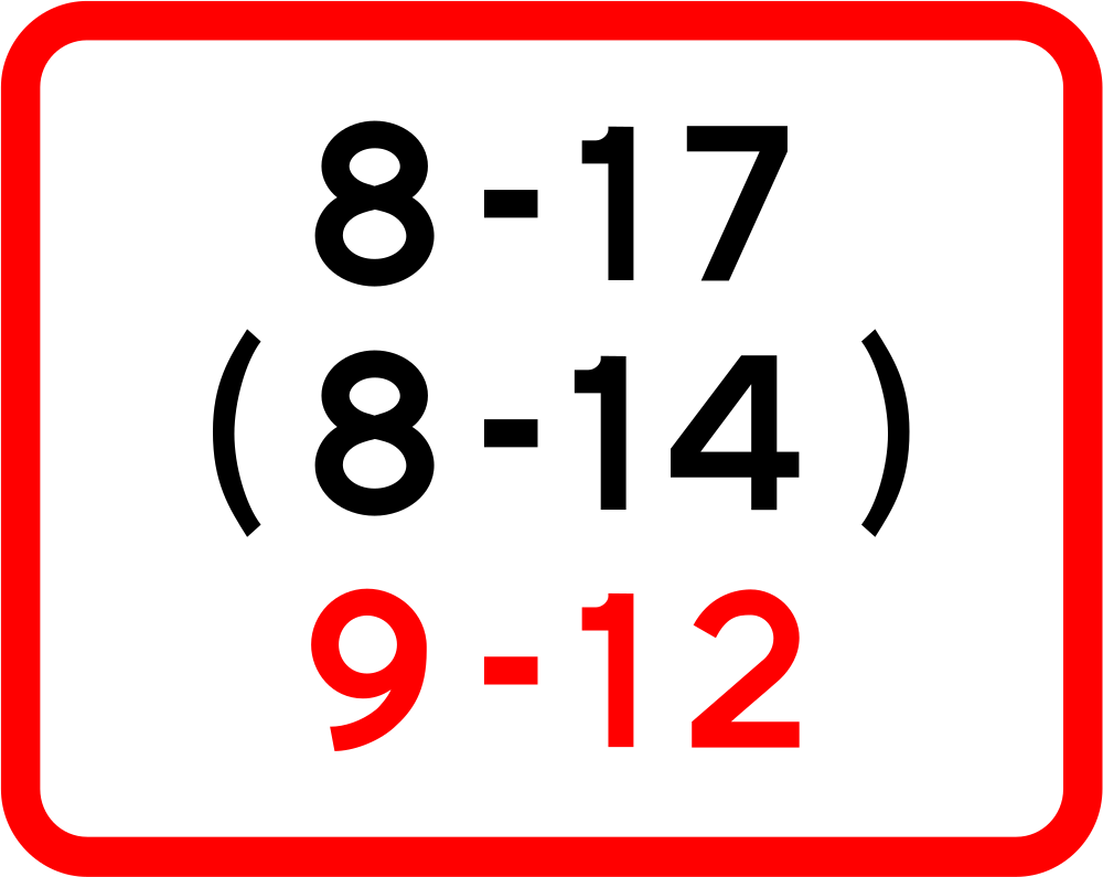
English • Supplementary plate U 3 • The main sign applies only for a stated number of hours or minutes, on specified weekdays or during specified hours. Black or white times apply on weekdays except Saturdays; bracketed times apply on Saturdays; red times apply on Sundays and public holidays.
Dansk • Undertavle U 3. Hovedtavlens angivelse gælder kun i et vist antal timer eller minutter, på visse ugedage eller inden for visse klokkeslæt. Klokkeslæt anført med sort eller hvidt gælder for hverdage undtagen lørdage, klokkeslæt anført i parentes gælder for lørdage, og klokkeslæt anført med rødt gælder for søn- og helligdage.
Sources
🔗 Commons.wikimedia.org
🔗 Retsinformation.dk • Bekendtgørelse nr. 425/2023, § 9
SVG source: Bewitchedroutine • Public domain • Original revision 2024-03-26. Wikimedia original unmodified.
149. New speed limit
This supplementary sign draws attention to a new speed limit that applies from this point.
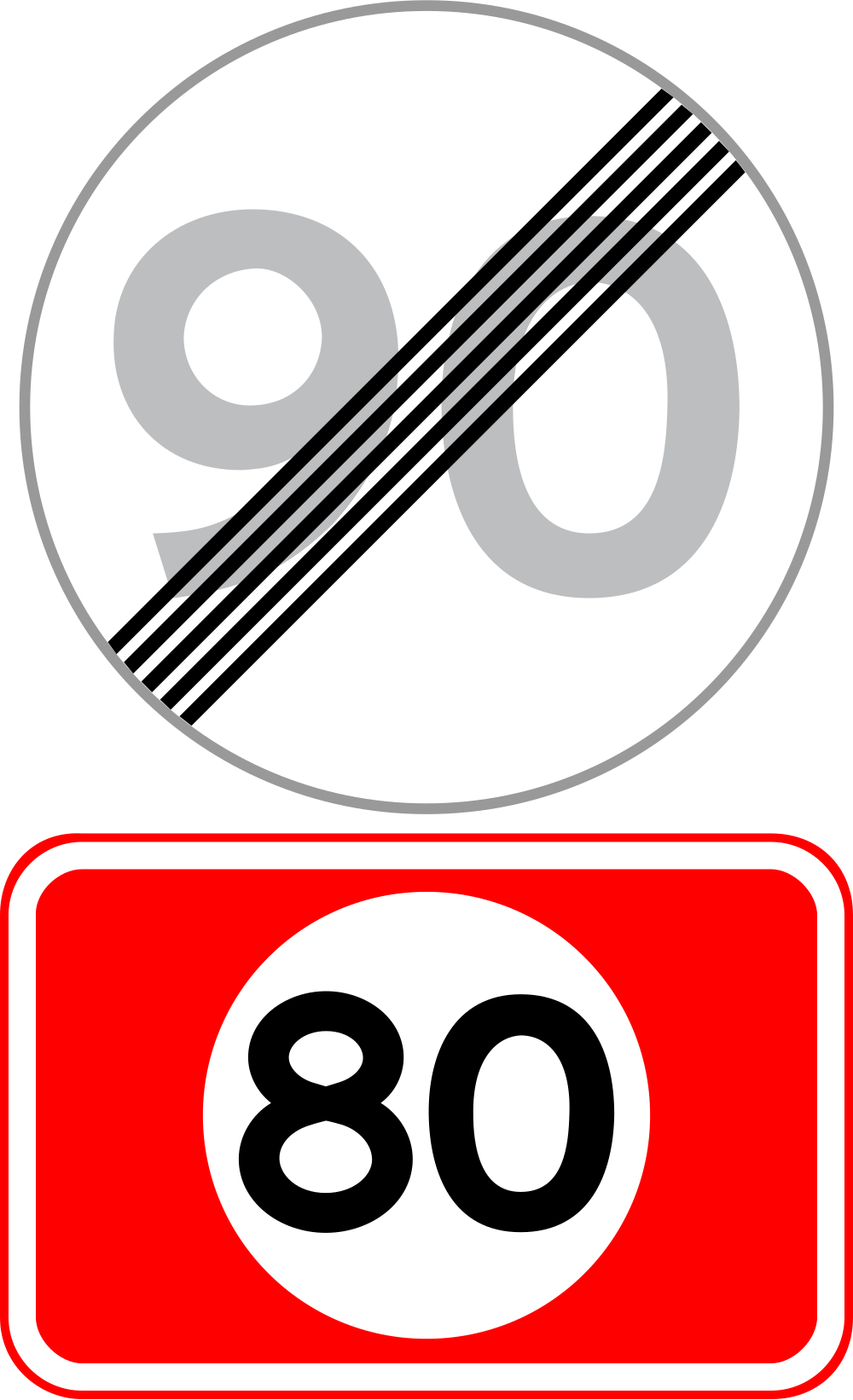
English • Traffic sign C 56 • End of local speed limit. May have a plate with the E 55 built-up-area symbol to emphasise that it is within a built-up area, or UC 57 showing the general limit outside built-up areas. Supplementary plate UC 57 gives information only about the general speed limit outside built-up areas. UC 57 may be used below C 56 only when C 56 ends a higher local limit outside a built-up area.
Dansk • Tavle C 56 • Ophør af lokal hastighedsbegrænsning. Tavlen kan være forsynet med undertavle med bysymbolet fra tavle E 55 for at understrege, at tavlen er opsat inden for tættere bebygget område. Tavlen kan være forsynet med undertavle UC 57 for at oplyse om den gældende generelle hastighedsgrænse uden for tættere bebygget område. Undertavle UC 57. UC 57 angiver kun oplysning om den gældende generelle hastighedsgrænse uden for tættere bebygget område. UC 57 må kun anvendes under C 56, når højere lokal hastighedsbegrænsning uden for tættere bebygget område ophæves med C 56.
Sources
🔗 Commons.wikimedia.org
🔗 Retsinformation.dk • Bekendtgørelse nr. 425/2023, § 19
SVG source: Bewitchedroutine • Public domain • Original revision 2024-03-21. Wikimedia original unmodified.
150. Recommended speed
This supplementary sign indicates a recommended speed rather than a maximum speed limit. Its legal effect depends on the applicable local rules.
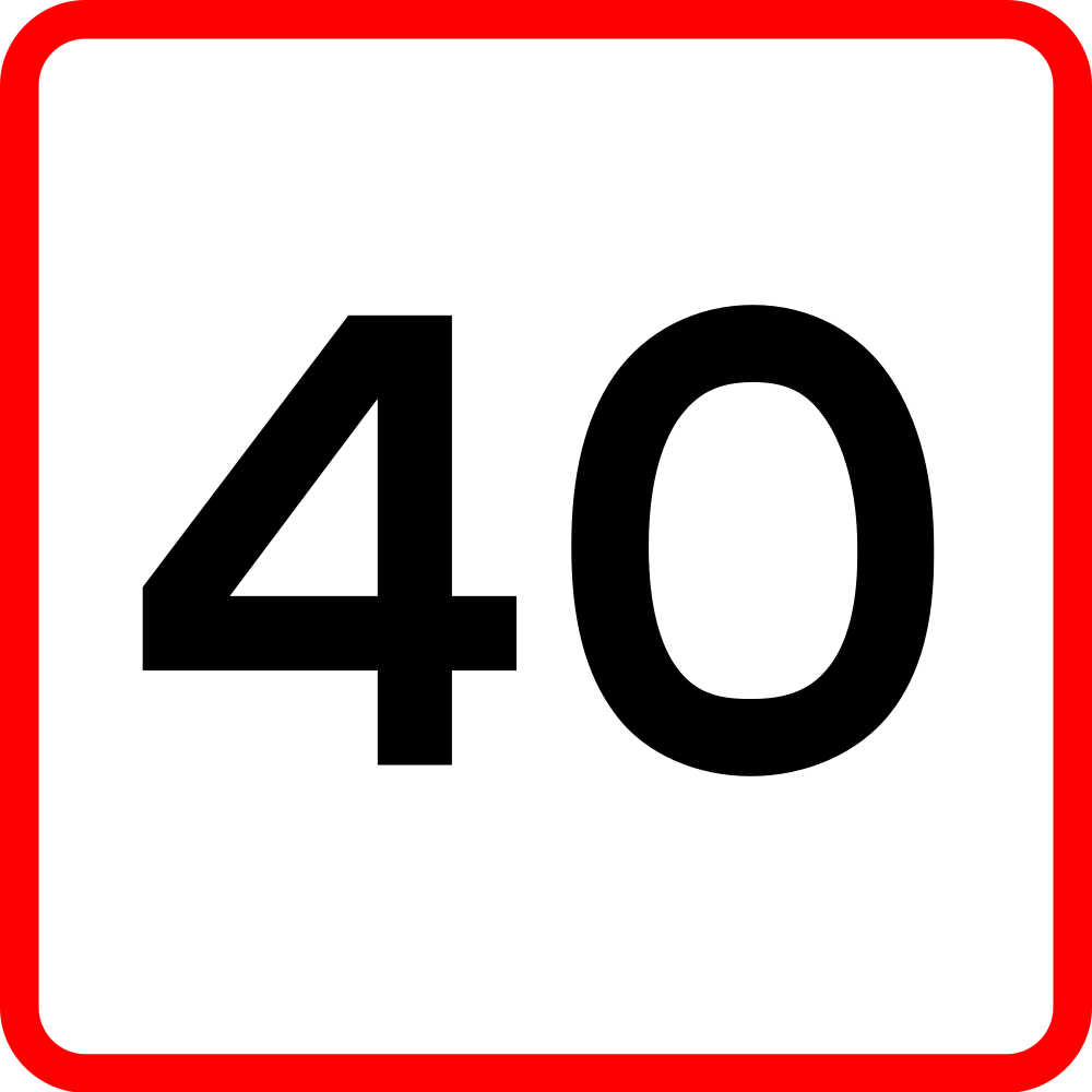
English • Supplementary plate UA 41 • Speed indication. Shows the speed at which the bend or bends can be negotiated under normal conditions.
Dansk • Undertavle UA 41 • Hastighedsangivelse. Undertavlen angiver den hastighed, hvormed svinget eller svingene under normale forhold kan gennemkøres.
Sources
🔗 Commons.wikimedia.org
🔗 Retsinformation.dk • Bekendtgørelse nr. 425/2023, § 13
SVG source: Bewitchedroutine • Public domain • Original revision 2024-03-13. Wikimedia original unmodified.