

QuizTraffic signsDenmark
Test your knowledge with our multiple-choice quiz. Learn from each answer and improve your understanding of the traffic rules and road signs of Denmark.
 Traffic signs
 Traffic rules
 Denmark
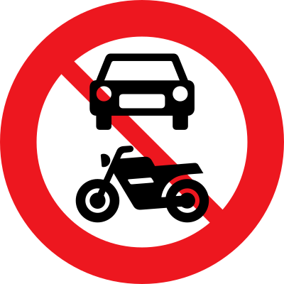
51. What does this traffic sign mean?
This traffic sign indicates that motorcycles and cars are prohibited. Motorcycles and cars may not enter or continue beyond the sign. Other road users may still be permitted unless another restriction applies.
English • Traffic sign C 22,1 • No motor vehicles, large mopeds, tractors or motorised machinery. A supplementary plate may also prohibit small mopeds.
Dansk • Tavle C 22,1 • Motorkøretøj, stor knallert, traktor og motorredskab forbudt. Det kan angives med undertavle, at kørsel med lille knallert også er forbudt.
Sources
🔗 Commons.wikimedia.org
🔗 Retsinformation.dk • Bekendtgørelse nr. 425/2023, § 19
SVG source: Gigillo83, drawn by original of Vejdirektoratet • Public domain • Original revision 2013-06-08. Wikimedia original unmodified.

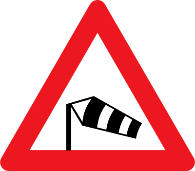
52. What does this traffic sign mean?
This traffic sign indicates a warning for strong crosswinds. Side winds may suddenly affect vehicle stability and steering. Reduce speed, keep a firm but controlled grip on the steering wheel and take extra care with high-sided vehicles, motorcycles and trailers.
English • Traffic sign A 95 • Crosswinds.
Dansk • Tavle A 95 • Sidevind.
Sources
🔗 Commons.wikimedia.org
🔗 Retsinformation.dk • Bekendtgørelse nr. 425/2023, § 13
SVG source: Gigillo83, drawn by original of Vejdirektoratet • Public domain • Original revision 2013-06-04. Wikimedia original unmodified.
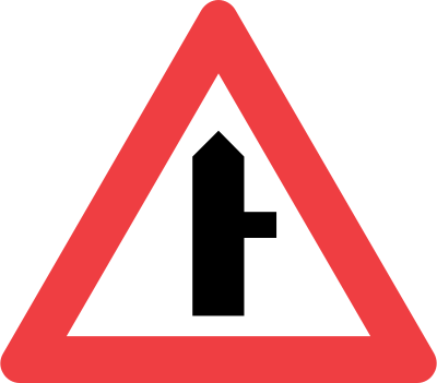
53. What does this traffic sign mean?
This traffic sign indicates that you have priority at the next intersection. A side road joins from the right, and traffic entering from that side road must give way.
English • Traffic sign A 11 • Dangerous junction where intersecting traffic must give way. If a road joins on only one side, the symbol may show this.
Dansk • Tavle A 11 • Farligt vejkryds, hvor den krydsende trafik har ubetinget vigepligt. Hvis der kun forekommer vejtilslutning i én vejside, kan det fremgå af symbolet.
Sources
🔗 Commons.wikimedia.org
🔗 Retsinformation.dk • Bekendtgørelse nr. 425/2023, § 13
SVG source: Vejdirektoratet • Public domain • Original revision 2013-06-08. Wikimedia original unmodified.
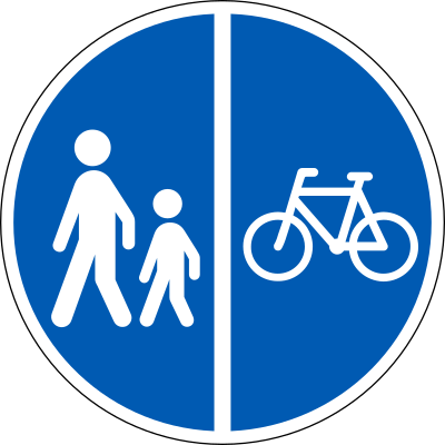
54. What does this traffic sign mean?
This traffic sign indicates a mandatory divided path for pedestrians and cyclists. Pedestrians and cyclists must use the section designated for them. Other road users may use the path only where the applicable signs or local rules permit them to do so.
English • Traffic sign D 26 • Separated path. Indicates parts separated by markings, a verge or similar feature. Each part must be used exclusively by the road-user category shown.
Dansk • Tavle D 26 • Delt sti. Tavlen angiver sti med flere baner, der er adskilt ved afstribning, rabat eller lignende. Hver bane skal benyttes af den færdselsart, der angives med symbol, og må kun benyttes af denne.
Sources
🔗 Commons.wikimedia.org
🔗 Retsinformation.dk • Bekendtgørelse nr. 425/2023, § 23
SVG source: Gigillo83, drawn by original of Vejdirektoratet • Public domain • Original revision 2013-06-10. Wikimedia original unmodified.
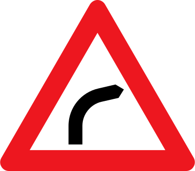
55. What does this traffic sign mean?
This traffic sign indicates a warning for a curve to the right. A right-hand bend lies ahead. Reduce speed before entering the curve, maintain your lane position and use smooth steering.
English • Traffic sign A 41,1 • Right-hand bend.
Dansk • Tavle A 41,1 • Højresving.
Sources
🔗 Commons.wikimedia.org
🔗 Retsinformation.dk • Bekendtgørelse nr. 425/2023, § 13
SVG source: Gigillo83, drawn by original of Vejdirektoratet • Public domain • Original revision 2013-06-04. Wikimedia original unmodified.
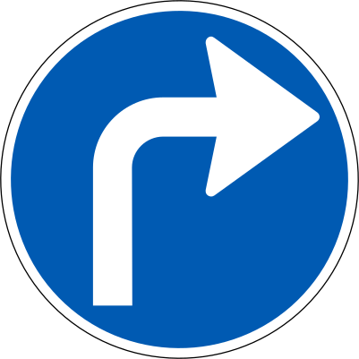
56. What does this traffic sign mean?
This traffic sign indicates that turning right is mandatory at the junction ahead. Traffic must turn right and may not continue straight ahead or turn left.
English • Traffic sign D 11 • Compulsory direction.
Dansk • Tavle D 11 • Påbudt kørselsretning.
Sources
🔗 Commons.wikimedia.org
🔗 Retsinformation.dk • Bekendtgørelse nr. 425/2023, § 23
SVG source: Gigillo83, drawn by original of Vejdirektoratet • Public domain • Original revision 2013-06-10. Wikimedia original unmodified.
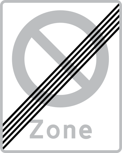
57. What does this traffic sign mean?
This traffic sign indicates the end of the no-parking zone. The zonal parking prohibition ends at this point. Other parking restrictions or conditions may still apply.
English • Traffic sign E 69 • End of zone.
Dansk • Tavle E 69 • Ophør af zone.
Sources
🔗 Commons.wikimedia.org
🔗 Retsinformation.dk • Bekendtgørelse nr. 425/2023, § 27
SVG source: Gigillo83, drawn by original of Vejdirektoratet • Public domain • Original revision 2013-06-11. Wikimedia original unmodified.
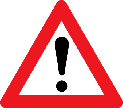
58. What does this traffic sign mean?
This traffic sign indicates a warning for a danger with no specific traffic sign. It's a general warning sign used when there is a hazard ahead that does not have its own dedicated warning sign. For example: road accidents, flooded roads and roads blocked by fallen trees. It usually has a supplementary sign attached that tells drivers of what hazard to expect.
English • Traffic sign A 99 • Other danger. The nature of the danger is stated on a plate below. With a plate reading ‘Tracks’, it indicates crossing tracks where staff warn road traffic of approaching trains, for example with flags, signal lamps or manually operated flashing warning lights.
Dansk • Tavle A 99 • Anden fare. Tavlen angiver fare, hvis art anføres på tavle under advarselstavlen. I forbindelse med undertavle med teksten »Spor« angiver tavlen krydsende spor, hvor vejtrafikken advares af personale, når tog nærmer sig, fx ved flag, signallygte eller manuelt betjente advarselsblinklys.
Sources
🔗 Commons.wikimedia.org
🔗 Retsinformation.dk • Bekendtgørelse nr. 425/2023, § 13
SVG source: Gigillo83, drawn by original of Vejdirektoratet • Public domain • Original revision 2013-06-04. Wikimedia original unmodified.
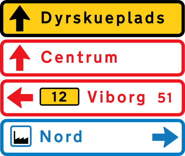
59. What does this traffic sign mean?
This traffic sign gives general information about road directions. The arrows, destinations and route information show which direction to follow.
English • Traffic sign F 14 • Temporary arrow direction sign. Traffic sign F 11 • White/red arrow direction sign for geographical destinations, ports, airports and similar destinations reached without using a motorway. Traffic sign F 13 • White/blue arrow direction sign for services, including transport terminals, commercial attractions, sights, service facilities, accommodation, businesses and similar destinations.
Dansk • Tavle F 14 • Midlertidig pilvejviser. Tavle F 11 • Hvid/rød pilvejviser. Pilvejviser til geografiske mål samt til havne, lufthavne og lignende, hvor der ikke køres ad motorvej. Tavle F 13 • Hvid/blå pilvejviser. Pilvejviser til servicevejvisning, herunder terminalmål eller kommercielle attraktioner, seværdighed, serviceanlæg, overnatningsmål, virksomheder og lignende.
Sources
🔗 Commons.wikimedia.org
🔗 Retsinformation.dk • Bekendtgørelse nr. 425/2023, § 34
SVG source: Gigillo83, drawn by original of Vejdirektoratet • Public domain • Original revision 2013-07-23. Wikimedia original unmodified.
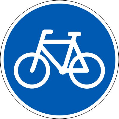
60. What does this traffic sign mean?
This traffic sign indicates a mandatory path for cyclists. Cyclists must use the designated path where the sign applies. Other road users may use the path only where the applicable signs or local rules permit them to do so.
English • Traffic sign D 21 • Cycle path. Cyclists and riders of small mopeds must use this path, which is reserved for them, subject to section 14(3) of the Road Traffic Act. Pedestrians may also use it under section 10. A supplementary plate may require small mopeds to use the carriageway.
Dansk • Tavle D 21 • Cykelsti. Tavlen angiver bane, som skal benyttes af cyklister og førere af lille knallert og kun må benyttes af disse, dog under hensyntagen til færdselslovens § 14, stk. 3. Banen kan dog benyttes af fodgængere, jf. færdselslovens § 10. Det kan angives med undertavle, at lille knallert skal føres på kørebanen.
Sources
🔗 Commons.wikimedia.org
🔗 Retsinformation.dk • Bekendtgørelse nr. 425/2023, § 23
SVG source: Gigillo83, drawn by original of Vejdirektoratet • Public domain • Original revision 2013-06-10. Wikimedia original unmodified.
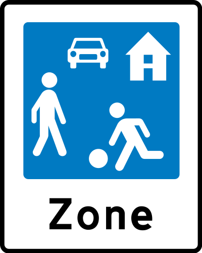
61. What does this traffic sign mean?
This traffic sign indicates the start of a residential area. Special traffic rules apply within the area according to the applicable signs and local regulations. These rules may affect speed, parking and how different road users use the road.
English • Traffic sign E 51 • Residential area for staying and playing. Special rules apply: 1) People may stay and play across the road's full width. 2) Driving is permitted only at very low speed, normally below 15 km/h. 3) Drivers must show particular care and consideration towards pedestrians and give way where their paths cross. 4) If people staying or playing on the road could come dangerously close to the passing vehicle, the driver must ensure they are aware of it and have made room before proceeding; they must not unnecessarily obstruct drivers. 5) Parking is permitted only in specially marked places, except for bicycles, mopeds and two-wheeled motorcycles. 6) Drivers must give way when leaving the area. May be used with plates U 1, U 2 or U 6 for advance warning.
Dansk • Tavle E 51 • Opholds- og legeområde. Tavlen angiver et område, hvor følgende særlige færdselsregler gælder: 1) Det er tilladt at opholde sig og lege på vejen i hele dens bredde. 2) Kørsel i området må kun ske med meget lav hastighed (normalt under 15 km/h). 3) De kørende skal udvise særlig agtpågivenhed og hensynsfuldhed over for gående. Hvor kørendes færdselsretning skærer gåendes, skal de kørende holde tilbage for de gående. 4) Når der på vejen opholder sig eller leger personer, der kan komme i farlig nærhed af køretøjet under dettes passage, må kørslen ikke fortsættes, forinden føreren har sikret sig, at disse personer er opmærksomme på køretøjet og har givet plads for passage. Sådanne personer må dog ikke unødigt hindre de kørende i at komme frem. 5) Parkering i opholds- og legeområder må ikke ske uden for særligt afmærkede pladser. Dette gælder dog ikke cykler, knallerter og tohjulede motorcykler. 6) Kørende har ubetinget vigepligt ved udkørsel fra et opholds- og legeområde. Tavlen kan anvendes med undertavlerne U 1, U 2 eller U 6 til forvarsling.
Sources
🔗 Commons.wikimedia.org
🔗 Retsinformation.dk • Bekendtgørelse nr. 425/2023, § 27
SVG source: Gigillo83, drawn by original of Vejdirektoratet • Public domain • Original revision 2022-11-27. Wikimedia original unmodified.
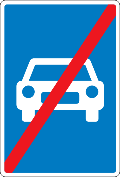
62. What does this traffic sign mean?
This traffic sign indicates the end of the expressway. The special traffic rules associated with the expressway end at this point. Follow the rules and traffic signs that apply to the road ahead.
English • Traffic sign E 45 • End of expressway. Normally not used on roads crossing an expressway or where exit roads join the ordinary road network.
Dansk • Tavle E 45 • Motortrafikvej ophører. Tavlen anvendes normalt ikke på veje, der krydser motortrafikvej eller ved frakørslers tilslutning til det almindelige vejnet.
Sources
🔗 Commons.wikimedia.org
🔗 Retsinformation.dk • Bekendtgørelse nr. 425/2023, § 27
SVG source: Gigillo83, drawn by original of Vejdirektoratet • Public domain • Original revision 2013-06-11. Wikimedia original unmodified.
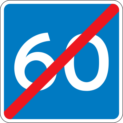
63. What does this traffic sign mean?
This traffic sign indicates the end of the advisory speed. The preceding speed recommendation ends at this point. Continue according to the applicable speed limits and road conditions.
English • Traffic sign E 40 • End of recommended speed.
Dansk • Tavle E 40 • Anbefalet hastighed ophører.
Sources
🔗 Commons.wikimedia.org
🔗 Retsinformation.dk • Bekendtgørelse nr. 425/2023, § 27
SVG source: Gigillo83, drawn by original of Vejdirektoratet • Public domain • Original revision 2013-06-11. Wikimedia original unmodified.
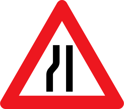
64. What does this traffic sign mean?
This traffic sign indicates a warning for a road narrowing on the left. The available road width decreases from the left side ahead. Reduce speed, follow the lane markings and maintain sufficient clearance from other traffic and the road edge.
English • Traffic sign A 43,2 • Road narrows on the left.
Dansk • Tavle A 43,2 • Indsnævret vej i venstre side.
Sources
🔗 Commons.wikimedia.org
🔗 Retsinformation.dk • Bekendtgørelse nr. 425/2023, § 13
SVG source: Gigillo83, drawn by original of Vejdirektoratet • Public domain • Original revision 2013-06-04. Wikimedia original unmodified.
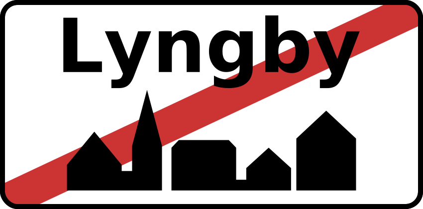
65. What does this traffic sign mean?
This traffic sign indicates the end of the built-up area. The traffic rules specifically associated with the built-up area cease to apply from this point according to the applicable local regulations.
English • Traffic sign E 56 • End of built-up area. The geographical place name may appear in Danish and in English or a neighbouring country's official language.
Dansk • Tavle E 56 • Ophør af tættere bebygget område. Der kan angives det geografiske navn på området på dansk samt på engelsk eller et nabolands officielle sprog.
Sources
🔗 Commons.wikimedia.org
🔗 Retsinformation.dk • Bekendtgørelse nr. 425/2023, § 27
SVG source: AleXXw • Public domain • Original revision 2011-11-07. Wikimedia original unmodified.
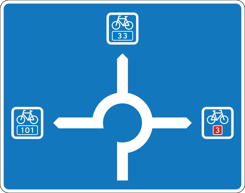
66. What does this traffic sign mean?
This traffic sign gives information about directions at a roundabout. The diagram shows the available exits and the destinations reached from them.
English • Traffic sign F 21,4 • Path diagram sign.
Dansk • Tavle F 21,4 • Stidiagramtavle.
Sources
🔗 Commons.wikimedia.org
🔗 Retsinformation.dk • Bekendtgørelse nr. 425/2023, § 34
SVG source: Gigillo83, drawn by original of Vejdirektoratet • Public domain • Original revision 2013-07-23. Wikimedia original unmodified.
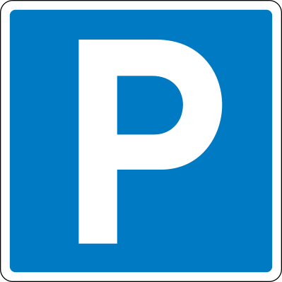
67. What does this traffic sign mean?
This traffic sign indicates that parking is allowed. Vehicles may be parked in the area covered by the sign subject to any indicated conditions, restrictions or local parking rules.
English • Traffic sign E 33 • Parking. Marks an area intended for parking. On a zone sign, E 33 indicates only restrictions on parking in the area. A roof symbol indicates indoor parking. Direction, distance, restrictions or exemptions may appear on the sign or a supplementary plate. For marked bays, see section 60, T 33. Where an unmarked parking area lies on the carriageway, plates UE 33,1–33,4 indicate its extent. The parking provisions in section 19 for C 61–62, UC 33 and UC 61–62 also apply. With plate E 23 for disabled users, stopping and parking are reserved for vehicles displaying a permit issued under section 88 a of the Road Traffic Act. A general restriction on particular vehicles may be lifted locally by a plate showing their symbols with ‘Permitted’. A black plate may refer to privately administered parking rules.
Dansk • Tavle E 33 • Parkering. Tavlen angiver areal, som er beregnet til parkering. På zonetavle anvendes E 33-tavlen alene til at angive begrænsninger i adgangen til at parkere i området. Et vinkelformet tagsymbol over symbolet tilkendegiver, at det drejer sig om indendørs parkering. Retning og/eller afstand til parkeringsplads og begrænsninger eller lempelser i adgangen til at parkere kan angives enten på selve tavlen eller på undertavle. Vedrørende parkering i bås, se § 60, T 33 Parkeringsbås. Ligger parkeringsarealet på kørebanen uden at være afmærket på denne, angives parkeringsarealets udstrækning på kørebanen med undertavlerne UE 33,1-33,4. Endvidere gælder bestemmelsen om parkering på samme måde, som anført i § 19 vedrørende C 61-62, UC 33 og UC 61-62. Hvor E 33 suppleres med undertavle E 23 Vejledning for invalide, angiver dette, at parkeringsarealet kun må benyttes til standsning og parkering af køretøjer, som er forsynet med en i medfør af færdselslovens § 88 a udstedt tilladelse. I områder, hvor der findes en generel parkeringsbegrænsning for visse køretøjer, kan denne parkeringsbegrænsning lokalt ophæves ved at supplere E 33 med en undertavle, der viser symbolet for de aktuelle køretøjer med »Tilladt« under symbolerne. Med sort undertavle kan henvises til regler for privatadministrerede parkeringsordninger.
Sources
🔗 Commons.wikimedia.org
🔗 Retsinformation.dk • Bekendtgørelse nr. 425/2023, § 27
SVG source: Gigillo83, drawn by original of Vejdirektoratet • Public domain • Original revision 2013-06-11. Wikimedia original unmodified.
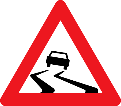
68. What does this traffic sign mean?
This traffic sign indicates a warning for a slippery road surface. The road ahead may provide reduced tyre grip because of water, ice, mud, oil or another surface condition. Reduce speed and avoid sudden braking, acceleration or steering movements.
English • Traffic sign A 31 • Slippery road. Indicates an unusually slippery carriageway. The cause must appear on a supplementary plate, such as ‘Slippery when wet’.
Dansk • Tavle A 31 • Glat vej. Tavlen angiver, at kørebanen kan være unormalt glat. Årsagen skal angives på undertavle, fx »Glat i vådt føre«.
Sources
🔗 Commons.wikimedia.org
🔗 Retsinformation.dk • Bekendtgørelse nr. 425/2023, § 13
SVG source: Gigillo83, drawn by original of Vejdirektoratet • Public domain • Original revision 2013-06-04. Wikimedia original unmodified.
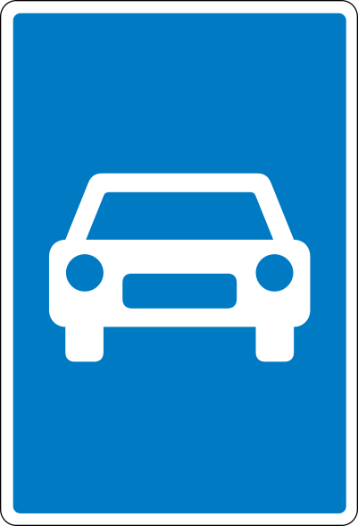
69. What does this traffic sign mean?
This traffic sign indicates the start of an expressway. From this point, the traffic rules and access conditions that apply to expressways take effect according to the applicable local regulations.
English • Traffic sign E 43 • Expressway. Marks a section where the special expressway and expressway entry/exit-road rules apply under section 48 of the Road Traffic Act.
Dansk • Tavle E 43 • Motortrafikvej. Tavlen angiver vejstrækning, hvor de særlige regler om kørsel på motortrafikvej og til- og frakørselsveje til motortrafikvej gælder, jf. færdselslovens § 48.
Sources
🔗 Commons.wikimedia.org
🔗 Retsinformation.dk • Bekendtgørelse nr. 425/2023, § 27
SVG source: Gigillo83, drawn by original of Vejdirektoratet • Public domain • Original revision 2013-06-11. Wikimedia original unmodified.
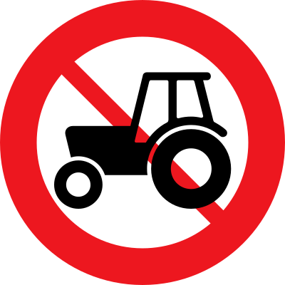
70. What does this traffic sign mean?
This traffic sign indicates that tractors are prohibited. Tractors covered by the sign may not enter or continue beyond it. Other road users may still be permitted unless another restriction applies.
English • Traffic sign C 24,1 • No tractors or motorised machinery. A mass on a supplementary plate may restrict the prohibition to tractors or machinery, including combinations, whose combined maximum authorised mass exceeds the value shown.
Dansk • Tavle C 24,1 • Traktor og motorredskab forbudt. Forbuddet kan med vægtangivelse på undertavle begrænses til kun at gælde for traktorer og motorredskaber, herunder vogntog med disse køretøjer, hvis samlede tilladte totalvægt er større end den angivne.
Sources
🔗 Commons.wikimedia.org
🔗 Retsinformation.dk • Bekendtgørelse nr. 425/2023, § 19
SVG source: Gigillo83, drawn by original of Vejdirektoratet • Public domain • Original revision 2013-06-08. Wikimedia original unmodified.
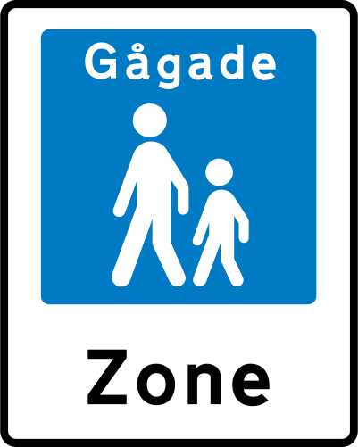
71. What does this traffic sign mean?
This traffic sign indicates the start of a pedestrian zone. Pedestrians are the principal road users within the zone, while access by vehicles and other road users is subject to the applicable traffic signs and local rules.
English • Traffic sign E 49 • Pedestrian street. Special rules apply: 1) Reserved for pedestrians. 2) Driving may be permitted, subject to points 4–8. 3) Permission is shown on a supplementary plate under section 18(3), points 2–5, or by ‘Driving permitted’ or plates permitting specified road users; times may be limited under section 9, U 3. 4) Driving is permitted only at very low speed, normally below 15 km/h. 5) Drivers must show particular care and consideration towards pedestrians under section 27(3) of the Road Traffic Act. 6) If pedestrians could come dangerously close to the passing vehicle, the driver must ensure they are aware of it and have made room before proceeding; they must not unnecessarily obstruct drivers. 7) Parking is permitted only in specially marked places, except for bicycles, mopeds and two-wheeled motorcycles. 8) Drivers must give way when leaving under section 26(3) of the Road Traffic Act. May be used with plates U 1, U 2 or U 6 for advance warning.
Dansk • Tavle E 49 • Gågade. Tavlen angiver et område, hvor følgende særlige færdselsregler gælder: 1) Området er reserveret til gående. 2) Tilladelse til kørsel i området kan gives. I så fald skal kørsel ske under iagttagelse af bestemmelserne i punkterne 4-8. 3) Eventuel tilladelse til kørsel angives på undertavle som anført i § 18, stk. 3, punkterne 2-5. Desuden kan anvendes undertavlen »Kørsel tilladt« eller andre undertavler, der tillader kørsel med bestemte færdselsarter. Tilladelse på undertavle kan afgrænses tidsmæssigt, jf. § 9, tavle U 3. 4) Kørsel i området må kun ske med meget lav hastighed (normalt under 15 km/h). 5) De kørende skal udvise særlig agtpågivenhed og hensynsfuldhed over for gående, jf. færdselslovens § 27, stk. 3. 6) Når der på vejen færdes personer, der kan komme i farlig nærhed af køretøjet under dettes passage, må kørslen ikke fortsættes, forinden føreren har sikret sig, at disse personer er opmærksomme på køretøjet og har givet plads for passage. Sådanne personer må dog ikke unødigt hindre de kørende i at komme frem. 7) Parkering i en gågade må ikke ske uden for særligt afmærkede pladser. Dette gælder dog ikke cykler, knallerter og tohjulede motorcykler. 8) Kørende har ubetinget vigepligt ved udkørsel fra en gågade, jf. færdselslovens § 26, stk. 3. Tavlen kan anvendes med undertavlerne U 1, U 2 eller U 6 til forvarsling.
Sources
🔗 Commons.wikimedia.org
🔗 Retsinformation.dk • Bekendtgørelse nr. 425/2023, § 27
SVG source: Gigillo83, drawn by original of Vejdirektoratet • Public domain • Original revision 2013-06-11. Wikimedia original unmodified.
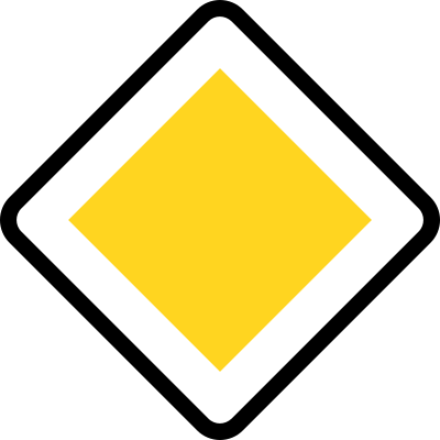
72. What does this traffic sign mean?
This traffic sign indicates the start of a priority road. Drivers on the priority road normally have priority over traffic entering from side roads until the priority road ends, unless traffic lights, other signs or applicable traffic rules indicate otherwise.
English • Traffic sign B 16 • Priority road. Traffic from side roads must give way unless B 11, B 13 or B 15 is placed on the priority road. Also prohibits parking on the carriageway outside built-up areas under section 29(3), point 3 of the Road Traffic Act. Plate UC 60,6 ‘No verge parking’, referred to in section 19, may also prohibit parking on the verge.
Dansk • Tavle B 16 • Hovedvej. Tavlen angiver, at færdslen fra sideveje har ubetinget vigepligt, medmindre tavle B 11, B 13 eller B 15 er opsat på hovedvejen. Tavlen angiver endvidere, at parkering på kørebanen er forbudt uden for tættere bebygget område, jf. færdselslovens § 29, stk. 3, nr. 3. Med den i § 19 nævnte undertavle UC 60,6 Parkering på rabat forbudt kan det angives, at parkering også er forbudt på rabatten.
Sources
🔗 Commons.wikimedia.org
🔗 Retsinformation.dk • Bekendtgørelse nr. 425/2023, § 16
SVG source: Gigillo83, drawn by original of Vejdirektoratet • Public domain • Original revision 2013-06-05. Wikimedia original unmodified.
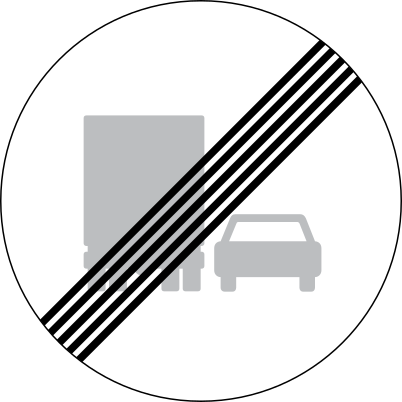
73. What does this traffic sign mean?
This traffic sign indicates the end of the overtaking prohibition for trucks. The preceding truck overtaking restriction ends at this point. Other overtaking rules and restrictions may still apply.
English • Traffic sign C 54 • End of overtaking prohibition for lorries.
Dansk • Tavle C 54 • Ophør af overhaling med lastbil forbudt.
Sources
🔗 Commons.wikimedia.org
🔗 Retsinformation.dk • Bekendtgørelse nr. 425/2023, § 19
SVG source: Gigillo83, drawn by original of Vejdirektoratet • Public domain • Original revision 2013-06-08. Wikimedia original unmodified.
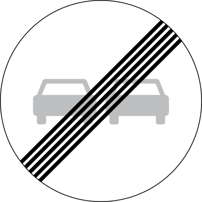
74. What does this traffic sign mean?
This traffic sign indicates the end of the overtaking prohibition. The preceding overtaking restriction ends at this point. Overtaking remains subject to the applicable traffic rules and any other restrictions.
English • Traffic sign C 53 • End of overtaking prohibition.
Dansk • Tavle C 53 • Ophør af overhaling forbudt.
Sources
🔗 Commons.wikimedia.org
🔗 Retsinformation.dk • Bekendtgørelse nr. 425/2023, § 19
SVG source: Gigillo83, drawn by original of Vejdirektoratet • Public domain • Original revision 2013-06-08. Wikimedia original unmodified.
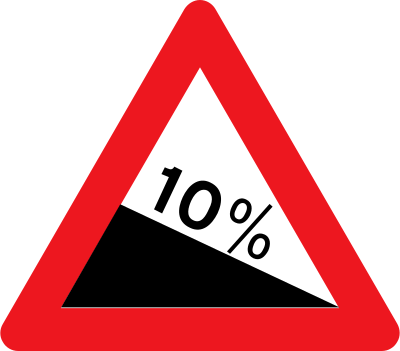
75. What does this traffic sign mean?
This traffic sign indicates a warning for a steep descent. A steep downhill gradient lies ahead and the vehicle may gain speed quickly. Reduce speed before the descent, select a suitable gear and use engine braking where appropriate. Allow extra distance for heavy or towing vehicles.
English • Traffic sign A 46,1 • Steep descent.
Dansk • Tavle A 46,1 • Stejl nedkørsel.
Sources
🔗 Commons.wikimedia.org
🔗 Retsinformation.dk • Bekendtgørelse nr. 425/2023, § 13
SVG source: Gigillo83, drawn by original of Vejdirektoratet • Public domain • Original revision 2013-06-04. Wikimedia original unmodified.
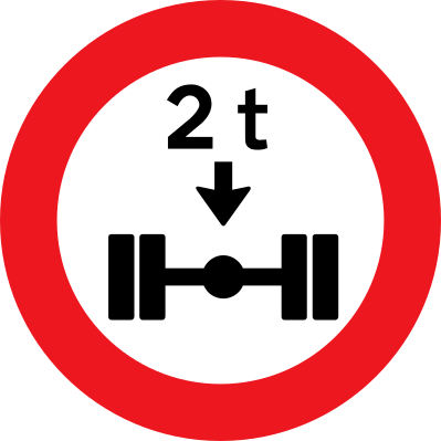
76. What does this traffic sign mean?
This traffic sign indicates that vehicles exceeding the indicated axle-load limit are prohibited. A vehicle whose load on an axle exceeds the displayed limit may not continue beyond the sign.
English • Traffic sign C 35 • Axle load limit. Vehicles whose actual axle load exceeds the stated value are prohibited.
Dansk • Tavle C 35 • Akseltryk. Tavlen forbyder kørsel med køretøjer, hvis faktiske akseltryk er større end det angivne.
Sources
🔗 Commons.wikimedia.org
🔗 Retsinformation.dk • Bekendtgørelse nr. 425/2023, § 19
SVG source: Gigillo83, drawn by original of Vejdirektoratet • Public domain • Original revision 2013-06-08. Wikimedia original unmodified.
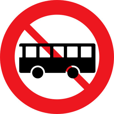
77. What does this traffic sign mean?
This traffic sign indicates that buses are prohibited. Buses covered by the sign may not enter or continue beyond it. Other road users may still be permitted unless another restriction applies.
English • Traffic sign C 23,2 • No buses or coaches. A mass on a supplementary plate may restrict the prohibition to buses or coaches, including combinations, whose combined maximum authorised mass exceeds the value shown.
Dansk • Tavle C 23,2 • Bus forbudt. Forbuddet kan med vægtangivelse på undertavle begrænses til kun at gælde for bus, herunder busvogntog, hvis samlede tilladte totalvægt er større end den angivne.
Sources
🔗 Commons.wikimedia.org
🔗 Retsinformation.dk • Bekendtgørelse nr. 425/2023, § 19
SVG source: Gigillo83, drawn by original of Vejdirektoratet • Public domain • Original revision 2013-06-08. Wikimedia original unmodified.
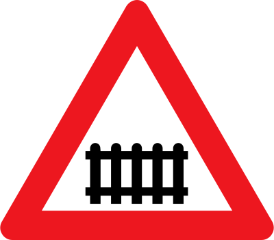
78. What does this traffic sign mean?
This traffic sign indicates a warning for a railway crossing with barriers. It alerts drivers to an upcoming level crossing with gates or barriers that close when a train approaches. Drivers should be ready to stop when the barriers are down or flashing lights activate. Never attempt to cross when gates are closing or closed.
English • Traffic sign A 73 • Level crossing with barriers.
Dansk • Tavle A 73 • Jernbaneoverkørsel med bomme.
Sources
🔗 Commons.wikimedia.org
🔗 Retsinformation.dk • Bekendtgørelse nr. 425/2023, § 13
SVG source: Gigillo83, drawn by original of Vejdirektoratet • Public domain • Original revision 2013-06-04. Wikimedia original unmodified.
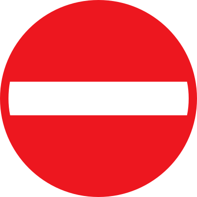
79. What does this traffic sign mean?
This traffic sign means no entry. Drivers may not enter from the direction in which the sign is placed.
English • Traffic sign C 19 • No entry. All vehicles are prohibited. A supplementary plate may also prohibit pushing a bicycle or moped on the carriageway.
Dansk • Tavle C 19 • Indkørsel forbudt. Tavlen forbyder indkørsel med ethvert køretøj. Det kan angives med undertavle, at det også er forbudt at trække cykel og knallert på kørebanen.
Sources
🔗 Commons.wikimedia.org
🔗 Retsinformation.dk • Bekendtgørelse nr. 425/2023, § 19
SVG source: Gigillo83, drawn by original of Vejdirektoratet • Public domain • Original revision 2013-06-08. Wikimedia original unmodified.
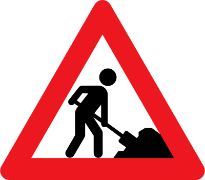
80. What does this traffic sign mean?
This traffic sign indicates a warning for roadworks. Construction or maintenance work is taking place on or beside the road. Reduce speed where necessary and be prepared for workers, machinery, temporary traffic signals, changed lane layouts or uneven road surfaces.
English • Traffic sign A 39 • Roadworks.
Dansk • Tavle A 39 • Vejarbejde.
Sources
🔗 Commons.wikimedia.org
🔗 Retsinformation.dk • Bekendtgørelse nr. 425/2023, § 13
SVG source: Gigillo83, drawn by original of Vejdirektoratet • Public domain • Original revision 2013-06-04. Wikimedia original unmodified.
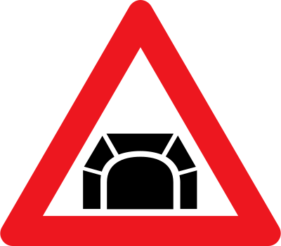
81. What does this traffic sign mean?
This traffic sign indicates a warning for a tunnel. Driving conditions may change at the tunnel entrance because of reduced light, limited visibility or restricted space. Reduce speed when necessary and follow the applicable rules for vehicle lighting, stopping, overtaking and lane use.
English • Traffic sign A 44 • Tunnel. The tunnel's name may appear on a supplementary plate.
Dansk • Tavle A 44 • Tunnel. Navnet på tunnelen kan anføres på undertavle.
Sources
🔗 Commons.wikimedia.org
🔗 Retsinformation.dk • Bekendtgørelse nr. 425/2023, § 13
SVG source: Gigillo83, drawn by original of Vejdirektoratet • Public domain • Original revision 2013-06-04. Wikimedia original unmodified.
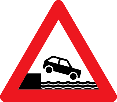
82. What does this traffic sign mean?
This traffic sign indicates a warning for a quayside or riverbank. The road approaches or runs close to an edge beside water, where a vehicle could leave the roadway and enter the water. Reduce speed, identify the road edge carefully and take extra care in darkness or poor visibility.
English • Traffic sign A 92 • Quayside. Indicates a ferry berth, quay or similar place. In addition to the normal advance distance under section 12, the sign may be placed immediately at the edge of the quay or similar place.
Dansk • Tavle A 92 • Havnekaj. Tavlen angiver færgeleje, kaj eller lignende. Tavlen kan foruden i normal afstand, jf. § 12, opsættes umiddelbart på kanten af kaj eller lignende.
Sources
🔗 Commons.wikimedia.org
🔗 Retsinformation.dk • Bekendtgørelse nr. 425/2023, § 13
SVG source: Gigillo83, drawn by original of Vejdirektoratet • Public domain • Original revision 2013-06-04. Wikimedia original unmodified.
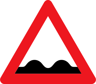
83. What does this traffic sign mean?
This traffic sign indicates a warning for a bad or uneven road surface. Potholes, bumps, depressions or other surface irregularities may affect vehicle stability and braking. Reduce speed and avoid sudden manoeuvres.
English • Traffic sign A 37 • Uneven road. Indicates dangerous irregularities in the road.
Dansk • Tavle A 37 • Ujævn vej. Tavlen angiver farlige ujævnheder på vejen.
Sources
🔗 Commons.wikimedia.org
🔗 Retsinformation.dk • Bekendtgørelse nr. 425/2023, § 13
SVG source: Gigillo83, drawn by original of Vejdirektoratet • Public domain • Original revision 2013-06-04. Wikimedia original unmodified.
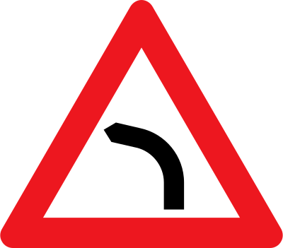
84. What does this traffic sign mean?
This traffic sign indicates a warning for a curve to the left. A left-hand bend lies ahead. Reduce speed before entering the curve, maintain your lane position and use smooth steering.
English • Traffic sign A 41,2 • Left-hand bend.
Dansk • Tavle A 41,2 • Venstresving.
Sources
🔗 Commons.wikimedia.org
🔗 Retsinformation.dk • Bekendtgørelse nr. 425/2023, § 13
SVG source: Gigillo83, drawn by original of Vejdirektoratet • Public domain • Original revision 2013-06-04. Wikimedia original unmodified.
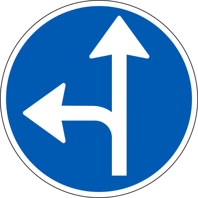
85. What does this traffic sign mean?
This traffic sign indicates that traffic must continue straight ahead or turn left. One of the indicated directions must be followed; turning right is prohibited.
English • Traffic sign D 11 • Compulsory direction.
Dansk • Tavle D 11 • Påbudt kørselsretning.
Sources
🔗 Commons.wikimedia.org
🔗 Retsinformation.dk • Bekendtgørelse nr. 425/2023, § 23
SVG source: Gigillo83, drawn by original of Vejdirektoratet • Public domain • Original revision 2013-06-10. Wikimedia original unmodified.
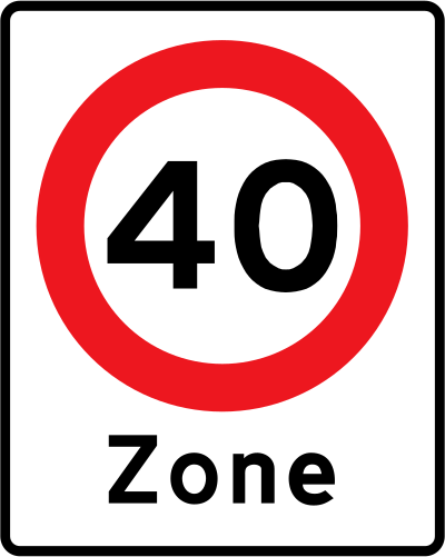
86. What does this traffic sign mean?
This traffic sign indicates the start of a zone with a speed limit. The displayed speed limit applies throughout the zone according to the applicable zonal rules, until the zone is ended or another rule replaces it.
English • Traffic sign E 68 • Zone. Marks an area where the rules represented by the incorporated signs apply, subject to E 33 Parking and E 68,9 Environmental zone. Details and the distance to the beginning may be shown. Applies until E 69 or replacement by another zone sign concerning the same matter. Local signs may create exceptions within the zone. Traffic sign C 55 • Local speed limit. Sets a limit on this road section under section 42 of the Road Traffic Act. Notwithstanding section 18(2), it applies until ended by an end sign, a distance on a supplementary plate or another speed limit. A mass plate may limit it to vehicles, including combinations, whose combined maximum authorised mass exceeds the stated value. It may apply only to specified vehicles where all these types appear on the same plate: lorry with any trailer, bus or coach with trailer, car up to 3,500 kg with trailer, and motorcycle with trailer. A plate may read ‘Noise’ where that is the reason for the limit.
Dansk • Tavle E 68 • Zonetavle. Tavlen angiver et område, hvor bestemmelserne for de tavler, der er anført som symbol, er gældende, se dog E 33 Parkering og E 68,9 Miljøzonetavle. Bestemmelsernes nærmere indhold og afstanden til områdets begyndelse kan angives på tavlen. Bestemmelserne gælder, indtil de ophæves ved tavle E 69, eller indtil de erstattes af angivelse vedrørende samme forhold på anden zonetavle. Inden for området kan zonetavlens bestemmelser fraviges ved lokal afmærkning. Tavle C 55 • Lokal hastighedsbegrænsning. Tavlen fastsætter en lokal hastighedsbegrænsning for en strækning på den aktuelle vej, jf. færdselslovens § 42. Hastighedsbegrænsningen gælder uanset bestemmelsen i § 18, stk. 2, indtil den ophæves ved ophørstavle, ved afstandsangivelse på undertavle eller ved angivelse af anden hastighedsbegrænsning. Hastighedsbegrænsningen kan ved vægtangivelse på undertavle begrænses til kun at gælde for køretøjer, herunder vogntog, hvis samlede tilladte totalvægt overstiger den angivne. Hastighedsbegrænsningen kan begrænses til kun at gælde bestemte køretøjer, når alle følgende køretøjstyper er vist på én og samme undertavle; lastbil samt eventuelt tilkoblet påhængskøretøj, bus med påhængskøretøj, bil til og med 3.500 kg. med påhængskøretøj og motorcykel med påhængskøretøj. På undertavle kan teksten »Støj« angives, når det er årsagen til en lokal hastighedsbegrænsning.
Sources
🔗 Commons.wikimedia.org
🔗 Retsinformation.dk • Bekendtgørelse nr. 425/2023, § 27
🔗 Retsinformation.dk • Bekendtgørelse nr. 425/2023, § 19
SVG source: Fry1989, drawn by original of Vejdirektoratet • Public domain • Original revision 2013-07-16. Wikimedia original unmodified.
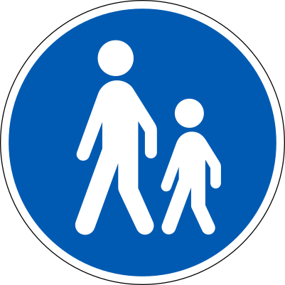
87. What does this traffic sign mean?
This traffic sign indicates the start of a mandatory path for pedestrians. Pedestrians must use the designated path, while other road users may use it only where the applicable signs or local rules permit them to do so.
English • Traffic sign D 22 • Footpath. Pedestrians must use this path, which is reserved exclusively for them.
Dansk • Tavle D 22 • Gangsti. Tavlen angiver bane, som skal benyttes af gående og kun må benyttes af disse.
Sources
🔗 Commons.wikimedia.org
🔗 Retsinformation.dk • Bekendtgørelse nr. 425/2023, § 23
SVG source: Gigillo83, drawn by original of Vejdirektoratet • Public domain • Original revision 2013-06-10. Wikimedia original unmodified.
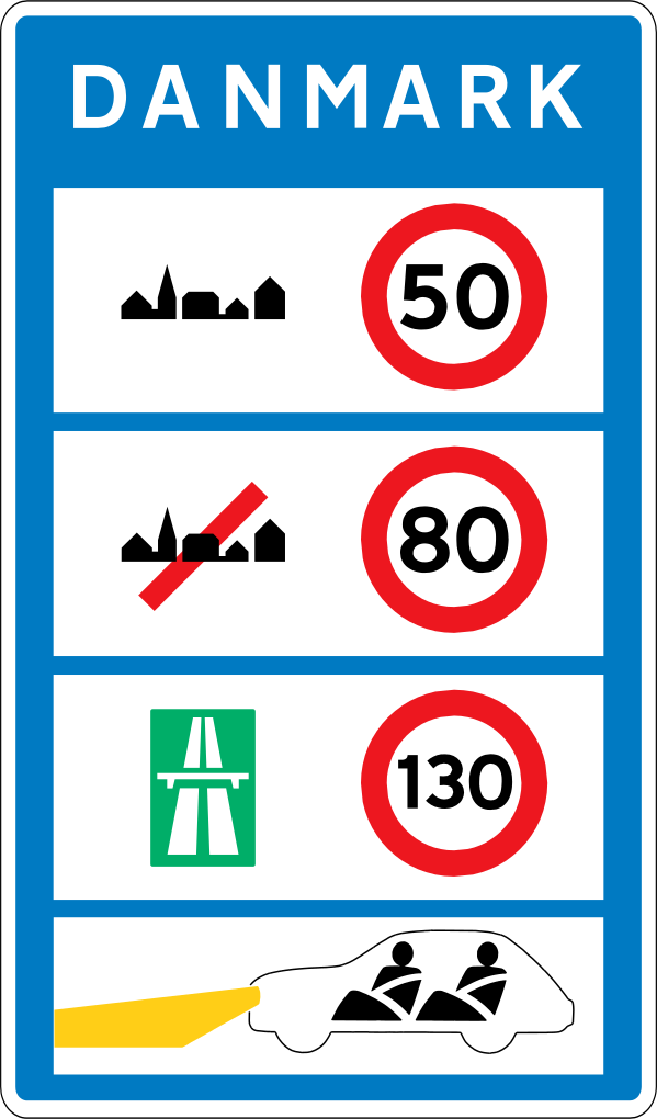
88. What does this traffic sign mean?
This traffic sign indicates the national speed limits. The applicable default maximum speeds depend on the road type, vehicle category and local traffic rules when no different speed limit is indicated.
English • Traffic sign E 80 • General speed limits. Shows the general speed limits applying in the country.
Dansk • Tavle E 80 • Generelle hastighedsbegrænsninger. Tavlen angiver de generelle hastighedsbegrænsninger, som gælder i landet.
Sources
🔗 Commons.wikimedia.org
🔗 Retsinformation.dk • Bekendtgørelse nr. 425/2023, § 27
SVG source: Gigillo83, drawn by original of Vejdirektoratet • Public domain • Original revision 2013-08-06. Wikimedia original unmodified.
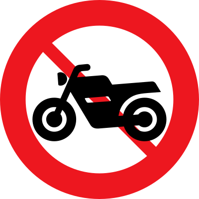
89. What does this traffic sign mean?
This traffic sign indicates that motorcycles are prohibited. Motorcyclists may not enter or continue beyond the sign. Other road users may still be permitted unless another restriction applies.
English • Traffic sign C 22,2 • No motorcycles or large mopeds. A supplementary plate may also prohibit small mopeds.
Dansk • Tavle C 22,2 • Motorcykel og stor knallert forbudt. Det kan angives på undertavle, at kørsel med lille knallert også er forbudt.
Sources
🔗 Commons.wikimedia.org
🔗 Retsinformation.dk • Bekendtgørelse nr. 425/2023, § 19
SVG source: Gigillo83, drawn by original of Vejdirektoratet • Public domain • Original revision 2013-06-08. Wikimedia original unmodified.
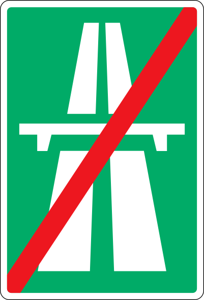
90. What does this traffic sign mean?
This traffic sign indicates the end of the motorway. The special motorway rules end at this point. Follow the speed limits, access rules and other traffic signs that apply to the road ahead.
English • Traffic sign E 44 • End of motorway. Normally not used where exit roads join the ordinary road network.
Dansk • Tavle E 44 • Motorvej ophører. Tavlen anvendes normalt ikke ved frakørslers tilslutning til det almindelige vejnet.
Sources
🔗 Commons.wikimedia.org
🔗 Retsinformation.dk • Bekendtgørelse nr. 425/2023, § 27
SVG source: Gigillo83, drawn by original of Vejdirektoratet • Public domain • Original revision 2013-08-06. Wikimedia original unmodified.
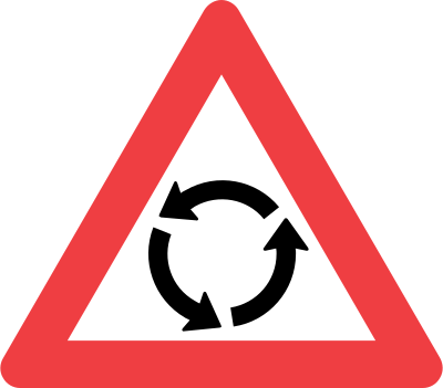
91. What does this traffic sign mean?
This traffic sign indicates a warning for a roundabout. A roundabout lies ahead. Reduce speed and follow the applicable priority signs, traffic signals and local roundabout rules when approaching and entering it.
English • Traffic sign A 16 • Roundabout.
Dansk • Tavle A 16 • Rundkørsel.
Sources
🔗 Commons.wikimedia.org
🔗 Retsinformation.dk • Bekendtgørelse nr. 425/2023, § 13
SVG source: Gigillo83, drawn by original of Vejdirektoratet • Public domain • Original revision 2013-06-04. Wikimedia original unmodified.
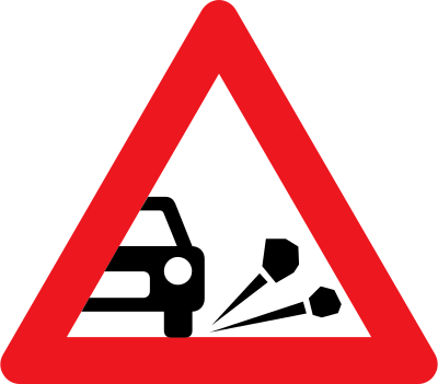
92. What does this traffic sign mean?
This traffic sign indicates a warning for loose chippings. Loose stones or gravel may reduce tyre grip and can be thrown up by passing vehicles. Reduce speed, increase your following distance and avoid sudden braking, acceleration or steering movements.
English • Traffic sign A 33 • Loose stones. Indicates particular danger from stones being thrown up.
Dansk • Tavle A 33 • Løse sten. Tavlen angiver særlig fare for stenslag.
Sources
🔗 Commons.wikimedia.org
🔗 Retsinformation.dk • Bekendtgørelse nr. 425/2023, § 13
SVG source: Gigillo83, drawn by original of Vejdirektoratet • Public domain • Original revision 2013-06-04. Wikimedia original unmodified.
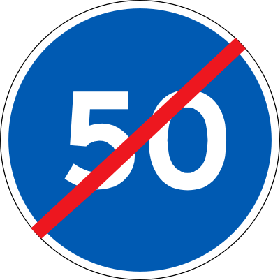
93. What does this traffic sign mean?
This traffic sign indicates the end of the minimum speed. The previously indicated minimum speed no longer applies beyond this point. Continue to follow any other posted speed requirements and the applicable traffic rules.
English • Traffic sign D 56 • End of minimum speed.
Dansk • Tavle D 56 • Ophør af mindste hastighed.
Sources
🔗 Commons.wikimedia.org
🔗 Retsinformation.dk • Bekendtgørelse nr. 425/2023, § 23
SVG source: Gigillo83, drawn by original of Vejdirektoratet • Public domain • Original revision 2013-06-25. Wikimedia original unmodified.
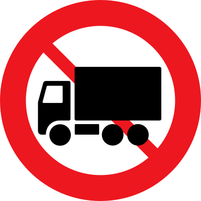
94. What does this traffic sign mean?
This traffic sign indicates that trucks are prohibited. Trucks covered by the sign may not enter or continue beyond it. Any applicable weight threshold or vehicle-category limitation is determined by the sign, supplementary information and local rules.
English • Traffic sign C 23,1 • No lorries. A mass on a supplementary plate may restrict the prohibition to lorries, including lorry combinations, whose combined maximum authorised mass exceeds the value shown.
Dansk • Tavle C 23,1 • Lastbil forbudt. Forbuddet kan med vægtangivelse på undertavle begrænses til kun at gælde for lastbil, herunder lastbilvogntog, hvis samlede tilladte totalvægt er større end den angivne.
Sources
🔗 Commons.wikimedia.org
🔗 Retsinformation.dk • Bekendtgørelse nr. 425/2023, § 19
SVG source: Gigillo83, drawn by original of Vejdirektoratet • Public domain • Original revision 2013-06-08. Wikimedia original unmodified.
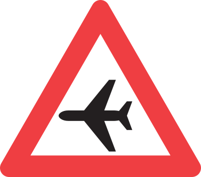
95. What does this traffic sign mean?
This traffic sign indicates a warning for low-flying aircraft. Aircraft may pass over the road at low altitude and can create sudden noise or visual distraction. Keep your attention on the road and maintain control of the vehicle.
English • Traffic sign A 96 • Low-flying aircraft.
Dansk • Tavle A 96 • Lavtgående fly.
Sources
🔗 Commons.wikimedia.org
🔗 Retsinformation.dk • Bekendtgørelse nr. 425/2023, § 13
SVG source: Vejdirektoratet • Public domain • Original revision 2013-10-15. Wikimedia original unmodified.
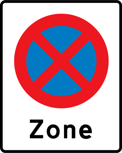
96. What does this traffic sign mean?
This traffic sign indicates the start of a no-parking and no-stopping zone. The parking and stopping restrictions apply throughout the zone according to the applicable zonal rules until the zone is ended or another rule replaces them.
English • Traffic sign E 68 • Zone. Marks an area where the rules represented by the incorporated signs apply, subject to E 33 Parking and E 68,9 Environmental zone. Details and the distance to the beginning may be shown. Applies until E 69 or replacement by another zone sign concerning the same matter. Local signs may create exceptions within the zone. Traffic sign C 61 • No stopping. Prohibits stopping on the carriageway except where required by other traffic. A supplementary plate may specify details, such as particular weekdays or hours and a parking prohibition or time-limited parking outside those periods.
Dansk • Tavle E 68 • Zonetavle. Tavlen angiver et område, hvor bestemmelserne for de tavler, der er anført som symbol, er gældende, se dog E 33 Parkering og E 68,9 Miljøzonetavle. Bestemmelsernes nærmere indhold og afstanden til områdets begyndelse kan angives på tavlen. Bestemmelserne gælder, indtil de ophæves ved tavle E 69, eller indtil de erstattes af angivelse vedrørende samme forhold på anden zonetavle. Inden for området kan zonetavlens bestemmelser fraviges ved lokal afmærkning. Tavle C 61 • Standsning forbudt. Tavlen forbyder standsning på kørebanen, som ikke sker af hensyn til den øvrige færdsel. Forbuddets nærmere indhold kan angives på undertavle. Det kan fx angives, at forbuddet kun gælder på visse ugedage eller inden for visse klokkeslæt, og at der uden for disse kan være parkeringsforbud eller tidsbegrænset parkering.
Sources
🔗 Commons.wikimedia.org
🔗 Retsinformation.dk • Bekendtgørelse nr. 425/2023, § 27
🔗 Retsinformation.dk • Bekendtgørelse nr. 425/2023, § 19
SVG source: Gigillo83, drawn by original of Vejdirektoratet • Public domain • Original revision 2013-06-11. Wikimedia original unmodified.
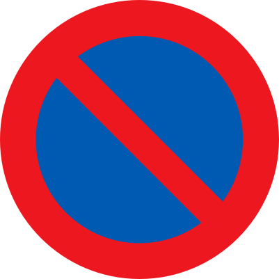
97. What does this traffic sign mean?
This traffic sign indicates that parking is prohibited. Vehicles may not be parked in the area covered by the sign unless an exception applies. Brief stopping to pick up or drop off passengers or to load or unload goods may still be permitted where local rules allow it.
English • Traffic sign C 62 • No parking. Prohibits parking on the carriageway. A supplementary plate may specify details, such as particular weekdays or hours and time-limited parking outside those periods.
Dansk • Tavle C 62 • Parkering forbudt. Tavlen forbyder parkering på kørebanen. Forbuddets nærmere indhold kan angives på undertavle. Det kan fx angives, at forbuddet kun gælder på visse ugedage eller inden for visse klokkeslæt, og at der uden for disse kan være tidsbegrænset parkering.
Sources
🔗 Commons.wikimedia.org
🔗 Retsinformation.dk • Bekendtgørelse nr. 425/2023, § 19
SVG source: Gigillo83, drawn by original of Vejdirektoratet • Public domain • Original revision 2013-06-08. Wikimedia original unmodified.
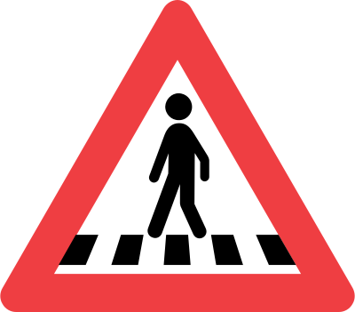
98. What does this traffic sign mean?
This traffic sign indicates a warning for a pedestrian crossing. A designated pedestrian crossing lies ahead. Reduce speed when necessary, watch carefully for pedestrians and be prepared to give way or stop according to the applicable local priority rules.
English • Traffic sign A 17 • Pedestrian crossing. With a plate reading ‘Pedestrian street’, indicates a crossing pedestrian street.
Dansk • Tavle A 17 • Fodgængerfelt. I forbindelse med undertavle med teksten »Gågade« angiver tavlen en krydsende gågade.
Sources
🔗 Commons.wikimedia.org
🔗 Retsinformation.dk • Bekendtgørelse nr. 425/2023, § 13
SVG source: Gigillo83, drawn by original of Vejdirektoratet • Public domain • Original revision 2013-06-04. Wikimedia original unmodified.
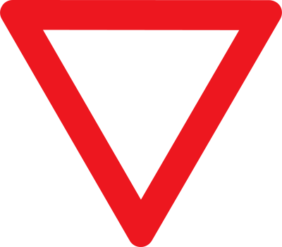
99. What does this traffic sign mean?
This traffic sign means give way. Slow down and give way to traffic that has priority. Stop if necessary and proceed only when it is safe.
English • Traffic sign B 11 • Give way. Road users entering or crossing a road must give way to moving traffic from both sides. Normally used with S 11 give-way line. With plates U 1 and UB 11,1, it gives advance warning of B 11 and B 13 respectively. D 12 compulsory roundabout direction may be placed below B 11.
Dansk • Tavle B 11 • Ubetinget vigepligt. Tavlen angiver, at trafikanterne ved kørsel ind på eller over en vej har vigepligt for den kørende færdsel fra begge sider (ubetinget vigepligt). Tavlen bruges normalt i forbindelse med S 11 Vigelinje. I kombination med undertavlerne U 1 og UB 11,1 bruges tavlen til forvarsling af henholdsvis B 11 og B 13. Under B 11 kan opsættes D 12 Påbudt kørselsretning i rundkørsel.
Sources
🔗 Commons.wikimedia.org
🔗 Retsinformation.dk • Bekendtgørelse nr. 425/2023, § 16
SVG source: Gigillo83, drawn by original of Vejdirektoratet • Public domain • Original revision 2013-06-05. Wikimedia original unmodified.
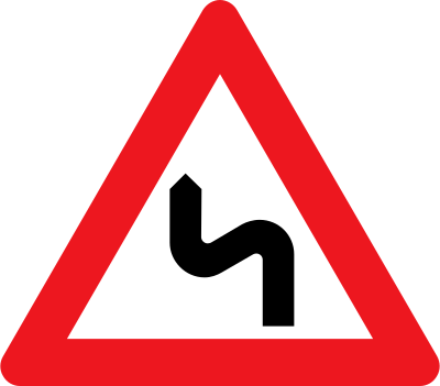
100. What does this traffic sign mean?
This traffic sign indicates a warning for successive curves, with the first curve to the left. Reduce speed before entering the winding section, maintain your lane position and be prepared for further changes in direction.
English • Traffic sign A 42,2 • Series of bends, first to the left.
Dansk • Tavle A 42,2 • Flere sving, det første til venstre.
Sources
🔗 Commons.wikimedia.org
🔗 Retsinformation.dk • Bekendtgørelse nr. 425/2023, § 13
SVG source: Gigillo83, drawn by original of Vejdirektoratet • Public domain • Original revision 2013-06-04. Wikimedia original unmodified.