

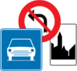
Wegweiser an einer KreuzungBrüssel
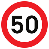 Verkehrsregeln
 Brüssel
41. Wegweiser an einer Kreuzung
Ein Wegweiser an einer Kreuzung zeigt Ziele und Strecken, die an einer bevorstehenden oder aktuellen Kreuzung erreichbar sind. Pfeile, Straßennummern, Symbole und Ortsnamen helfen Fahrern, die richtige Richtung und, sofern angegeben, den richtigen Fahrstreifen zu wählen.
Das Zeichen dient der Routenführung, bestimmt aber normalerweise weder Vorfahrt noch Abbiegerecht oder Geschwindigkeitsbegrenzung. Fahrer müssen weiterhin Ampeln, Vorschriftszeichen, Fahrstreifenpfeile, Fahrbahnmarkierungen und örtliche Verkehrsregeln beachten.
Which Belgian signs guide drivers before an intersection?
Traffic signs F25 and F27 are Belgian advance direction signs, legally called voorwegwijzers.
 Kreuzungsverlauf, Richtungen und Ziele.
Signal routier F25 • Signal de préavis.
Verkeersbord F25 • Voorwegwijzer.
 Richtungen und Ziele an der Kreuzung.
Signal routier F27 • Signal de préavis.
Verkeersbord F27 • Voorwegwijzer.
Which Belgian sign points towards a destination at the intersection?
Traffic sign F29 is a direction sign, legally called a wegwijzer.
What does Belgian sign F25 show?
F25 shows the approaching intersection in a simplified schematic form, with the available road directions represented by lines or arrows.
Does F25 show every traffic island and verge?
No. Details such as traffic islands, medians and verges are normally omitted so the main road directions remain easy to understand.
How does F25 show the priority road?
The road that has priority at the intersection is represented by a wider line.
Does the wider line itself give you priority?
No. It communicates the existing priority-road layout. Drivers must still follow the actual B1, B5, B9, B15 or other applicable priority signs.
Can F25 show road numbers?
Yes. The appropriate road number or numbers may be displayed within the corresponding route arrow.
What does Belgian sign F27 show?
F27 lists destinations in separate groups according to whether the route continues straight ahead, to the left or to the right.
How are directions ordered on F27?
The sections are normally arranged from top to bottom as straight ahead, left and right.
Where are the arrows placed on F27?
The straight-ahead and left arrows are placed on the left side of their sections, while the right arrow is placed on the right.
What is the difference between F25 and F27?
F25 uses a schematic drawing of the intersection. F27 groups destinations in separate text-and-arrow sections without reproducing the junction as a road diagram.
What is the difference between F25 or F27 and F29?
F25 and F27 provide advance information before the intersection. F29 is a direction sign pointing towards a destination at or near the point where the driver must turn.
Can F25 or F27 display the distance in kilometres?
No. Under the current Belgian placement rules, F25 and F27 do not display kilometre distances.
Can F29 display a distance?
Yes. The distance in kilometres may be displayed on an F29 direction sign.
How many destinations may be shown for each direction?
Belgian placement rules currently limit F25 and F27 to a maximum of three destination inscriptions per direction.
How are destinations ordered?
For each direction, destinations are normally arranged from top to bottom in decreasing order of distance, with the more distant destination appearing first.
How far before an intersection is F25 or F27 placed?
The signs are normally installed approximately 200 metres before the intersection outside a built-up area and approximately 100 metres before it inside a built-up area.
Can the sign be placed farther away?
Yes. The distance may be increased because of traffic speed, traffic density, road layout or the need to choose a lane at an important intersection.
Can a Belgian direction sign show a motorway symbol?
Yes. The F5 motorway symbol may be incorporated to indicate that the displayed route continues over a motorway.
Can it show an expressway route?
Yes. The F9 expressway symbol may be displayed to indicate that the signed route continues over a Belgian autoweg.
Does a destination shown on F25 or F27 make the turn legal?
No. Drivers must still comply with traffic lights, turn prohibitions, mandatory-direction signs and lane markings.
Does an F25 or F27 sign impose a lane choice?
Not necessarily. It provides route guidance. A separate F13 or F15 sign and the road arrows may prescribe the lane or direction that must be followed.
What does Belgian sign F13 mean?
F13 announces directional arrows on the road and prescribes the choice of a traffic lane.
What does Belgian sign F15 mean?
F15 prescribes the choice of direction for the displayed lanes. The number of arrows represents the number of traffic lanes.
Must you follow road arrows after choosing a lane?
Yes. At the intersection, drivers using a lane marked with selection arrows must follow one of the directions indicated for that lane.
What if you enter the wrong lane?
Follow the legally permitted direction from that lane and choose another route afterwards. Do not cross a continuous line or make a sudden movement across traffic.
Does a guide sign change the speed limit?
No. The applicable regional, zonal, posted and vehicle-specific speed limits remain in force.
Does a guide sign change priority?
No. The route diagram may show the priority road, but legal priority is determined by the actual priority signs, traffic lights and road rules.
What changes on 1 June 2027?
Belgium’s new Code of the Public Road retains F25 and F27 as advance direction signs and F29 as a direction sign. F29 may continue to display the distance in kilometres.


